Category:Newton County, Arkansas
Vai alla navigazione
Vai alla ricerca
Counties of Arkansas: Arkansas · Ashley · Baxter · Benton · Boone · Bradley · Calhoun · Carroll · Chicot · Clark · Clay · Cleburne · Cleveland · Columbia · Conway · Craighead · Crawford · Crittenden · Cross · Dallas · Desha · Drew · Faulkner · Franklin · Fulton · Garland · Grant · Greene · Hempstead · Hot Spring · Howard · Independence · Izard · Jackson · Jefferson · Johnson · Lafayette · Lawrence · Lee · Lincoln · Little River · Logan · Lonoke · Madison · Marion · Miller · Mississippi · Monroe · Montgomery · Nevada · Newton · Ouachita · Perry · Phillips · Pike · Poinsett · Polk · Pope · Prairie · Pulaski · Randolph · Saline · Scott · Searcy · Sebastian · Sevier · Sharp · St. Francis · Stone · Union · Van Buren · Washington · White · Woodruff · Yell
contea dello stato dell'Arkansas   | |||||
| Carica un file multimediale | |||||
| Istanza di | |||||
|---|---|---|---|---|---|
| Luogo | Arkansas, Stati Uniti d'America | ||||
| Capitale | |||||
| Data di fondazione o creazione |
| ||||
| Popolazione |
| ||||
| Superficie |
| ||||
| Distinto da | |||||
 | |||||
Sottocategorie
Questa categoria contiene le 15 sottocategorie indicate di seguito, su un totale di 15.
A
- Arkansas Highway 74 (5 F)
- Arkansas Highway 103 (10 F)
- Arkansas Highway 43 (28 F)
B
- Boxley Grist Mill (41 F)
D
- Dogpatch USA (6 F)
K
M
- Mossville, Arkansas (1 F)
P
- Ponca, Arkansas (2 F)
U
- Upper Buffalo Wilderness (19 F)
W
- Western Grove, Arkansas (2 F)
File nella categoria "Newton County, Arkansas"
Questa categoria contiene 35 file, indicati di seguito, su un totale di 35.
-
 Buffalo River banner.jpg 2 000 × 285; 442 KB
-
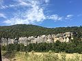
 Buffalo River, at the start of Hemmed in Hollow Trail - panoramio.jpg 3 968 × 2 976; 5,48 MB
-
 Buffalo2010 096.jpg 2 448 × 3 264; 7,17 MB
-

-
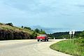
 Highway 16 and Highway 21 overlap, Newton County, AR.jpg 2 995 × 1 685; 1,16 MB
-
 Highway 21 departs Highway 16.jpg 4 000 × 3 000; 4,49 MB
-
 Highway 7S, Marble Falls, AR.jpg 3 835 × 2 157; 2,43 MB
-

-
 Kentucky Township, AR, USA - panoramio.jpg 5 184 × 3 456; 7,01 MB
-
 Low Gap, Arkansas 001.jpg 4 456 × 2 506; 3,23 MB
-
 Low Gap, Arkansas 002.jpg 2 951 × 1 660; 1,84 MB
-
 Map of Arkansas highlighting Newton County.svg 1 278 × 1 113; 90 KB
-
 Near Whitaker Point - Hawksbill Crag - panoramio.jpg 5 784 × 1 764; 5,24 MB
-
 On top of Glory Hole - Ozark National Forest - Arkansas - USA - panoramio.jpg 1 851 × 744; 1,44 MB
-
 Ozark Highlands Scenic Byway 001.jpg 1 611 × 1 077; 795 KB
-
 Ozark Highlands Scenic Byway 002.jpg 2 570 × 3 870; 3,21 MB
-
 Ozark Highlands Scenic Byway.gif 400 × 400; 40 KB
-
 Ponca Township, AR, USA - panoramio (2).jpg 4 000 × 3 000; 3,61 MB
-
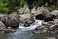 Richland Creek in the Richland Creek Wilderness, AR.jpg 5 616 × 3 744; 13,77 MB
-
 Steel Creek.jpg 3 264 × 2 448; 2,99 MB
-
 Sunlit treetops from above (Unsplash).jpg 3 992 × 2 992; 4,56 MB
-

-

-
 The Eye of the Needle - panoramio.jpg 3 968 × 2 232; 3,08 MB
-
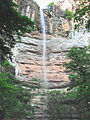
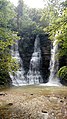
 Top of Stepp Creek Falls - panoramio.jpg 2 848 × 2 136; 3,07 MB
-
 Toyota Tacoma Truck in the Ozark Mountains, Dirty (46584142555).jpg 7 951 × 5 066; 31,08 MB
-
 Trail to Hemmed-In Hollow - panoramio.jpg 3 968 × 2 976; 3,81 MB
-
 Twin Falls, Camp Orr Boy Scout Camp, Arkansas.jpg 2 952 × 5 248; 6,59 MB
-
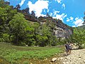
 Upper Stepp Creek - panoramio.jpg 2 848 × 2 136; 3 MB
-
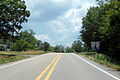
 US 412 in Madison County, AR.jpg 1 957 × 1 312; 879 KB
-
 USA Newton County, Arkansas age pyramid.svg 520 × 600; 7 KB
-
 Very Old House near Lost Valley State Park - panoramio.jpg 3 121 × 2 306; 4,92 MB
-
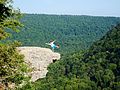 Whitaker Point - Hawksbill Crag - panoramio (1).jpg 3 571 × 2 678; 4,06 MB
-
 Whitaker Point - Hawksbill Crag - panoramio.jpg 2 678 × 3 571; 4,31 MB
-
 Whitaker Point.jpg 3 264 × 2 448; 1,18 MB


.jpg)


.jpg)


.jpg)


.jpg)


.jpg)

