Category:Nieuwkerke Churchyard, Commonwealth Plot
Jump to navigation
Jump to search
cemetery plot within Nieuwkerke Churchyard in Belgium  | |||||
| Upload media | |||||
| Instance of | |||||
|---|---|---|---|---|---|
| Part of | |||||
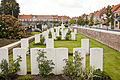
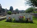
| Location | Nieuwkerke, Heuvelland, Arrondissement of Ypres, West Flanders, Flemish Region, Belgium | ||||
| Heritage designation | |||||
| Quantity buried |
| ||||
 | |||||
|
This is a category about onroerend erfgoed number 213329
|
Media in category "Nieuwkerke Churchyard, Commonwealth Plot"
The following 23 files are in this category, out of 23 total.
-
 Nieuwkerke (Neuve-Eglise) Churchyard-17.JPG 1,945 × 1,331; 3.24 MB
-
 Nieuwkerke (Neuve-Eglise) Churchyard-18.JPG 1,945 × 1,297; 3.03 MB
-
 Nieuwkerke (Neuve-Eglise) Churchyard-19.JPG 1,945 × 1,299; 2.85 MB
-
 Nieuwkerke (Neuve-Eglise) Churchyard-20.JPG 1,945 × 1,297; 3.04 MB
-
 Nieuwkerke (Neuve-Eglise) Churchyard-21.JPG 1,945 × 1,229; 2.79 MB
-
 Nieuwkerke (Neuve-Eglise) Churchyard-23.JPG 1,337 × 1,945; 2.38 MB
-
 Nieuwkerke (Neuve-Eglise) Churchyard-25.JPG 1,422 × 1,945; 1.94 MB
-
 Nieuwkerke (Neuve-Eglise) Churchyard-4.JPG 1,945 × 1,479; 2.45 MB
-
 Nieuwkerke (Neuve-Eglise) Churchyard-5.JPG 1,646 × 1,646; 2.38 MB
-
 Nieuwkerke (Neuve-Eglise) Churchyard-6.JPG 1,646 × 1,646; 2.5 MB
-
 Nieuwkerke (Neuve-Eglise) Churchyard-7.JPG 1,646 × 1,646; 2.46 MB
-
 Nieuwkerke Churchyard 10 1 (cropped).JPG 1,937 × 2,904; 3.84 MB
-
 Nieuwkerke Churchyard 10 1.JPG 3,079 × 4,618; 8.58 MB
-
 Nieuwkerke Churchyard 2 1.JPG 4,604 × 3,070; 10.57 MB
-
 Nieuwkerke Churchyard 4.JPG 4,752 × 3,168; 10.81 MB
-
 Nieuwkerke Churchyard 7-2.JPG 1,889 × 1,259; 2.24 MB
-
 Nieuwkerke Churchyard 8.JPG 4,752 × 3,168; 11.09 MB
-
 Nieuwkerke Churchyard 9 1.JPG 4,344 × 2,896; 10.03 MB
-
 Nieuwkerke Churchyard, Commonwealth Plot 2023.jpg 3,451 × 3,644; 2.38 MB
-
 Nieuwkerke Churchyard, Commonwealth Plot en 2024.jpg 3,468 × 2,702; 7.16 MB
-

-

-
 Nieuwkerke Churchyard, groot perk - 2682 - onroerenderfgoed.jpg 640 × 480; 80 KB
_Churchyard-17.JPG)
_Churchyard-18.JPG)
_Churchyard-19.JPG)
_Churchyard-20.JPG)
_Churchyard-21.JPG)
_Churchyard-23.JPG)
_Churchyard-25.JPG)
_Churchyard-4.JPG)
_Churchyard-5.JPG)
_Churchyard-6.JPG)
_Churchyard-7.JPG)
.JPG)


