Category:Ofenhaus, Saint-Ours
Jump to navigation
Jump to search
| Object location | | View all coordinates using: OpenStreetMap |
|---|
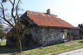
building with oven in Saint-Ours in the canton of Fribourg, Switzerland  | |||||
| Upload media | |||||
| Instance of | |||||
|---|---|---|---|---|---|
| Part of | |||||
| Location | St. Ursen, Sense District, Canton of Fribourg, Switzerland | ||||
| Street address |
| ||||
| Heritage designation | |||||
 | |||||
Media in category "Ofenhaus, Saint-Ours"
This category contains only the following file.
-
 Ofenhaus Geretach 2B Mar 2011.jpg 4,752 × 3,168; 6.47 MB