Category:Old county maps of Norfolk, England
Jump to navigation
Jump to search
Ceremonial counties of England: Bedfordshire · Berkshire · Buckinghamshire · Cambridgeshire · Cheshire · Cornwall · Derbyshire · Devon · Dorset · Durham · East Riding of Yorkshire · Essex · Gloucestershire · Hampshire · Herefordshire · Hertfordshire · Kent · Lancashire · Leicestershire · Lincolnshire · Norfolk · Northamptonshire · Northumberland · Nottinghamshire · Oxfordshire · Rutland · Shropshire · Somerset · Staffordshire · Suffolk · Surrey · Warwickshire · Wiltshire · Worcestershire
City-counties:
Former historic counties: Cumberland · Huntingdonshire · Middlesex · North Riding of Yorkshire · Sussex · West Riding of Yorkshire · Westmorland · Yorkshire
Other former counties:
City-counties:
Former historic counties: Cumberland · Huntingdonshire · Middlesex · North Riding of Yorkshire · Sussex · West Riding of Yorkshire · Westmorland · Yorkshire
Other former counties:
Media in category "Old county maps of Norfolk, England"
The following 16 files are in this category, out of 16 total.
-
 Saxton Norfolk map Stage II 1583.jpg 4,125 × 2,880; 2.68 MB
-
 Nortfolcia ; vernacule Norfolke - btv1b53056583c (1 of 2).jpg 6,088 × 4,768; 4.51 MB
-
 Atlas Van der Hagen-KW1049B11 026-NORTFOLCIA; NORTFOLKE.jpeg 5,500 × 4,253; 3.65 MB
-
 Nortfolcia vernacule Norfolke (8643504806).jpg 800 × 668; 123 KB
-
 Wenceslas Hollar - Norfolk (State 4).jpg 3,169 × 2,441; 2.85 MB
-
 "Nortfolcia, Nordfolke" (22247181972).jpg 3,876 × 3,008; 2.02 MB
-

-
 Maps of England circa 1670, Norfolke 26 of 40 (13432983484).jpg 6,600 × 4,983; 4.65 MB
-
 Nortfolcia vernacule Norfolke - CBT 6596847.jpg 5,508 × 4,394; 6.6 MB
-
 Norfolk - By H. Moll Geographer - btv1b53056714p.jpg 4,168 × 3,120; 1.88 MB
-

-
 Aikin(1800) p271 - Norfolk.jpg 1,952 × 1,106; 391 KB
-
 Gray1824.norfolk.jpg 805 × 978; 169 KB
-

-
 Pigot and Co (1842) p1.416 - Map of Norfolk.jpg 2,160 × 1,345; 850 KB
-
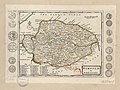
 Map of Norfolk (Corbridge 1727).jpg 8,443 × 6,209; 23.08 MB

.jpg)

.jpg)
.jpg)
.jpg)
.5.(22).jpg)
.jpg)


_p271_-_Norfolk.jpg)

.jpg)
_p1.416_-_Map_of_Norfolk.jpg)
.jpg)