Category:Old county maps of Warwickshire
Jump to navigation
Jump to search
Ceremonial counties of England: Bedfordshire · Berkshire · Buckinghamshire · Cambridgeshire · Cheshire · Cornwall · Derbyshire · Devon · Dorset · Durham · East Riding of Yorkshire · Essex · Gloucestershire · Hampshire · Herefordshire · Hertfordshire · Kent · Lancashire · Leicestershire · Lincolnshire · Norfolk · Northamptonshire · Northumberland · Nottinghamshire · Oxfordshire · Rutland · Shropshire · Somerset · Staffordshire · Suffolk · Surrey · Warwickshire · Wiltshire · Worcestershire
City-counties:
Former historic counties: Cumberland · Huntingdonshire · Middlesex · North Riding of Yorkshire · Sussex · West Riding of Yorkshire · Westmorland · Yorkshire
Other former counties:
City-counties:
Former historic counties: Cumberland · Huntingdonshire · Middlesex · North Riding of Yorkshire · Sussex · West Riding of Yorkshire · Westmorland · Yorkshire
Other former counties:
Media in category "Old county maps of Warwickshire"
The following 22 files are in this category, out of 22 total.
-
 Warwickshire - John Speed Map 1610.jpg 6,591 × 5,033; 5.28 MB
-
 17th Century map of Warwickshire.jpg 3,456 × 2,592; 5.83 MB
-

-

-
 Wigorniensis comitatus cum Warwicensi, nec non Conventriae Libertas (8642405041).jpg 4,925 × 3,921; 5.06 MB
-

-

-
 Maps of England circa 1670, Warwick 7 of 40 (13431666543).jpg 4,809 × 4,568; 3.01 MB
-
 The counti of Warwick the shire towne and citie of Coventre described (5384792127).jpg 9,127 × 7,285; 13.87 MB
-
 Wigorniensis comitatus cum Warwicensi nec non Conventriae Libertas - CBT 6596859.jpg 5,934 × 4,760; 8.79 MB
-
 Warwick Shire - By H. Moll Geographer - btv1b530566183.jpg 3,016 × 4,168; 1.93 MB
-

-
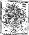
 Aikin(1800) p196 - Warwickshire.jpg 1,126 × 1,876; 378 KB
-
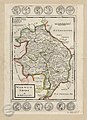
 1813 James Wallis County Map Warwickshire Hand Colour Small Book Print.jpg 2,304 × 3,332; 3.74 MB
-
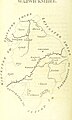
 Gray1824.warks.jpg 811 × 976; 189 KB
-
 1828 Ebden's New Map of the County Warwickshire.jpg 2,434 × 3,063; 2.11 MB
-
 Pigot and Co (1842) p2.416 - Map of Warwickshire.jpg 1,310 × 2,158; 902 KB
-
 98 of 'England and Wales Delineated, etc' (11033413103).jpg 2,384 × 1,453; 841 KB
-
 99 of 'England and Wales Delineated, etc' (11033012784).jpg 2,384 × 1,481; 847 KB
-
 1889 George Philip County Map Warwickshire Print London Geographical.jpg 3,968 × 5,577; 8.94 MB
-

-
 MILLER(1896) p8 - Warwickshire.jpg 2,564 × 2,167; 1.2 MB


.jpg)
.jpg)
.jpg)
.jpg)
.5.(32).jpg)
.jpg)
.jpg)


_p196_-_Warwickshire.jpg)


_p2.416_-_Map_of_Warwickshire.jpg)
.jpg)
.jpg)

.jpg)
_p8_-_Warwickshire.jpg)