Category:Old maps of Derry
Jump to navigation
Jump to search
Subcategories
This category has only the following subcategory.
Media in category "Old maps of Derry"
The following 10 files are in this category, out of 10 total.
-
-

-
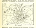
 CANE(1859) p122 MAP OF LONDONDERRY AS BESIEGED IN 1688.jpg 4,755 × 3,037; 3.79 MB
-
-
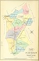
 CANE(1859) p054 MAP OF LONDONDERRY.jpg 2,315 × 1,515; 2.94 MB
-
 563 of '(Our own country. Descriptive, historical, pictorial.)' (11210021923).jpg 1,910 × 1,485; 738 KB
-
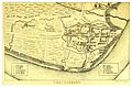
 WALKER(1893) p197 MAP OF DERRY - AS BESIGED IN 1688-89.jpg 1,876 × 1,049; 859 KB
-
 Journal of the Royal Society of Antiquaries of Ireland (1915) (14757539126).jpg 4,256 × 2,348; 917 KB
-
-
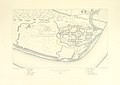
 The plat of the Cittie of Londonderrie as it stands built and fortyfied (27114684854).jpg 5,368 × 4,324; 8.02 MB
_(By_Sir_T._A._L.)%27_(11014140793).jpg)
)%27_(11167446183).jpg)
_p122_MAP_OF_LONDONDERRY_AS_BESIEGED_IN_1688.jpg)
%27_(11041318385).jpg)
_p054_MAP_OF_LONDONDERRY.jpg)
%27_(11210021923).jpg)
_p197_MAP_OF_DERRY_-_AS_BESIGED_IN_1688-89.jpg)
_(14757539126).jpg)
_Company%27s_illustrated_guide_to_the_sporting_and_touring_grounds_of_the_north_of_Ireland_(1908)_(14593387888).jpg)
.jpg)