Category:Old maps of Monmouthshire
Jump to navigation
Jump to search
Subcategories
This category has the following 7 subcategories, out of 7 total.
- Old county maps of Monmouthshire (19 F)
M
- Old maps of Monmouth (9 F)
Media in category "Old maps of Monmouthshire"
The following 5 files are in this category, out of 5 total.
-
 Ordnance Survey Drawings - Newport (OSD 176).jpg 4,000 × 2,283; 2.7 MB
-
 Ordnance Survey Drawings - Chepstow, Monmouthshire (OSD 175).jpg 2,683 × 4,000; 4.02 MB
-
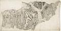 Ordnance Survey Drawings - Abergavenny, Monmouthshire (Sir Fynwy) (OSD 194).jpg 5,809 × 2,973; 4.32 MB
-
 Ordnance Survey Drawings - Bedwas, Caerphilly (OSD 193).jpg 4,000 × 2,443; 4.64 MB
-
 86 of 'England and Wales Delineated, etc' (11033989125).jpg 2,416 × 1,479; 845 KB
.jpg)
.jpg)
_(OSD_194).jpg)
.jpg)
.jpg)