Category:Old maps of the Hebrides
Jump to navigation
Jump to search
Subcategories
This category has the following 2 subcategories, out of 2 total.
Media in category "Old maps of the Hebrides"
The following 19 files are in this category, out of 19 total.
-

-

-
 14 of 'The Wild Hebrides. (With illustrations.)' (11057520274).jpg 1,361 × 2,211; 767 KB
-
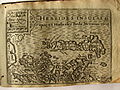 17th Century map of the Hebrides Islands.jpg 3,456 × 2,592; 5.83 MB
-
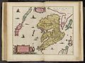
 Uistus Insula by Blaeu 1665.jpg 9,054 × 6,705; 20.93 MB
-

-
 The Harmsworth atlas and Gazetter 1908 (135848634).jpg 12,532 × 9,586; 130.01 MB
-

-
 A Description of the Western Islands of Scotland (Rum, Eigg, Muck).jpg 614 × 461; 123 KB
-
 A Map of the North West Part of the Western Islands - By H. Moll - btv1b53056697z.jpg 2,672 × 3,632; 1.44 MB
-
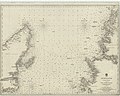 Admiralty Chart No 2386 North Minch, published 1849.jpg 10,052 × 8,012; 16.74 MB
-
 FMIB 36828 Raz des Hebrides.jpeg 628 × 809; 201 KB
-
 Ila Insula by Blaeu 1665.jpg 9,090 × 6,705; 8.48 MB
-

-
 Iura Insula by Blaeu 1665.jpg 9,102 × 6,705; 8.51 MB
-
 Mula Insula by Blaeu 1665.jpg 9,054 × 6,705; 9.33 MB
-
 The channel between Sky I and the Lewis Mackenzie 74400898.jpg 9,899 × 6,779; 11.45 MB
-
 UBBasel Map 1570-1590 Kartenslg Mappe 238-45 Hebride Orcade.tiff 4,320 × 1,959, 2 pages; 24.24 MB
-
 WESTERN ISLANDS.jpg 3,954 × 6,000; 1.61 MB
.jpg)
.jpg)
%27_(11057520274).jpg)


.jpg)
.jpg)
.jpg)


.jpg)


_Edited_by_E._G._Ravenstein_..._Illustrated,_etc%27_(11190553595).jpg)