Category:OpenStreetMap maps of Paris 13e arrondissement
Jump to navigation
Jump to search
Media in category "OpenStreetMap maps of Paris 13e arrondissement"
The following 18 files are in this category, out of 18 total.
-
 13e Arrondissement, Paris, France - Open Street Map.png 2,058 × 1,868; 4.64 MB
-
 13th arrondissement of Paris & the Cité florale - OSM 2020.svg 512 × 469; 2.38 MB
-
 13th arrondissement of Paris & the Quartier asiatique - OSM 2020.svg 512 × 469; 2.41 MB
-
 13th arrondissement of Paris - OSM 2020.svg 1,795 × 1,645; 2.32 MB
-
 2014 collegiale Saint-Marcel emplacement.jpg 533 × 446; 235 KB
-
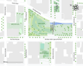
 Campus des Grands Moulins - OSM 2021.svg 1,461 × 1,078; 283 KB
-
 Campus des Grands Moulins - Plan 2021.svg 1,461 × 1,078; 279 KB
-
 Campus des Grands Moulins - Plan colored 2021.svg 1,461 × 1,078; 245 KB
-
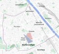
 Cité florale, Paris - OSM 2020.svg 512 × 360; 96 KB
-
 Jardins Abbé-Pierre - Grands-Moulins, Paris - OSM 2022.svg 1,170 × 920; 175 KB
-
 Map of the 13th arrondissement of Paris - OSM 2020.svg 1,795 × 1,645; 2.36 MB
-
 Paris Rive Gauche - OSM 2022.svg 1,834 × 850; 736 KB
-
 Quarters of the 13th arrondissement of Paris - OSM 2020.svg 1,795 × 1,645; 2.33 MB
-
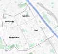
 Quartier de Bercy, Paris - OSM 2020.svg 1,428 × 951; 610 KB
-
 Secteurs de Paris Rive Gauche - OSM 2022.svg 1,834 × 850; 739 KB
-
 Triangle de Choisy & Olympiades, Paris - OSM 2020.svg 1,990 × 1,950; 446 KB
-
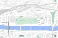
 Université Paris 7 - Paris Rive Gauche Campus.jpg 1,987 × 1,909; 1.08 MB
-
 Université Paris 7 - Paris Rive Gauche Campus.svg 744 × 1,052; 282 KB


