Category:OpenStreetMap maps of Paris 19e arrondissement
Jump to navigation
Jump to search
Media in category "OpenStreetMap maps of Paris 19e arrondissement"
The following 12 files are in this category, out of 12 total.
-
 19e Arrondissement, Paris, France - Open Street Map.png 1,934 × 1,918; 4.18 MB
-
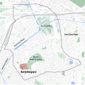 19th arrondissement of Paris & the Butte Bergeyre - OSM 2020.svg 512 × 508; 2.27 MB
-
 19th arrondissement of Paris - OSM 2020.svg 1,557 × 1,545; 2.22 MB
-
 Bassin de La Villette, Paris - OSM 2022.svg 1,550 × 720; 357 KB
-
 Butte Bergeyre, Paris - OSM 2020.svg 2,150 × 1,400; 270 KB
-
 Map of Paris, 19e arrondissement, parc des Buttes-Chaumont.svg 920 × 881; 2.6 MB
-
 Map of the 19th arrondissement of Paris - OSM 2020.svg 1,557 × 1,545; 2.25 MB
-
 Parc des Buttes-Chaumont - OSM 2020.svg 1,870 × 1,710; 423 KB
-
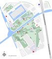
 Plan of the Parc de la Villette - OSM 2016.svg 1,682 × 1,913; 346 KB
-
 Plan of the Parc de la Villette with follies - OSM 2016.svg 1,680 × 1,910; 240 KB
-
 Plan of the Parc de la Villette with gardens - OSM 2016.svg 1,682 × 1,913; 205 KB
-
 Quarters of the 19th arrondissement of Paris - OSM 2020.svg 1,557 × 1,545; 2.23 MB


