Category:Orleton
Jump to navigation
Jump to search
village and civil parish in Herefordshire, UK  | |||||
| Upload media | |||||
| Instance of | |||||
|---|---|---|---|---|---|
| Location | Herefordshire, West Midlands, England | ||||
| Population |
| ||||
| Elevation above sea level |
| ||||
| Different from | |||||
 | |||||
English: Orleton is a village in northern Herefordshire, England, at , about 7 km north of Leominster. The population of the civil parish at the 2011 census was 794. (→Orleton)

Subcategories
This category has only the following subcategory.
S
Media in category "Orleton"
The following 200 files are in this category, out of 292 total.
(previous page) (next page)-

-
 A Bible book view at Orleton Church - geograph.org.uk - 5792269.jpg 3,264 × 2,448; 1.59 MB
-
 A field at Orleton - geograph.org.uk - 5160054.jpg 800 × 600; 128 KB
-
 A field of maize above Portway - geograph.org.uk - 5160037.jpg 800 × 600; 127 KB
-
 A hope, Yelds Hill - geograph.org.uk - 2204338.jpg 640 × 480; 146 KB
-
 A pulpit view at Orleton Church - geograph.org.uk - 5792260.jpg 3,264 × 2,448; 1.65 MB
-
 An entrance view of Orleton Church - geograph.org.uk - 5778676.jpg 3,264 × 2,448; 3.17 MB
-
 An entrance view of Orleton Church ^2 - geograph.org.uk - 5791933.jpg 3,264 × 2,448; 2.78 MB
-
 An organ view at Orleton Church - geograph.org.uk - 5791948.jpg 3,264 × 2,448; 1.68 MB
-

-
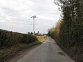
 B4361 Junction - geograph.org.uk - 4381303.jpg 800 × 600; 62 KB
-
 B4361 near Lendoma - geograph.org.uk - 6313988.jpg 800 × 600; 92 KB
-
 B4361 passes The Maidenhead Inn - geograph.org.uk - 3748390.jpg 3,416 × 2,333; 951 KB
-
 B4361, Orleton - geograph.org.uk - 6313998.jpg 800 × 600; 94 KB
-
 B4362 junction with Kitchen Hill Road - geograph.org.uk - 3748258.jpg 2,999 × 2,247; 783 KB
-
 B4362 towards Comberton - geograph.org.uk - 6314020.jpg 800 × 600; 97 KB
-
 Bircher Coppice - geograph.org.uk - 2010316.jpg 640 × 480; 105 KB
-
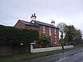
 Brick House (Orleton) - geograph.org.uk - 6148638.jpg 3,648 × 2,736; 4.72 MB
-
 Brick House, Tunnel Lane, Orleton - geograph.org.uk - 3223291.jpg 3,341 × 2,321; 1.45 MB
-
 Bridleway Entrance Near Orleton - geograph.org.uk - 1746028.jpg 480 × 640; 192 KB
-
 Brook near Orleton Common - geograph.org.uk - 1840610.jpg 640 × 480; 160 KB
-
 Carved Dragon inside St. George's Church (Chancel ^ Orleton) - geograph.org.uk - 6147649.jpg 3,648 × 2,736; 3.05 MB
-
 Ceiling at St. George's Church (Nave ^ Orleton) - geograph.org.uk - 5762670.jpg 1,920 × 1,080; 762 KB
-
 Chest at St. George's Church (Orleton) - geograph.org.uk - 5762680.jpg 3,648 × 2,736; 2.99 MB
-
 Chest at St. George's Church (Orleton) - geograph.org.uk - 5762688.jpg 3,648 × 2,736; 2.78 MB
-
 Church Croft (Orleton) - geograph.org.uk - 6148817.jpg 3,648 × 2,736; 5 MB
-
 Church Farm (Orleton) - geograph.org.uk - 6134307.jpg 3,648 × 2,056; 3.49 MB
-
 Church Farm (Orleton) - geograph.org.uk - 6148820.jpg 3,648 × 2,736; 4.5 MB
-
 Church House Cottage (Orleton) - geograph.org.uk - 6148812.jpg 3,648 × 2,736; 5.03 MB
-
 Church Lane (Orleton) - geograph.org.uk - 5763838.jpg 1,920 × 1,080; 1.01 MB
-
 Churchyard at St. George's Church (Orleton) - geograph.org.uk - 5763745.jpg 3,648 × 2,736; 4.52 MB
-
 Churchyard at St. George's Church (Orleton) - geograph.org.uk - 6147667.jpg 3,648 × 2,736; 4.28 MB
-
 Churchyard at St. George's Church (Orleton) - geograph.org.uk - 6147706.jpg 3,648 × 2,736; 4.74 MB
-
 Clock inside St. George's Church (Bell Tower ^ Orleton) - geograph.org.uk - 5763727.jpg 1,920 × 1,080; 713 KB
-
 Clock on St. George's Church (Bell Tower ^ Orleton) - geograph.org.uk - 5762653.jpg 2,048 × 1,360; 1.06 MB
-
 Comma - geograph.org.uk - 2204321.jpg 640 × 480; 94 KB
-
 Comma - geograph.org.uk - 2204327.jpg 640 × 625; 66 KB
-
 Cottage on the B4361, Orleton - geograph.org.uk - 6314015.jpg 800 × 600; 72 KB
-
 Country road near Orleton Common - geograph.org.uk - 6033596.jpg 751 × 1,024; 659 KB
-
 Crop field near Bilbury Farm - geograph.org.uk - 6314054.jpg 640 × 480; 49 KB
-
 Crop field near Manor Farm - geograph.org.uk - 6313986.jpg 800 × 600; 77 KB
-
 Crop field near Portway - geograph.org.uk - 6314017.jpg 800 × 600; 65 KB
-
 Derelict Barn (Orleton) - geograph.org.uk - 5762123.jpg 1,920 × 1,080; 1.07 MB
-
 Derelict Cottage (Orleton) - geograph.org.uk - 5762162.jpg 1,920 × 1,080; 1.02 MB
-
 Derelict Cottage (Orleton) - geograph.org.uk - 6147783.jpg 3,648 × 2,736; 5.02 MB
-
 Diamond clock view at Orleton Church - geograph.org.uk - 5791983.jpg 3,264 × 2,448; 1.89 MB
-
 Electricity sub-station - geograph.org.uk - 5620657.jpg 1,024 × 768; 341 KB
-
 End of Millbrook Way, Orleton - geograph.org.uk - 4458661.jpg 1,600 × 1,202; 1.35 MB
-
 Engraved face at Orleton Church ^1 - geograph.org.uk - 5791962.jpg 3,264 × 2,448; 1.73 MB
-
 Engraved face at Orleton Church ^2 - geograph.org.uk - 5791967.jpg 3,264 × 2,448; 1.8 MB
-
 Entrance to St. George's Church (Orleton) - geograph.org.uk - 5762663.jpg 2,048 × 1,360; 1.39 MB
-
 Farmland near Orleton - geograph.org.uk - 5620650.jpg 1,024 × 768; 281 KB
-
 Field below Lodge Farm - geograph.org.uk - 2010313.jpg 640 × 480; 116 KB
-
 Field opposite Inchmoor - geograph.org.uk - 5620665.jpg 1,024 × 768; 226 KB
-
 Field, Orleton Common - geograph.org.uk - 1840620.jpg 640 × 480; 123 KB
-
 Footpath signs near Orleton - geograph.org.uk - 4458668.jpg 1,600 × 1,067; 1.1 MB
-

-
 Fractured gravestone, St George's Orleton - geograph.org.uk - 3950606.jpg 4,320 × 3,240; 4.86 MB
-
 Grand Piano at St. George's Church (Nave ^ Orleton) - geograph.org.uk - 5762682.jpg 3,648 × 2,736; 2.49 MB
-
 Horse by St. George's Church (Orleton) - geograph.org.uk - 6147715.jpg 3,648 × 2,736; 4.6 MB
-
 Horse by St. George's Church (Orleton) - geograph.org.uk - 6147723.jpg 3,648 × 2,736; 4.14 MB
-
 Horse by St. George's Church (Orleton) - geograph.org.uk - 6147725.jpg 3,648 × 2,736; 4.73 MB
-
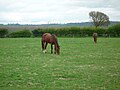 Horses by St. George's Church (Orleton) - geograph.org.uk - 5763752.jpg 3,648 × 2,736; 4.33 MB
-
 House in Orleton - panoramio.jpg 480 × 640; 80 KB
-
 In a state of collapse - geograph.org.uk - 5620677.jpg 1,024 × 768; 325 KB
-
 Inside St. George's Church (Bell Tower ^ Orleton) - geograph.org.uk - 5763726.jpg 1,920 × 1,080; 896 KB
-
 Inside St. George's Church (Bell Tower ^ Orleton) - geograph.org.uk - 5763731.jpg 1,920 × 1,080; 666 KB
-
 Interior view of Orleton Church - geograph.org.uk - 5791942.jpg 3,264 × 2,448; 1.73 MB
-
 Kings Road (Orleton) - geograph.org.uk - 6131288.jpg 3,648 × 2,056; 3.44 MB
-
 Kitchen Hill Road (Orleton) - geograph.org.uk - 6148626.jpg 3,648 × 2,736; 4.67 MB
-
 Lamp and Sign at St. George's Church (Orleton) - geograph.org.uk - 6147774.jpg 3,648 × 2,736; 4.82 MB
-
 Lamp at St. George's Church (Orleton) - geograph.org.uk - 6147673.jpg 3,648 × 2,736; 4.87 MB
-
 Lane and footpath near Richard's Castle - geograph.org.uk - 2430001.jpg 640 × 480; 118 KB
-
 Lodge Farm - geograph.org.uk - 2010315.jpg 640 × 480; 120 KB
-
 Mechanism at St. George's Church (Orleton) - geograph.org.uk - 5762699.jpg 3,648 × 2,736; 2.43 MB
-
 Medieval cross in church yard of St George's - geograph.org.uk - 3950602.jpg 4,320 × 3,240; 4.87 MB
-
 Millbrook Close, Orleton - geograph.org.uk - 2286363.jpg 640 × 480; 83 KB
-
 Mother and daughter near Lodge Farm - geograph.org.uk - 219998.jpg 640 × 480; 124 KB
-
 No. 1 Church Lane (Orleton) - geograph.org.uk - 6148513.jpg 3,648 × 2,736; 3.83 MB
-
 Old barn, Orleton - geograph.org.uk - 6314013.jpg 800 × 600; 71 KB
-

-
 Old building in Orleton - geograph.org.uk - 2912780.jpg 640 × 480; 79 KB
-
 Old Milepost by the B4361, Portway, Orleton parish (geograph 6050990).jpg 851 × 1,276; 244 KB
-
 Old roadway, Lodge Farm - geograph.org.uk - 2204243.jpg 640 × 480; 112 KB
-
 Old Tap at Orleton - geograph.org.uk - 5763848.jpg 2,048 × 1,360; 1.33 MB
-

-
 Ordnance Survey Cut Mark - geograph.org.uk - 5329302.jpg 640 × 342; 63 KB
-
 Orleton - Access By The Brook - geograph.org.uk - 1746037.jpg 640 × 480; 250 KB
-
 Orleton - Barn On Kitchen Hill Road - geograph.org.uk - 1746061.jpg 640 × 480; 169 KB
-
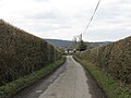
 Orleton - Kitchen Hill Road - geograph.org.uk - 1746058.jpg 640 × 480; 141 KB
-
 Orleton - Lane To Kitchen Hill Road - geograph.org.uk - 1746055.jpg 640 × 480; 174 KB
-
 Orleton - Millbrook Way - geograph.org.uk - 1746034.jpg 640 × 480; 171 KB
-

-
 Orleton - The Maidenhead Inn - geograph.org.uk - 1746049.jpg 640 × 480; 166 KB
-
 Orleton - Tunnel Lane - geograph.org.uk - 1746031.jpg 640 × 480; 160 KB
-
 Orleton Church (St. George's Church) - geograph.org.uk - 5778688.jpg 3,264 × 2,448; 1.57 MB
-
 Orleton Church back view - geograph.org.uk - 5778691.jpg 3,264 × 2,448; 1.52 MB
-
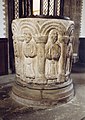
 Orleton Church font - geograph.org.uk - 5791938.jpg 3,264 × 2,448; 1.88 MB
-
 Orleton Church of England Primary School - geograph.org.uk - 6131307.jpg 3,648 × 2,056; 3.41 MB
-
 Orleton Church of England Primary School - geograph.org.uk - 6134292.jpg 3,648 × 2,736; 4.74 MB
-
 Orleton Church sign - geograph.org.uk - 5778658.jpg 3,264 × 2,448; 2.26 MB
-
 Orleton Church tower view ^1 - geograph.org.uk - 5778680.jpg 3,264 × 2,448; 1.98 MB
-
 Orleton Church tower view ^2 - geograph.org.uk - 5778682.jpg 3,264 × 2,448; 2.18 MB
-
 Orleton Community Board Sign - geograph.org.uk - 6134288.jpg 3,648 × 2,736; 4.76 MB
-
 Orleton House (Orleton) - geograph.org.uk - 6148714.jpg 3,648 × 2,736; 3.33 MB
-
 Orleton Methodist Church - geograph.org.uk - 5762151.jpg 3,648 × 2,736; 3.77 MB
-
 Orleton Methodist Church - geograph.org.uk - 5762156.jpg 3,648 × 2,736; 4.17 MB
-
 Orleton playing fields. - geograph.org.uk - 53100.jpg 640 × 480; 51 KB
-
 Orleton Post Office - geograph.org.uk - 2380460.jpg 640 × 480; 344 KB
-
 Orleton Post Office - geograph.org.uk - 6148561.jpg 3,648 × 2,736; 4.76 MB
-
 Orleton Post Office ^ War Memorial - geograph.org.uk - 6148555.jpg 4,096 × 2,633; 4.7 MB
-
 Orleton Post Office. - geograph.org.uk - 53097.jpg 640 × 480; 79 KB
-
 Orleton Rise Holiday Park - geograph.org.uk - 2430044.jpg 640 × 480; 57 KB
-
 Orleton Village Hall - geograph.org.uk - 2286370.jpg 640 × 450; 83 KB
-
 Orleton Village Hall - geograph.org.uk - 53102.jpg 640 × 480; 97 KB
-
 Orleton War Memorial - geograph.org.uk - 6148584.jpg 2,736 × 3,648; 4.85 MB
-
 Orleton War Memorial - geograph.org.uk - 6148618.jpg 2,736 × 3,648; 4.66 MB
-
 Orleton, St George - geograph.org.uk - 6361566.jpg 4,000 × 3,000; 4.8 MB
-

-

-

-
 Orleton, St. George's Church, Fragments of medieval glass - geograph.org.uk - 6144360.jpg 7,230 × 4,819; 4.36 MB
-

-

-

-

-

-

-

-

-

-

-

-

-

-
 Orleton, St. George's Church, Southern aspect - geograph.org.uk - 6144317.jpg 6,042 × 4,028; 4.22 MB
-

-
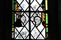
 Orleton, St. George's Church, Stained glass window - geograph.org.uk - 6144363.jpg 6,918 × 4,612; 6.43 MB
-
 Orleton, St. George's Church, Stained glass window - geograph.org.uk - 6144373.jpg 7,026 × 4,684; 3.71 MB
-
 Orleton, St. George's Church, The nave from the chancel - geograph.org.uk - 6144329.jpg 7,151 × 4,767; 5.79 MB
-
 Orleton, St. George's Church, The nave roof - geograph.org.uk - 6144341.jpg 7,088 × 4,725; 5.77 MB
-
 Orleton, St. George's Church, The pulpit - geograph.org.uk - 6144326.jpg 6,473 × 4,315; 4.67 MB
-
 Orleton, St. George's Church, Western doorway - geograph.org.uk - 6144324.jpg 5,667 × 3,778; 6.83 MB
-
 Owl Sculpture at Orleton Church of England Primary School - geograph.org.uk - 6134282.jpg 3,648 × 2,736; 4.65 MB
-
 Path to St. George's Church (Orleton) - geograph.org.uk - 6147778.jpg 3,648 × 2,736; 4.71 MB
-
 Perseverance Cottage, Orleton - geograph.org.uk - 6314010.jpg 800 × 600; 77 KB
-
 Post Office, Orleton - geograph.org.uk - 3950212.jpg 4,320 × 3,240; 4.26 MB
-

-

-

-
 Road, Yelds Hill - geograph.org.uk - 2204311.jpg 640 × 480; 139 KB
-
 Seat by Kings Road (Orleton) - geograph.org.uk - 5762121.jpg 3,648 × 2,736; 4.61 MB
-
 Services board, St George Orleton - geograph.org.uk - 5210607.jpg 1,024 × 683; 340 KB
-
 Shed at St. George's Church (Orleton) - geograph.org.uk - 5763804.jpg 3,648 × 2,736; 4.83 MB
-
 Sign at Orleton Church of England Primary School - geograph.org.uk - 6134286.jpg 3,648 × 2,736; 4.78 MB
-
 Sign at St. George's Church (Orleton) - geograph.org.uk - 5762138.jpg 2,048 × 1,360; 1.31 MB
-
 Sign at the Boot Inn (Orleton) - geograph.org.uk - 6148654.jpg 3,648 × 2,736; 4.69 MB
-
 Sign for the Baker's Arms, Orleton - geograph.org.uk - 6314006.jpg 710 × 800; 90 KB
-
 Spire at St. George's Church (Bell Tower ^ Orleton) - geograph.org.uk - 5763740.jpg 3,648 × 2,736; 3.64 MB
-
 St George's Orleton - geograph.org.uk - 3950596.jpg 4,320 × 3,240; 4.29 MB
-
 St George, Orleton - East end - geograph.org.uk - 4405948.jpg 717 × 1,024; 134 KB
-
 St George, Orleton - Font - geograph.org.uk - 4405952.jpg 709 × 1,024; 161 KB
-
 St George, Orleton - Font - geograph.org.uk - 4405953.jpg 770 × 1,086; 586 KB
-
 St George, Orleton - Font - geograph.org.uk - 4405955.jpg 770 × 1,086; 597 KB
-
 St George, Orleton - geograph.org.uk - 4405946.jpg 1,104 × 773; 504 KB
-
 St George, Orleton - geograph.org.uk - 5210609.jpg 1,024 × 683; 468 KB
-
 St George, Orleton - Pulpit - geograph.org.uk - 4405949.jpg 726 × 1,024; 147 KB
-
 St. George's Church (Altar ^ Orleton) - geograph.org.uk - 5762694.jpg 1,920 × 1,080; 654 KB
-
 St. George's Church (Bell Tower ^ Orleton) - geograph.org.uk - 5762659.jpg 2,048 × 1,360; 1.44 MB
-
 St. George's Church (Bell Tower ^ Orleton) - geograph.org.uk - 5762665.jpg 2,048 × 1,360; 1.38 MB
-
 St. George's Church (Bell Tower ^ Orleton) - geograph.org.uk - 5763812.jpg 3,648 × 2,736; 3.3 MB
-
 St. George's Church (Bell Tower ^ Orleton) - geograph.org.uk - 6147676.jpg 2,736 × 3,648; 4.42 MB
-
 St. George's Church (Chancel ^ Orleton) - geograph.org.uk - 5762706.jpg 3,648 × 2,736; 3.09 MB
-
 St. George's Church (Chancel ^ Orleton) - geograph.org.uk - 5763806.jpg 3,648 × 2,736; 3.8 MB
-
 St. George's Church (Close-Up of the Bell Tower ^ Orleton) - geograph.org.uk - 5762650.jpg 2,048 × 1,360; 1.15 MB
-
 St. George's Church (Cross ^ Orleton) - geograph.org.uk - 5763808.jpg 3,648 × 2,736; 4.73 MB
-
 St. George's Church (Cross ^ Orleton) - geograph.org.uk - 5763818.jpg 3,648 × 2,736; 4.19 MB
-
 St. George's Church (Cross ^ Orleton) - geograph.org.uk - 6147679.jpg 3,648 × 2,736; 4.68 MB
-
 St. George's Church (Font ^ Orleton) - geograph.org.uk - 5762676.jpg 3,648 × 2,736; 3.4 MB
-
 St. George's Church (Font ^ Orleton) - geograph.org.uk - 6141149.jpg 3,648 × 2,736; 3.29 MB
-
 St. George's Church (Nave ^ Orleton) - geograph.org.uk - 5762683.jpg 1,920 × 1,080; 699 KB
-
 St. George's Church (Nave ^ Orleton) - geograph.org.uk - 5762689.jpg 1,920 × 1,080; 896 KB
-
 St. George's Church (Organ ^ Orleton) - geograph.org.uk - 5762695.jpg 3,648 × 2,736; 2.76 MB
-
 St. George's Church (Organ ^ Orleton) - geograph.org.uk - 6147654.jpg 3,648 × 2,736; 3.17 MB
-
 St. George's Church (Orleton) - geograph.org.uk - 5762145.jpg 2,048 × 1,360; 1.42 MB
-
 St. George's Church (Orleton) - geograph.org.uk - 5762649.jpg 2,048 × 1,360; 1.44 MB
-
 St. George's Church (Orleton) - geograph.org.uk - 5762673.jpg 1,920 × 1,080; 752 KB
-
 St. George's Church (Orleton) - geograph.org.uk - 5763722.jpg 1,920 × 1,080; 957 KB
-
 St. George's Church (Orleton) - geograph.org.uk - 5763736.jpg 1,920 × 1,080; 998 KB
-
 St. George's Church (Orleton) - geograph.org.uk - 5763749.jpg 3,648 × 2,736; 4.61 MB
-
 St. George's Church (Orleton) - geograph.org.uk - 5763756.jpg 1,920 × 1,080; 1.02 MB
-
 St. George's Church (Orleton) - geograph.org.uk - 5763774.jpg 3,648 × 2,736; 4.01 MB
-
 St. George's Church (Orleton) - geograph.org.uk - 5763780.jpg 3,648 × 2,736; 3.74 MB
-
 St. George's Church (Orleton) - geograph.org.uk - 5763822.jpg 3,648 × 2,736; 4.81 MB
-
 St. George's Church (Orleton) - geograph.org.uk - 6134328.jpg 3,648 × 2,736; 4.85 MB
-
 St. George's Church (Orleton) - geograph.org.uk - 6141368.jpg 3,648 × 2,056; 2.33 MB
-
 St. George's Church (Orleton) - geograph.org.uk - 6147736.jpg 3,648 × 2,736; 4.72 MB
-
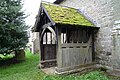 St. George's Church (Porch ^ Orleton) - geograph.org.uk - 5762657.jpg 2,048 × 1,360; 1.38 MB
-
 St. George's Church (Porch ^ Orleton) - geograph.org.uk - 6134347.jpg 3,648 × 2,736; 4.83 MB
-
 St. George's Church (Pulpit ^ Orleton) - geograph.org.uk - 5762685.jpg 3,648 × 2,736; 3.1 MB


_-_geograph.org.uk_-_6148638.jpg)


_-_geograph.org.uk_-_6147649.jpg)
_-_geograph.org.uk_-_5762670.jpg)
_-_geograph.org.uk_-_5762680.jpg)
_-_geograph.org.uk_-_5762688.jpg)
_-_geograph.org.uk_-_6148817.jpg)
_-_geograph.org.uk_-_6134307.jpg)
_-_geograph.org.uk_-_6148820.jpg)
_-_geograph.org.uk_-_6148812.jpg)
_-_geograph.org.uk_-_5763838.jpg)
_-_geograph.org.uk_-_5763745.jpg)
_-_geograph.org.uk_-_6147667.jpg)
_-_geograph.org.uk_-_6147706.jpg)
_-_geograph.org.uk_-_5763727.jpg)
_-_geograph.org.uk_-_5762653.jpg)


_-_geograph.org.uk_-_5762123.jpg)
_-_geograph.org.uk_-_5762162.jpg)
_-_geograph.org.uk_-_6147783.jpg)


_-_geograph.org.uk_-_5762663.jpg)


_-_geograph.org.uk_-_5762682.jpg)
_-_geograph.org.uk_-_6147715.jpg)
_-_geograph.org.uk_-_6147723.jpg)
_-_geograph.org.uk_-_6147725.jpg)
_-_geograph.org.uk_-_5763752.jpg)


_-_geograph.org.uk_-_5763726.jpg)
_-_geograph.org.uk_-_5763731.jpg)

_-_geograph.org.uk_-_6131288.jpg)
_-_geograph.org.uk_-_6148626.jpg)
_-_geograph.org.uk_-_6147774.jpg)
_-_geograph.org.uk_-_6147673.jpg)


_-_geograph.org.uk_-_5762699.jpg)


_-_geograph.org.uk_-_6148513.jpg)


.jpg)


_-_geograph.org.uk_-_5778688.jpg)


_-_geograph.org.uk_-_6148714.jpg)


_1_-_geograph.org.uk_-_6144386.jpg)
_2_-_geograph.org.uk_-_6144387.jpg)
_3_-_geograph.org.uk_-_6144389.jpg)


_-_geograph.org.uk_-_6147778.jpg)


_-_geograph.org.uk_-_6147641.jpg)
_-_geograph.org.uk_-_6147647.jpg)

_-_geograph.org.uk_-_5762121.jpg)

_-_geograph.org.uk_-_5763804.jpg)

_-_geograph.org.uk_-_5762138.jpg)
_-_geograph.org.uk_-_6148654.jpg)

_-_geograph.org.uk_-_5763740.jpg)


_-_geograph.org.uk_-_5762694.jpg)
_-_geograph.org.uk_-_5762659.jpg)
_-_geograph.org.uk_-_5762665.jpg)
_-_geograph.org.uk_-_5763812.jpg)
_-_geograph.org.uk_-_6147676.jpg)
_-_geograph.org.uk_-_5762706.jpg)
_-_geograph.org.uk_-_5763806.jpg)
_-_geograph.org.uk_-_5762650.jpg)
_-_geograph.org.uk_-_5763808.jpg)
_-_geograph.org.uk_-_5763818.jpg)
_-_geograph.org.uk_-_6147679.jpg)
_-_geograph.org.uk_-_5762676.jpg)
_-_geograph.org.uk_-_6141149.jpg)
_-_geograph.org.uk_-_5762683.jpg)
_-_geograph.org.uk_-_5762689.jpg)
_-_geograph.org.uk_-_5762695.jpg)
_-_geograph.org.uk_-_6147654.jpg)
_-_geograph.org.uk_-_5762145.jpg)
_-_geograph.org.uk_-_5762649.jpg)
_-_geograph.org.uk_-_5762673.jpg)
_-_geograph.org.uk_-_5763722.jpg)
_-_geograph.org.uk_-_5763736.jpg)
_-_geograph.org.uk_-_5763749.jpg)
_-_geograph.org.uk_-_5763756.jpg)
_-_geograph.org.uk_-_5763774.jpg)
_-_geograph.org.uk_-_5763780.jpg)
_-_geograph.org.uk_-_5763822.jpg)
_-_geograph.org.uk_-_6134328.jpg)
_-_geograph.org.uk_-_6141368.jpg)
_-_geograph.org.uk_-_6147736.jpg)
_-_geograph.org.uk_-_5762657.jpg)
_-_geograph.org.uk_-_6134347.jpg)
_-_geograph.org.uk_-_5762685.jpg)