Category:Osterwitz
Jump to navigation
Jump to search
former municipality in Austria  | |||||
| Upload media | |||||
| Instance of |
| ||||
|---|---|---|---|---|---|
| Location | |||||
| Area |
| ||||
| Elevation above sea level |
| ||||
| official website | |||||
 | |||||
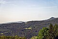
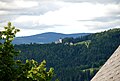
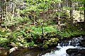
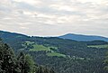
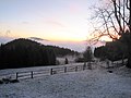
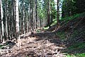
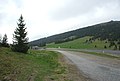
English: Osterwitz is a former municipality in the district of Deutschlandsberg in the Austrian state of Styria.
Subcategories
This category has the following 21 subcategories, out of 21 total.
B
- Bauernschreck Koralmgebiet 1913 (25 F)
- Beichtzettel aus Osterwitz (20 F)
F
- Frauenbründl, Osterwitz (5 F)
- Friedhof Osterwitz (5 F)
G
H
- Handhöhkreuz (26 F)
K
- Kloareinisch (30 F)
N
- Nigljosl (37 F)
P
- Pfarrhof Osterwitz (9 F)
- Postcards of Osterwitz (22 F)
R
- Leo Reinisch (33 F)
S
- Stoffbach (4 F)
W
- Waldbahn Deutschlandsberg (23 F)
Media in category "Osterwitz"
The following 92 files are in this category, out of 92 total.
-
 Andenken an Maria Osterwitz Kirche.jpg 1,412 × 1,645; 954 KB
-
 Auf Wiedersehen in Osterwitz.jpg 1,920 × 1,080; 1,023 KB
-
 Bauernstube Pongratz vlg. Schober 1920er Jahre.jpg 708 × 459; 275 KB
-
 Bei der Gipflhüttn.jpg 2,693 × 1,669; 1.07 MB
-
 Block Glimmerschiefer auf der Hebalm.jpg 2,685 × 1,937; 1.62 MB
-
 Blütenstände.JPG 2,896 × 1,944; 1.38 MB
-
 Bürstlingwiese neu.JPG 2,896 × 1,944; 1.65 MB
-
 Ehemaliger Seeberg nördlich See Eben.JPG 2,896 × 1,944; 1.35 MB
-

-
 Gedenktafel an Leo Reinisch an seinem Geburtshaus.JPG 2,560 × 1,920; 3.23 MB
-
 Getreideernte in Osterwitz um 1935.jpg 1,142 × 796; 606 KB
-
 Gneisglimmerschiefer Hebalm.JPG 2,896 × 1,944; 1.36 MB
-
 Hebalpe Stockalpe Schmutz 1822.jpg 2,383 × 319; 304 KB
-
 ID 474 Linde 0006.jpg 2,000 × 3,000; 1,010 KB
-
 ID 475 Föhre 0025.jpg 2,000 × 3,000; 2.81 MB
-
 ID 475 Föhre 0032.jpg 2,000 × 3,000; 2.25 MB
-
 Kumpfkogel, Moseralm, Handalm Osterwitz.jpg 2,896 × 1,944; 2.44 MB
-
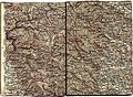 Landkarte Deutschlandsberg, Wolfsberg, Hebalm 2.jpg 6,286 × 4,630; 45.93 MB
-
 Logo Osterwitz, Zeichnung Melitta Zingler.JPG 878 × 938; 473 KB
-
 Logo-Zeichnung-Osterwitz.jpg 1,243 × 1,646; 541 KB
-
 Luftaufnahme Osterwitz.jpg 3,008 × 2,000; 2.8 MB
-
 Map at osterwitz.png 400 × 240; 3 KB
-
 Mittlere Koralpe Laßnitztal.jpg 2,896 × 1,944; 3.15 MB
-
 Moseralm1.jpg 2,896 × 1,944; 1.29 MB
-
 Netzpläne Autobuslinien Weststeiermark, Oststeiermark Sommer 1934.jpg 10,558 × 8,407; 58.32 MB
-
 Oberes Laßnitztal von Sallegg aus.jpg 2,896 × 1,828; 2.67 MB
-
 Osterwitz - alte Hofstätte.jpg 207 × 270; 14 KB
-
 Osterwitz 294A0700 Styria.jpg 6,436 × 2,696; 3.4 MB
-
 Osterwitz CF9A3183.jpg 3,333 × 2,222; 2.71 MB
-
 Osterwitz Gemeindegebäude.jpg 2,896 × 1,944; 2.64 MB
-
 Osterwitz Getreideernte Zachfeld ca. 1930.jpg 693 × 478; 241 KB
-
 Osterwitz im Bezirk DL.png 645 × 645; 29 KB
-
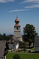
 Osterwitz Kirche vom Norden.jpg 2,896 × 1,944; 1.2 MB
-
 Osterwitz Kirche,Pfarrhof.jpg 3,008 × 2,000; 2.92 MB
-
 Osterwitz mit Kumpfkogel und Schwanberger Brendl.jpg 2,896 × 1,944; 2.12 MB
-
 Osterwitz mit Kumpfkogel.jpg 2,896 × 1,632; 2.23 MB
-
 Osterwitz Panorama, Foto Wiesbauer.jpg 4,288 × 1,429; 3.63 MB
-
 Osterwitz Pfarrhof, Kirche, altes Schulhaus.jpg 3,741 × 2,494; 5.45 MB
-
 Osterwitz Pfarrkirchenturm von Nordzufahrt.jpg 2,896 × 1,944; 838 KB
-
 Osterwitz um 1925.jpg 245 × 380; 48 KB
-
 Osterwitz um 1930.jpg 384 × 255; 56 KB
-
 Osterwitz und Kumpfkogel.jpg 2,896 × 1,944; 325 KB
-
 Osterwitz von Nord.JPG 3,008 × 2,000; 2.63 MB
-
 Osterwitz von St Oswald 2023-06-22.jpg 6,016 × 4,016; 15.17 MB
-
 Osterwitz von St Oswald aus.jpg 2,896 × 1,944; 4.68 MB
-
 Osterwitz von Südost.jpg 3,508 × 1,229; 2.21 MB
-
 Osterwitz vor der Schwanberger Brendl (Wolscheneck).jpg 2,896 × 1,944; 4.64 MB
-
Osterwitzer Roas.webm 4 min 8 s, 1,440 × 1,080; 81.6 MB
-
 Personalstand 1817.jpg 3,295 × 2,664; 5.61 MB
-
 Personalstand 1893.jpg 3,590 × 2,724; 6.32 MB
-
 Pöschlkapelle 2023-06-01 l Südkopf der ehem Brücke über die Laßnitz Weggabelung.jpg 6,016 × 4,016; 19.41 MB
-
 Pöschlkapelle 2023-06-01 n Südkopf der ehem Brücke über die Laßnitz Weggabelung.jpg 6,016 × 4,016; 15.28 MB
-
 Pöschlkapelle 2023-06-01 p Mündung Rettenbach in Laßnitz.jpg 4,016 × 6,016; 16.21 MB
-
 Pöschlkapelle 2023-06-01 q Mündung Rettenbach in Laßnitz.jpg 6,016 × 4,016; 11.58 MB
-
 Pöschlkapelle 2023-06-01 t Südkopf der ehem Brücke über die Laßnitz.jpg 6,016 × 4,016; 12.67 MB
-
 Pöschlkapelle 2023-06-01 u Laßnitz alter Pöschlweg oberhalb Standort.jpg 6,016 × 4,016; 15.18 MB
-
 Pöschlkogel.jpg 2,896 × 1,944; 642 KB
-
 Pöschlkogel2.jpg 2,896 × 1,944; 615 KB
-
 Pöschlkogel3.jpg 2,896 × 1,944; 584 KB
-
 Pöschlkogel4.jpg 2,896 × 1,944; 482 KB
-
 Quellgebiet der Laßnitz bei der Handalm.jpg 2,837 × 1,829; 732 KB
-
 RAD Lager Brendlschlag 1939.jpg 6,628 × 4,222; 19.88 MB
-
 Regenbogen Osterwitz (Horst Pobernel).jpg 6,000 × 4,000; 4.38 MB
-
 Rettenbach vor Mündung.JPG 1,944 × 2,896; 1.55 MB
-
 Seemoos Gerinne.jpg 1,931 × 2,686; 2.31 MB
-
 Seemoos2.JPG 2,896 × 1,944; 1.36 MB
-
 Sonnenaufgang Brunnen2.jpg 448 × 336; 43 KB
-
 Sonnenaufgang Winter.jpg 2,048 × 1,536; 1.17 MB
-
 Speikkogel, Kumpfkogel und Moseralm.jpg 2,896 × 1,944; 1.69 MB
-
 Speikkogel, Moseralm, Handalm, Osterwitz.jpg 2,896 × 1,888; 2.42 MB
-
 Spitzegg Osterwitz Schwarzkogel.jpg 2,896 × 1,944; 3.68 MB
-
 St Oswald in Freiland Kirchenstadel dahinter Osterwitz.jpg 2,896 × 1,944; 4.79 MB
-
 Stoffkogel, Pöschl.jpg 2,896 × 1,944; 473 KB
-
 Stoffkogel, Pöschl2.jpg 2,896 × 1,944; 483 KB
-
 Sulm- und Stullneggtal von Weinebene.jpg 2,896 × 1,944; 963 KB
-
 Talnebel.jpg 3,648 × 2,736; 1.55 MB
-
 Talschluss.jpg 2,896 × 1,944; 361 KB
-
 Teufelsstein Osterwitz.jpg 3,648 × 2,736; 2.6 MB
-
 Unterwegs zur Yakfütterung.jpg 2,048 × 1,536; 2.63 MB
-
 Vor der Trahütterhütte in Osterwitz ca. 1935.jpg 678 × 459; 201 KB
-
 Waldbahntrasse5.JPG 2,896 × 1,944; 1.65 MB
-
 Wanderspruch.JPG 1,944 × 2,896; 1.37 MB
-
 Weineben Passhöhe Ri Ktn.JPG 2,896 × 1,944; 1.26 MB
-
 Weineben Passhöhe Ri Stmk.JPG 2,896 × 1,944; 1.31 MB
-
 Weineben Passhöhe2.jpg 2,896 × 1,944; 1.28 MB
-
 Weineben Wegweiser.jpg 1,944 × 2,896; 1.23 MB
-
 Weinebene Blick nach Osten 05062011 111.jpg 4,288 × 2,848; 2.06 MB
-
 Weinebene Blick nach Osten auf die Passstrasse 05062011 112.jpg 4,288 × 2,848; 3.8 MB
-
 Weinebene Passhöhe.jpg 2,896 × 1,944; 870 KB
-
 Weinebene.jpg 3,648 × 2,736; 2.32 MB
-
 Willkommen in Osterwitz.jpg 1,295 × 883; 406 KB
-
 Örtliche Situation und Kataster ehem Strelly-Säge am Rettenbach.jpg 3,747 × 2,175; 1.95 MB


,_Steiermark.jpg)


.jpg)


.jpg)


