Category:Paddlesworth
Jump to navigation
Jump to search
English: Paddlesworth is a village located about 3 miles (4.8km) NNW of Folkestone in Kent, England, near Hawkinge. The Early Norman parish church is dedicated to St Oswald; and the public house is 'The Cat and Custard Pot'.
village and civil parish in Folkestone and Hythe District, Kent, England, UK  | |||||
| Upload media | |||||
| Instance of | |||||
|---|---|---|---|---|---|
| Location | Folkestone and Hythe, Kent, South East England, England | ||||
 | |||||
Subcategories
This category has the following 2 subcategories, out of 2 total.
A
- Acrise Park (9 F)
P
Media in category "Paddlesworth"
The following 66 files are in this category, out of 66 total.
-
 A distant view of the sea - geograph.org.uk - 3311179.jpg 1,142 × 856; 183 KB
-
 Aerodrome Road, Paddlesworth - geograph.org.uk - 6396716.jpg 5,456 × 3,632; 2.64 MB
-
 Aggressive dog bites off more then he could chew - geograph.org.uk - 6396688.jpg 5,456 × 3,632; 4.87 MB
-
 Bridleway leading to Shuttlesfield - geograph.org.uk - 6396725.jpg 4,152 × 2,560; 1.11 MB
-
 Bridleway leading to Shuttlesfield - geograph.org.uk - 6396742.jpg 4,471 × 3,117; 2.08 MB
-
 Bridleway to Acrise Court - geograph.org.uk - 5524018.jpg 640 × 480; 124 KB
-
 Bridleway to Shuttlesfield (2) - geograph.org.uk - 2107723.jpg 3,072 × 2,304; 1.88 MB
-
 Bridleway to Shuttlesfield - geograph.org.uk - 2107707.jpg 3,072 × 2,304; 2.26 MB
-
 Car park, Cat ^ Custard Pot, Paddlesworth Lane - geograph.org.uk - 5292775.jpg 3,264 × 2,448; 3.85 MB
-
 Cheriton Hill Trig And Reservoir - geograph.org.uk - 3335079.jpg 2,592 × 1,944; 1.7 MB
-
 Clearing in Acrise Wood - geograph.org.uk - 865410.jpg 640 × 480; 212 KB
-

-

-
 Crossroads on Winterage Lane - geograph.org.uk - 865426.jpg 640 × 480; 221 KB
-
 Entering Paddlesworth from the west - geograph.org.uk - 1562157.jpg 640 × 479; 169 KB
-
 Farm track near Paddlesworth Court Farm - geograph.org.uk - 5016324.jpg 640 × 428; 141 KB
-
 Field off School Lane - geograph.org.uk - 1955878.jpg 1,024 × 683; 164 KB
-
 Footpath to Hawkinge - geograph.org.uk - 3169873.jpg 4,288 × 3,216; 3.8 MB
-
 Footpath to Redsole Farm - geograph.org.uk - 3169888.jpg 4,288 × 3,216; 3.38 MB
-
 Footpath to School Road - geograph.org.uk - 3169865.jpg 4,288 × 3,216; 3.67 MB
-
 Footpath to Sole Farm - geograph.org.uk - 2107733.jpg 3,072 × 2,304; 1.58 MB
-
 Inside St Benedict's, Paddlesworth (50338331887).jpg 1,024 × 768; 297 KB
-
 Junction on road to Shuttlesfield - geograph.org.uk - 865461.jpg 640 × 480; 160 KB
-
 Lane from Denshole to Paddlesworth - geograph.org.uk - 5016343.jpg 640 × 428; 203 KB
-
 Lane from Paddlesworth to Densole - geograph.org.uk - 5016337.jpg 640 × 428; 134 KB
-
 Lane from Sole Pond Farm to Aerodrome Road - geograph.org.uk - 5571701.jpg 4,000 × 3,000; 4.18 MB
-
 Little Shuttlesfield - geograph.org.uk - 865453.jpg 640 × 480; 168 KB
-

-

-
 North Downs Way east of Etchinghill - geograph.org.uk - 351491.jpg 640 × 467; 53 KB
-
 Paddlesworth village sign - geograph.org.uk - 6396723.jpg 2,523 × 2,504; 893 KB
-
 Paddlesworth village sign.jpg 640 × 480; 258 KB
-
 Path leading to Paddlesworth - geograph.org.uk - 6396680.jpg 5,456 × 3,632; 2.56 MB
-
 Path leading to Paddlesworth - geograph.org.uk - 6396681.jpg 5,456 × 3,632; 3.41 MB
-
 Path leading to Paddlesworth - geograph.org.uk - 6396683.jpg 4,479 × 2,908; 1.53 MB
-
 Pillbox - panoramio.jpg 2,048 × 1,536; 626 KB
-
 Postbox on Upper Arpinge Road, Paddlesworth - geograph.org.uk - 6396710.jpg 3,632 × 5,456; 2.58 MB
-
 Road to Redsole Farm - geograph.org.uk - 3169862.jpg 4,288 × 3,216; 3.28 MB
-
 Shuttlesfield - geograph.org.uk - 441284.jpg 640 × 417; 254 KB
-
 St Oswald, Paddlesworth - Chancel - geograph.org.uk - 3910399.jpg 1,000 × 660; 197 KB
-
 St Oswald, Paddlesworth - Doorway - geograph.org.uk - 3910396.jpg 667 × 1,000; 298 KB
-
 St Oswald, Paddlesworth - East end - geograph.org.uk - 3910401.jpg 1,000 × 663; 200 KB
-
 St Oswald, Paddlesworth - Font - geograph.org.uk - 3910398.jpg 667 × 1,000; 165 KB
-
 St Oswald, Paddlesworth - geograph.org.uk - 3910391.jpg 1,000 × 664; 214 KB
-
 St Oswald, Paddlesworth - geograph.org.uk - 3910392.jpg 1,000 × 667; 179 KB
-

-
 St Oswald, Paddlesworth - Stained glass window - geograph.org.uk - 3910397.jpg 396 × 1,000; 146 KB
-
 The Cat and Custard Pot from the SW - geograph.org.uk - 867838.jpg 640 × 480; 187 KB
-
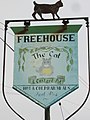 The Cat and Custard Pot, pub sign - geograph.org.uk - 851786.jpg 480 × 640; 144 KB
-
 The Cat ^ Custard Pot, Paddleworth - geograph.org.uk - 6396695.jpg 5,456 × 3,632; 1.72 MB
-
 The Cat ^ Custard Pot, Paddleworth - geograph.org.uk - 6396697.jpg 3,632 × 5,456; 1.51 MB
-
 The Cat ^ Custard Pot, Paddleworth - geograph.org.uk - 6396702.jpg 5,456 × 3,632; 2 MB
-

-
 The Spitfire March - geograph.org.uk - 2432867.jpg 768 × 1,024; 200 KB
-
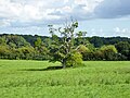 Tree in field, Paddlesworth - geograph.org.uk - 5524028.jpg 640 × 480; 141 KB
-
 View along lane by Acrise Wood - geograph.org.uk - 865400.jpg 640 × 480; 279 KB
-
 View of Densole and Reinden Wood - geograph.org.uk - 2107746.jpg 3,072 × 1,728; 1.2 MB
-

-
 Cattle-grid to military training land - geograph.org.uk - 441302.jpg 640 × 428; 214 KB
-
 Cheriton Hill - geograph.org.uk - 161059.jpg 640 × 480; 108 KB
-
 Cheriton Hill - geograph.org.uk - 8080.jpg 640 × 480; 109 KB
-

-
 Looking across valley - geograph.org.uk - 429058.jpg 640 × 480; 212 KB
-
 Off Winterage Lane - geograph.org.uk - 415319.jpg 640 × 480; 68 KB
-

-
 Track by Pillars Wood - geograph.org.uk - 441356.jpg 640 × 428; 173 KB


_-_geograph.org.uk_-_2107723.jpg)


.jpg)


