Category:Palaeogeography
Jump to navigation
Jump to search
the study of historical geography  | |||||
| Upload media | |||||
| Instance of | |||||
|---|---|---|---|---|---|
| Part of | |||||
| Discoverer or inventor | |||||
| Start time |
| ||||
| |||||
Subcategories
This category has the following 37 subcategories, out of 37 total.
Media in category "Palaeogeography"
The following 86 files are in this category, out of 86 total.
-
 1 Ma paleoglobe.png 3,814 × 1,754; 414 KB
-
 1040 Ma paleoglobe.png 3,814 × 1,754; 2.3 MB
-
 15 Ma paleoglobe.png 3,814 × 1,754; 329 KB
-
 1590 Ma.png 3,814 × 1,754; 1.54 MB
-
 170 Ma.png 3,814 × 1,754; 301 KB
-
 1740 Ma paleoglobe.png 3,814 × 1,754; 1.55 MB
-
 2000 Ma paleoglobe.png 3,814 × 1,754; 1.18 MB
-
 220 Ma paleoglobe.png 3,814 × 1,754; 291 KB
-
 2200 Ma.png 3,814 × 1,754; 997 KB
-
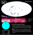
 2400 Ma paleoglobe.png 3,814 × 1,754; 904 KB
-
 250 Million Years Future World (Pangaea Proxima).jpg 8,000 × 5,000; 898 KB
-
 2650 Ma paleoglobe.png 3,814 × 1,754; 740 KB
-
 275 Ma paleoglobe.png 3,814 × 1,754; 296 KB
-
 3000 Ma paleoglobe.png 3,814 × 1,754; 504 KB
-
 330 Ma paleoglobe.png 3,814 × 1,754; 290 KB
-
 370 Ma paleoglobe.png 3,814 × 1,754; 289 KB
-
 40 Ma paleoglobe.png 3,814 × 1,754; 335 KB
-
 440 Ma paleoglobe.png 3,814 × 1,754; 292 KB
-
 460 Ma paleoglobe.png 3,814 × 1,754; 289 KB
-
 510 Ma paleoglobe.png 3,814 × 1,754; 286 KB
-
 600 Ma paleoglobe.png 3,814 × 1,754; 280 KB
-
 720 Ma.png 3,814 × 1,754; 288 KB
-
 750 Ma paleoglobe.png 3,814 × 1,754; 274 KB
-
 AHG-EP-P-92-p3.jpg 5,952 × 8,799; 28.81 MB
-
 Arctic Alaska-Chukotka 100Ma.jpg 1,497 × 815; 267 KB
-
 Arctic Alaska-Chukotka 150Ma.jpg 1,497 × 815; 251 KB
-
 Arctic Alaska-Chukotka 50Ma.jpg 1,497 × 815; 328 KB
-
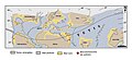
 AVALONIA.svg 784 × 367; 49 KB
-
 Bystrzyca.jpg 960 × 720; 79 KB
-
-
 Distribution of caseid synapsids in late Paleozoic Pangea detail.jpg 1,728 × 892; 254 KB
-
 Distribution of caseid synapsids in late Paleozoic Pangea.jpg 1,728 × 892; 266 KB
-
 Future World,Pangaea Proxima,250 Million Years..jpg 10,000 × 8,000; 1.52 MB
-
 Glasiasi Huron.svg 1,350 × 1,439; 527 KB
-
 H76fxz43jwp71.webp 1,080 × 433; 48 KB
-
 Hanging Valley (a paleo-canyon) near Red Rock Point (3952551867).jpg 1,600 × 1,067; 624 KB
-
 Image 0.00Mya.jpg 3,000 × 2,000; 217 KB
-
 Image 000.00My -Present day.jpg 948 × 487; 29 KB
-
 Image 050.00MY-formation of Pangaea Proxima.jpg 948 × 487; 26 KB
-
 Image 100.00Ma Paleomap.jpg 1,280 × 1,734; 68 KB
-
 Image 100.00MPVF Amasia.jpg 2,948 × 2,487; 254 KB
-
 Image 100.00MY-Pangaea Proxima.jpg 948 × 487; 27 KB
-
 Image 1100.00MYA.jpg 1,280 × 734; 51 KB
-
 Image 130.00,ya.jpg 3,000 × 2,000; 191 KB
-
 Image 150.00Myf.jpg 3,000 × 2,000; 185 KB
-
 Image 1500.00MYA.jpg 1,280 × 734; 43 KB
-
 Image 155.00Ma Paleomap.jpg 1,280 × 1,734; 69 KB
-
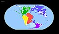 Image 170.00MYA.jpg 1,280 × 734; 64 KB
-
 Image 20.00Mya.jpg 3,000 × 2,000; 210 KB
-
 Image 200.00MY-formation of PangaeaProxima.jpg 948 × 487; 27 KB
-
 Image 200.00MYA.jpg 1,280 × 734; 65 KB
-
 Image 200.00Mya.jpg 3,000 × 2,000; 153 KB
-
 Image 200.00Myf.jpg 3,000 × 2,000; 270 KB
-
 Image 205.00Ma Paleomap.jpg 1,280 × 1,734; 67 KB
-
 Image 250.00MYA.jpg 1,280 × 734; 61 KB
-
 Image 250.00Myf.jpg 3,000 × 2,000; 189 KB
-
 Image 310.00MYA.jpg 1,280 × 734; 56 KB
-
 Image 355.00Ma Paleomap.jpg 1,280 × 1,734; 67 KB
-
 Image 430.00Ma Paleomap.jpg 1,280 × 1,734; 66 KB
-
 Image 430.00MYA.jpg 1,280 × 734; 51 KB
-
 Image 45.00Mya.jpg 3,000 × 2,000; 221 KB
-
 Image 490.00MYA.jpg 1,280 × 734; 49 KB
-
 Image 50.00Myf.jpg 3,000 × 2,000; 158 KB
-
 Image 55.00Ma Paleomap.jpg 1,280 × 1,734; 75 KB
-
 Image 590.00MYA.jpg 1,280 × 734; 51 KB
-
 Image 60.00Mya.jpg 3,000 × 2,000; 222 KB
-
 Image 850.00MYA.jpg 1,280 × 734; 51 KB
-
 Image 95.00Mya.jpg 3,000 × 2,000; 212 KB
-
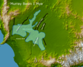 Lake Bungunnia of the Murray Basin.png 1,224 × 1,000; 2.47 MB
-
 Odra.jpg 3,024 × 4,032; 1.52 MB
-
 Ordovician 470.svg 1,052 × 744; 34 KB
-

-
 Paleographic map of beginning Bedford Time in eastern North America.jpg 3,400 × 4,450; 436 KB
-
 Paleographic map of early Bedford Time in eastern North America.jpg 3,400 × 4,450; 485 KB
-
 Paleographic map of end Bedford Time in eastern North America.jpg 3,400 × 4,450; 477 KB
-
 Paleostarorzecze.jpg 720 × 960; 182 KB
-
 Pangaea assembly 430.png 1,123 × 794; 128 KB
-
 Pangaea assembly 490.png 1,123 × 794; 131 KB
-
 Pangea assembly 250.png 1,123 × 794; 159 KB
-
 Rdzen.jpg 3,024 × 4,032; 7.89 MB
-
 Riachuelo Formation cross section.png 6,072 × 3,417; 5.17 MB
-
 Upper Cambrian SPICE Map.png 1,004 × 514; 236 KB
-
 Vaalbara Continent.jpg 1,920 × 1,080; 525 KB
-
 Долуханов Павел Маркович.jpg 1,118 × 1,620; 251 KB
-
 Дропстоун1.jpg 2,277 × 1,438; 2.15 MB
-
 Лагерь на Каитуни2.jpg 1,757 × 1,150; 1.06 MB


.jpg)


.jpg)


_near_Red_Rock_Point_(3952551867).jpg)


