Category:Papenveer
Jump to navigation
Jump to search
| Object location | | View all coordinates using: OpenStreetMap |
|---|
human settlement in the Netherlands  | |||||
| Upload media | |||||
| Instance of | |||||
|---|---|---|---|---|---|
| Location | Nieuwkoop, South Holland, Netherlands | ||||
 | |||||
Media in category "Papenveer"
The following 5 files are in this category, out of 5 total.
-
 Map - NL - Nieuwkoop - Wijk 03 Ter Aar - Buurt 02 Papenveer.svg 375 × 375; 26 KB
-
 Aarkanaal Papenveer.jpg 1,897 × 1,280; 302 KB
-
 Exterieur OVERZICHT - Papenveer - 20297942 - RCE.jpg 1,183 × 1,200; 308 KB
-
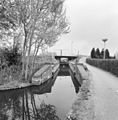 Overzicht schutsluisje - Papenveer - 20353255 - RCE.jpg 1,176 × 1,200; 384 KB
-
 Schutsluis Papenveer.jpg 2,048 × 1,536; 649 KB


