Category:Perth, Scotland
Jump to navigation
Jump to search
city in Perth and Kinross, Scotland, UK   | |||||
| Upload media | |||||
| Instance of |
| ||||
|---|---|---|---|---|---|
| Location |
| ||||
| Located in or next to body of water | |||||
| Population |
| ||||
| Different from | |||||
| official website | |||||
 | |||||
Subcategories
This category has the following 23 subcategories, out of 23 total.
B
- Branklyn Garden (10 F)
C
- Perth City Council (3 F)
F
- Friarton Island (14 F)
G
J
K
M
- Mercat cross, Perth (11 F)
N
P
S
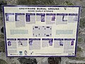
- Signs in Perth, Scotland (6 F)
T
Media in category "Perth, Scotland"
The following 200 files are in this category, out of 388 total.
(previous page) (next page)-
 19890711a Perth.jpg 2,342 × 1,518; 966 KB
-
 43138 on Tay Viaduct.jpg 9,144 × 6,096; 9.56 MB
-
 A busy place - geograph.org.uk - 1638838.jpg 640 × 480; 73 KB
-
 A change of direction - geograph.org.uk - 2395344.jpg 640 × 480; 102 KB
-
 A glimpse of the Tay valley - geograph.org.uk - 23502.jpg 640 × 480; 177 KB
-
 American troops entering Perth, Scotland, 1918 - NARA - 530943.tif 3,000 × 2,390; 6.84 MB
-
 Andy Gray, Perth born Actor.jpg 615 × 909; 84 KB
-
 Arcoss the chilly river - geograph.org.uk - 1658166.jpg 640 × 428; 60 KB
-
 Atholl Crescent 2024.jpg 4,032 × 3,024; 2.8 MB
-
 Bankhead.jpg 4,041 × 3,881; 4.92 MB
-
 Beasties by the Tay - geograph.org.uk - 1134075.jpg 640 × 480; 45 KB
-
 Beech hedge in spring - geograph.org.uk - 789808.jpg 484 × 640; 104 KB
-
 Bellwood Riverside Park, Easter Sunday - geograph.org.uk - 734924.jpg 640 × 483; 103 KB
-
 Boat moored in the River Tay - geograph.org.uk - 4030374.jpg 640 × 490; 533 KB
-
 Calm waters - geograph.org.uk - 3366097.jpg 2,048 × 1,536; 524 KB
-
 Camilla Bell Park in Perth.jpg 4,624 × 3,468; 4.17 MB
-
 Carteret Millais, Perth, Scotland.jpg 1,632 × 916; 625 KB
-

-

-
 Choppy water below Queens Bridge - geograph.org.uk - 2716103.jpg 640 × 480; 121 KB
-
 Christmas in the Rodney Gardens, Perth - geograph.org.uk - 1633162.jpg 640 × 480; 101 KB
-
 Christmas View from Queens Bridge - geograph.org.uk - 2208242.jpg 640 × 482; 106 KB
-
 Coa Scotland Town Perth big.svg 576 × 760; 258 KB
-
 Coa Scotland Town Perth.svg 260 × 300; 131 KB
-
 Craigend Interchange - geograph.org.uk - 6967.jpg 640 × 480; 76 KB
-
 Craigievar 2024.jpg 5,712 × 4,284; 9.69 MB
-
 Crossing Moncreiffe Island - geograph.org.uk - 4529915.jpg 800 × 450; 340 KB
-
 Customs seal, from Perth.jpg 1,018 × 887; 316 KB
-
 Cutlog Vennel (geograph 4711403).jpg 640 × 480; 88 KB
-
 Cycle track - geograph.org.uk - 460127.jpg 640 × 419; 126 KB
-
 D Steven and Son (Wick) Scania, Perth, 21 May 2015.jpg 3,104 × 1,746; 1.52 MB
-
 Daffodils in Kinnoull Woods - geograph.org.uk - 375487.jpg 640 × 480; 189 KB
-
 Daffodils, North Inch - geograph.org.uk - 1213053.jpg 640 × 480; 153 KB
-
 Damson blossom - geograph.org.uk - 394731.jpg 640 × 480; 147 KB
-
-
 England and Scotland 152.jpg 1,024 × 768; 312 KB
-
 England and Scotland 153.jpg 1,024 × 768; 287 KB
-
 England and Scotland 154.jpg 1,024 × 768; 365 KB
-
 England and Scotland 155.jpg 1,024 × 768; 365 KB
-
 England and Scotland 158.jpg 1,024 × 768; 247 KB
-
 Euphemia Millais Gray.jpg 901 × 1,314; 449 KB
-
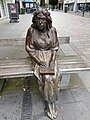 Fair Maid of Perth statue 2024.jpg 4,284 × 5,712; 6.19 MB
-
 Fair Maid's House 2024.jpg 5,712 × 4,284; 6.53 MB
-
 Fair Maid's House date stone.jpg 5,712 × 4,284; 9.92 MB
-
 Ferns - geograph.org.uk - 694782.jpg 640 × 480; 126 KB
-
 Field beside the Scouring Burn - geograph.org.uk - 1506384.jpg 640 × 480; 124 KB
-
 Flag of Perth.png 4,134 × 2,475; 538 KB
-
 Flood Plains in Perthshire.JPG 2,048 × 1,536; 1.05 MB
-
 Flood water levels - geograph.org.uk - 1969143.jpg 428 × 640; 79 KB
-
 Floral display - geograph.org.uk - 192210.jpg 640 × 480; 88 KB
-
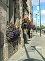 Floral display on Tay Street, Perth - geograph.org.uk - 2065996.jpg 480 × 640; 107 KB
-
 Flowers next to the cathedral - geograph.org.uk - 869771.jpg 640 × 493; 107 KB
-
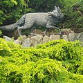 Fox Sculpture in Rodney Gardens Perth - geograph.org.uk - 4169438.jpg 640 × 640; 196 KB
-
 Free Presbyterian Church, Perth.jpg 4,032 × 3,024; 2.67 MB
-
 Frosty foggy morning looking from Perth Towards Dundee.jpg 8,256 × 5,504; 43.4 MB
-
 Frozen bank to bank - geograph.org.uk - 1658804.jpg 640 × 479; 106 KB
-
 Frozen over - geograph.org.uk - 1658159.jpg 640 × 428; 40 KB
-
 Full Up - geograph.org.uk - 2235110.jpg 1,024 × 667; 92 KB
-
 Gannochy duck pond.jpg 640 × 485; 103 KB
-
 Gaskhill 2024.jpg 5,712 × 4,284; 7.29 MB
-
 George Street, Perth - geograph.org.uk - 2882580.jpg 640 × 426; 71 KB
-
 Giant hogweed growing by the River Tay - geograph.org.uk - 4029989.jpg 640 × 427; 445 KB
-
 Greyfriars 2024 2.jpg 5,712 × 4,284; 5.75 MB
-
 Greyfriars 2024.jpg 4,284 × 5,712; 8.27 MB
-
 Greyfriars Burial Ground 2024.jpg 9,038 × 3,828; 12.96 MB
-
 High tide is not always peaceful - geograph.org.uk - 765027.jpg 640 × 480; 99 KB
-
 Ice and reflections on the Tay - geograph.org.uk - 1653377.jpg 640 × 480; 102 KB
-
 Ice floes - geograph.org.uk - 1658162.jpg 640 × 428; 42 KB
-
 Ice forming on the Tay - geograph.org.uk - 1638366.jpg 640 × 479; 106 KB
-
 Ice^ - geograph.org.uk - 1658215.jpg 421 × 640; 66 KB
-
 Into Town. - geograph.org.uk - 1658180.jpg 428 × 640; 66 KB
-
 Inveraven, rear of.jpg 3,666 × 2,780; 2.33 MB
-
 Inveraven.jpg 5,712 × 4,284; 9.24 MB
-
 James VI ryal 1569 74001479.jpg 800 × 393; 122 KB
-
 Jet skiing on the River Tay - geograph.org.uk - 4031866.jpg 640 × 425; 242 KB
-
 Jet skiing on the River Tay - geograph.org.uk - 4031869.jpg 640 × 430; 338 KB
-
 Jet skiing on the River Tay - geograph.org.uk - 4031872.jpg 640 × 427; 346 KB
-
 Kinnoull FC (8595701219).jpg 3,648 × 2,736; 1.94 MB
-
 Kinnoull FC (8595703793).jpg 2,737 × 2,119; 794 KB
-
 Kinnoull FC (8596805584).jpg 3,648 × 2,736; 2.28 MB
-
 Kinnoull Terrace 2024.jpg 3,816 × 4,502; 6.12 MB
-
 Klimadiagramm-metrisch-deutsch-Perth (Schottland)-GB.png 1,024 × 713; 110 KB
-
 Lickley Street.jpg 1,024 × 615; 128 KB
-
 Little Grebe - geograph.org.uk - 1658172.jpg 640 × 484; 78 KB
-
 M90 Motorway - geograph.org.uk - 563587.jpg 640 × 416; 55 KB
-
 John Macdonald.png 411 × 464; 163 KB
-
 Mallard - geograph.org.uk - 411957.jpg 640 × 480; 139 KB
-
 Marjorie Dence Plaque in Perth Theatre hallway.jpg 2,992 × 2,992; 2.25 MB
-
 Memorial Euphemia Chalmers Gray.jpg 469 × 619; 95 KB
-
 Middle Church, Perth, Scotland.jpg 4,032 × 3,024; 3.54 MB
-
 Moncreiff railway bridge - geograph.org.uk - 3257879.jpg 2,048 × 1,536; 861 KB
-
 Moncreiffe Bridge - geograph.org.uk - 3366088.jpg 2,048 × 1,536; 747 KB
-
 Moncrieffe Island, Perth - geograph.org.uk - 2547552.jpg 800 × 533; 95 KB
-
 Moncrieffe.jpg 640 × 426; 50 KB
-
 More Ice on the Tay - geograph.org.uk - 1658213.jpg 640 × 428; 66 KB
-
 Muirton Park Perth.png 646 × 768; 577 KB
-
 Municipal Buildings, Perth 2024.jpg 4,032 × 3,024; 2.81 MB
-
 Murray Royal - geograph.org.uk - 23490.jpg 640 × 480; 159 KB
-
 Murthly Garden (1).jpg 1,200 × 900; 333 KB
-
 Murthly Garden (2).jpg 1,200 × 900; 205 KB
-
 Murthly Garden (3).jpg 1,200 × 900; 307 KB
-
 Murthly Garden (4).jpg 1,200 × 900; 280 KB
-
 Murthly Garden (5).jpg 1,200 × 900; 275 KB
-
 Murthly Garden (6).jpg 1,200 × 900; 322 KB
-
 Murthly Garden (7).jpg 1,200 × 900; 281 KB
-
 Murthly Garden (8).jpg 900 × 1,200; 370 KB
-
 Murthly Garden (9).jpg 1,200 × 900; 256 KB
-
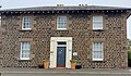
 Newlands House 2024.jpg 3,024 × 4,032; 2.91 MB
-
 Newlands House gable end.jpg 4,284 × 5,712; 5.1 MB
-
 Norie Miller Gardens from Queens Bridge - geograph.org.uk - 2740294.jpg 640 × 482; 128 KB
-
 Norie Miller gardens under snow - geograph.org.uk - 1636137.jpg 640 × 479; 104 KB
-
 Norie-Miller Walk 2024.jpg 5,712 × 4,284; 9.02 MB
-

-
 North end of Willowgate channel - geograph.org.uk - 2672388.jpg 1,600 × 1,063; 759 KB
-
 North Inch bandstand.jpg 1,600 × 1,020; 362 KB
-
 North Inch.jpg 640 × 480; 164 KB
-
 Northern Belle - geograph.org.uk - 4529905.jpg 800 × 600; 402 KB
-
 Northern Belle - geograph.org.uk - 4529911.jpg 800 × 450; 369 KB
-
 Old city wall, Perth, Scotland.jpg 5,244 × 4,155; 7.82 MB
-
 Old Perth mercat cross (geograph 3680407).jpg 480 × 640; 94 KB
-
 Old Perth mercat cross.jpg 4,284 × 5,712; 9.26 MB
-
 Old Ship Inn 2024.jpg 3,024 × 4,032; 3.59 MB
-
 Old Ship Inn old sign.jpg 4,284 × 5,712; 6.01 MB
-
 Original Perth City Hall.jpg 1,107 × 719; 256 KB
-
-
 Otter at Perth - geograph.org.uk - 873052.jpg 640 × 480; 100 KB
-
 Otter in the Tay - geograph.org.uk - 236627.jpg 640 × 480; 168 KB
-
 Parklands Hotel 2024.jpg 4,032 × 3,024; 3.72 MB
-
 Patriotism on Queens Bridge - geograph.org.uk - 3024000.jpg 480 × 640; 91 KB
-
 Perth - geograph.org.uk - 613832.jpg 638 × 432; 233 KB
-
 Perth 1971 postal strike private stamp.jpg 310 × 181; 14 KB
-
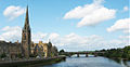
 Perth and the river Tay - geograph.org.uk - 2335320.jpg 640 × 480; 42 KB
-
 Perth Bridge over the Tay, from the air - geograph.org.uk - 3605720.jpg 1,024 × 681; 180 KB
-
 Perth Brooch Anderson 1881b Fig 14 scotlandinearlyc00anderich 0047.jpg 1,621 × 1,867; 505 KB
-
 Perth Brooch Anderson 1881b Fig 15 scotlandinearlyc00anderich 0048.jpg 1,368 × 1,783; 388 KB
-
 Perth City - geograph.org.uk - 777325.jpg 640 × 480; 60 KB
-
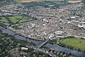 Perth city centre from the air (geograph 3605803).jpg 1,024 × 681; 279 KB
-
 Perth Farmers' Market - geograph.org.uk - 835415.jpg 640 × 489; 106 KB
-
 Perth from above.jpg 1,024 × 681; 221 KB
-
 Perth from Bridgend, Scotland-LCCN2002695036.jpg 3,652 × 2,728; 3.06 MB
-
 Perth from the air - geograph.org.uk - 3606191.jpg 1,024 × 681; 209 KB
-
 Perth Harbour - geograph.org.uk - 2567186.jpg 4,000 × 3,000; 1.87 MB
-
 Perth Harbour - geograph.org.uk - 39890.jpg 640 × 480; 56 KB
-
 Perth harbour - geograph.org.uk - 6424883.jpg 2,359 × 1,730; 761 KB
-
 Perth in the wet - geograph.org.uk - 777319.jpg 640 × 480; 69 KB
-
 Perth mercat cross detail.jpg 4,281 × 4,962; 8.62 MB
-
 Perth Municipal Buildings 2024 2.jpg 4,032 × 3,024; 3.89 MB
-
 Perth Municipal Buildings 2024 3.jpg 4,032 × 3,024; 3.92 MB
-
 Perth Museum 2024.jpg 3,993 × 2,108; 1.93 MB
-
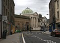 Perth Museum and Art Gallery (geograph 4613660).jpg 3,095 × 2,225; 2.41 MB
-
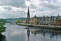
 Perth on the Tay.jpg 1,219 × 629; 104 KB
-
 Perth Prison - former Governor's House (building 12).jpg 3,714 × 2,160; 2.12 MB
-
 Perth Prison - panoramio.jpg 3,008 × 2,000; 2.72 MB
-
 Perth Prison - visitor centre entrance (building 11).jpg 4,369 × 2,460; 2.59 MB
-
 Perth Prison - visitor centre from Edinburgh Road.jpg 3,683 × 1,129; 783 KB
-
 Perth Railway Bridge - geograph.org.uk - 4529878.jpg 800 × 600; 477 KB
-
 Perth Railway Bridge - geograph.org.uk - 4529887.jpg 800 × 600; 456 KB
-
 Perth Railway Bridge - geograph.org.uk - 4599836.jpg 2,540 × 1,892; 2.26 MB
-
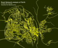 Perth road network analysis (6109227974).png 762 × 627; 332 KB
-
-
 Perth Skate Park - geograph.org.uk - 9256.jpg 640 × 480; 82 KB
-
 Perth to Dundee railway - geograph.org.uk - 4529897.jpg 800 × 600; 594 KB
-
 Perth Travelodge - geograph.org.uk - 11258.jpg 640 × 480; 102 KB
-
 Perth war memorial 2024.jpg 4,284 × 5,712; 8.38 MB
-
 Perth Women on Wikipedia course October 2023 (1).jpg 4,624 × 2,604; 3.93 MB
-
 Perth Women on Wikipedia course October 2023 (2).jpg 4,624 × 2,604; 3.91 MB
-
 Perth, downstream along the Tay - geograph.org.uk - 2524474.jpg 640 × 480; 68 KB
-
 Perth, Scotland (8924340443).jpg 4,000 × 3,000; 4.63 MB
-
 Perth, Scotland - Bank of Tay.jpg 6,847 × 1,850; 14.48 MB
-
 Perth, The River Tay - geograph.org.uk - 1711376.jpg 799 × 1,256; 889 KB
-
 Perth, upstream along the Tay - geograph.org.uk - 2524478.jpg 640 × 480; 78 KB
-
-
 Perthsigns.jpg 265 × 508; 25 KB
-
 Pitheavlis (34337139485).jpg 5,441 × 3,627; 7.37 MB
-
 Plaque at the Bell Playground in Perth.jpg 4,624 × 3,468; 7.78 MB
-
 Plaque on Needless Road, Perth.jpg 508 × 640; 88 KB
-
 Plaque on Smeatons bridge.jpg 640 × 485; 154 KB
-
 Plum blossom - geograph.org.uk - 394734.jpg 640 × 480; 141 KB
-
 Primrose Crescent, Perth.jpg 640 × 477; 81 KB
-
 Prison, Perth, Scotland (8925143299).jpg 4,000 × 3,000; 4.15 MB
-
 Quarry car park - geograph.org.uk - 753437.jpg 480 × 640; 110 KB
-
 Quarrymill - geograph.org.uk - 498967.jpg 640 × 415; 104 KB
-
 Quay at Perth - geograph.org.uk - 2547502.jpg 800 × 534; 176 KB
-
 Queens Bentley displaying lights.jpg 672 × 528; 149 KB
-
-
 Railing, Tay Street - geograph.org.uk - 2061589.jpg 640 × 480; 111 KB
-
 Railway bridge over the Earn - geograph.org.uk - 682876.jpg 640 × 480; 48 KB
-
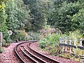
 Railway line - geograph.org.uk - 564153.jpg 452 × 640; 87 KB
-
 Red Brig - geograph.org.uk - 328935.jpg 640 × 635; 178 KB
-
 Red tailed bumble bee - geograph.org.uk - 409724.jpg 640 × 480; 184 KB
-
 Reflections in the Tay at Perth - geograph.org.uk - 2547537.jpg 800 × 534; 205 KB
-
 Reflections on the Tay - geograph.org.uk - 4190819.jpg 640 × 427; 286 KB
-
 Rennies at perth bus station (8660399892).jpg 2,592 × 1,728; 696 KB
-

-
 River fun - geograph.org.uk - 2395332.jpg 640 × 480; 96 KB
-
 River Tay - geograph.org.uk - 1969443.jpg 640 × 428; 48 KB
-
 River Tay - geograph.org.uk - 4143170.jpg 3,846 × 2,535; 2.3 MB
-
 River Tay - Perth - geograph.org.uk - 4146474.jpg 3,600 × 2,400; 4.1 MB
-
 River Tay and St Matthew's Church - geograph.org.uk - 2683009.jpg 1,280 × 960; 507 KB
-
 River Tay at Friarton, Perth - geograph.org.uk - 5368402.jpg 640 × 480; 73 KB


.jpg)

_Scania,_Perth,_21_May_2015.jpg)


.jpg)
.jpg)
.jpg)

-GB.png)


.jpg)
.jpg)
.jpg)
.jpg)
.jpg)
.jpg)
.jpg)
.jpg)
.jpg)


.jpg)


.jpg)


.jpg)

.jpg)

.jpg)


.png)


.jpg)
.jpg)

.jpg)


.jpg)


.jpg)


.jpg)


