Category:Peterchurch
Jump to navigation
Jump to search
village and civil parish in Herefordshire, United Kingdom  | |||||
| Upload media | |||||
| Instance of | |||||
|---|---|---|---|---|---|
| Location | Herefordshire, West Midlands, England | ||||
 | |||||
Cymraeg: Pentref yn Swydd Henffordd, Gorllewin Canolbarth Lloegr, Lloegr ydy Peterchurch. (→Peterchurch)
Polski: Peterchurch – wieś w Anglii, w hrabstwie Herefordshire. Leży 17 km na zachód od miasta Hereford i 204 km na zachód od Londynu. (→Peterchurch)

Subcategories
This category has the following 6 subcategories, out of 6 total.
P
- Peterchurch WWI Memorial (2 F)
S
U
- Urishay Castle (5 F)
- Urishay Castle Chapel (2 F)
W
- Wellbrook Manor (2 F)
Media in category "Peterchurch"
The following 200 files are in this category, out of 201 total.
(previous page) (next page)-

-
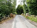
 A river bridge, Peterchurch - geograph.org.uk - 3494904.jpg 800 × 600; 198 KB
-
 Albion Garage, Peterchurch - geograph.org.uk - 3494851.jpg 800 × 487; 116 KB
-
 Alms Houses, Peterchurch - geograph.org.uk - 3494959.jpg 800 × 656; 148 KB
-
 B4348 Golden Valley road - geograph.org.uk - 2749048.jpg 1,024 × 768; 465 KB
-
 B4348 towards Peterchurch - geograph.org.uk - 2749051.jpg 1,024 × 768; 455 KB
-
 Beef pasture - geograph.org.uk - 2745350.jpg 1,024 × 577; 349 KB
-
 Bordercraft in Peterchurch - geograph.org.uk - 3702098.jpg 800 × 545; 95 KB
-
 Boston Cottage, Hinton - geograph.org.uk - 3702723.jpg 800 × 600; 101 KB
-
 Boughton Arms pub, Peterchurch - geograph.org.uk - 3942360.jpg 4,320 × 3,240; 3.51 MB
-
 Bridge on the River Dore, Peterchurch - geograph.org.uk - 3523131.jpg 2,592 × 3,456; 2.85 MB
-
 Bridge over the Dore near Hinton - geograph.org.uk - 3702681.jpg 800 × 664; 147 KB
-
 Bridge over the Dore, Peterchurch - geograph.org.uk - 3070293.jpg 640 × 480; 119 KB
-
 Bridleway on Stockley Hill - geograph.org.uk - 4505651.jpg 800 × 450; 195 KB
-
 Bridleway through West Lawn Common - geograph.org.uk - 4586876.jpg 800 × 451; 208 KB
-
 Bridleway to Blakemere Hill - geograph.org.uk - 2749091.jpg 1,024 × 768; 462 KB
-
 Bridleway to Rough Leath Barn and Wood - geograph.org.uk - 2749059.jpg 1,024 × 768; 422 KB
-

-
 Cereal land on Stockley Hill - geograph.org.uk - 4507773.jpg 800 × 600; 270 KB
-
 Chapel Lane, Peterchurch - geograph.org.uk - 3702297.jpg 800 × 600; 104 KB
-
 Childrens playground, Peterchurch - geograph.org.uk - 1555220.jpg 640 × 481; 111 KB
-
 Closure Place, Peterchurch - geograph.org.uk - 3070533.jpg 640 × 425; 68 KB
-
 Country house above Peterchurch - geograph.org.uk - 2907749.jpg 640 × 480; 110 KB
-
 Distances from Peterchurch - geograph.org.uk - 3070224.jpg 640 × 538; 101 KB
-
 Disused Petrol Station - geograph.org.uk - 1555205.jpg 640 × 481; 56 KB
-
 Dragon's Pool Farm - geograph.org.uk - 2746190.jpg 1,024 × 768; 461 KB
-
 Drinking trough near Oldtay Farm - geograph.org.uk - 2203885.jpg 1,024 × 768; 300 KB
-
 Edge of Park Wood - geograph.org.uk - 2746205.jpg 1,024 × 768; 456 KB
-
 Edwardian houses, Peterchurch - geograph.org.uk - 3702187.jpg 800 × 651; 118 KB
-

-
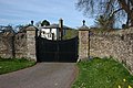
 Entrance Gates to Snodhill Castle - geograph.org.uk - 5833806.jpg 4,096 × 2,168; 3.84 MB
-
 Entrance to Clothier Farm - geograph.org.uk - 392286.jpg 640 × 426; 106 KB
-
 Entrance to Hinton Hall, near Peterchurch - geograph.org.uk - 391615.jpg 640 × 426; 135 KB
-
 Ewe and lambs in the Golden Valley - geograph.org.uk - 392214.jpg 640 × 426; 119 KB
-
 Fairfield front.jpg 3,264 × 2,448; 2.75 MB
-
 Fairfield High School, Peterchurch - geograph.org.uk - 3070175.jpg 640 × 480; 68 KB
-
 Fairfield School - geograph.org.uk - 1555248.jpg 640 × 481; 65 KB
-
 Farm by Snodhill Castle - geograph.org.uk - 5833796.jpg 1,920 × 1,080; 1.09 MB
-

-
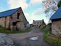
 Farmhouse at Snodhill - geograph.org.uk - 2203650.jpg 1,024 × 768; 248 KB
-
 Farmland above Blakemere - geograph.org.uk - 3810311.jpg 1,024 × 680; 344 KB
-
 Farmland above the Golden Valley - geograph.org.uk - 3810343.jpg 1,024 × 680; 264 KB
-
 Farmland in the Golden Valley - geograph.org.uk - 3810549.jpg 1,024 × 680; 298 KB
-
 Farmland near Pitt Farm - geograph.org.uk - 2203547.jpg 1,024 × 768; 299 KB
-
 Farmland north of Snodhill - geograph.org.uk - 2203608.jpg 1,024 × 768; 229 KB
-
 Feeding racks - geograph.org.uk - 3810302.jpg 800 × 531; 159 KB
-
 Fire Station, Peterchurch - geograph.org.uk - 154380.jpg 640 × 426; 95 KB
-
 Flock of sheep near Snodhill Hall - geograph.org.uk - 2203550.jpg 1,024 × 768; 206 KB
-
 Food for Thought, Peterchurch - geograph.org.uk - 3494811.jpg 800 × 637; 89 KB
-
 Footpath and green lane - geograph.org.uk - 2746202.jpg 1,024 × 641; 463 KB
-
 Footpath crossing the Golden Valley - geograph.org.uk - 2749050.jpg 1,024 × 768; 447 KB
-
 Footpath from Long Lane - geograph.org.uk - 2746176.jpg 1,024 × 768; 437 KB
-
 Ford in Cwm Garw - geograph.org.uk - 4598538.jpg 800 × 451; 236 KB
-
 Golden Valley landscape - geograph.org.uk - 2745292.jpg 1,024 × 576; 334 KB
-

-

-
 Green hazel - geograph.org.uk - 4598543.jpg 800 × 601; 379 KB
-
 Hinton Cross Garage, Hinton - geograph.org.uk - 3702705.jpg 800 × 428; 69 KB
-
 Hinton Cross, Hinton - geograph.org.uk - 3702727.jpg 800 × 643; 126 KB
-
 Hinton pumping station - geograph.org.uk - 3702718.jpg 800 × 653; 132 KB
-
 Lane from Hinton to Fairfield - geograph.org.uk - 3702714.jpg 800 × 641; 110 KB
-
 Lane near Snodhill Park - geograph.org.uk - 2203855.jpg 1,024 × 768; 173 KB
-
 Lane to Dorstone from Hinton - geograph.org.uk - 3702735.jpg 800 × 762; 117 KB
-

-
 Lane to Park Farm - geograph.org.uk - 2203679.jpg 1,024 × 768; 317 KB
-
 Lewis Way, Peterchurch - geograph.org.uk - 3702095.jpg 800 × 600; 100 KB
-
 Long Lane - geograph.org.uk - 2746186.jpg 1,024 × 768; 466 KB
-
 Long Lane, Hinton - geograph.org.uk - 3702732.jpg 692 × 800; 115 KB
-
 Lucy's Hair ^ Beauty in Peterchurch - geograph.org.uk - 3702082.jpg 799 × 800; 142 KB
-
 Main road through Peterchurch - geograph.org.uk - 3702342.jpg 800 × 515; 89 KB
-
 Mowbage Lane at Upper Mowbage - geograph.org.uk - 2749057.jpg 1,024 × 768; 465 KB
-
 Mowbage Lane, Peterchurch - geograph.org.uk - 3702667.jpg 800 × 647; 105 KB
-
 Nags Head in Peterchurch - geograph.org.uk - 3702371.jpg 800 × 524; 84 KB
-
 Nags Head, Peterchurch - geograph.org.uk - 3814207.jpg 1,024 × 680; 264 KB
-
 Northern boundary of Peterchurch - geograph.org.uk - 3702668.jpg 800 × 751; 115 KB
-
 Oatley Farm - geograph.org.uk - 2745276.jpg 1,024 × 768; 450 KB
-
 Oatley farm near Peterchurch - geograph.org.uk - 392278.jpg 640 × 426; 102 KB
-
 Old Lodge - geograph.org.uk - 2203809.jpg 1,024 × 768; 317 KB
-
 Old Milepost by the B4348, Peterchurch - geograph.org.uk - 6056493.jpg 1,267 × 1,608; 328 KB
-
 Old Tay Lane - geograph.org.uk - 2203869.jpg 1,024 × 768; 294 KB
-
 Part of the Golden Valley - geograph.org.uk - 2908012.jpg 640 × 480; 88 KB
-
 Pasture land - geograph.org.uk - 2749082.jpg 1,024 × 768; 433 KB
-
 Pasture near Oldtay Farm - geograph.org.uk - 2746196.jpg 1,024 × 578; 324 KB
-
 Penllan - geograph.org.uk - 5643064.jpg 1,600 × 901; 629 KB
-
 Peterchurch - geograph.org.uk - 2744988.jpg 640 × 427; 114 KB
-
 Peterchurch Fire Station - geograph.org.uk - 3702198.jpg 800 × 518; 92 KB
-
 Peterchurch fire station tower - geograph.org.uk - 3702205.jpg 800 × 670; 146 KB
-
 Peterchurch Play Area - geograph.org.uk - 3494856.jpg 800 × 554; 107 KB
-
 Peterchurch Police Station - geograph.org.uk - 3069583.jpg 640 × 512; 86 KB
-
 Peterchurch Police Station - geograph.org.uk - 392185.jpg 640 × 426; 106 KB
-
 Peterchurch Primary School - geograph.org.uk - 3494804.jpg 800 × 485; 109 KB
-
-
 Peterchurch, St. Peter's Church - geograph.org.uk - 4633918.jpg 3,909 × 3,660; 7.72 MB
-
 Peterchurch, St. Peter's Church - geograph.org.uk - 4633923.jpg 3,938 × 3,062; 7.55 MB
-

-

-
 Peterchurch, St. Peter's Church, The apse - geograph.org.uk - 4633936.jpg 3,646 × 2,398; 6.19 MB
-
 Peterchurch, St. Peter's Church, The nave - geograph.org.uk - 4633925.jpg 4,964 × 3,181; 7.45 MB
-
 Peterchurch, St. Peter's Church, The pulpit - geograph.org.uk - 4633929.jpg 3,879 × 2,570; 4.59 MB
-
 Pig pen in the woods - geograph.org.uk - 2907712.jpg 640 × 480; 142 KB
-
 Poached land - geograph.org.uk - 2745300.jpg 1,024 × 768; 477 KB
-
 Pond on a hill - geograph.org.uk - 3810305.jpg 1,024 × 680; 309 KB
-
 Poston Mill Caravan Park, Peterchurch - geograph.org.uk - 589158.jpg 640 × 439; 57 KB
-
 Princes Orchard, Peterchurch - geograph.org.uk - 3702093.jpg 800 × 563; 82 KB
-
 River Dore near Hinton - geograph.org.uk - 3702678.jpg 800 × 600; 142 KB
-
 River Dore, Peterchurch - geograph.org.uk - 1555240.jpg 640 × 481; 160 KB
-
 River Dore, Peterchurch - geograph.org.uk - 3070288.jpg 640 × 480; 147 KB
-
 River Dore, Peterchurch - geograph.org.uk - 3494868.jpg 800 × 600; 167 KB
-
 Riverside field in Hinton - geograph.org.uk - 3702687.jpg 800 × 634; 130 KB
-
-
 Road to Peterchurch - geograph.org.uk - 2745286.jpg 1,024 × 768; 443 KB
-
 Road to Urishay - geograph.org.uk - 2745306.jpg 1,024 × 768; 445 KB
-
 Road to Urishay - geograph.org.uk - 4589345.jpg 800 × 450; 232 KB
-
 SE boundary of Peterchurch - geograph.org.uk - 3069498.jpg 640 × 518; 74 KB
-
 Sheep and lambs on Dolward Farm - geograph.org.uk - 390669.jpg 640 × 426; 118 KB
-
 Sheep in a field at Hinton - geograph.org.uk - 390800.jpg 640 × 426; 118 KB
-
 Sheep pasture above Old Lodge - geograph.org.uk - 2203798.jpg 1,024 × 768; 225 KB
-
 Sheep pasture at Park Farm - geograph.org.uk - 2203669.jpg 1,024 × 768; 285 KB
-
 Signpost in the Golden Valley - geograph.org.uk - 2749060.jpg 1,024 × 768; 446 KB
-
 Small stream - geograph.org.uk - 2746199.jpg 1,024 × 768; 482 KB
-
 Snodhill Castle (Keep) - geograph.org.uk - 5833208.jpg 1,920 × 1,080; 1.02 MB
-
 Snodhill Castle (Keep) - geograph.org.uk - 5833212.jpg 1,920 × 1,080; 1.07 MB
-
 Snodhill Castle (Keep) - geograph.org.uk - 5833218.jpg 1,920 × 1,080; 1.05 MB
-
 Snodhill Castle (Keep) - geograph.org.uk - 5833225.jpg 1,920 × 1,080; 1,005 KB
-
 Snodhill Castle (Keep) - geograph.org.uk - 5833727.jpg 2,048 × 1,360; 1.37 MB
-
 Snodhill Castle (Keep) - geograph.org.uk - 5833739.jpg 2,048 × 1,360; 1.42 MB
-
 Snodhill Castle (Keep) - geograph.org.uk - 5833755.jpg 4,096 × 3,072; 5.3 MB
-
 Snodhill Castle (Motte) - geograph.org.uk - 5833725.jpg 2,048 × 1,360; 1.44 MB
-
 Snodhill Castle (Wall ^1) - geograph.org.uk - 5833718.jpg 2,048 × 1,360; 1.38 MB
-
 Snodhill Castle (Wall ^2) - geograph.org.uk - 5833734.jpg 2,048 × 1,360; 1.36 MB
-
 Snodhill Castle - 1 - geograph.org.uk - 2203625.jpg 1,024 × 768; 295 KB
-
 Snodhill Castle - 3 - geograph.org.uk - 2203642.jpg 768 × 1,024; 219 KB
-
 Snodhill Castle - geograph.org.uk - 5817120.jpg 4,096 × 3,072; 5.29 MB
-
 Snodhill Castle - geograph.org.uk - 5833216.jpg 1,920 × 1,080; 1.02 MB
-
 Snodhill Castle - geograph.org.uk - 5833233.jpg 1,920 × 1,080; 1.11 MB
-
 Snodhill Castle - geograph.org.uk - 5833279.jpg 4,096 × 2,304; 4.1 MB
-
 Snodhill Castle - geograph.org.uk - 5833746.jpg 2,048 × 1,360; 1.35 MB
-
 Snodhill Castle - geograph.org.uk - 5833760.jpg 2,048 × 1,360; 1.46 MB
-
 Snodhill Castle - geograph.org.uk - 5833762.jpg 2,048 × 1,360; 1.36 MB
-
 Snodhill Castle - geograph.org.uk - 5833776.jpg 4,096 × 2,168; 3.73 MB
-
 Snodhill Castle - geograph.org.uk - 5833789.jpg 4,096 × 2,168; 4.82 MB
-
 Snodhill Ford - geograph.org.uk - 4293883.jpg 3,872 × 2,592; 4.65 MB
-
 Snodhill Park - geograph.org.uk - 2203826.jpg 1,024 × 768; 221 KB
-

-
 Stream at Wilmaston - geograph.org.uk - 2749054.jpg 1,024 × 769; 433 KB
-
 Stubble field and the Black Mountains - geograph.org.uk - 3812429.jpg 1,024 × 680; 331 KB
-

-
 The B4347 through Peterchurch - geograph.org.uk - 2380642.jpg 979 × 711; 150 KB
-
 The B4348 north of Peterchurch - geograph.org.uk - 3810546.jpg 1,024 × 680; 241 KB
-
 The Boughton Arms public house, Peterchurch in 2006.jpg 640 × 480; 72 KB
-
 The Boughton Arms, Peterchurch - geograph.org.uk - 3494821.jpg 800 × 540; 103 KB
-
 The Castle (Snodhill) - geograph.org.uk - 5833798.jpg 1,920 × 1,080; 1.04 MB
-
 The Golden Valley - geograph.org.uk - 2747011.jpg 1,024 × 768; 480 KB
-
 The grave of Robert Jones VC - geograph.org.uk - 2907594.jpg 640 × 480; 128 KB
-

-
 The Old Bakery, Hinton - geograph.org.uk - 3702695.jpg 736 × 800; 125 KB
-
 The Village of Peterchurch - geograph.org.uk - 5833238.jpg 1,920 × 1,080; 1 MB
-
 The Wells Cottage, Peterchurch - geograph.org.uk - 2749079.jpg 1,024 × 768; 451 KB
-
 Thornberry Close houses, Peterchurch - geograph.org.uk - 3702287.jpg 800 × 584; 108 KB
-
 Three crosses, Peterchurch churchyard - geograph.org.uk - 3494934.jpg 800 × 600; 191 KB
-
 Track through the woods west of Snodhill - geograph.org.uk - 2203655.jpg 1,024 × 768; 295 KB
-
 Trees at Snodhill Castle - geograph.org.uk - 5833266.jpg 1,920 × 1,080; 1,023 KB
-

-
 US Military Ambulance, Peterchurch - geograph.org.uk - 392177.jpg 640 × 426; 125 KB
-
 Valley of the Trenant Brook, 1 - geograph.org.uk - 5643069.jpg 1,600 × 901; 654 KB
-
 Valley of the Trenant Brook, 2 - geograph.org.uk - 5643070.jpg 1,600 × 901; 616 KB
-

-
 Victorian postbox at Snodhill - geograph.org.uk - 2747018.jpg 768 × 1,024; 479 KB
-
 View from Snodhill Castle (Keep) - geograph.org.uk - 5833224.jpg 1,920 × 1,080; 1.07 MB
-
 View from Snodhill Castle - geograph.org.uk - 5833227.jpg 1,920 × 1,080; 1.07 MB
-

-
 View to the east from above Blakemere - geograph.org.uk - 3810296.jpg 1,024 × 680; 293 KB
-
 Walking the dogs - geograph.org.uk - 2749086.jpg 1,024 × 768; 448 KB
-
 Walking to Hinton - geograph.org.uk - 3702670.jpg 793 × 800; 156 KB
-
 War Memorial, Peterchurch - geograph.org.uk - 3494840.jpg 684 × 800; 132 KB
-
 Wesley Place, Peterchurch - geograph.org.uk - 3702329.jpg 800 × 749; 156 KB
-
 West Herefordshire pastoral scene - geograph.org.uk - 2746182.jpg 1,024 × 768; 466 KB
-
 Western half of Alms Houses, Peterchurch - geograph.org.uk - 3494954.jpg 800 × 772; 186 KB
-
 Wilmaston sign and crest - geograph.org.uk - 2749067.jpg 1,024 × 768; 494 KB
-
 Winter trees - geograph.org.uk - 2746170.jpg 1,024 × 641; 407 KB
-
 WWII ambulance at Peterchurch - geograph.org.uk - 3548319.jpg 640 × 480; 199 KB
-
 Blakemere Hill Wood - geograph.org.uk - 154839.jpg 640 × 426; 131 KB
-
 Bordercraft, Peterchurch - geograph.org.uk - 154383.jpg 640 × 426; 103 KB
-
 Bridleway near Oldtay Farm - geograph.org.uk - 390716.jpg 640 × 426; 156 KB
-
 Cornfield, near Hinton, Peterchurch - geograph.org.uk - 270439.jpg 640 × 449; 109 KB
-
 Crop Spraying - geograph.org.uk - 155454.jpg 640 × 426; 97 KB
-
 Drainage Leat - geograph.org.uk - 154372.jpg 640 × 426; 138 KB
-
 Farm Building, Greenway Farm - geograph.org.uk - 154395.jpg 640 × 426; 117 KB
-
 Farmland near Peterchurch - geograph.org.uk - 390824.jpg 640 × 426; 133 KB
-
 Hedge near Peterchurch - geograph.org.uk - 392203.jpg 426 × 640; 131 KB
-
 Mawbage Farm, Peterchurch - geograph.org.uk - 154364.jpg 640 × 426; 138 KB
-
 Newhouse Farm, near Peterchurch - geograph.org.uk - 390705.jpg 640 × 426; 116 KB
-
 Rough Leath Barn - geograph.org.uk - 154831.jpg 640 × 426; 124 KB
-
 Rough Leath Wood - geograph.org.uk - 154790.jpg 426 × 640; 154 KB
-
 Snowy fields in the Golden Valley - geograph.org.uk - 85122.jpg 480 × 640; 104 KB
-
 Stockley Hill - geograph.org.uk - 155451.jpg 640 × 426; 105 KB
-
 The Nags Head, Peterchurch - geograph.org.uk - 154787.jpg 640 × 426; 81 KB
-
 Track to Lyonshall Barn - geograph.org.uk - 154843.jpg 640 × 426; 104 KB
-
 Track to the south of Peterchurch - geograph.org.uk - 390649.jpg 640 × 426; 125 KB
-
 Trig Point, Stockley Hill - geograph.org.uk - 154841.jpg 640 × 426; 145 KB


_-_geograph.org.uk_-_5833208.jpg)
_-_geograph.org.uk_-_5833212.jpg)
_-_geograph.org.uk_-_5833218.jpg)
_-_geograph.org.uk_-_5833225.jpg)
_-_geograph.org.uk_-_5833727.jpg)
_-_geograph.org.uk_-_5833739.jpg)
_-_geograph.org.uk_-_5833755.jpg)
_-_geograph.org.uk_-_5833725.jpg)
_-_geograph.org.uk_-_5833718.jpg)
_-_geograph.org.uk_-_5833734.jpg)


_-_geograph.org.uk_-_5833798.jpg)


_-_geograph.org.uk_-_5833224.jpg)


