Category:Political maps of Canada
Jump to navigation
Jump to search
Countries of the Americas: Argentina · Bolivia · Brazil · Canada · Chile · Colombia · Costa Rica · Ecuador · El Salvador · Grenada · Honduras · Mexico · Panama · Paraguay · Peru · Saint Vincent and the Grenadines · Trinidad and Tobago · United States of America · Uruguay · Venezuela
Other areas: French Guiana · Guadeloupe · Martinique · Saint Barthélemy · Saint-Martin · Saint Pierre and Miquelon · United States Virgin Islands
Other areas: French Guiana · Guadeloupe · Martinique · Saint Barthélemy · Saint-Martin · Saint Pierre and Miquelon · United States Virgin Islands
Subcategories
This category has the following 5 subcategories, out of 5 total.
A
E
I
M
Media in category "Political maps of Canada"
The following 84 files are in this category, out of 84 total.
-
 1857 Colton Map of Canada and Alaska - Geographicus - Canada-colton-1857.jpg 3,500 × 2,828; 2.96 MB
-
 2021 Prediction Map, Jaac Doduck.png 1,027 × 798; 286 KB
-

-
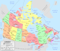
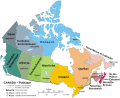
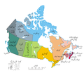
 A Political map of Canada.svg 1,130 × 920; 272 KB
-
 Bedford.png 542 × 504; 16 KB
-
 BillC-38Votingintentionsandfinalvote.png 2,000 × 2,524; 669 KB
-
 Canada 2019 Preliminary.png 4,000 × 3,128; 295 KB
-
 Canada geopolitical.png 1,280 × 1,128; 551 KB
-
 Canada lower.PNG 1,688 × 1,099; 73 KB
-
 Canada map (LT).png 1,670 × 1,418; 497 KB
-
 Canada Maritime provinces map.png 262 × 212; 4 KB
-
 Canada political map - en.svg 1,114 × 942; 423 KB
-
 Canada political map - fr.svg 1,114 × 942; 424 KB
-
 Canada population per senator map.svg 1,304 × 1,263; 113 KB
-
 Canada provinces (LT).png 1,670 × 1,418; 555 KB
-
 Canada provinces Regionl.png 3,176 × 2,380; 787 KB
-
 Canada provinces-blank-map XMLcomments-CSSclasses-SVGids green.svg 978 × 950; 68 KB
-
 Canada provincial parties map by political position.svg 1,304 × 1,263; 99 KB
-
 Canada upper lower map.PNG 1,688 × 1,099; 73 KB
-
 Canada upper.PNG 1,688 × 1,099; 40 KB
-
 Canada Western provinces map.png 262 × 212; 4 KB
-
 Canadian PM birthplace.png 2,800 × 2,413; 979 KB
-
 Canadian Senate Divisions.png 650 × 520; 61 KB
-
 Canpoligeoicon.png 100 × 87; 3 KB
-
 Carte administrative du Canada.png 1,280 × 1,128; 522 KB
-
 Carte Politique du Canada.svg 1,130 × 920; 218 KB
-
 Cartwright-L'Anse au Clair.png 774 × 959; 29 KB
-
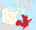 Central provinces in Canada.svg 512 × 435; 110 KB
-
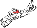 Colchester North.png 735 × 568; 23 KB
-
-
 CPC Endorsements (2022-02-04).png 1,064 × 795; 343 KB
-
 CPC Endorsements (2022-04-04).png 1,096 × 807; 344 KB
-
 CPC Endorsements (2022-06-04).png 1,027 × 783; 342 KB
-
 CPC Endorsements (2022-10-04).png 1,087 × 810; 341 KB
-
 CPC Endorsements (2022-11-04).png 1,087 × 799; 341 KB
-
 CPC Endorsements (2022-27-03).png 1,084 × 797; 341 KB
-
 CPC Endorsements (2022-28-03).png 1,076 × 807; 341 KB
-
 CPC Endorsements (2022-29-03).png 1,067 × 789; 340 KB
-
 Eastern provinces in Canada.svg 512 × 435; 110 KB
-
 Esperanta-kanado.PNG 716 × 599; 153 KB
-
 Geopolitical map of Canada heb.png 1,280 × 1,128; 373 KB
-
 Geopolitical map of Canada.png 1,280 × 1,128; 545 KB
-
 GoverningPoliticalPartyByProvince v2.png 2,057 × 1,737; 368 KB
-
 GoverningPoliticalPartyByProvince.png 2,057 × 1,737; 519 KB
-
 Kanada brezhoneg.PNG 2,000 × 1,728; 167 KB
-
 Kanada poliittinen kartta FI.png 1,280 × 1,107; 297 KB
-
 Kanada poliittinen maantiede kartta FI.png 1,280 × 1,128; 495 KB
-
 Kanada poliittinen maantiede kartta+FI.png 1,280 × 1,128; 606 KB
-
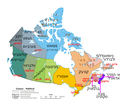
 Kanadskie provincii russkii.png 1,000 × 864; 81 KB
-
 Map Canada political 2.png 1,280 × 1,107; 387 KB
-
 Map Canada political MR.png 1,280 × 1,107; 306 KB
-
 Map Canada political ru.png 1,280 × 1,107; 341 KB
-
 Map Canada political-fr.png 1,280 × 1,107; 261 KB
-
 Map Canada political-geo-be-x-old.png 1,280 × 1,128; 401 KB
-
 Map Canada political-geo.png 1,280 × 1,128; 492 KB
-
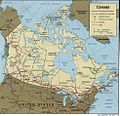 Map of Canada.jpg 977 × 948; 244 KB
-
 Mapa politico de Canada.png 1,280 × 1,107; 327 KB
-
 Mapa político do Canadá-gl.png 1,280 × 1,107; 315 KB
-
 Northern territories in Canada.svg 512 × 435; 107 KB
-
 Political map of Canada (hy).png 1,280 × 1,107; 264 KB
-
 Political map of Canada ar.png 693 × 599; 147 KB
-
 Political map of Canada bs.png 1,280 × 1,107; 364 KB
-
 Political map of Canada heb.png 693 × 599; 160 KB
-
 Political map of Canada it.svg 512 × 443; 984 KB
-
 Political map of Canada ms.svg 1,097 × 930; 123 KB
-
 Political map of Canada Persian.png 1,281 × 1,108; 542 KB
-
 Political map of Canada Persian.svg 512 × 443; 593 KB
-
 Political map of Canada pt.png 1,280 × 1,107; 300 KB
-
 Political map of Canada pt.svg 512 × 422; 282 KB
-
 Political map of Canada sr.png 1,280 × 1,107; 288 KB
-
 Political map of Canada thai.png 1,280 × 1,107; 337 KB
-
 Political map of Canada zh-tc.png 1,280 × 1,107; 325 KB
-
 Political map of Canada-ang.svg 1,160 × 920; 155 KB
-
 Political map of Canada-el.png 1,280 × 1,107; 241 KB
-
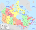
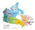
 Political map of Canada.png 1,280 × 1,107; 245 KB
-
 Political map of Canada.svg 1,130 × 920; 285 KB
-
 PPC map.png 6,600 × 5,500; 3.96 MB
-
 Prairie provinces in Canada.svg 512 × 435; 107 KB
-
 Provincial Parties Oct 2023.jpg 13,200 × 10,200; 7.16 MB
-
 Quebec–Chaudiere-appalaches.png 421 × 483; 14 KB
-
 Senators By Provence.png 1,482 × 1,395; 65 KB
-
 The Maritimes in Canada.svg 512 × 435; 108 KB
-
 Western provinces in Canada.svg 512 × 435; 107 KB
-
 Провинции и територии на Канада.png 1,280 × 1,107; 316 KB


%27_(11247807404).jpg)


.png)


.png)


_2014.png)
.png)
.png)
.png)
.png)
.png)
.png)
.png)
.png)


.png)


