Category:Political maps of Uruguay
Jump to navigation
Jump to search
Countries of the Americas: Argentina · Bolivia · Brazil · Canada · Chile · Colombia · Costa Rica · Ecuador · El Salvador · Grenada · Honduras · Mexico · Panama · Paraguay · Peru · Saint Vincent and the Grenadines · Trinidad and Tobago · United States of America · Uruguay · Venezuela
Other areas: French Guiana · Guadeloupe · Martinique · Saint Barthélemy · Saint-Martin · Saint Pierre and Miquelon · United States Virgin Islands
Other areas: French Guiana · Guadeloupe · Martinique · Saint Barthélemy · Saint-Martin · Saint Pierre and Miquelon · United States Virgin Islands
Subcategories
This category has the following 5 subcategories, out of 5 total.
I
M
T
Media in category "Political maps of Uruguay"
The following 10 files are in this category, out of 10 total.
-
 Departments of Uruguay (LT).png 595 × 610; 28 KB
-
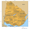 Departments of Uruguay (map).png 450 × 436; 26 KB
-
 Fuerza politica mas votada por departamento.png 765 × 765; 17 KB
-
 Ruling Parties of Uruguay.svg 595 × 666; 61 KB
-
 Uruguay Base Map.png 860 × 705; 248 KB
-
 Uruguay departments named.png 500 × 547; 27 KB
-
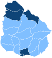
 Uruguay departments numbered.png 300 × 328; 11 KB
-
 Uruguay pol 95.jpg 1,020 × 1,186; 255 KB
-
 Uruguay UKR UNOCHA.png 1,000 × 1,103; 131 KB
-
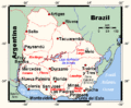 Uruguaymap.gif 508 × 419; 16 KB
.png)
.png)


