Category:Portskewett
Jump to navigation
Jump to search
village and community in Monmouthshire, Wales  Eglwys y Santes Fair, Porth Sgiwed | |||||
| Upload media | |||||
| Pronunciation audio | |||||
|---|---|---|---|---|---|
| Instance of | |||||
| Location | Monmouthshire, Wales | ||||
 | |||||
Cymraeg: Pentref a chymuned yn Sir Fynwy yw Porth Sgiwed neu Porthsgiwed (Cyfeirnod OS: ST4988); hefyd Porth Ysgewin neu Porthysgewin (Saesneg: Portskewett. Enw person yw Ysgewin, sef tarddiad y gair; yr un gair ag ysgawen, mae'n debyg. Saif i'r de-orllewin o dref Cas-gwent. Roedd poblogaeth y gymuned yn 2001 yn 2,041.
Subcategories
This category has the following 4 subcategories, out of 4 total.
N
- New Passage Ferry (3 F)
S
- St Mary's Church, Portskewett (23 F)
- St Pierre Pill (8 F)
Media in category "Portskewett"
The following 200 files are in this category, out of 229 total.
(previous page) (next page)-
 2010 Wales Monmouthshire Community Portskewett map.svg 512 × 682; 699 KB
-
 2024 Wales Monmouthshire Community Portskewett map.svg 512 × 682; 603 KB
-
 A48 eastbound at Killcrow Hill - geograph.org.uk - 3274950.jpg 640 × 480; 90 KB
-
 AJ Access Platforms UK, Portskewett - geograph.org.uk - 2058158.jpg 640 × 447; 82 KB
-

-

-
 Black Rock - geograph.org.uk - 1085657.jpg 480 × 640; 132 KB
-
 Black Rock Cottage - geograph.org.uk - 2061069.jpg 640 × 579; 87 KB
-
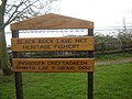 Black Rock Lave Net Heritage Fishery - geograph.org.uk - 346939.jpg 640 × 480; 106 KB
-
 Black Rock Picnic Area - geograph.org.uk - 5402261.jpg 640 × 480; 84 KB
-
 Black Rock Picnic Site - geograph.org.uk - 5402278.jpg 640 × 480; 91 KB
-
 Black Rock Road - geograph.org.uk - 2061065.jpg 640 × 449; 78 KB
-

-

-
 Black Rock Road heading for Portskewett - geograph.org.uk - 2061225.jpg 640 × 480; 100 KB
-
 Black Rock steps - geograph.org.uk - 2061061.jpg 480 × 640; 100 KB
-
 Black seaweed at Black Rock - geograph.org.uk - 2061056.jpg 640 × 544; 89 KB
-
 Black-rock.jpg 640 × 480; 71 KB
-
 Bramble Lodge - geograph.org.uk - 2065868.jpg 640 × 456; 99 KB
-
 Bridge at Portskewett Pier.jpg 3,000 × 2,693; 1.31 MB
-
 Bridge over the dismantled Black Rock branch line - geograph.org.uk - 3923330.jpg 4,680 × 3,120; 4.99 MB
-
 BT phonebox, Crick Road, Portskewett - geograph.org.uk - 5710786.jpg 700 × 800; 133 KB
-

-
 Canterbury Way, Portskewett - geograph.org.uk - 5704434.jpg 782 × 800; 176 KB
-

-

-
 Castlegate Business Park, Portskewett - geograph.org.uk - 95624.jpg 640 × 480; 87 KB
-
 Charston Island from Black Rock - geograph.org.uk - 5402255.jpg 640 × 480; 67 KB
-
 Charston Lighthouse and Second Severn Crossing - geograph.org.uk - 6086151.jpg 1,024 × 768; 132 KB
-
 Charston Rock - geograph.org.uk - 2061039.jpg 640 × 399; 68 KB
-
 Charston Rock - geograph.org.uk - 5402238.jpg 640 × 480; 44 KB
-
 Charston Rock lighthouse - geograph.org.uk - 3268034.jpg 3,168 × 4,752; 2.87 MB
-
 Church Hall, Crick Road, Portskewett - geograph.org.uk - 5704411.jpg 800 × 722; 128 KB
-
 Coastline, Black Rock - geograph.org.uk - 2061031.jpg 640 × 480; 96 KB
-

-

-

-

-
 Cropthorne Farm near Portskewett - geograph.org.uk - 2065826.jpg 640 × 498; 82 KB
-

-
 Direction Post on South Wales Coast Path - geograph.org.uk - 3923353.jpg 3,120 × 4,680; 4.18 MB
-
 Drainage Ditch - geograph.org.uk - 5401524.jpg 640 × 480; 77 KB
-
 Dual carriageway track ahead - geograph.org.uk - 2061002.jpg 640 × 480; 114 KB
-
 Easterly view over dismantled Black Rock branch - geograph.org.uk - 3380334.jpg 3,000 × 4,000; 3.57 MB
-

-

-
 Entrance to Harold's Park, Portskewett - geograph.org.uk - 5704496.jpg 798 × 800; 224 KB
-
 Entrance to St Pierre Lodges - geograph.org.uk - 2066171.jpg 640 × 536; 93 KB
-
 Entrance to two farms, Ifton Hill - geograph.org.uk - 2065957.jpg 640 × 534; 76 KB
-
 Farm land near St Pierre Pill - geograph.org.uk - 5401535.jpg 640 × 480; 66 KB
-
 Field edge view at Coltshay Hill Triangulation Pillar - geograph.org.uk - 5210096.jpg 4,000 × 3,000; 3.4 MB
-
 Field entrance - geograph.org.uk - 2065856.jpg 611 × 640; 131 KB
-
 Field entrance, Bridge View Farm - geograph.org.uk - 2065959.jpg 640 × 480; 84 KB
-
 Footbridge at site of Portskewett station - geograph.org.uk - 3380237.jpg 4,000 × 3,000; 3 MB
-
 Former National School, Portskewett - geograph.org.uk - 4356653.jpg 3,264 × 2,448; 1.81 MB
-
 Former National School, Portskewett - geograph.org.uk - 4356655.jpg 3,264 × 2,448; 1.83 MB
-
 Freight Train at Portskewett - geograph.org.uk - 3335088.jpg 1,024 × 690; 1.01 MB
-

-
 Gate on the track to Black Rock - geograph.org.uk - 2061000.jpg 640 × 480; 143 KB
-
 Grade II Listed Old Rectory, Portskewett - geograph.org.uk - 5704356.jpg 800 × 757; 153 KB
-
 Gray Hill View, Portskewett - geograph.org.uk - 2058461.jpg 640 × 421; 59 KB
-
 Hair Studio, Main Road, Portskewett - geograph.org.uk - 5703830.jpg 800 × 769; 112 KB
-
 Harold's Park, Portskewett - geograph.org.uk - 2058851.jpg 640 × 437; 85 KB
-
 Heading for Ifton Hill - geograph.org.uk - 2065927.jpg 557 × 640; 100 KB
-
-
 Heston-brake-2.jpg 752 × 500; 93 KB
-
 House, Leechpool Holdings - geograph.org.uk - 2065944.jpg 640 × 480; 97 KB
-
 Ifton Hill bus stops - geograph.org.uk - 2066135.jpg 640 × 632; 118 KB
-
 Ifton Hill nursery - geograph.org.uk - 2066128.jpg 640 × 480; 78 KB
-
 Information board and seat, Black Rock Picnic Area - geograph.org.uk - 5593365.jpg 1,024 × 768; 1.15 MB
-
 Information Board, Black Rock - geograph.org.uk - 5402273.jpg 640 × 480; 90 KB
-

-
 King Harold's View, Portskewett - geograph.org.uk - 5703798.jpg 800 × 651; 108 KB
-
 Kissing Gate on the Welsh Coast Path - geograph.org.uk - 5402622.jpg 640 × 480; 81 KB
-
 Lave net fishing - geograph.org.uk - 3254411.jpg 3,456 × 2,592; 3.43 MB
-
 Lave Net fishing, Blackrock - geograph.org.uk - 3254391.jpg 1,200 × 1,600; 360 KB
-
 Leechpool Holdings - geograph.org.uk - 2065883.jpg 640 × 480; 97 KB
-
 Leechpool House - geograph.org.uk - 2065886.jpg 640 × 640; 133 KB
-
 Leechpool House bus stop - geograph.org.uk - 2065894.jpg 640 × 461; 79 KB
-
 Leechpool on a rainy afternoon - geograph.org.uk - 1912316.jpg 4,288 × 2,848; 3.01 MB
-

-
 Lineside pylon, Sudbrook - geograph.org.uk - 2059233.jpg 480 × 640; 63 KB
-

-

-

-
 Main Road houses, Portskewett - geograph.org.uk - 5703824.jpg 800 × 600; 113 KB
-
 Main Road, Portskewett - geograph.org.uk - 5703736.jpg 800 × 662; 112 KB
-
 Main Road, Portskewett - geograph.org.uk - 5705403.jpg 800 × 703; 94 KB
-

-
 Map at Black Rock picnic area - geograph.org.uk - 5402263.jpg 640 × 480; 83 KB
-
 Millstone Cottages, Portskewett - geograph.org.uk - 2058622.jpg 640 × 480; 92 KB
-
 Millstone Cottages, Portskewett - geograph.org.uk - 5710588.jpg 800 × 601; 110 KB
-
 Monument Close, Portskewett - geograph.org.uk - 2058876.jpg 640 × 480; 62 KB
-
 Monument Close, Portskewett - geograph.org.uk - 5704455.jpg 800 × 712; 101 KB
-
 New Passage Ferry, Portskewett.jpg 2,742 × 3,200; 955 KB
-
 North-west view of dismantled Black Rock branch - geograph.org.uk - 3380330.jpg 4,000 × 3,000; 5.51 MB
-
 Northern boundary sign, Sudbrook - geograph.org.uk - 5704441.jpg 800 × 642; 113 KB
-
 Northern edge of Sudbrook - geograph.org.uk - 2058882.jpg 640 × 420; 58 KB
-

-

-
 Oaklands Park, Portskewett - geograph.org.uk - 5704326.jpg 800 × 563; 133 KB
-
 Oil train at Portskewett - geograph.org.uk - 3380233.jpg 3,882 × 2,911; 4.45 MB
-
 Oil train at Portskewett - geograph.org.uk - 3380234.jpg 4,000 × 3,000; 3.83 MB
-

-
 Old Post Office, Main Road, Portskewett - geograph.org.uk - 5705400.jpg 800 × 729; 131 KB
-
 Old Rectory, Portskewett - geograph.org.uk - 5704343.jpg 800 × 704; 150 KB
-
 Passage Wharf Pill - geograph.org.uk - 2711922.jpg 640 × 480; 92 KB
-
 Passing through the Severn Rail Tunnel - geograph.org.uk - 6214807.jpg 1,024 × 768; 123 KB
-
 Pasture land, Sudbrook - geograph.org.uk - 4356644.jpg 3,264 × 2,448; 1.83 MB
-

-

-

-
 Pier foundations, Portskewett.jpg 4,000 × 3,000; 4.77 MB
-

-

-

-

-
 Portskewett - Please drive carefully - geograph.org.uk - 5720819.jpg 800 × 741; 205 KB
-
 Portskewett Garage, Portskewett - geograph.org.uk - 5703604.jpg 800 × 515; 88 KB
-
 Portskewett House, Portskewett, September 2010.jpg 3,264 × 2,448; 1.57 MB
-

-
 Portskewett Inn, Portskewett - geograph.org.uk - 5703752.jpg 800 × 756; 98 KB
-
 Portskewett National School inscription - geograph.org.uk - 5703677.jpg 642 × 800; 113 KB
-

-
 Portskewett Pier (G J Stodart 1887).jpg 4,649 × 2,755; 645 KB
-

-
 Powerlines near Portskewett - geograph.org.uk - 1016827.jpg 640 × 426; 41 KB
-
 Pylons at a bend in Black Rock Road - geograph.org.uk - 2061232.jpg 480 × 640; 66 KB
-

-

-
 Rail bridge over St Pierre Pill - geograph.org.uk - 2385024.jpg 4,188 × 2,688; 1.39 MB
-
 Rail-Head Treatment Train at Portskewett (geograph 5930699).jpg 4,023 × 3,017; 5.18 MB
-
 Rail-Head Treatment Train at Portskewett - geograph.org.uk - 5930701.jpg 3,781 × 2,835; 3.83 MB
-
 Railway heading for Caldicot - geograph.org.uk - 2061269.jpg 640 × 563; 138 KB
-
 Railway heading for Chepstow - geograph.org.uk - 2061260.jpg 640 × 573; 130 KB
-
 Railway line at Portskewett - geograph.org.uk - 3380245.jpg 4,000 × 3,000; 2.8 MB
-
 Railway line at Portskewett - geograph.org.uk - 3380250.jpg 4,000 × 3,000; 3.67 MB
-
 Railway line at Portskewett - geograph.org.uk - 3380335.jpg 4,000 × 3,000; 3.33 MB
-
 Railway line at Portskewett - geograph.org.uk - 3380340.jpg 4,000 × 3,000; 3.16 MB
-
 Railway line between Chepstow and Caldicot - geograph.org.uk - 5325827.jpg 4,000 × 3,000; 4.34 MB
-

-

-
 Railway line west of the bridge, Portskewett - geograph.org.uk - 4356625.jpg 3,264 × 2,448; 1.95 MB
-
 Railway line, east of the bridge, Portskewett - geograph.org.uk - 4356629.jpg 3,264 × 2,448; 1.88 MB
-
 Recreation ground car park, Portskewett - geograph.org.uk - 3833737.jpg 2,560 × 1,920; 2.11 MB
-
 Red Cliff, St Pierre Pill - geograph.org.uk - 2385047.jpg 2,827 × 1,690; 956 KB
-

-

-

-

-
 Roadbridge ^ footbridge over railway, Portskewett - geograph.org.uk - 4356620.jpg 3,264 × 2,448; 1.8 MB
-
 Rocks at Sudbrook Point - geograph.org.uk - 5325850.jpg 4,000 × 3,000; 3.69 MB
-
 Rocks at Sudbrook Point - geograph.org.uk - 5325851.jpg 4,000 × 3,000; 3.93 MB
-
 Rocks at Sudbrook Point - geograph.org.uk - 5325854.jpg 4,000 × 3,000; 3.66 MB
-
 SE edge of Portskewett - geograph.org.uk - 2061234.jpg 640 × 501; 95 KB
-
 Sea wall, Portskewett.jpg 4,000 × 3,000; 5.24 MB
-
 Seawall and foreshore at Black Rock - geograph.org.uk - 3268031.jpg 4,752 × 3,168; 3.13 MB
-
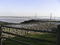
 Second Severn Crossing - geograph.org.uk - 5402596.jpg 640 × 480; 76 KB
-
 Severn Crossings - geograph.org.uk - 1085671.jpg 640 × 480; 68 KB
-
 Shady bower on track to Black Rock - geograph.org.uk - 2061006.jpg 640 × 416; 78 KB
-
 Shore line at Black Rock - geograph.org.uk - 1125025.jpg 640 × 480; 55 KB
-
 Signpost on a Portskewett corner - geograph.org.uk - 5710648.jpg 703 × 800; 199 KB
-
 Site of former paper mill in Sudbrook - geograph.org.uk - 5325848.jpg 4,000 × 2,250; 3.37 MB
-
 Small conifer on a Portskewett corner - geograph.org.uk - 5710799.jpg 771 × 800; 192 KB
-

-
 South Gloucestershire , River Severn - geograph.org.uk - 4622925.jpg 4,204 × 2,792; 7.67 MB
-
 South Wales Coastal Path Information point - geograph.org.uk - 3923344.jpg 5,472 × 3,648; 6.84 MB
-
 South-east view over dismantled Black Rock branch - geograph.org.uk - 3380325.jpg 4,000 × 3,000; 4.95 MB
-
 Southbrook Farm, Sudbrook - geograph.org.uk - 2059251.jpg 640 × 469; 75 KB
-
 Southbrook Farm, Sudbrook - geograph.org.uk - 4356638.jpg 3,264 × 2,448; 1.83 MB
-
 Spar shop, 7 Main Road, Portskewett - geograph.org.uk - 5703809.jpg 800 × 654; 105 KB
-
 Staggered crossroads in Portskewett - geograph.org.uk - 5710657.jpg 800 × 681; 116 KB
-
 Station Road, Portskewett - geograph.org.uk - 5704888.jpg 800 × 503; 71 KB
-

-
 Sudbrook mobile phone mast - geograph.org.uk - 2060994.jpg 640 × 551; 83 KB
-

-
 Sudbrook Road railway bridge - geograph.org.uk - 2059220.jpg 640 × 540; 90 KB
-
 Sunnycroft, Portskewett - geograph.org.uk - 5705099.jpg 800 × 684; 90 KB
-

-
 The Caerwent branch - geograph.org.uk - 5325891.jpg 3,000 × 4,000; 6.61 MB
-
 The Caerwent branch - geograph.org.uk - 5325899.jpg 3,000 × 4,000; 5.58 MB
-
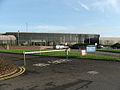
 The David Broome Event Centre - geograph.org.uk - 4656060.jpg 1,024 × 768; 254 KB
-
 The foreshore at Black Rock - geograph.org.uk - 5593616.jpg 1,024 × 1,024; 1.27 MB
-
 The Old Smithy, Main Road, Portskewett - geograph.org.uk - 5706521.jpg 800 × 658; 103 KB
-
 The Portskewett Inn, Portskewett - geograph.org.uk - 4356662.jpg 3,264 × 2,448; 1.83 MB
-
 The Prince of Wales Bridge - geograph.org.uk - 6355354.jpg 1,024 × 768; 951 KB
-
 The road to Crick from the south - geograph.org.uk - 2809861.jpg 640 × 480; 59 KB
-
 The road to Leechpool - geograph.org.uk - 2065847.jpg 640 × 480; 103 KB
-
 The Second Severn Crossing - geograph.org.uk - 6214142.jpg 1,024 × 576; 287 KB
-

-

-
 The shoreline at Black Rock - geograph.org.uk - 3380312.jpg 4,000 × 3,000; 2.93 MB
-
 The view NE from Black Rock - geograph.org.uk - 2061046.jpg 640 × 480; 97 KB
-

-

-
 Track and footpath, Portskewett - geograph.org.uk - 4356647.jpg 3,264 × 2,448; 1.96 MB
-
 Track into Harold's Park, Portskewett - geograph.org.uk - 5704505.jpg 800 × 597; 143 KB
-

-
 Train, railway and transmission towers, Portskewett - geograph.org.uk - 4356595.jpg 4,320 × 3,240; 3.02 MB
-
 Turning for Leechpool - geograph.org.uk - 2065840.jpg 640 × 480; 99 KB


.jpg)
,_Portskewett_-_geograph.org.uk_-_5703713.jpg)


.jpg)


