Category:Poverty Point
Aller à la navigation
Aller à la recherche
|
Ce site est inscrit au Patrimoine Mondial de l'UNESCO sous l'intitulé :
Monumental Earthworks of Poverty Point.
|
|
Ceci est la catégorie d’un monument référencé dans le National Register of Historic Places des États-Unis sous le numéro 66000382. |
site préhistorique et monument national des États-Unis situé en Louisiane  | |||||
| Téléverser des médias | |||||
| Nature de l’élément |
| ||||
|---|---|---|---|---|---|
| Culture | |||||
| Lieu | Paroisse de Carroll Ouest, Louisiane, É.-U. | ||||
| Propriétaire | |||||
| Opérateur | |||||
| Statut patrimonial |
| ||||
| Catégorie des aires protégées de l'UICN | |||||
| Superficie |
| ||||
| Réputé identique à | Poverty Point State Historic Site | ||||
| site officiel | |||||
 | |||||
Média dans la catégorie « Poverty Point »
Cette catégorie comprend 38 fichiers, dont les 38 ci-dessous.
-
 Barrow pit at Poverty Point IMG 7422.JPG 4 608 × 3 456 ; 5,75 Mio
-
 Bayou Maçon.jpg 3 888 × 2 592 ; 2,4 Mio
-
 Bird Mound at Poverty Point.jpg 2 334 × 1 400 ; 2,12 Mio
-
 Circular structures at Poverty Point IMG 7433.JPG 4 608 × 3 456 ; 4,11 Mio
-
 Louisiana - Poverty Point - Karte (blank version).png 1 178 × 1 719 ; 708 kio
-
 Louisiana - Poverty Point - Karte (English version).png 1 178 × 1 719 ; 762 kio
-
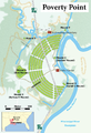 Louisiana - Poverty Point - Karte.png 1 178 × 1 719 ; 1,01 Mio
-
 Louisiana - Poverty Point - Karte.svg 566 × 825 ; 452 kio
-
 Magnificent Landformations & Waterways at Poverty Point.jpg 3 888 × 2 592 ; 1,6 Mio
-
 Mound & Mound at Poverty Point.jpg 2 052 × 2 736 ; 5,66 Mio
-
 Mound A at Poverty Point.jpg 1 024 × 768 ; 711 kio
-
 Mound A at the Monumental Earthworks Poverty Point World Heritage Site.jpg 3 888 × 2 500 ; 1,45 Mio
-
 Mound B at Poverty Point IMG 7424.JPG 4 608 × 3 456 ; 3,9 Mio
-
 Mound B.jpg 3 888 × 2 592 ; 1,65 Mio
-
 Museum at Poverty Point, LA IMG 7419 1.jpg 3 686 × 2 765 ; 2,21 Mio
-
 Poverty point 1938 USACE-1 retouched.jpg 1 000 × 1 419 ; 803 kio
-
 Poverty point 1938 USACE-2.jpg 1 544 × 2 175 ; 1,22 Mio
-
 Poverty point 1938 USACE-3.jpg 1 290 × 1 834 ; 1,18 Mio
-
 Poverty point 1938 USACE.jpg 1 329 × 1 856 ; 2,26 Mio
-
 Poverty Point Aerial HRoe 2014.jpg 400 × 265 ; 144 kio
-
 Poverty Point Archaeological Museum.jpg 3 648 × 2 736 ; 4,3 Mio
-
 Poverty Point clay utensils HRoe 2009.jpg 700 × 477 ; 410 kio
-
 Poverty Point female figurines HRoe 2009.jpg 600 × 472 ; 364 kio
-
 Poverty Point gorgets atlatl weights HRoe 2009.jpg 700 × 580 ; 482 kio
-
 Poverty Point Mounds overview HRoe 2013.jpg 900 × 562 ; 513 kio
-
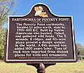
 Poverty Point sign near Epps, LA IMG 7418.JPG 4 608 × 3 456 ; 2,53 Mio
-
 Poverty Point World Heritage Site.jpg 3 888 × 2 514 ; 1,8 Mio
-
 Poverty pt objects.jpg 576 × 427 ; 245 kio
-
 PovertyPoint.jpg 450 × 283 ; 24 kio
-
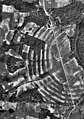
 Povery Point Site, Louisiana, Aerial Photograph.tif 1 299 × 1 432 ; 1,81 Mio
-
 Ridge 1 Poverty Point and Hut.jpg 2 750 × 1 650 ; 3,86 Mio
-
 Ridges One through Six at Poverty Point.jpg 3 888 × 2 592 ; 1,64 Mio
-
 Scenic nature watch at Poverty Point IMG 7426.JPG 4 608 × 3 456 ; 5,94 Mio
-
 Steps to Mound A, Poverty Point IMG 7429.JPG 4 608 × 3 456 ; 4 Mio
-
 The T Shaped Mound (A) at Poverty Point.jpg 3 252 × 2 592 ; 1,25 Mio
-
 Tram Tour of Poverty Point.jpg 3 035 × 1 821 ; 2,25 Mio
-
 West Carroll Parish - Poverty Point - 20220719124841.jpg 4 032 × 3 024 ; 1,82 Mio
-
 West Carroll Parish - Poverty Point - 20220719124952.jpg 800 × 697 ; 167 kio


.png)


_at_Poverty_Point.jpg)


.png)
Catégories :
- Archaic period in North America
- Archaeological sites on the National Register of Historic Places in Louisiana
- National Register of Historic Places in West Carroll Parish, Louisiana
- Pre-Columbian architecture in Louisiana
- Native American mounds in Louisiana
- 2nd-millennium BC architecture
- 1st-millennium BC architecture
- World Heritage Sites in the United States
- National Historic Landmarks in Louisiana
- National Monuments of the United States by name
- National Monuments of Louisiana
- National Park Service in Louisiana
- 0-22-meter-tall structures in the United States