Category:Railway lines in Devon
Jump to navigation
Jump to search
Subcategories
This category has the following 16 subcategories, out of 16 total.
Media in category "Railway lines in Devon"
The following 41 files are in this category, out of 41 total.
-
 Approach to Black Sand Bridge - geograph.org.uk - 1586697.jpg 480 × 640; 101 KB
-
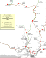
 Churston lines.gif 2,975 × 3,399; 223 KB
-
 Dartmouth Steam Railway south of Lower Noss Point - geograph.org.uk - 4930795.jpg 1,600 × 1,200; 629 KB
-
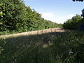
 Disused railway near Leigh Farm - geograph.org.uk - 489249.jpg 640 × 480; 144 KB
-
 Exeter to Dawlish and Torbay (29034460928).jpg 4,085 × 2,927; 3.36 MB
-
 Exmouth branch 1861.gif 800 × 978; 65 KB
-
 Exmouth branch 1903.gif 800 × 978; 71 KB
-
 Former railway track - geograph.org.uk - 489446.jpg 640 × 480; 124 KB
-
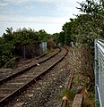
 Former railwayline - geograph.org.uk - 598393.jpg 600 × 450; 104 KB
-
 Granite Way - Dartmoor Railway - geograph.org.uk - 4958149.jpg 1,600 × 1,067; 812 KB
-
 Heathfield branch line near Ventiford, looking north - geograph.org.uk - 3145294.jpg 4,000 × 3,000; 5.19 MB
-
 Honiton and Exeter this way - geograph.org.uk - 1531211.jpg 640 × 415; 101 KB
-
 Old line past Mount Gould (565587200).jpg 2,560 × 1,920; 3.94 MB
-
 Old track (3777583409).jpg 2,310 × 1,564; 3.44 MB
-
 Old track (3778390512).jpg 1,500 × 1,554; 2.28 MB
-
 Passing loop, Seaton Tramway - geograph.org.uk - 4082652.jpg 1,024 × 768; 145 KB
-
 PD&SWJR 1892.gif 3,382 × 4,572; 400 KB
-
 Railway line by the Templar Way - geograph.org.uk - 1052392.jpg 640 × 480; 115 KB
-
 Railway line, Jetty Marsh - geograph.org.uk - 1014588.jpg 480 × 640; 124 KB
-
 Railway signal E21 - geograph.org.uk - 5676176.jpg 2,577 × 2,300; 2.18 MB
-
 Sandstone cliffs east of Dawlish - geograph.org.uk - 4814137.jpg 1,600 × 1,200; 438 KB
-
 SD&Tavi opening.jpg 1,360 × 777; 247 KB
-
 Sdr map 1848.gif 3,863 × 3,408; 306 KB
-
 Sdr map 1876.gif 3,863 × 3,408; 461 KB
-
 Solar Powered Loggers - geograph.org.uk - 5008401.jpg 1,600 × 1,200; 640 KB
-
 South West Main Line Cockwood - geograph.org.uk - 4910045.jpg 640 × 480; 109 KB
-
 Staverton Mill (2).jpg 5,152 × 3,864; 7.69 MB
-
 Tavistock lines 1865.gif 1,483 × 1,871; 115 KB
-
 Tavistock lines 1874.gif 1,483 × 1,871; 128 KB
-
 Tavistock lines 1890.gif 1,486 × 1,876; 158 KB
-

-

-
 The railway near Sprey Head - geograph.org.uk - 4934915.jpg 1,024 × 768; 256 KB
-
 The Tarka Trail near Smytham Manor - geograph.org.uk - 415344.jpg 640 × 426; 158 KB
-
 The Tarka Trail near Sowford Moor - geograph.org.uk - 415361.jpg 640 × 426; 167 KB
-
 The Tarka Trail near Weare Giffard - geograph.org.uk - 414144.jpg 640 × 426; 172 KB
-
 The Tarka Trail near Winswell - geograph.org.uk - 422153.jpg 640 × 426; 160 KB
-

-
 Towards Laira Rail Depot (513838836).jpg 2,000 × 2,667; 4.12 MB
-
 Tracks (3699205192).jpg 2,211 × 1,366; 1.64 MB
-
 Waterloo this way - geograph.org.uk - 1531209.jpg 640 × 427; 95 KB


.jpg)


.jpg)
.jpg)
.jpg)


.jpg)


.jpg)
.jpg)
