Category:Railway lines in Wales
Jump to navigation
Jump to search
Wikimedia category | |||||
| Upload media | |||||
| Instance of | |||||
|---|---|---|---|---|---|
| Category combines topics | |||||
 | |||||
Subcategories
This category has the following 30 subcategories, out of 30 total.
A
B
C
E
G
H
M
N
O
R
S
T
V
W
Media in category "Railway lines in Wales"
The following 59 files are in this category, out of 59 total.
-
 A view north from Dovey Junction station - geograph.org.uk - 4928419.jpg 640 × 480; 184 KB
-
 Aberdare Branch railway line, Pontcynon - geograph.org.uk - 3079953.jpg 640 × 613; 162 KB
-

-
 Brymbo Moss Incline.png 1,500 × 1,125; 4.23 MB
-
 Brymbo Summerhill incline.png 1,500 × 1,125; 4.24 MB
-
 Cardiff to Merthyr railway line. - geograph.org.uk - 827089.jpg 640 × 480; 61 KB
-
 Carrog Station Sidings - geograph.org.uk - 4138139.jpg 1,280 × 851; 270 KB
-
 Castle limeworks bridge, Ruabon.png 1,500 × 1,125; 4.1 MB
-
 End of the line at Llanberis - geograph.org.uk - 4551978.jpg 480 × 640; 88 KB
-

-

-
 From level crossing to platform 2, Rhoose - geograph.org.uk - 6338304.jpg 1,330 × 1,600; 495 KB
-

-

-
 Inverness to Kyle 20160730 083545 (28363056390).jpg 2,560 × 1,536; 1.54 MB
-
 Inverness to Kyle 20160730 083547 (28030205434).jpg 2,560 × 1,536; 1.57 MB
-
 Inverness to Kyle 20160730 083549 (28568799861).jpg 2,560 × 1,536; 1.56 MB
-
 Looking east from Capel Bangor level crossing - geograph.org.uk - 6445820.jpg 1,024 × 576; 278 KB
-

-
 Overgrown railway - geograph.org.uk - 4779517.jpg 1,600 × 1,200; 507 KB
-
 Passing loop, Dolygaer - geograph.org.uk - 4051369.jpg 1,024 × 816; 234 KB
-
 Potts railway 1866.png 1,525 × 871; 122 KB
-

-
 Railway Bridge over River Dee, Llangollen - geograph.org.uk - 2320344.jpg 1,208 × 958; 242 KB
-
 Railway line, Machynlleth (6026560430).jpg 2,048 × 3,072; 3.05 MB
-
 Railway lines and ferry terminal - geograph.org.uk - 5870008.jpg 1,024 × 683; 520 KB
-

-
-
 Railway north-west of Llangollen in Denbighshire - geograph.org.uk - 5196867.jpg 1,024 × 1,024; 809 KB
-
 Railway north-west of Llangollen in Denbighshire - geograph.org.uk - 5196870.jpg 768 × 1,024; 608 KB
-
 Railway sidings, Machen - geograph.org.uk - 4058334.jpg 4,000 × 3,000; 4.35 MB
-
 Railway towards Bangor - geograph.org.uk - 3395941.jpg 1,280 × 856; 316 KB
-

-
 Railway WSW of Rhydypwllan Level Crossing, Pantyffordd - geograph.org.uk - 6368716.jpg 1,600 × 1,318; 456 KB
-
-
-
 Self storage containers in Bagillt station yard - geograph.org.uk - 2989717.jpg 1,600 × 1,200; 456 KB
-
 Semaphore signal, Blaenau Ffestiniog - geograph.org.uk - 1439727.jpg 640 × 512; 48 KB
-
 Shrops & mont 1911.png 1,525 × 871; 129 KB
-
 The Chester-Holyhead Line at Towyn - geograph.org.uk - 4000763.jpg 5,184 × 3,456; 4.79 MB
-
 The Chester-Holyhead Line at Towyn - geograph.org.uk - 4000776.jpg 5,184 × 3,456; 3.41 MB
-
 The end of the line at Corwen - geograph.org.uk - 4927023.jpg 640 × 480; 273 KB
-
 The level stretch above Hebron - geograph.org.uk - 447689.jpg 640 × 480; 61 KB
-
 The line to Betws y Coed - geograph.org.uk - 5137001.jpg 640 × 427; 110 KB
-
 The River Dyfi, Machynlleth (6026000315).jpg 3,072 × 2,048; 3.28 MB
-

-

-

-
 Traeth Mawr Viaduct DSC02982c.jpg 1,500 × 1,000; 254 KB
-
 Traeth Mawr Viaduct DSC02987c.jpg 1,500 × 1,000; 326 KB
-
 Traeth Mawr Viaduct IMG 0262c.jpg 1,500 × 1,000; 228 KB
-
 Traeth Mawr Viaduct IMG 0275c.jpg 1,500 × 1,000; 244 KB
-
 Traeth Mawr Viaduct IMG 0277c.jpg 1,500 × 1,000; 223 KB
-
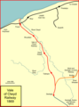 V-o-clwyd.png 768 × 1,039; 54 KB
-
 Vale of Rheidol Railway - geograph.org.uk - 4932843.jpg 4,000 × 3,000; 3.86 MB
-
-
 View inland from Capel Bangor level crossing - geograph.org.uk - 5649348.jpg 1,024 × 768; 498 KB
-

-


.jpg)
.jpg)
.jpg)


.jpg)


.jpg)


