Category:Ramsgate
Jump to navigation
Jump to search
town in Kent, England, UK .jpg) Vue aérienne de la ville avec son port au premier plan, en août 2018. | |||||
| Upload media | |||||
| Instance of | |||||
|---|---|---|---|---|---|
| Location | Thanet, Kent, South East England, England | ||||
| Population |
| ||||
| Elevation above sea level |
| ||||
| Different from | |||||
| Said to be the same as | Ramsgate (Wikimedia duplicated page, civil parish) | ||||
| official website | |||||
 | |||||
Subcategories
This category has the following 19 subcategories, out of 19 total.
A
B
C
- Carol Peters (bus company) (4 F)
- Countryside around Ramsgate (13 F)
E
- Eastonways (bus company) (2 F)
- Ellington Park, Ramsgate (10 F)
G
- Graffiti in Ramsgate (5 F)
- Granville Marina (9 F)
H
M
- Maps of Ramsgate (11 F)
P
T
W
Media in category "Ramsgate"
The following 200 files are in this category, out of 1,013 total.
(previous page) (next page)-

-
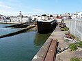
 "Sundowner" in Ramsgate harbour - July 2017 - geograph.org.uk - 5485034.jpg 1,024 × 727; 482 KB
-
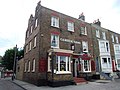
 "The Vale Tavern" PH sign in Ramsgate - geograph.org.uk - 2551828.jpg 990 × 1,024; 181 KB
-
 'Lantic Bay' dredging Ramsgate harbour - geograph.org.uk - 2522769.jpg 640 × 480; 158 KB
-

-
 1 and 3 High Street, St. Lawrence - geograph.org.uk - 5221173.jpg 640 × 428; 126 KB
-
 1 Granville Marina, Ramsgate - geograph.org.uk - 5687674.jpg 5,202 × 3,465; 2.78 MB
-
 1, Archway Road - geograph.org.uk - 5192325.jpg 2,448 × 3,264; 1.74 MB
-
 1, Chatham Place - geograph.org.uk - 3606016.jpg 848 × 636; 158 KB
-
 1, Chatham Place - geograph.org.uk - 4681702.jpg 3,208 × 2,448; 2.22 MB
-
 10 ^ 11, Granville Marina - geograph.org.uk - 4685387.jpg 2,448 × 3,264; 1.96 MB
-
 100, South Eastern Road - geograph.org.uk - 5188683.jpg 2,448 × 3,264; 2.28 MB
-
 127 ^ 129, King Street - geograph.org.uk - 5388210.jpg 2,448 × 3,264; 1.77 MB
-
 14, Nelson Crescent, Ramsgate.jpg 1,600 × 1,200; 348 KB
-
 15, George Street - geograph.org.uk - 4688918.jpg 2,448 × 3,264; 2.28 MB
-
 154 ^ 156, King Street - geograph.org.uk - 4684059.jpg 2,448 × 3,264; 1.9 MB
-
 2, Shah Place - geograph.org.uk - 5188695.jpg 2,448 × 3,264; 2.38 MB
-
 20, West Cliff Road - geograph.org.uk - 5655479.jpg 2,448 × 3,264; 2.16 MB
-
 22, Hereson Road, Ramsgate - geograph.org.uk - 3856461.jpg 3,216 × 4,288; 4.6 MB
-
 23, Addington Street - geograph.org.uk - 4690277.jpg 2,293 × 3,264; 1.5 MB
-
 24, Addington Street - geograph.org.uk - 5655493.jpg 2,448 × 3,264; 1.66 MB
-
 25, Chatham Street - geograph.org.uk - 5189541.jpg 2,448 × 3,264; 2.37 MB
-
 27, Addington Street - geograph.org.uk - 4690309.jpg 2,402 × 3,264; 1.94 MB
-
 29, Albion Road - geograph.org.uk - 5929001.jpg 2,448 × 3,264; 1.78 MB
-
 29, Royal Road - geograph.org.uk - 5651147.jpg 2,448 × 3,264; 1.85 MB
-
 29, Royal Road - geograph.org.uk - 6158717.jpg 2,448 × 3,264; 2.13 MB
-
 3, Nelson Crescent - geograph.org.uk - 5651152.jpg 2,448 × 3,264; 2.22 MB
-
 3, Vale Square - geograph.org.uk - 5655466.jpg 2,448 × 3,264; 2.5 MB
-
 31, Victoria Road - geograph.org.uk - 5386718.jpg 3,264 × 2,448; 3.85 MB
-
 36B, Addington Street - geograph.org.uk - 6452357.jpg 2,102 × 3,264; 1.92 MB
-
 41, Addington Street - geograph.org.uk - 6451340.jpg 2,448 × 2,900; 1.53 MB
-
 41, West Cliff Road - geograph.org.uk - 4249077.jpg 1,113 × 832; 201 KB
-
 5 ^ 7, Plains of Waterloo - geograph.org.uk - 4684149.jpg 2,448 × 3,264; 2.23 MB
-
 6, Avenue Road - geograph.org.uk - 5386710.jpg 2,448 × 3,264; 2.24 MB
-
 6, Avenue Road - geograph.org.uk - 5932138.jpg 3,264 × 2,448; 2.05 MB
-
 69, West Cliff Road - geograph.org.uk - 5932201.jpg 2,448 × 3,264; 1.52 MB
-
 69-73, King Street - geograph.org.uk - 5192254.jpg 2,402 × 3,264; 2.01 MB
-
 7, Paragon - geograph.org.uk - 6002671.jpg 2,448 × 3,264; 1.84 MB
-
 72, Margate Road - geograph.org.uk - 5188738.jpg 2,448 × 3,264; 2.56 MB
-
 8, Vale Square - geograph.org.uk - 5655472.jpg 2,448 × 3,264; 2.07 MB
-
 93, West Cliff Road - geograph.org.uk - 4849525.jpg 2,448 × 3,264; 2.08 MB
-
 94, Queen Street - geograph.org.uk - 4249088.jpg 1,058 × 791; 211 KB
-
 97, King Street - geograph.org.uk - 5653890.jpg 2,448 × 3,264; 1.99 MB
-
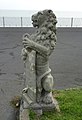 A Granville lion by Victoria Parade - geograph.org.uk - 2142572.jpg 437 × 640; 70 KB
-
 A small sand quarry - geograph.org.uk - 3104882.jpg 640 × 430; 72 KB
-
-

-

-
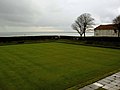 A wet bowling green Ramsgate - geograph.org.uk - 1189369.jpg 640 × 480; 50 KB
-
 A254 Ramsgate 3137298 ca284bc8.jpg 640 × 430; 56 KB
-
 A256 - geograph.org.uk - 3101702.jpg 640 × 430; 49 KB
-
 A299, Canterbury Road East - geograph.org.uk - 3723945.jpg 640 × 480; 250 KB
-
 Abbey Grove - geograph.org.uk - 3107687.jpg 640 × 430; 58 KB
-
 Abbey Grove, Pegwell - geograph.org.uk - 4596644.jpg 2,272 × 1,704; 815 KB
-
 Admiral Fox, Ramsgate - geograph.org.uk - 4791842.jpg 2,272 × 1,704; 955 KB
-
 Advert for Farley - geograph.org.uk - 3133891.jpg 640 × 430; 56 KB
-
 AFCWimbledonRamsgate.jpg 444 × 287; 22 KB
-
 Age and Sons sign, Ramsgate - geograph.org.uk - 5686486.jpg 3,465 × 5,202; 2.05 MB
-
 Albion Hill, Ramsgate - geograph.org.uk - 5686505.jpg 5,202 × 3,465; 3.17 MB
-
 Albion House Ramsgate.jpg 1,600 × 1,127; 331 KB
-
 Albion House, Albion Place - geograph.org.uk - 3603921.jpg 816 × 612; 107 KB
-
 Albion Place Gardens - geograph.org.uk - 2729818.jpg 3,072 × 2,304; 1.71 MB
-
 Albion Steps, CT11 - geograph.org.uk - 3853686.jpg 640 × 480; 84 KB
-
 Alterations to Royal Victoria Pavilion, Harbour Parade - geograph.org.uk - 5189593.jpg 3,264 × 2,448; 1.77 MB
-
 Alterations to Royal Victoria Pavilion, Harbour Parade - geograph.org.uk - 5189596.jpg 3,264 × 2,448; 3.33 MB
-
 Alterations to Royal Victoria Pavilion, Harbour Parade - geograph.org.uk - 5261717.jpg 3,264 × 2,448; 2.19 MB
-
 Alterations to Royal Victoria Pavilion, Harbour Parade - geograph.org.uk - 5262616.jpg 3,264 × 2,448; 1.48 MB
-
 Alterations to Royal Victoria Pavilion, Harbour Parade - geograph.org.uk - 5383857.jpg 3,264 × 2,448; 2.1 MB
-
 Alterations to Royal Victoria Pavilion, Harbour Parade - geograph.org.uk - 5385153.jpg 3,264 × 2,420; 1.37 MB
-
 Anath Gospel Hall - geograph.org.uk - 3094248.jpg 3,872 × 2,592; 4.64 MB
-
 Anchors, cannons and similar objects, Ramsgate - geograph.org.uk - 4545143.jpg 1,024 × 684; 240 KB
-
 Argyll Drive, Ramsgate - geograph.org.uk - 5914702.jpg 1,600 × 1,125; 412 KB
-
 Arthur Boyd Houghton02.jpg 520 × 637; 75 KB
-
 ASDA - geograph.org.uk - 3133907.jpg 640 × 430; 40 KB
-
 Asda, Ramsgate - geograph.org.uk - 3094243.jpg 3,872 × 2,592; 3.35 MB
-
 Ash House, Ramsgate - geograph.org.uk - 3856366.jpg 3,216 × 4,288; 5.2 MB
-
 Ashburnham Road, St. Lawrence - geograph.org.uk - 4791832.jpg 2,272 × 1,704; 647 KB
-
 Augusta Road - geograph.org.uk - 1701833.jpg 640 × 480; 29 KB
-
 Augusta road 10th Feb 2010 - geograph.org.uk - 1701825.jpg 640 × 480; 67 KB
-
 B T Tools, Alma Road - geograph.org.uk - 4681760.jpg 3,264 × 2,448; 1.84 MB
-
 Bandstand, Wellington Crescent - geograph.org.uk - 3145544.jpg 1,024 × 680; 188 KB
-
 Beach Retreat, Marina Esplanade, Ramsgate - geograph.org.uk - 6395830.jpg 4,398 × 2,973; 1.26 MB
-
 Beach Retreat, The Arches, Marina Esplanade - geograph.org.uk - 4252475.jpg 1,077 × 807; 194 KB
-
 Bedford Inn, Ramsgate - geograph.org.uk - 4596492.jpg 2,272 × 1,704; 826 KB
-
 Bit of Solar for the Beacons - geograph.org.uk - 5913880.jpg 3,864 × 5,152; 2.4 MB
-
 Boat builders’ slipways - geograph.org.uk - 5652954.jpg 3,264 × 2,448; 2.04 MB
-
 Boat builders’ slipways - geograph.org.uk - 5929028.jpg 3,264 × 2,448; 1.85 MB
-
 Boat builders’ slipways - geograph.org.uk - 6003330.jpg 3,064 × 2,429; 1.6 MB
-
 Boat builders’ slipways - geograph.org.uk - 6158694.jpg 3,264 × 2,448; 1.95 MB
-
 Boating pond, West Cliff, Ramsgate - geograph.org.uk - 5210521.jpg 640 × 428; 148 KB
-
 Bowling Green - geograph.org.uk - 3112750.jpg 640 × 430; 37 KB
-
 Bowling Green - geograph.org.uk - 3112755.jpg 640 × 430; 34 KB
-
 Bowling Green, Royal Esplanade - geograph.org.uk - 3112793.jpg 640 × 430; 32 KB
-
 Bowling Green, Royal Esplanade - geograph.org.uk - 3112797.jpg 640 × 430; 29 KB
-
 Breakwater at Ramsgate - geograph.org.uk - 5570702.jpg 3,888 × 2,592; 1.18 MB
-
 Building site beside Haine Road (A256) - geograph.org.uk - 4236817.jpg 943 × 686; 139 KB
-
 Building site, St Mildred’s Avenue - geograph.org.uk - 5388303.jpg 3,214 × 2,448; 2.29 MB
-
 Bus leaving Westwood bus garage - geograph.org.uk - 3274631.jpg 1,024 × 768; 102 KB
-
 Bus on Leopold Street, Ramsgate - geograph.org.uk - 3274621.jpg 1,024 × 768; 171 KB
-
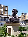 Bust of Vincent Van Gogh ramsgate, spencer square unveiling 1.jpg 2,304 × 3,072; 1.45 MB
-
 Bust of Vincent Van Gogh ramsgate, spencer square unveiling 2.jpg 2,304 × 3,072; 1.43 MB
-
 Bust of Vincent Van Gogh ramsgate, spencer square unveiling.jpg 2,304 × 3,072; 1.51 MB
-
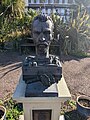 Bust of Vincent Van Gogh Ramsgate.jpg 737 × 983; 321 KB
-
 Buxton Road, Northwood - geograph.org.uk - 4580834.jpg 2,272 × 1,704; 741 KB
-

-
 Cafe on A254 Ramsgate 2262663 e6e8212d.jpg 3,072 × 2,304; 1.85 MB
-
 Cafes at Grange Road, Vale Road junction - geograph.org.uk - 6017831.jpg 4,910 × 2,777; 2.23 MB
-
 Cafeteria and boating pool, Ramsgate - geograph.org.uk - 2847168.jpg 640 × 440; 60 KB
-
 Cambrian Cottages, Ramsgate - geograph.org.uk - 4792008.jpg 2,272 × 1,704; 806 KB
-
 Camden Arms, Ramsgate - geograph.org.uk - 4014062.jpg 3,488 × 2,616; 2.2 MB
-
 Canterbury Road East, Nethercourt - geograph.org.uk - 5160259.jpg 2,048 × 1,536; 925 KB
-

-
 Catholic Church of St Ethelbert, Ramsgate - geograph.org.uk - 3856495.jpg 4,288 × 3,216; 5.22 MB
-
 Cavendish Street - geograph.org.uk - 6445039.jpg 2,448 × 3,264; 2.59 MB
-
 Cavendish Street, Ramsgate - geograph.org.uk - 5344447.jpg 3,264 × 2,448; 1.67 MB
-
 Celandine Hall market, Ramsgate - geograph.org.uk - 5686500.jpg 5,202 × 3,465; 3.67 MB
-
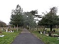 Central path, Ramsgate Cemetery - geograph.org.uk - 3856560.jpg 4,288 × 3,216; 5.29 MB
-
 Chalk Hill Bridge - geograph.org.uk - 2358554.jpg 3,072 × 2,304; 1.92 MB
-
 Chalk Hill Junction on the A256 Ramsgate Road - geograph.org.uk - 2358512.jpg 3,072 × 2,304; 1.99 MB
-

-

-
 Channel View Court, Granville Marina, Ramsgate - geograph.org.uk - 6395827.jpg 5,100 × 3,429; 1.51 MB
-
 Chapel Road, St. Lawrence - geograph.org.uk - 4580582.jpg 2,272 × 1,704; 793 KB
-
 Chapel Road, St. Lawrence - geograph.org.uk - 4791830.jpg 2,272 × 1,704; 773 KB
-
 Charlotte Court, Ramsgate - geograph.org.uk - 4572096.jpg 480 × 640; 101 KB
-
 Chartham Terrace - geograph.org.uk - 3117103.jpg 640 × 430; 106 KB
-
 Chartham Terrace, Ramsgate - geograph.org.uk - 3862611.jpg 4,288 × 3,216; 6.06 MB
-
 Chatham House School - geograph.org.uk - 3133884.jpg 640 × 430; 86 KB
-
 Chester Cottage, Cannonbury Road - geograph.org.uk - 4680499.jpg 2,448 × 3,264; 1.79 MB
-
 Chester Cottage, Cannonbury Road - geograph.org.uk - 5187764.jpg 2,448 × 3,264; 2.1 MB
-
 Chilton Allotments - geograph.org.uk - 2359453.jpg 3,072 × 2,304; 2.28 MB
-
 Chimney Pots - geograph.org.uk - 1845700.jpg 1,024 × 768; 188 KB
-
 Chimney Stack - geograph.org.uk - 1845704.jpg 1,024 × 768; 157 KB
-
 Church Hill, Ramsgate - geograph.org.uk - 4572068.jpg 640 × 480; 113 KB
-
 Clarendon Gardens, Ramsgate - geograph.org.uk - 5344457.jpg 3,264 × 2,448; 2.09 MB
-
 Cliff top path, Winterstoke Gardens - geograph.org.uk - 5213909.jpg 640 × 428; 131 KB
-
 Cliff top west of Pegwell - geograph.org.uk - 3104879.jpg 640 × 430; 53 KB
-
 Cliff Tops Hotel - geograph.org.uk - 3121284.jpg 640 × 430; 62 KB
-
 Cliff-top shelter - geograph.org.uk - 4855405.jpg 640 × 480; 81 KB
-
 Clifton Lawn, Ramsgate - geograph.org.uk - 4596569.jpg 2,272 × 1,704; 901 KB
-
 Cliftonville Avenue, Newington - geograph.org.uk - 4580643.jpg 2,272 × 1,704; 769 KB
-
 Clock House and boat builders' slipways - geograph.org.uk - 3578098.jpg 1,086 × 774; 151 KB
-
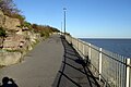
 Coast path at Ramsgate Sands - geograph.org.uk - 5686545.jpg 5,202 × 3,465; 2.92 MB
-
 Coasters Bar and Cafe, Ramsgate - geograph.org.uk - 6206600.jpg 1,280 × 851; 335 KB
-
 Coastguard Cottages - geograph.org.uk - 3104884.jpg 640 × 430; 52 KB
-
 Coastguard Cottages - geograph.org.uk - 3104887.jpg 640 × 430; 57 KB
-
 Coastguard Cottages, Pegwell Bay - geograph.org.uk - 6018082.jpg 5,202 × 3,465; 2.3 MB
-
 Coastguard Cottages, Ramsgate - geograph.org.uk - 4014084.jpg 3,488 × 2,616; 2.71 MB
-
 Coastguard Cottages, Ramsgate - geograph.org.uk - 5213932.jpg 640 × 428; 135 KB
-
 Coastguard Cottages, Victoria Parade - geograph.org.uk - 5932124.jpg 3,264 × 2,448; 2.08 MB
-
 Coleman’s Yard - geograph.org.uk - 6445994.jpg 3,264 × 2,448; 3.62 MB
-
 Coleman’s Yard carpark - geograph.org.uk - 4249132.jpg 1,175 × 881; 183 KB
-
 Coloured Gravel outside Primark - geograph.org.uk - 5913956.jpg 4,676 × 3,470; 3.01 MB
-
 Colourful hoarding, Bellevue Road - geograph.org.uk - 5190741.jpg 3,264 × 2,448; 2.37 MB
-

-
 Conqueror Ale House, Grange Road - geograph.org.uk - 6017834.jpg 5,202 × 3,465; 4.39 MB
-

-
 Conversion of former Rank-Hovis flour mill, Margate Road - geograph.org.uk - 4851685.jpg 3,264 × 2,448; 2.04 MB
-
 Copper Chimney Pots - geograph.org.uk - 1845702.jpg 1,024 × 768; 166 KB
-
 Corner of Meeting St and High St, Ramsgate - geograph.org.uk - 5685747.jpg 5,202 × 3,465; 3.26 MB
-
 Cottage Road, CT11 - geograph.org.uk - 3853671.jpg 480 × 640; 76 KB
-
 Coxes Avenue, Northwood - geograph.org.uk - 4580846.jpg 2,272 × 1,704; 784 KB
-
 Coxes Lane, Northwood - geograph.org.uk - 4580844.jpg 2,272 × 1,704; 686 KB
-
 Creeper clad house on West Dumpton Lane - geograph.org.uk - 2645029.jpg 640 × 480; 213 KB
-
 Crescent, West Cliff Promenade - geograph.org.uk - 3121263.jpg 640 × 430; 46 KB
-
 Cross Quays development - geograph.org.uk - 3720373.jpg 800 × 532; 106 KB
-
 Cross Quays Development, Westwood, Kent - geograph.org.uk - 3720376.jpg 529 × 800; 116 KB
-
 Crumbling cliff near Pegwell - geograph.org.uk - 3094067.jpg 3,872 × 2,592; 5.07 MB
-
 Custom House, Ramsgate - geograph.org.uk - 4544685.jpg 1,024 × 684; 222 KB
-
 Daphne intill kajen i Ramsgate, England 1948 SLSA 1150 foto 8936.jpg 3,922 × 4,000; 1.57 MB
-
 Dead Harbour Porpoise beside Westcliffe - geograph.org.uk - 3862519.jpg 4,163 × 3,045; 6.17 MB
-
 Deal Cutter Public House - geograph.org.uk - 3856343.jpg 4,288 × 3,216; 3.85 MB
-
 Deal Cutter, Ramsgate - geograph.org.uk - 4014048.jpg 3,488 × 2,616; 2.15 MB
-
 Decorative path by Ramsgate Sands - geograph.org.uk - 4572143.jpg 480 × 640; 110 KB
-
 Demolished wall, St Augustine’s Abbey, St Augustine’s Road - geograph.org.uk - 5187713.jpg 3,264 × 2,448; 2.65 MB
-
 Demolition of 1, Archway Road - geograph.org.uk - 5654690.jpg 2,448 × 3,264; 2.23 MB
-
 Demolition of 1, Archway Road - geograph.org.uk - 5654702.jpg 2,294 × 3,256; 2 MB
-
 Demolition site - geograph.org.uk - 5189572.jpg 3,264 × 2,448; 3.59 MB
-
 Demolition site - geograph.org.uk - 5261692.jpg 3,264 × 2,448; 4.01 MB
-
 Demolition site and hoarding. High St, Ramsgate - geograph.org.uk - 5685748.jpg 5,202 × 3,465; 2.78 MB
-
 Derelict petrol station, West Cliff Road - geograph.org.uk - 3571100.jpg 816 × 612; 127 KB
-
 Derelict plot of land, 69, West Cliff Road - geograph.org.uk - 4249061.jpg 1,044 × 783; 209 KB
-
 Derelict premises, King Street - geograph.org.uk - 4852782.jpg 3,264 × 2,448; 2.14 MB
-
 Derelict site to let, Effingham Street - geograph.org.uk - 4855539.jpg 3,264 × 2,448; 1.94 MB
-
 Derelict site, D’Este Road - geograph.org.uk - 4854165.jpg 3,264 × 2,448; 2.23 MB
-
 Derelict site, D’Este Road - geograph.org.uk - 4854173.jpg 3,264 × 2,448; 2 MB
-
 Derelict site, D’Este Road - geograph.org.uk - 4854193.jpg 3,264 × 2,448; 3.68 MB
-
 Derelict site, D’Este Road - geograph.org.uk - 5386675.jpg 2,448 × 3,264; 2.5 MB
-
 Derelict site, Effingham Street - geograph.org.uk - 4688982.jpg 3,264 × 2,448; 2.05 MB
-
 Derelict site, King Street - geograph.org.uk - 5932163.jpg 3,264 × 2,448; 1.75 MB
-
 Derelict Terminal at Pegwell Bay Hoverport - geograph.org.uk - 5585292.jpg 1,014 × 689; 631 KB
-
 Derelict warehouse, Margate Road - geograph.org.uk - 4850845.jpg 3,264 × 2,448; 2.14 MB
-

-
 Dilapidated building - geograph.org.uk - 5932187.jpg 3,264 × 2,448; 1.99 MB
-
 Dog Bone (92924159).jpeg 1,371 × 2,048; 863 KB
-
 Door to the Belle Vue, Pegwell Road - geograph.org.uk - 6018066.jpg 5,202 × 3,465; 2.92 MB
-
 Dr Collis (cropped).JPG 2,792 × 3,716; 4.24 MB
-
 Dr Collis.JPG 3,240 × 4,320; 5.24 MB
-
 Earl St Vincent sign - geograph.org.uk - 2662934.jpg 480 × 640; 73 KB
-
 Earl St. Vincent, Ramsgate - geograph.org.uk - 4014058.jpg 3,488 × 2,616; 2.51 MB


_dispensary,_Broad_Street,_CT11_-_geograph.org.uk_-_3863611.jpg)


_-_geograph.org.uk_-_4236817.jpg)


.jpeg)

.JPG)


