Category:Rock formations in Wisconsin
Jump to navigation
Jump to search
States of the United States: Alabama · Alaska · Arizona · Arkansas · California · Colorado · Connecticut · Delaware · Florida · Georgia · Hawaii · Idaho · Illinois · Indiana · Iowa · Kansas · Kentucky · Louisiana · Maine · Maryland · Massachusetts · Michigan · Minnesota · Mississippi · Missouri · Montana · Nebraska · Nevada · New Hampshire · New Jersey · New Mexico · New York · North Carolina · North Dakota · Ohio · Oklahoma · Oregon · Pennsylvania · Rhode Island · South Carolina · South Dakota · Tennessee · Texas · Utah · Vermont · Virginia · Washington · West Virginia · Wisconsin · Wyoming – Washington, D.C.
American Samoa · Northern Mariana Islands
American Samoa · Northern Mariana Islands
Wikimedia category | |||||
| Upload media | |||||
| Instance of | |||||
|---|---|---|---|---|---|
| Category combines topics | |||||
| Wisconsin | |||||
state of the United States of America      | |||||
| Pronunciation audio | |||||
| Instance of | |||||
| Part of | |||||
| Named after | |||||
| Location |
| ||||
| Located in or next to body of water | |||||
| Capital | |||||
| Legislative body | |||||
| Executive body | |||||
| Highest judicial authority | |||||
| Anthem |
| ||||
| Head of government |
| ||||
| Inception |
| ||||
| Highest point | |||||
| Population |
| ||||
| Area |
| ||||
| Elevation above sea level |
| ||||
| Maximum temperature record |
| ||||
| Minimum temperature record |
| ||||
| official website | |||||
 | |||||
Subcategories
This category has the following 18 subcategories, out of 18 total.
*
B
C
D
- Devil's Gateway (2 F)
E
- Elephant Trunk Rock (4 F)
- Enee Point (5 F)
L
N
- Natural Bridge (Wisconsin) (6 F)
P
R
- Rabbit Rock (Wisconsin) (3 F)
S
- Schoonmaker Reef (2 F)
- Soldiers' Home Reef (2 F)
V
- Van Hise Rock (12 F)
Media in category "Rock formations in Wisconsin"
The following 25 files are in this category, out of 25 total.
-
 2003-08-14 Rock formations on I-90 exit 55 in Wisconsin.jpg 2,560 × 1,920; 1.5 MB
-
 Baraboo Quartzite Rock Formation - panoramio.jpg 4,540 × 3,663; 6.54 MB
-
 Castle Rock (13904161947).jpg 2,112 × 3,284; 2.29 MB
-
 Castle Rock near Camp Douglas, WI.jpg 1,000 × 600; 210 KB
-
 Cross Plains from the Ice Age Trail - panoramio.jpg 4,608 × 3,456; 3.19 MB
-
 Driftless Area - panoramio (13).jpg 3,000 × 4,000; 8.18 MB
-
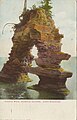
 FMIB 36204 Devil's Doorway from Above, Devil's Lake, Wis.jpeg 984 × 518; 114 KB
-
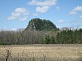
 Gfp-wisconsin-mill-bluff-state-park-camel-bluff.jpg 1,667 × 2,500; 1.24 MB
-
 High Cliff State Park The Ledge Cliff.JPG 3,472 × 2,314; 1.58 MB
-
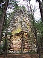
 Leaning Tower of Rock (15163519427).jpg 3,960 × 2,461; 4.73 MB
-
 Limery Ridge - panoramio.jpg 2,592 × 1,944; 2.16 MB
-
 MendotaStation SWOutcrop2Reduced.jpg 7,656 × 3,256; 4.66 MB
-
 Outcrop on Powers Bluff.jpg 2,736 × 3,648; 6.51 MB
-
 Roche A Cri 2.JPG 1,600 × 1,200; 1,017 KB
-
 Roche-A-CriRock.jpg 1,728 × 2,304; 831 KB
-
 Rock Cut - panoramio (1).jpg 4,608 × 3,456; 12.23 MB
-
 Rock Cut on Hwy 14 - panoramio.jpg 4,608 × 3,456; 6.96 MB
-
 Rock on Mississippi River Bluff - panoramio.jpg 2,592 × 1,944; 3.7 MB
-
 Rock Outcrop near Cross Plains - panoramio.jpg 4,608 × 3,456; 5.87 MB
-
 ShipRock.jpg 3,801 × 2,401; 2.24 MB
-
 The Dells of the Wisconsin River in June 2015 01.JPG 4,000 × 3,000; 2.66 MB
-
 Willow River State Park.jpg 1,920 × 1,280; 791 KB
-
 Wisconsin's Amnicon Falls State Park (2008).jpg 1,944 × 2,592; 1.01 MB
-
 Wisconsin's Devil's Lake State Park (2008).jpg 1,944 × 2,592; 1.53 MB
-
 Wisconsin's Mill Bluff State Park (2008).jpg 1,944 × 2,504; 970 KB


.jpg)


.jpg)


.jpg)


.jpg)


.jpg)
.jpg)
.jpg)