Category:Ross-on-Wye
Jump to navigation
Jump to search
town in Herefordshire, England  | |||||
| Upload media | |||||
| Instance of | |||||
|---|---|---|---|---|---|
| Location | Herefordshire, West Midlands, England | ||||
| Located in or next to body of water | |||||
| official website | |||||
 | |||||
Български: Рос он Уай е град в западна Англия, разположен в графство Херефордшър, регион Западен Мидландс. Населението на града през 2001 година е 10 089 души. (→Рос он Уай)
Cymraeg: Tref yn Swydd Henffordd, Lloegr, ar afon Gwy, ger y ffin â Chymru, ydy'r Rhosan-ar-Wy (Saesneg: Ross-on-Wye). Mae ganddi boblogaeth o tua 8,000. Mae'r ffordd A40 yn pasio heibio'r dref. (→Rhosan ar Wy)
English: Ross-on-Wye ( Welsh: Rhosan ar Wy) is a small market town with a population of 10,089 (according to the 2001 census), falling to 9,574 at the 2011 Census. in south eastern Herefordshire, England, located on the River Wye, and on the northern edge of the Forest of Dean. (→Ross-on-Wye)
فارسی: راس-آن-وای (به انگلیسی: Ross-on-Wye) یک شهرک در بریتانیا است که در هرفوردشر واقع شدهاست. (→راس-آن-وای)
Français : Ross-on-Wye (Rhosan ar Wy en gallois) est une ville du Herefordshire, en Angleterre. Traversée par la Wye, elle est située au nord de la forêt de Dean. Au moment du recensement de 2001, elle comptait habitants. (→Ross-on-Wye)
Italiano: Ross-on-Wye (in lingua gallese Rhosan ar Wy) è un paese di 10.089 abitanti della contea dell'Herefordshire, in Inghilterra. (→Ross-on-Wye)
Nederlands: Ross-On-Wye is een plaats in het zuidoosten van het bestuurlijke gebied Herefordshire, in het gelijknamige Engelse graafschap. Zoals de naam aangeeft, ligt het stadje aan de Wye, één van de langste rivieren van het Verenigd Koninkrijk. Van origine slechts Ross genaamd, werd in 1931 de toevoeging on Wye aangebracht, om een onderscheid te maken met gelijknamige plaatsen in het Verenigd Koninkrijk. (→Ross-on-Wye)
Norsk nynorsk: Ross-on-Wye er ein by i grevskapet Herefordshire i England. Han har kring 10 000 innbyggjarar og ligg ved elva Wye nord i Forest of Dean. (→Ross-on-Wye)
Polski: Ross-on-Wye ( wal. Rhosan ar Wy) – niewielkie miasto w Anglii nad rzeką Wye, w południowo-wschodniej części hrabstwa Herefordshire, na północnym skraju lasu Forest of Dean. (→Ross-on-Wye)
Română: Ross-on-Wye este un oraș în comitatul Herefordshire, regiunea West Midlands, Anglia. (→Ross-on-Wye)
Русский: Росс-он-Уай . (→Росс-он-Уай)
Svenska: Ross-on-Wye ( kymriska Rhosan ar Wy) är en småstad med 10 089 invånare (2001) i sydöstra Herefordshire i England. Staden ligger vid floden Wye och i norra utkanten av Forest of Dean. Den är känd för sina antikaffärer, sin marknadsplats och sina många pubar. (→Ross-on-Wye)

Subcategories
This category has the following 10 subcategories, out of 10 total.
A
C
E
G
H
N
P
S
T
Media in category "Ross-on-Wye"
The following 200 files are in this category, out of 2,559 total.
(previous page) (next page)-

-
 'Harrods of Ross' - rebranded, again - geograph.org.uk - 5180021.jpg 1,600 × 901; 490 KB
-
 'Morrisons roundabout' - geograph.org.uk - 5953571.jpg 1,600 × 1,200; 1.25 MB
-
 1-2 Copse Cross Street, Ross-on-Wye - geograph.org.uk - 5500598.jpg 532 × 640; 139 KB
-
 10 Old Gloucester Road, Ross-on-Wye - geograph.org.uk - 5500470.jpg 640 × 501; 175 KB
-
 19-20 Gloucester Road, Ross-on-Wye - geograph.org.uk - 5500577.jpg 640 × 479; 138 KB
-
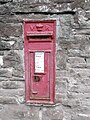 19th century post box, Alton Street - geograph.org.uk - 5212740.jpg 480 × 640; 99 KB
-
 20 Broad Street, Ross-on-Wye - geograph.org.uk - 5499514.jpg 640 × 539; 212 KB
-
 20-21 Station Street, Ross-on-Wye - geograph.org.uk - 5499575.jpg 640 × 488; 114 KB
-
 23 Brookend Street, Ross-on-Wye - geograph.org.uk - 5499556.jpg 640 × 480; 181 KB
-
 4 St Mary's Street, Ross-on-Wye - geograph.org.uk - 5491558.jpg 486 × 640; 123 KB
-

-
 44-46 New Street, Ross-on-Wye - geograph.org.uk - 5498223.jpg 502 × 640; 145 KB
-
 5 miles to Lydbrook from Ross-on-Wye - geograph.org.uk - 3566924.jpg 798 × 800; 165 KB
-
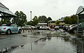
 A bit of flooding, Ross Riverside - geograph.org.uk - 4294056.jpg 800 × 450; 148 KB
-
 A couple of sickly looking trees - geograph.org.uk - 1231795.jpg 640 × 480; 114 KB
-
 A day on the river - geograph.org.uk - 954851.jpg 640 × 382; 66 KB
-
 A fine crop, 2016 - geograph.org.uk - 5104795.jpg 1,200 × 1,600; 494 KB
-
 A fine viticultural crop - geograph.org.uk - 5915794.jpg 1,312 × 1,600; 772 KB
-
 A hillside view, Ross-on-Wye - geograph.org.uk - 3192499.jpg 640 × 421; 64 KB
-

-
 A quick look over - geograph.org.uk - 3402473.jpg 800 × 451; 229 KB
-
 A quiet afternoon at Labels - geograph.org.uk - 1144216.jpg 640 × 480; 157 KB
-
 A Ross-on-Wye engineering business - geograph.org.uk - 1072136.jpg 640 × 480; 158 KB
-

-

-
 A straight, narrow footpath - geograph.org.uk - 4345888.jpg 800 × 800; 223 KB
-
 A suburban cul-de-sac - geograph.org.uk - 4213481.jpg 800 × 600; 309 KB
-
 A sure sign of spring - geograph.org.uk - 3862831.jpg 599 × 800; 244 KB
-
 A triangle of public land - geograph.org.uk - 4994294.jpg 1,600 × 1,200; 1.27 MB
-
 A view of Ross-on-Wye - geograph.org.uk - 911681.jpg 640 × 480; 102 KB
-
 A walk from Kerne Bridge to Ross-on-Wye (49) (geograph 7352252).jpg 4,320 × 3,240; 5.17 MB
-
-
 A winter visitor, 1 - geograph.org.uk - 4806073.jpg 598 × 448; 191 KB
-
 A winter visitor, 2 - geograph.org.uk - 4806082.jpg 697 × 527; 218 KB
-

-
 A40 approaching the River Wye - geograph.org.uk - 3645169.jpg 2,475 × 1,506; 2.03 MB
-
 A40 at Hildersley village boundary - geograph.org.uk - 4632939.jpg 640 × 481; 68 KB
-
 A40 at Ross on Wye - geograph.org.uk - 2053287.jpg 640 × 480; 63 KB
-
 A40 Bridstow Bridge - geograph.org.uk - 4925089.jpg 1,600 × 759; 552 KB
-

-
 A40 cutting, Ross-on-Wye - geograph.org.uk - 2044348.jpg 640 × 480; 54 KB
-
 A40 dual carriageway at Ross-on-Wye - geograph.org.uk - 1827408.jpg 3,008 × 2,000; 1.51 MB
-
 A40 dual carriageway, Ross-on-Wye - geograph.org.uk - 2044345.jpg 640 × 480; 59 KB
-
 A40 east of Ross-on-Wye - geograph.org.uk - 1971791.jpg 640 × 480; 271 KB
-
 A40 in cutting near Ross-on-Wye - geograph.org.uk - 2324753.jpg 640 × 480; 37 KB
-
 A40 near Hildersley Farm - geograph.org.uk - 4632938.jpg 640 × 481; 46 KB
-
 A40 north of Ross on Wye - geograph.org.uk - 3645164.jpg 2,439 × 1,446; 1.86 MB
-
 A40 Ross eastern bypass - geograph.org.uk - 5718945.jpg 1,600 × 902; 806 KB
-
 A40 Ross on Wye - geograph.org.uk - 3857705.jpg 1,600 × 1,071; 258 KB
-
 A40 roundabout at Ross on Wye - geograph.org.uk - 4089889.jpg 2,592 × 3,872; 3.58 MB
-

-
 A40, Hildersley - geograph.org.uk - 5212746.jpg 800 × 600; 220 KB
-
 A40, Hildersley - geograph.org.uk - 5212749.jpg 800 × 600; 189 KB
-
 A40, Ross-on-Wye - geograph.org.uk - 4097363.jpg 1,600 × 1,063; 824 KB
-
 A40, Ross-on-Wye - geograph.org.uk - 4097524.jpg 1,600 × 1,063; 478 KB
-
 A40, Ross-on-Wye eastern bypass - geograph.org.uk - 1033052.jpg 640 × 480; 75 KB
-
 A40-A449 roundabout, Ross-on-Wye 1 - geograph.org.uk - 1307405.jpg 640 × 480; 234 KB
-
 A40-A449 roundabout, Ross-on-Wye 2 - geograph.org.uk - 1307416.jpg 640 × 481; 235 KB
-
 A449 approaching M50 - geograph.org.uk - 2324762.jpg 640 × 480; 35 KB
-
 A449 on Bridstow Bridge - geograph.org.uk - 3422522.jpg 1,024 × 768; 96 KB
-

-
 Abbeygate in Ross-on-Wye - geograph.org.uk - 5350199.jpg 800 × 631; 97 KB
-
 Abbotsfield Funeral Directors, Ross-on-Wye - geograph.org.uk - 4975381.jpg 1,600 × 1,200; 955 KB
-

-
 Access to Morley Square - geograph.org.uk - 1325631.jpg 640 × 480; 228 KB
-
 Acer and architect - geograph.org.uk - 783663.jpg 640 × 348; 85 KB
-
 Acer and architect 2 - geograph.org.uk - 1280679.jpg 640 × 480; 231 KB
-
 Acer palmatum 'Ariadne' - geograph.org.uk - 6136438.jpg 1,600 × 1,206; 794 KB
-
 Achillea millefolium 'Terracotta', 1 - geograph.org.uk - 5050171.jpg 1,600 × 1,200; 1.43 MB
-
 Achillea millefolium 'Terracotta', 2 - geograph.org.uk - 5050175.jpg 1,600 × 1,203; 1.24 MB
-
 Aerial and chimney - geograph.org.uk - 5692170.jpg 1,600 × 900; 425 KB
-
 After sunset, Alton Road - geograph.org.uk - 4266783.jpg 800 × 450; 119 KB
-
 After sunset, River Wye, 1 - geograph.org.uk - 5243470.jpg 1,600 × 901; 568 KB
-
 After sunset, River Wye, 2 - geograph.org.uk - 5249565.jpg 1,600 × 899; 601 KB
-
 After sunset, River Wye, 3 - geograph.org.uk - 5249569.jpg 1,600 × 1,200; 908 KB
-
 After sunset, River Wye, 4 - geograph.org.uk - 5249572.jpg 1,600 × 1,200; 945 KB
-
 After the fire, Cropper Row, Haigh, 1 - geograph.org.uk - 4888732.jpg 1,600 × 900; 704 KB
-
 After the fire, Cropper Row, Haigh, 2 - geograph.org.uk - 4888747.jpg 1,600 × 1,200; 906 KB
-
 Afternoon before the bonfire - geograph.org.uk - 4230496.jpg 800 × 600; 217 KB
-
 Aldi (Ross-on-Wye) - geograph.org.uk - 6311064.jpg 3,648 × 2,736; 3.48 MB
-
 Alley behind the Alton Street Surgery - geograph.org.uk - 4774766.jpg 1,600 × 1,200; 913 KB
-
 Alley off Cantilupe Road, Ross-on-Wye - geograph.org.uk - 963772.jpg 640 × 480; 97 KB
-
 Alley off Gloucester Road, Ross-on-Wye - geograph.org.uk - 4222354.jpg 600 × 800; 249 KB
-
 Alleyway between Gloucester Road and Cantilupe Road - geograph.org.uk - 5240709.jpg 1,200 × 1,600; 749 KB
-
 Alleyway between Mount Pleasant and Three Crosses Road - geograph.org.uk - 5883846.jpg 1,600 × 1,200; 1.07 MB
-
 Alleyway off Cantilupe Road - geograph.org.uk - 6075002.jpg 1,600 × 902; 685 KB
-
 Alleyway with autumn colour - geograph.org.uk - 4680890.jpg 800 × 450; 262 KB
-
 Allium gigantium - geograph.org.uk - 4998643.jpg 1,200 × 1,600; 896 KB
-
 Also available in white - geograph.org.uk - 1732306.jpg 640 × 479; 102 KB
-
 Alton Avenue - geograph.org.uk - 4311186.jpg 800 × 600; 256 KB
-
 Alton Avenue, Ross-on-Wye - geograph.org.uk - 4766778.jpg 1,600 × 1,200; 750 KB
-

-
 Alton Court 1 - geograph.org.uk - 1576433.jpg 640 × 480; 253 KB
-
 Alton Court 2 - geograph.org.uk - 1576438.jpg 640 × 480; 250 KB
-
 Alton Court, Ross on Wye - geograph.org.uk - 4098391.jpg 3,872 × 2,592; 4.74 MB
-
 Alton House - geograph.org.uk - 2746915.jpg 1,024 × 680; 200 KB
-
 Alton House, Ross-on-Wye - geograph.org.uk - 5326585.jpg 800 × 461; 87 KB
-
 Alton House, Ross-on-Wye - geograph.org.uk - 5709606.jpg 1,600 × 1,200; 774 KB
-
 Alton House, Ross-on-Wye - geograph.org.uk - 6040420.jpg 1,600 × 903; 589 KB
-

-
 Alton Road - geograph.org.uk - 2746916.jpg 1,024 × 680; 171 KB
-
 Alton Road dusk, 1 - geograph.org.uk - 4766884.jpg 1,600 × 1,202; 666 KB
-
 Alton Road dusk, 2 - geograph.org.uk - 4766888.jpg 1,600 × 1,201; 701 KB
-

-

-
 Alton Road Industrial Estate, Ross-on-Wye - geograph.org.uk - 5888248.jpg 1,600 × 901; 711 KB
-
 Alton Road, Ross - geograph.org.uk - 5212742.jpg 800 × 600; 183 KB
-
 Alton Road, Ross-on-Wye - geograph.org.uk - 4345891.jpg 800 × 600; 155 KB
-

-
 Alton Street houses, Ross-on-Wye - geograph.org.uk - 5287807.jpg 800 × 600; 107 KB
-
 Alton Street snow scene, 2 - geograph.org.uk - 5699959.jpg 1,600 × 900; 543 KB
-
 Alton Street surgery car park - geograph.org.uk - 2736371.jpg 1,024 × 768; 640 KB
-
 Alton Street surgery car park 2 - geograph.org.uk - 2736377.jpg 1,024 × 769; 631 KB
-
 Alton Street Surgery in Ross-on-Wye - geograph.org.uk - 6170417.jpg 1,600 × 968; 333 KB
-
 Alton Street Surgery, Ross-on-Wye - geograph.org.uk - 3482903.jpg 800 × 748; 176 KB
-
 Alton Street traffic - geograph.org.uk - 5176009.jpg 1,600 × 900; 662 KB
-
 Alton Street, Ross-on-Wye - geograph.org.uk - 4805974.jpg 1,600 × 1,201; 682 KB
-
 Alton Street, voting intentions - geograph.org.uk - 4998618.jpg 1,600 × 1,200; 1,005 KB
-

-
 An autumnal walk around Ross-on-Wye, 1 - geograph.org.uk - 5180095.jpg 1,600 × 1,200; 1.11 MB
-
 An autumnal walk around Ross-on-Wye, 10 - geograph.org.uk - 5186285.jpg 1,600 × 901; 815 KB
-
 An autumnal walk around Ross-on-Wye, 11 - geograph.org.uk - 5186290.jpg 1,600 × 901; 774 KB
-
 An autumnal walk around Ross-on-Wye, 12 - geograph.org.uk - 5186294.jpg 1,600 × 901; 811 KB
-
 An autumnal walk around Ross-on-Wye, 13 - geograph.org.uk - 5186298.jpg 1,600 × 1,200; 1.07 MB
-
 An autumnal walk around Ross-on-Wye, 14 - geograph.org.uk - 5186302.jpg 1,200 × 1,600; 953 KB
-
 An autumnal walk around Ross-on-Wye, 15 - geograph.org.uk - 5186313.jpg 1,600 × 901; 672 KB
-
 An autumnal walk around Ross-on-Wye, 16 - geograph.org.uk - 5186321.jpg 1,600 × 901; 719 KB
-
 An autumnal walk around Ross-on-Wye, 17 - geograph.org.uk - 5186329.jpg 1,600 × 901; 601 KB
-
 An autumnal walk around Ross-on-Wye, 19 - geograph.org.uk - 5186348.jpg 1,600 × 901; 595 KB
-
 An autumnal walk around Ross-on-Wye, 2 - geograph.org.uk - 5184275.jpg 3,240 × 4,320; 4.72 MB
-
 An autumnal walk around Ross-on-Wye, 3 - geograph.org.uk - 5184276.jpg 4,320 × 2,432; 3.77 MB
-
 An autumnal walk around Ross-on-Wye, 4 - geograph.org.uk - 5184279.jpg 4,040 × 3,036; 4.83 MB
-
 An autumnal walk around Ross-on-Wye, 5 - geograph.org.uk - 5184282.jpg 1,600 × 1,203; 1.02 MB
-
 An autumnal walk around Ross-on-Wye, 6 - geograph.org.uk - 5186199.jpg 1,600 × 1,200; 1.1 MB
-
 An autumnal walk around Ross-on-Wye, 7 - geograph.org.uk - 5186209.jpg 1,600 × 1,200; 1.09 MB
-
 An autumnal walk around Ross-on-Wye, 8 - geograph.org.uk - 5186270.jpg 1,600 × 1,200; 1.04 MB
-
 An autumnal walk around Ross-on-Wye, 9 - geograph.org.uk - 5186275.jpg 1,600 × 901; 653 KB
-
 Anemone hupehensis 'Margarete' - geograph.org.uk - 5124322.jpg 1,600 × 1,200; 709 KB
-
 Anemone x hybrida 'Panima' - geograph.org.uk - 5694875.jpg 1,200 × 1,600; 775 KB
-
 Anemone x hybrida 'Serenade' - geograph.org.uk - 4708318.jpg 799 × 800; 251 KB
-
 Angling on the River Wye - geograph.org.uk - 1947356.jpg 1,500 × 1,000; 316 KB
-
 Annette in Ross-on-Wye - geograph.org.uk - 5350506.jpg 790 × 800; 121 KB
-
 Another dirty car cleaned - geograph.org.uk - 2263735.jpg 800 × 534; 305 KB
-
 Another shopping day done - geograph.org.uk - 2263728.jpg 800 × 597; 466 KB
-
 Another view of a future housing estate - geograph.org.uk - 4329523.jpg 3,872 × 2,592; 3.06 MB
-
 Aphids multiplying on Hellebores - geograph.org.uk - 4789919.jpg 1,600 × 1,200; 1.18 MB
-
 Apple buds, 6 - geograph.org.uk - 6127755.jpg 1,201 × 1,600; 787 KB
-
 Apple buds, 7 - geograph.org.uk - 6151208.jpg 1,200 × 1,600; 617 KB
-
 Apple buds,1 - geograph.org.uk - 6100829.jpg 1,202 × 1,600; 570 KB
-
 Apple buds,2 - geograph.org.uk - 6109432.jpg 1,200 × 1,600; 555 KB
-
 Apple buds,3 - geograph.org.uk - 6109562.jpg 1,200 × 1,600; 537 KB
-
 Apple buds,4 - geograph.org.uk - 6120876.jpg 1,200 × 1,600; 614 KB
-
 Apple foliage in November, 1 - geograph.org.uk - 5210212.jpg 1,600 × 1,200; 1.08 MB
-
 Apple foliage in November, 2 - geograph.org.uk - 5210219.jpg 1,600 × 1,200; 1.16 MB
-
 Approaching the A40, Ross-on-Wye - geograph.org.uk - 2044341.jpg 640 × 480; 65 KB
-
 Approaching the A40-A449 roundabout - geograph.org.uk - 1307423.jpg 640 × 480; 263 KB
-
 Aqua Heat, Ross-on-Wye - geograph.org.uk - 4213484.jpg 800 × 450; 164 KB
-

-

-
-
 Archenfield Road, Ross on Wye - geograph.org.uk - 4098394.jpg 3,872 × 2,592; 4.2 MB
-
 Archenfield Road-Walford Road junction - geograph.org.uk - 4234481.jpg 800 × 535; 273 KB
-

-

-
 Armorial Bearings of the YONGE family of Merivale, Ross, Herefordshire.png 1,200 × 1,200; 891 KB
-
 Artwork on shop facade in Ross-on-Wye - geograph.org.uk - 3423713.jpg 1,024 × 768; 134 KB
-
 Ash tree by Cantilupe Road, Ross-on-Wye - geograph.org.uk - 1297711.jpg 640 × 480; 244 KB
-
 Ash tree by the Small Brook - geograph.org.uk - 4927675.jpg 1,200 × 1,600; 1.06 MB
-
 Ashburton Court, Ross-on-Wye - geograph.org.uk - 3475281.jpg 800 × 497; 98 KB
-
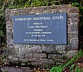
 Ashburton Industrial Estate - geograph.org.uk - 3238301.jpg 899 × 1,200; 560 KB
-
-
 Ashburton Industrial Estate, Ross-on-Wye - geograph.org.uk - 4474366.jpg 800 × 450; 227 KB
-
 Ashburton Industrial Estate, Ross-on-Wye - geograph.org.uk - 5221293.jpg 1,600 × 900; 633 KB
-
 Ashfield Park, Ross-on-Wye - geograph.org.uk - 1128349.jpg 640 × 480; 200 KB
-
 Ashfield Park, Ross-on-Wye - geograph.org.uk - 896188.jpg 640 × 480; 135 KB
-
 Ashton and Daniels, Ross-on-Wye - geograph.org.uk - 5288396.jpg 800 × 618; 106 KB
-
 Asparagus land east of Coleraine Farm - geograph.org.uk - 896245.jpg 640 × 480; 95 KB
-
 At The Prospect, Ross-on-Wye - geograph.org.uk - 5409261.jpg 1,600 × 1,198; 1.04 MB
-

-
 Autumn colour at Biblins camp - November 2013 - panoramio.jpg 2,667 × 2,998; 1.47 MB
-
 Autumn colour at Ross Garden Store, 1 - geograph.org.uk - 4203576.jpg 800 × 800; 323 KB
-
 Autumn colour at Ross Garden Store, 2 - geograph.org.uk - 4203580.jpg 800 × 450; 217 KB
-
 Autumn colour at Ross Garden Store, 3 - geograph.org.uk - 4203583.jpg 800 × 800; 339 KB
-
 Autumn colour at Ross Garden Store, 4 - geograph.org.uk - 4203586.jpg 800 × 800; 390 KB
-
 Autumn colour at Ross Garden Store, 5 - geograph.org.uk - 4203587.jpg 800 × 601; 206 KB
-
 Autumn colour at Ross Garden Store, 6 - geograph.org.uk - 4203588.jpg 800 × 601; 188 KB
-
 Autumn colour at Ross Garden Store, 7 - geograph.org.uk - 4203593.jpg 800 × 800; 351 KB
-
 Autumn colour at Ross Garden Store, 8 - geograph.org.uk - 4203601.jpg 800 × 800; 366 KB
-
 Autumn colour in Broad Street - geograph.org.uk - 5176129.jpg 1,600 × 1,200; 820 KB
-
 Autumn colour in Gloucester Road - geograph.org.uk - 5180025.jpg 1,600 × 902; 667 KB
-
 Autumn colour, St. Mary's churchyard - geograph.org.uk - 3179659.jpg 1,200 × 676; 433 KB
-
 Autumn colours - November 2013 - panoramio.jpg 4,000 × 3,000; 3.1 MB
-
 Autumn colours at Biblins camp - November 2013 - panoramio.jpg 4,000 × 3,000; 1.86 MB
-
 Autumn Colours in the Wye Gorge - Biblins - November 2013 - panoramio.jpg 4,000 × 3,000; 1.88 MB
-
 Autumn colours in the Wye Gorge, November 2013 - panoramio.jpg 4,000 × 3,000; 1.98 MB
-
 Autumn colours, Ross-on-Wye - geograph.org.uk - 3192434.jpg 640 × 388; 78 KB
-
 Autumn comes to Ross-on-Wye - geograph.org.uk - 4222552.jpg 800 × 450; 196 KB
-

-
 Autumn fungus - geograph.org.uk - 2171819.jpg 2,048 × 1,474; 1.03 MB
_-_geograph.org.uk_-_6311254.jpg)


_(geograph_7352252).jpg)


_-_geograph.org.uk_-_6311064.jpg)


