Category:Rough Island
Jump to navigation
Jump to search
tidal island in Rough Firth, Dumfries and Galloway, Scotland, UK  | |||||
| Upload media | |||||
| Instance of | |||||
|---|---|---|---|---|---|
| Location | Dumfries and Galloway, Scotland | ||||
| Located in or next to body of water | |||||
 | |||||
Media in category "Rough Island"
The following 21 files are in this category, out of 21 total.
-

-
 Causeway in Rough Firth at low tide - geograph.org.uk - 1574728.jpg 640 × 360; 56 KB
-
 Causeway to Rough Island - 1 - geograph.org.uk - 1366674.jpg 640 × 400; 93 KB
-
 Causeway to Rough Island - 2 - geograph.org.uk - 1366677.jpg 640 × 425; 136 KB
-

-

-

-

-
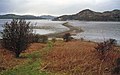
 Rockcliffe from Rough Island - geograph.org.uk - 1366679.jpg 640 × 398; 91 KB
-
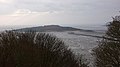
 Rough Island - geograph.org.uk - 537137.jpg 640 × 480; 92 KB
-
 Rough Island 01.jpg 6,000 × 4,000; 10.98 MB
-
 Rough Island 02.jpg 26,537 × 3,039; 8.13 MB
-
 Rough Island 03.jpg 31,493 × 3,933; 11.59 MB
-
-

-
 Rough Island from Rockcliffe - geograph.org.uk - 978456.jpg 640 × 480; 77 KB
-

-
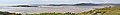
 Rough Island from Tornat Wood - geograph.org.uk - 1305616.jpg 640 × 476; 298 KB
-

-
 Rough Island shoreline - geograph.org.uk - 1366682.jpg 640 × 384; 101 KB
-


