Category:Royal Tunbridge Wells
Jump to navigation
Jump to search

Deutsch: Royal Tunbridge Wells, auch Tunbridge Wells, ist eine Stadt im äußersten Westen der Grafschaft Kent nahe der Grenze zu Sussex im Südosten Englands im Vereinigten Königreich. Tunbridge Wells ist darüber hinaus Verwaltungssitz des Borough of Tunbridge Wells.
English: Royal Tunbridge Wells (usually shortened to Tunbridge Wells) is a town in west Kent, England, about southeast of central London, bordering the county of East Sussex. It is situated at the northern edge of the High Weald, the sandstone geology of which is exemplified by the rock formations at the Wellington Rocks and High Rocks.
Français : Royal Tunbridge Wells (souvent appelé Tunbridge Wells) est une ville dans l'ouest du Kent et à la limite du Sussex en Angleterre. Elle a environ habitants (recensement de 2001).
Italiano: Royal Tunbridge Wells (di solito abbreviato in Tunbridge Wells) è una città di 56.500 abitanti della contea del Kent, in Inghilterra.
Nederlands: Royal Tunbridge Wells is een plaats in het bestuurlijke gebied Tunbridge Wells, in het Engelse graafschap Kent. De plaats telt 45.000 inwoners.
Norsk bokmål: Tunbridge Wells (offisielt Royal Tunbridge Wells) er en by i området Weald i Kent, England, rett nord for grensen til East Sussex. Den har omkring 100 000 innbyggere (folketelling 2001), og er administrasjonssenter for distriktet Tunbridge Wells.
Normaund: Les Fontaines dé Tunbridge (en Angliais: Tunbridge Wells) est eune ville dans l'Kent en Angliétèrre.
Polski: Royal Tunbridge Wells, (często nazywane po prostu Tunbridge Wells) to miasto w hrabstwie Kent w Anglii, na północ od graniczącego hrabstwa East Sussex. Miasto jest centrum administracyjnym dla regionu Tunbridge Wells Borough, region ma populację około 104 tys., a miasto liczy około 45 tys. mieszkańców (2001).
Română: Tunbridge Wells sau oficial Royal Tunbridge Wells este un oraş şi un district nemetropolitan (districtul este numit doar Tunbridge Wells) în Regatul Unit, în comitatul Kent, regiunea North West, Anglia. Districtul are o populaţie de 104.600 locuitori, din care 75.000 locuiesc în oraşul propriu zis Royal Tunbridge Wells.
Simple English: Royal Tunbridge Wells is a town in Kent, England, UK. It is not far from the border with East Sussex. It should not be confused with Tonbridge, a smaller town to the north.
Svenska: Tunbridge Wells är en stad i västra Kent, England, Storbritannien. Staden har omkring 100 000 invånare.
town in Kent, England  | |||||
| Upload media | |||||
| Instance of | |||||
|---|---|---|---|---|---|
| Location | Tunbridge Wells, Kent, South East England, England | ||||
| Head of government |
| ||||
| Population |
| ||||
| Elevation above sea level |
| ||||
 | |||||
Subcategories
This category has the following 34 subcategories, out of 34 total.
B
D
G
- Grove Hill Tunnel (9 F)
- Grove Tunnel (4 F)
H
K
- Knights Wood (5 F)
L
M
- Maps of Royal Tunbridge Wells (13 F)
N
- Nevill Golf Club (13 F)
- Nevill Ground (40 F)
P
R
S
- Southborough Bourne (41 F)
T
- Tunbridge Wells Crematorium (3 F)
- Tunbridge Wells Golf Club (22 F)
- Tunbridge Wells Tunnel (5 F)
- Tunbridge Wells War Memorial (50 F)
W
Pages in category "Royal Tunbridge Wells"
This category contains only the following page.
Media in category "Royal Tunbridge Wells"
The following 162 files are in this category, out of 162 total.
-

-
 Barra Head, N.B. (NBY 439236).jpg 3,600 × 2,333; 845 KB
-

-
 Calverley Market Hall, Tunbridge Wells.jpg 252 × 275; 31 KB
-
 Central Tunbridge Wells - geograph.org.uk - 6597828.jpg 1,024 × 684; 218 KB
-
 Coat of arms of Royal Tunbridge Wells.jpg 279 × 500; 36 KB
-
 Coat of arms of Royal Tunbridge Wells.svg 155 × 279; 233 KB
-
 Do Well Doubt Not - geograph.org.uk - 5534809.jpg 426 × 640; 87 KB
-

-
 Entering Tunbridge Wells, A264 - geograph.org.uk - 6651254.jpg 1,024 × 684; 208 KB
-
 Farm just north of High Rocks Lane - geograph.org.uk - 1227679.jpg 640 × 430; 100 KB
-
 Farm road to Mouseden - geograph.org.uk - 1610638.jpg 640 × 427; 100 KB
-
 Ferndale area of Tunbridge Wells - geograph.org.uk - 121920.jpg 640 × 480; 122 KB
-
 Ford T, Bachelor & Sons, Tunbridge Wells.JPG 1,516 × 945; 322 KB
-

-

-

-
 Hotel du Vin and Bistro Tunbridge Wells, Royal Tunbridge Wells, United Kingdom (Unsplash).jpg 5,935 × 4,016; 11.79 MB
-
 John Spare Court, Whitefield Rd - geograph.org.uk - 1284495.jpg 640 × 430; 112 KB
-
 K1 Tunbridge Wells.jpg 526 × 822; 80 KB
-
 Kent - panoramio (1).jpg 2,976 × 3,968; 2.73 MB
-
 Kent - Sussex Border, Bayham Road - geograph.org.uk - 121136.jpg 640 × 480; 143 KB
-
 Kent or Sussex^ - geograph.org.uk - 1056649.jpg 640 × 430; 107 KB
-

-
 Looking towards St Luke's Church - geograph.org.uk - 1184813.jpg 640 × 430; 80 KB
-
 Mary White in 1947.jpg 776 × 480; 29 KB
-

-
 New Sports Centre and 3G Pitch, St John's Road, Tunbridge Wells.jpg 750 × 500; 59 KB
-
 Newey and Eyre, North Farm Estate - geograph.org.uk - 1065621.jpg 640 × 430; 63 KB
-
 North Farm Coachworks - geograph.org.uk - 1064047.jpg 640 × 430; 59 KB
-
 North Farm Cottages - geograph.org.uk - 1064065.jpg 640 × 430; 90 KB
-
 Oak Rd Bike course - geograph.org.uk - 1104678.jpg 640 × 430; 92 KB
-
 Odd looking stone building on Langton Rd - geograph.org.uk - 1548189.jpg 640 × 430; 137 KB
-
 Offices off Grove Hill Rd - geograph.org.uk - 1264533.jpg 640 × 430; 46 KB
-
 Oil storage depot. - geograph.org.uk - 1064054.jpg 640 × 430; 59 KB
-

-

-
 Old Railway Line - geograph.org.uk - 1174927.jpg 640 × 430; 143 KB
-
 Old warehouse, Culverden Square - geograph.org.uk - 1087989.jpg 640 × 430; 85 KB
-

-
 Open space outside St John's Church - geograph.org.uk - 1518084.jpg 640 × 428; 99 KB
-
 Outcrop of rock by Harmony St - geograph.org.uk - 1608082.jpg 640 × 430; 156 KB
-

-

-

-
 Plan of Sherwood Park Spa, Tunbridge Wells Wellcome L0023008.jpg 1,100 × 1,634; 726 KB
-
 Political Differences^ - geograph.org.uk - 4621272.jpg 640 × 426; 68 KB
-
 Pond, Denny Bottom - geograph.org.uk - 790502.jpg 640 × 427; 248 KB
-
-

-
 QED, 4 Clanricarde Gardens - geograph.org.uk - 1299535.jpg 640 × 430; 83 KB
-
 Radio Mast, Frant Rd - geograph.org.uk - 1056697.jpg 430 × 640; 55 KB
-
 Railway bridge, East of High Rocks - geograph.org.uk - 1104188.jpg 640 × 430; 124 KB
-

-
 Roofscape - geograph.org.uk - 5850905.jpg 1,024 × 681; 136 KB
-
 Roofscape, Tunbridge Wells - geograph.org.uk - 4744878.jpg 640 × 480; 116 KB
-
 Roofscape, Tunbridge Wells - geograph.org.uk - 4744928.jpg 640 × 480; 109 KB
-
 Rooftops - geograph.org.uk - 5350164.jpg 640 × 426; 74 KB
-
 Rooftops - geograph.org.uk - 6511424.jpg 1,024 × 681; 201 KB
-
 Royal Tunbridge Wells, United Kingdom (Unsplash).jpg 6,016 × 4,016; 4.4 MB
-
 Rural Urban Fringe Tunbridge Wells - geograph.org.uk - 121138.jpg 640 × 480; 122 KB
-
 Rustic tulip vase (Unsplash).jpg 6,016 × 4,016; 11.61 MB
-

-
 Semi urban footpath near Denney Bottom - geograph.org.uk - 1047670.jpg 640 × 430; 119 KB
-

-
 Shandon Close, Pembury Rd - geograph.org.uk - 1173842.jpg 640 × 430; 112 KB
-
 Sherwood Park Spa, Tunbridge Wells; perspective of the conce Wellcome V0014898.jpg 3,676 × 2,104; 3.93 MB
-
 Small stream near High Brooms station - geograph.org.uk - 1045671.jpg 430 × 640; 106 KB
-

-
 South American Missionary Society - geograph.org.uk - 1173822.jpg 640 × 430; 107 KB
-
 Sports Centre, St John's Road, Tunbridge Wells.jpg 695 × 521; 100 KB
-
 Sprat's Brook - geograph.org.uk - 694544.jpg 479 × 640; 179 KB
-
 Squirrel on a clock, Camden Road. - geograph.org.uk - 768632.jpg 430 × 640; 41 KB
-

-

-
 St Stephens Cottages - geograph.org.uk - 1495207.jpg 640 × 430; 124 KB
-
 Steps off St Luke's Rd - geograph.org.uk - 1736108.jpg 640 × 430; 178 KB
-
 Steps to a walkway off St. Luke's Rd - geograph.org.uk - 1122828.jpg 640 × 430; 123 KB
-
 Steps to the cold bath - geograph.org.uk - 1516822.jpg 640 × 430; 197 KB
-
 Steps up from the cold bath - geograph.org.uk - 1516825.jpg 640 × 430; 187 KB
-
 Stream in Mouseden Wood - geograph.org.uk - 1610630.jpg 640 × 427; 114 KB
-
 Street light on a footpath, Rusthall - geograph.org.uk - 1047641.jpg 640 × 430; 131 KB
-

-

-
 Sunset Lodge and Charles Court - geograph.org.uk - 1117362.jpg 640 × 430; 89 KB
-
 Sunset over Tunbridge Wells - geograph.org.uk - 2226621.jpg 640 × 430; 67 KB
-
 Tea rooms, Calverley Gardens - geograph.org.uk - 1057382.jpg 640 × 430; 81 KB
-
 Temperance House Cranbrook.jpg 427 × 640; 79 KB
-
 The Chalybeate Spring - geograph.org.uk - 3651495.jpg 640 × 430; 51 KB
-
 The Chalybeate Spring - geograph.org.uk - 3651499.jpg 430 × 640; 59 KB
-
 The Chapel, Tunbridge Wells - geograph.org.uk - 1581858.jpg 427 × 640; 84 KB
-
 The Coach House, Church Rd - geograph.org.uk - 1155510.jpg 640 × 430; 50 KB
-
 The Entrance to David Salomons House - geograph.org.uk - 121897.jpg 640 × 480; 142 KB
-
 The entrance to Rust Hall - geograph.org.uk - 1609088.jpg 640 × 404; 104 KB
-

-
 The Lake, Lake Rd - geograph.org.uk - 1103703.jpg 640 × 430; 112 KB
-
 The Lake, Lake Rd - geograph.org.uk - 1286582.jpg 640 × 430; 137 KB
-

-
 The Old Cold Bath - geograph.org.uk - 1103852.jpg 640 × 430; 140 KB
-
 The Old Medway Coal Depot - geograph.org.uk - 1670076.jpg 640 × 430; 124 KB
-
 The Old Warehouse, Farmcombe Lane - geograph.org.uk - 1185862.jpg 640 × 430; 60 KB
-

-

-
 To let^ - geograph.org.uk - 1063956.jpg 640 × 430; 58 KB
-
 To Let^ Hamilton Court, Chilston Rd - geograph.org.uk - 1123338.jpg 640 × 430; 119 KB
-
 Tourist Information sign, Langton Rd - geograph.org.uk - 1548160.jpg 640 × 625; 167 KB
-
 Track approaching Claremont School - geograph.org.uk - 1117528.jpg 640 × 430; 113 KB
-
 Traffic Calming Measures, Farmcombe Lane - geograph.org.uk - 1185859.jpg 640 × 430; 111 KB
-

-

-

-
 Trinity Close, Pembury Rd - geograph.org.uk - 1173754.jpg 640 × 430; 66 KB
-
 Trinity House - geograph.org.uk - 1155535.jpg 640 × 430; 79 KB
-
 Trinity Mews, Forest Rd - geograph.org.uk - 1056677.jpg 640 × 430; 126 KB
-
 Tunbridge Wells - geograph.org.uk - 3547173.jpg 640 × 430; 87 KB
-
 Tunbridge Wells - geograph.org.uk - 3801919.jpg 640 × 430; 74 KB
-
 Tunbridge Wells Half Marathon Medal.jpg 1,804 × 1,536; 1.81 MB
-
 Tunbridge Wells in the time of Charles II. Wellcome L0005675.jpg 1,212 × 1,508; 931 KB
-
 Tunbridge Wells roofscape - geograph.org.uk - 3390686.jpg 640 × 426; 65 KB
-
 Tunbridge Wells roofscape - geograph.org.uk - 4348383.jpg 640 × 430; 75 KB
-
 Tunbridge Wells sandstone Cliff - geograph.org.uk - 70981.jpg 480 × 640; 211 KB
-

-
 Tunbridge Wells skyline - geograph.org.uk - 799699.jpg 640 × 480; 91 KB
-
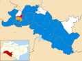
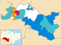
 Tunbridge Wells UK ward map 2011.svg 1,425 × 1,053; 567 KB
-
 Tunbridge Wells UK ward map 2012.svg 1,425 × 1,053; 568 KB
-
 Tunbridge Wells UK ward map 2014.svg 1,425 × 1,053; 567 KB
-
 Tunbridge Wells UK ward map 2015.svg 1,425 × 1,053; 567 KB
-
 Tunbridge Wells UK ward map 2016.svg 1,425 × 1,053; 567 KB
-
 Tunbridge Wells UK ward map 2018.svg 1,425 × 1,053; 567 KB
-
 Tunbridge Wells UK ward map 2019.svg 1,425 × 1,053; 568 KB
-
 Tunbridge Wells UK ward map 2022.svg 1,425 × 1,053; 567 KB
-
 Tunbridge Wells UK ward map 2023.svg 1,425 × 1,053; 567 KB
-
 Tunbridge Wells UK ward map 2024.svg 981 × 606; 284 KB
-
 Tunbridge Wells. Wellcome L0005674.jpg 1,654 × 1,069; 804 KB
-
 Tunbridge Wells; the Chalybeate Springs. Wellcome L0005678.jpg 1,142 × 1,684; 1.04 MB
-
 Tunbridge-miscellany.png 300 × 590; 11 KB
-

-
 Unofficial path on High Wood Lane - geograph.org.uk - 1410227.jpg 640 × 480; 102 KB
-
 View from Mount Ephraim - geograph.org.uk - 3788332.jpg 4,000 × 3,000; 3.99 MB
-
 View from Mount Ephraim to the centre of Tunbridge Wells - geograph.org.uk - 3788335.jpg 4,000 × 3,000; 4.36 MB
-

-
 View of Tunbridge Wells Skyline from Mount Ephraim - geograph.org.uk - 1731798.jpg 3,072 × 1,728; 1.29 MB
-
 View over St John's - geograph.org.uk - 4756620.jpg 640 × 426; 68 KB
-
 View over Tunbridge Wells - geograph.org.uk - 5135489.jpg 640 × 426; 75 KB
-
 View over Tunbridge Wells - geograph.org.uk - 6685780.jpg 1,024 × 685; 222 KB
-

-

-
 View Southwards from Cornford Lane - geograph.org.uk - 1610609.jpg 640 × 427; 52 KB
-
 View towards Tunbridge Wells - geograph.org.uk - 4770882.jpg 640 × 428; 112 KB
-
 Viewpoint over the town, Mount Ephraim - geograph.org.uk - 1548938.jpg 640 × 430; 145 KB
-
 W. A. Turners - geograph.org.uk - 1056778.jpg 640 × 430; 57 KB
-
 W. A. Turners Factory - geograph.org.uk - 1056775.jpg 640 × 430; 68 KB
-

-
 Walkway behind St John's Rd - geograph.org.uk - 1284465.jpg 640 × 430; 92 KB
-
 Welcome to East Sussex - geograph.org.uk - 1518323.jpg 453 × 640; 83 KB
-
 William West Neve.jpg 210 × 365; 101 KB
-

-
 Wooden shed, Little Bayhall - geograph.org.uk - 1300960.jpg 640 × 392; 58 KB
-
 Industrial site, Reynolds Lane - geograph.org.uk - 1670316.jpg 640 × 430; 90 KB
-
 Northern End of Montecute Field - geograph.org.uk - 695897.jpg 640 × 479; 118 KB
-
 Semi urban footpath near Denney Bottom - geograph.org.uk - 1047675.jpg 640 × 430; 129 KB
-
 View of Broadwater Down - geograph.org.uk - 149189.jpg 640 × 480; 129 KB
_(14760306552).jpg)
.jpg)


.jpg)


.jpg)


.jpg)


.jpg)

.jpg)


