Category:Rudolf Minger Denkmal
Jump to navigation
Jump to search
| Object location | | View all coordinates using: OpenStreetMap |
|---|
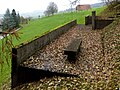
Deutsch: Denkmal für Rudolf Minger, Bundesrat. Adresse: Mühlehubelweg, Schüpfen. Erbaut 1960 von Hans Brechbühler.
| NO WIKIDATA ID FOUND! Search for Rudolf Minger Denkmal on Wikidata | |
| Upload media |
Media in category "Rudolf Minger Denkmal"
The following 4 files are in this category, out of 4 total.
-
 Mingerdenkmal 2.jpg 3,426 × 2,570; 1.73 MB
-
 Mingerdenkmal 3.jpg 4,320 × 3,240; 3.6 MB
-
 Mingerdenkmal 4.jpg 3,750 × 2,813; 2.42 MB
-
 Mingerdenkmal.jpg 3,719 × 2,789; 2.16 MB


