Category:SVG maps
跳转到导航
跳转到搜索
Vector graphics maps coded SVG
Please categorize any SVG map in here. You can also categorize maps in any subcategory of Category:maps, e.g. you can put SVG maps of Tuvalu into Category:Maps of Tuvalu and Category:SVG maps of Oceania, and SVG maps of the Nile both in Category:Nile and Category:SVG maps of Africa (we can sort that out later using CatScan/CategoryIntersect), but use the most specific subcategories that you can.

子分类
本分类有以下31个子分类,共有31个子分类。
!
*
+
- SVG maps:Translation possible (4187 F)
:
A
- Animated SVG maps (21 F)
F
H
I
M
- SVG maps of the Moon (22 F)
O
P
R
S
- SVG simplified maps (1 F)
T
- SVG Maps of Türkvision (12 F)
U
- SVG UTC hue4maps (30 F)
V
- SVG vexilographic maps (1 F)
W
分类“SVG maps”中的媒体文件
以下86个文件属于本分类,共86个文件。
-
 2019-20 Hong Kong protest supporting countries.svg 1,104 × 566;1.45 MB
-
 A four-colour map of the Red Sea with names in Spanish.svg 220 × 282;1.65 MB
-
 Age of Majority - Global.svg 512 × 259;972 KB
-
 Ahold Worldwide.svg 2,731 × 1,402;5.22 MB
-
 Americas Secondary Political Divisions map.svg 1,016 × 1,063;1.09 MB
-
 Artzibar - mapa.svg 479 × 526;615 KB
-
 Attacks done by or inspired by ISIS.svg 2,754 × 1,397;1.71 MB
-
 Australia states territories.svg 1,204 × 884;1.02 MB
-
 Carte de l'écluse de Suresnes.svg 1,052 × 744;708 KB
-
 Carte de la circonscription de Beauport—Côte-de-Beaupré—Île d'Orléans—Charlevoix.svg 1,052 × 744;20.62 MB
-
 Carte de la circonscription de la Jonquière.svg 774 × 768;14.96 MB
-
 Carte topographique de l'île d'Elbe.svg 1,052 × 744;3.09 MB
-
 Carte topographique du groupe du Sella.svg 1,052 × 744;2.86 MB
-
 Carte topographique du Triangolo Lariano.svg 1,052 × 744;4 MB
-
 Carte topographique Elbrouz.svg 1,454 × 1,018;6.63 MB
-
 Caucasus-ethnic ru.svg 512 × 577;170 KB
-

-
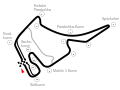 Circuit Hockenheimring-2002.svg 512 × 384;11 KB
-
 Colonial Africa (1939).svg 1,149 × 1,136;728 KB
-
 Cratons JA.svg 2,000 × 1,364;268 KB
-
 Cratons NL.svg 2,000 × 1,364;283 KB
-
 Disney+ Locations New.png 1,920 × 975;266 KB
-
 Francisco Beltrao Localizacao.svg 971 × 691;817 KB
-
 Grasbrook.svg 1,560 × 1,055;3.64 MB
-
 Gripe District (Split).svg 1,086 × 415;93 KB
-
 HeiankyouMap.svg 512 × 591;335 KB
-
-

-
 Hetednapi adventisták.svg 3,672 × 1,864;3.44 MB
-
 Hong Kong Railway Route Map blank.svg 1,038 × 950;23 KB
-
 Iceland road map.svg 12,332 × 10,513;67.37 MB
-
 Inca Expansion.svg 512 × 926;134 KB
-
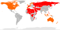
 Islam by country monochrome.svg 1,545 × 710;2.53 MB
-
 Islam by country.svg 1,545 × 710;1.68 MB
-
 Islam by country2.svg 1,545 × 710;1.67 MB
-
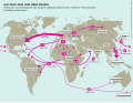
 Kanadische Arktisexpedition 1913-1918.svg 1,202 × 675;634 KB
-
 Kman District (Split).svg 1,086 × 415;93 KB
-
 Kocunar District (Split).svg 1,086 × 415;93 KB
-

-
 Location of Yazd province in Iran.svg 1,200 × 1,071;470 KB
-
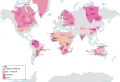
 Map of countries with Lindex stores.svg 271 × 215;1.26 MB
-
 Map of Jawahar Nagar.svg 648 × 338;921 KB
-
 Map of the Czech Republic clip art.svg 571 × 322;544 KB
-
 Map test zh.svg 1,500 × 1,200;15 KB
-
 Map test.svg 1,500 × 1,200;16 KB
-
 Mapa das eleições municipais de Pinhais (2020).svg 1,000 × 873;16 KB
-
 Mapa das zonas eleitorais de Curitiba (1985) - com nome.svg 524 × 833;39 KB
-
 Mapa SVG das Zonas eleitorais de Curitiba (1996).svg 612 × 792;16 KB
-
 Mappa delle Nazioni attualmente in Guerra.svg 2,754 × 1,398;1.09 MB
-
 Mertojak District (Split).svg 1,086 × 415;93 KB
-
 MinasGerais Municip CarlosChagas.svg 2,147 × 1,723;2.9 MB
-
 Moyen Orient Amarna 1 eu.svg 1,885 × 1,354;3.97 MB
-
 Onesti district heating system map.svg 3,000 × 2,170;333 KB
-

-
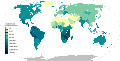
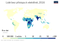 People-without-electricity-country-2016-cs.svg 850 × 600;149 KB
-
 People-without-electricity-country-2016.svg 850 × 600;151 KB
-
 Personnes-sans-accès-à-l'électricité-2016.svg 850 × 600;151 KB
-
 Plan de Soignies Pourbaix 1770.svg 1,784 × 1,607;1.73 MB
-

-
 Platner - Ancient Rome city growth.svg 669 × 651;119 KB
-
 Plokite District (Split).svg 1,086 × 415;93 KB
-
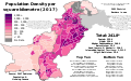 Population Density by Pakistani District - 2017 Census.svg 3,200 × 2,000;2.43 MB
-
 Pujanke District (Split).svg 1,086 × 415;93 KB
-
 Rampa de Payares.svg 284 × 494;876 KB
-
 Red Sea map TH.svg 220 × 282;1.78 MB
-
 Romanian-Ukrainian territorial dispute.svg 1,035 × 868;41 KB
-
 Rwanda North Korea Locator.svg 1,670 × 1,397;1.2 MB
-
 SaoPaulo Municip Hortolandia.svg 1,020 × 638;1.07 MB
-

-
 Sirobuja District (Split).svg 1,086 × 415;93 KB
-
 Split 3 District (Split).svg 1,086 × 415;93 KB
-

-
 Sućidar District (Split).svg 1,086 × 415;93 KB
-
 Swedish Gold Coast Map-sr.svg 922 × 674;261 KB
-
 Syrian Civil War map (August 7, 2024).svg 922 × 762;3.56 MB
-
 Tracks of the Hippodrome de Vincennes - OSM 2021.svg 512 × 421;42 KB
-
 United Nations geographical subregions.svg 940 × 477;1.72 MB
-
 UNWTO Tourism Regions.svg 853 × 433;1.4 MB
-
 Visoka District (Split).svg 1,086 × 415;93 KB
-
 Vol Sabena C712 du 13 juillet 1968.svg 279 × 275;182 KB
-
 Voyage du Karluk.svg 1,202 × 675;634 KB
-
 Zonas eleitorais de Curitiba (1985).svg 744 × 1,052;34 KB
-
 Österreichisch-Schlesien 1746 en.svg 897 × 628;39 KB
-
 Žnjan District (Split).svg 1,086 × 415;93 KB
-
 Джем.svg 1,052 × 744;387 KB
-
 Соединенные Штаты Европы.svg 512 × 393;471 KB


.svg)


.svg)
_-_com_nome.svg)
.svg)


.svg)


.svg)


.svg)


.svg)
.svg)
.svg)
.svg)
.svg)
.svg)
.svg)
.svg)
.svg)
.svg)
.svg)
.svg)