Category:SVG site plans
Jump to navigation
Jump to search
Subcategories
This category has the following 2 subcategories, out of 2 total.
F
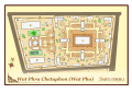
- Floor Plan of Wat Phra Kaew (4 F)
S
Media in category "SVG site plans"
The following 157 files are in this category, out of 157 total.
-
 1875ordnancesurvey 16storestreet.svg 263 × 300; 198 KB
-
 2009PresidentialInaugurationCeremonyMap.svg 759 × 921; 467 KB
-
 Aeroparque Jorge Newbery.svg 2,608 × 700; 205 KB
-
 Angkor Wat map(cs).svg 1,768 × 1,235; 123 KB
-
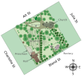
 Astrid Chapel Memorial Map.svg 900 × 1,200; 32 KB
-
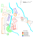
 Awatplan04colours.svg 583 × 407; 57 KB
-
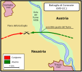 Battaglia di Coronate.svg 390 × 340; 24 KB
-
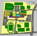 Benet Academy Campus Map.svg 458 × 440; 795 KB
-
 Brno turany airfield 20090927 Holy Mass Pope Benedict XVI.svg 517 × 362; 25 KB
-
 Bulguksa-map.svg 1,000 × 1,000; 70 KB
-
 Carte Operation Tonga.svg 1,075 × 1,073; 125 KB
-
 Changwon-circuit.svg 744 × 524; 990 KB
-
 Circular pit house.svg 158 × 152; 203 KB
-
 Complexe episcopal merovingien lyon.svg 780 × 640; 26 KB
-
 Domfreiheit Minden.svg 1,790 × 1,358; 568 KB
-
 Christ Church Cathedral Dublin - Plan Park en.svg 1,600 × 2,500; 620 KB
-
 Christ Church Cathedral Dublin - Plan Park pl.svg 1,600 × 2,500; 647 KB
-
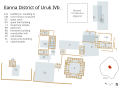
 Eanna neosumerian.svg 1,878 × 1,487; 682 KB
-
 Eanna3.svg 1,878 × 1,356; 599 KB
-
 Eanna4a.svg 1,878 × 1,356; 575 KB
-
 Eanna4b.svg 1,878 × 1,356; 577 KB
-
 Eanna4composite.svg 1,878 × 1,356; 582 KB
-
 Eanna5.svg 1,878 × 1,356; 573 KB
-
 Early Scandinavian Dublin - Carlingford.svg 922 × 522; 213 KB
-
 Early Scandinavian Dublin - Dyflinn.svg 947 × 907; 75 KB
-
 Early Scandinavian Dublin - Elagh.svg 686 × 808; 201 KB
-
 Early Scandinavian Dublin - Moy.svg 873 × 1,213; 291 KB
-
 Early Scandinavian Dublin - North-East.svg 1,431 × 787; 159 KB
-
 Early Scandinavian Dublin - South-East.svg 762 × 789; 555 KB
-
 Early Scandinavian Dublin - South-West.svg 663 × 743; 913 KB
-
 Early Scandinavian Dublin - Southern Ui Neill.svg 1,181 × 741; 860 KB
-
 Early Scandinavian Dublin - Strangford.svg 671 × 804; 168 KB
-
 Early Scandinavian Dublin - Tirawley.svg 655 × 655; 195 KB
-
 Eilean Donan Castle Map 1887.svg 779 × 574; 260 KB
-
 Empty map of the Binnenhof, The Hague, the Netherlands.svg 1,486 × 1,387; 124 KB
-
 Floor map - Ta' Ħaġrat Temples.svg 1,013 × 1,176; 170 KB
-
 Fort de la Montagne.svg 1,200 × 1,400; 71 KB
-
 Fr Abbaye Chaalis blank map.svg 297 × 329; 75 KB
-
 Fr Abbaye Chaalis map with legend.svg 297 × 329; 81 KB
-
 Freely interpreted floor map of Alhambra Spain.svg 5,923 × 3,000; 528 KB
-
 Gundet battle map.svg 561 × 506; 12 KB
-
 Harbour city.svg 910 × 1,047; 239 KB
-
 Hochob Plan.svg 695 × 619; 18 KB
-
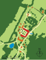
 Hong kong parkview.svg 516 × 396; 127 KB
-
 Karte Standedge-Tunnel.svg 1,037 × 980; 696 KB
-
 Kastell Arnsburg Lageplan.svg 588 × 644; 141 KB
-
 Khadakwasla Dam Map.svg 700 × 447; 24 KB
-
 Kisimul Castle Map 1887-en.svg 744 × 714; 172 KB
-
 Kisimul Castle Map 1887-fr.svg 744 × 714; 172 KB
-
 Kisimul Castle Map Labelled-en.svg 744 × 714; 248 KB
-
 Kisimul Castle Map Labelled-fr.svg 744 × 714; 248 KB
-
 Kisimul Castle Map-en.svg 744 × 714; 248 KB
-
 Kisimul Castle Map-fr.svg 744 × 714; 248 KB
-
 La Venta Site Plan.svg 600 × 700; 47 KB
-
 Lageplan der Synagoge Memmingen.svg 512 × 378; 5 KB
-
 Lageplan Mindener Dom.svg 1,448 × 1,448; 526 KB
-
 Lageplan Ruine Brandenburg.svg 1,449 × 852; 213 KB
-
 Leontopolis site.svg 790 × 790; 45 KB
-
 Localisation des facultés à Rennes au XIXe.svg 662 × 777; 101 KB
-
 Locator map Corvey.svg 640 × 496; 1.2 MB
-
 Map Corvey 1250.svg 1,244 × 819; 791 KB
-
 Map of Angkor Thom de.svg 1,000 × 800; 27 KB
-
 Map of Angkor Thom.svg 1,000 × 800; 51 KB
-
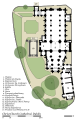
 Map of Memorial Stadium And Oak Grove.svg 898 × 749; 812 KB
-
 Map of Mystras-en.svg 732 × 571; 264 KB
-
 Map of Mystras-fr.svg 733 × 651; 1.63 MB
-
 Map of Mystras-he.svg 733 × 651; 1.68 MB
-
 Map of Mystras-ru.svg 850 × 651; 1.59 MB
-
 Map of the Tomb of Tutankhamun.svg 356 × 580; 14 KB
-
 Map of UNT athletic facilities.svg 2,036 × 2,486; 42 KB
-
 Map of Vithoba Temple Pandharpur.svg 600 × 420; 28 KB
-
 Minas-Tirith-ok.svg 750 × 900; 22 KB
-
 Minas-Tirith-Rama-b.svg 1,734 × 1,734; 1.82 MB
-
 Minas-Tirith-Rama-c.svg 1,734 × 1,734; 1.83 MB
-
 Mobile bay jubilee.svg 367 × 430; 2.98 MB
-
 Monte Alban archaeological site.svg 233 × 451; 281 KB
-
 Monuments médiévaux candé.svg 1,687 × 1,288; 11 KB
-
 Neak Pean layout fr.svg 580 × 580; 38 KB
-
 Neak Pean layout.svg 580 × 580; 38 KB
-
 Oppidum entremont map-de.svg 1,170 × 598; 122 KB
-
 Pacific place.svg 807 × 328; 141 KB
-
 Parc Cwm long cairn site plan.svg 272 × 385; 22 KB
-
 Pałac Bílá Voda - plan.svg 472 × 611; 296 KB
-
 Pinxton Castle schematic plan.svg 512 × 512; 31 KB
-
 Plan - Imam Abdullah Zawiyah.svg 1,180 × 1,121; 44 KB
-
 Plan AI Khanoum-de.svg 764 × 800; 168 KB
-
 Plan AI Khanoum-fr.svg 764 × 800; 186 KB
-
 Plan Aphaia sanctuary-de.svg 1,780 × 2,780; 218 KB
-
 Plan Aphaia sanctuary-en.svg 1,780 × 2,780; 224 KB
-
 Plan Aphaia sanctuary-es.svg 1,780 × 2,780; 187 KB
-
 Plan Aphaia sanctuary-fr.svg 1,780 × 2,780; 171 KB
-
 Plan Corvey.svg 1,019 × 675; 253 KB
-
 Plan Dodona sanctuary-de.svg 563 × 720; 107 KB
-
 Plan Dodona sanctuary-en.svg 563 × 720; 98 KB
-
 Plan Dodona sanctuary-fr.svg 563 × 720; 107 KB
-
 Plan fouilles arch maison Byrsa.svg 391 × 972; 171 KB
-
 Plan fouilles colline Byrsa.svg 1,000 × 450; 58 KB
-
 Plan Katharinenkloster Sinai.svg 1,598 × 1,413; 223 KB
-
 Plan Olympia sanctuary-de.svg 2,500 × 1,580; 754 KB
-
 Plan Olympia sanctuary-el.svg 2,500 × 1,580; 834 KB
-
 Plan Olympia sanctuary-en.svg 2,500 × 1,580; 754 KB
-
 Plan Olympia sanctuary-es.svg 2,500 × 1,580; 774 KB
-
 Plan Olympia sanctuary-fr.svg 2,500 × 1,580; 755 KB
-
 Plan Olympia sanctuary-mk.svg 2,500 × 1,580; 732 KB
-
 Plan Olympia sanctuary-pt.svg 2,500 × 1,580; 384 KB
-
 Plan Olympia sanctuary-uk.svg 2,500 × 1,580; 748 KB
-
 Plan Olympia sanctuary-zh.svg 2,500 × 1,580; 750 KB
-
 Plan quartier Hannibal Byrsa fouilles françaises.svg 1,154 × 1,195; 72 KB
-
 Plan Samothrace sanctuary-de.svg 520 × 580; 110 KB
-
 Plan Samothrace sanctuary-en.svg 520 × 580; 110 KB
-
 Plan Samothrace sanctuary-es.svg 520 × 580; 90 KB
-
 Plan Samothrace sanctuary-fr.svg 520 × 580; 110 KB
-
 Plan Troy-Hisarlik-el.svg 1,280 × 1,155; 100 KB
-
 Plan Troy-Hisarlik-en.svg 1,280 × 1,155; 146 KB
-
 Plan Troy-Hisarlik-fr.svg 1,280 × 1,155; 158 KB
-
 Plan Troy-Hisarlik-ru.svg 1,280 × 1,155; 162 KB
-
 Plan Troy-Hisarlik-tr.svg 1,280 × 1,155; 158 KB
-
 Plano de Monte Albán.svg 762 × 762; 428 KB
-
 Plano La Venta.svg 765 × 990; 38 KB
-
 Plano Troia-Hissarlik.svg 731 × 659; 154 KB
-
 Port of Tianjin's Dongjiang Port Area Map.svg 2,839 × 4,604; 152 KB
-
 Pseudocrater Skútusstaðir map.svg 606 × 458; 143 KB
-
 Reichskanzlei-Fuehrerbunker-fa.svg 2,451 × 4,005; 129 KB
-
 Reichskanzlei-Fuehrerbunker.svg 2,408 × 3,299; 134 KB
-
 Royal Grammar School Guildford Site Map.svg 835 × 600; 225 KB
-
 Royal Palace Monaco plan2 - PT.svg 3,189 × 1,782; 62 KB
-
 Sabourin.svg 688 × 396; 23 KB
-
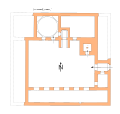
 Santa Maria la Nova - interior.svg 141 × 322; 27 KB
-
 Savannah Portland NewYork City Blocks.svg 325 × 575; 3 KB
-
 Scottish Parliament site plan.svg 1,000 × 1,465; 99 KB
-
 Skansen Klubka.svg 1,157 × 743; 76 KB
-
 Smederevo Fortress map - RU.svg 620 × 531; 38 KB
-
 Smederevo Fortress map.svg 620 × 531; 68 KB
-
 Squarish pit house.svg 139 × 152; 202 KB
-
 StJohnsAshfield Sitemap.svg 1,050 × 980; 432 KB
-
 Tell Megiddo Archaeology sites map.svg 1,000 × 800; 141 KB
-
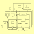
 The Tomb of Tutankhamun according to Howard Carter - en.svg 744 × 1,052; 1.53 MB
-
 Thuburbo Majus center plan-en.svg 1,149 × 994; 135 KB
-
 Thuburbo Majus center plan-fr.svg 1,052 × 979; 135 KB
-
 Thuburbo Majus full plan-en.svg 1,831 × 1,134; 144 KB
-
 Thuburbo Majus full plan-fr.svg 1,831 × 1,134; 144 KB
-
 Timgad archaeological sites map-fr.svg 1,150 × 1,430; 150 KB
-
 Trebic podklasteri jewish cemetery.svg 888 × 662; 38 KB
-
 Trebic zamosti.svg 1,562 × 751; 106 KB
-
 Tres Zapotes site plan.svg 536 × 595; 198 KB
-
 Virginia Polytechnic Institute and State University map.svg 781 × 1,440; 237 KB
-
 Watphomap.svg 744 × 524; 734 KB
-
 Waukegan harbor superfund.svg 1,212 × 2,158; 67 KB
-
 Whitehouse street map.svg 721 × 688; 28 KB
-
 Wisteria Lane map, season 1.svg 1,056 × 622; 32 KB
-
 WisteriaLane.svg 561 × 321; 74 KB
-
 WTC Building Arrangement and Site Plan comparison.svg 1,423 × 1,756; 344 KB
-
 WTC Building Arrangement and Site Plan ru.svg 1,423 × 1,756; 283 KB
-
 WTC Building Arrangement and Site Plan.svg 1,423 × 1,756; 273 KB
-
 WTC Building Arrangement in preliminary site plan.svg 1,423 × 1,756; 657 KB
-
 Łańcut palace - park map.svg 1,007 × 797; 49 KB
-
 柏崎刈波原子力発電所 全景 線のみA4.svg 1,052 × 744; 77 KB


.svg)


