Category:SVG maps of Guyana
Jump to navigation
Jump to search
Countries of the Americas: Antigua and Barbuda · Argentina · The Bahamas · Barbados · Belize · Bolivia · Brazil · Canada · Chile · Colombia · Costa Rica · Cuba · Dominica · Dominican Republic · Ecuador · El Salvador · Grenada · Guatemala · Guyana · Haiti · Honduras · Jamaica · Mexico · Nicaragua · Panama · Paraguay · Peru · Saint Kitts and Nevis · Saint Lucia · Saint Vincent and the Grenadines · Suriname · Trinidad and Tobago · United States of America · Uruguay · Venezuela
Other areas: Anguilla · Aruba · Bermuda · British Virgin Islands · Cayman Islands · Curaçao · Dutch Caribbean · Falkland Islands · French Guiana · Greenland · Guadeloupe · Martinique · Puerto Rico · Saint Barthélemy · Saint-Martin · Saint Pierre and Miquelon · Sint Maarten
Other areas: Anguilla · Aruba · Bermuda · British Virgin Islands · Cayman Islands · Curaçao · Dutch Caribbean · Falkland Islands · French Guiana · Greenland · Guadeloupe · Martinique · Puerto Rico · Saint Barthélemy · Saint-Martin · Saint Pierre and Miquelon · Sint Maarten
Subcategories
This category has the following 5 subcategories, out of 5 total.
Media in category "SVG maps of Guyana"
The following 17 files are in this category, out of 17 total.
-
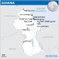
Guyana - Location Map (2013) - GUY - UNOCHA.svg 250 × 250; 505 KB
-
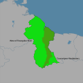
Guyana disputed w1 countrymap.svg 1,000 × 1,000; 20 KB
-
Guyana Locator Map Neutral.svg 842 × 595; 391 KB
-
Guyanas-es.svg 480 × 330; 396 KB
-
Guyanas-hu.svg 480 × 330; 396 KB
-
Guyanas-mk.svg 480 × 330; 283 KB
-
Guyanas-ro.svg 480 × 330; 789 KB
-
Guyanas-ru.svg 480 × 330; 315 KB
-
Guyanas-uk.svg 512 × 352; 321 KB
-
Guyanas.svg 480 × 330; 710 KB
-
Koppen-Geiger Map GUY future.svg 1,056 × 850; 596 KB
-
Koppen-Geiger Map GUY present.svg 1,234 × 850; 582 KB
-
Map of the Guianas Neutral.svg 842 × 595; 213 KB
-
Mapa da Guiana (OCHA).svg 254 × 254; 555 KB
-
Suriname oilmap.svg 814 × 586; 2.96 MB
-
Suriname onshore oilmap.svg 519 × 126; 2.93 MB
-
Territorial claims against Guyana.svg 627 × 922; 424 KB


