Category:SVG maps of Trinidad and Tobago
Jump to navigation
Jump to search
Countries of the Americas: Antigua and Barbuda · Argentina · The Bahamas · Barbados · Belize · Bolivia · Brazil · Canada · Chile · Colombia · Costa Rica · Cuba · Dominica · Dominican Republic · Ecuador · El Salvador · Grenada · Guatemala · Guyana · Haiti · Honduras · Jamaica · Mexico · Nicaragua · Panama · Paraguay · Peru · Saint Kitts and Nevis · Saint Lucia · Saint Vincent and the Grenadines · Suriname · Trinidad and Tobago · United States of America · Uruguay · Venezuela
Other areas: Anguilla · Aruba · Bermuda · British Virgin Islands · Cayman Islands · Curaçao · Dutch Caribbean · French Guiana · Greenland · Guadeloupe · Martinique · Puerto Rico · Saint Barthélemy · Saint-Martin · Saint Pierre and Miquelon · Sint Maarten
Other areas: Anguilla · Aruba · Bermuda · British Virgin Islands · Cayman Islands · Curaçao · Dutch Caribbean · French Guiana · Greenland · Guadeloupe · Martinique · Puerto Rico · Saint Barthélemy · Saint-Martin · Saint Pierre and Miquelon · Sint Maarten
Subcategories
This category has the following 3 subcategories, out of 3 total.
Media in category "SVG maps of Trinidad and Tobago"
The following 16 files are in this category, out of 16 total.
-
 Blank map of Trinidad and Tobago.svg 780 × 756; 94 KB
-
 Caribbean maritime boundaries map zh.svg 3,561 × 2,221; 2.87 MB
-
 Caribbean maritime boundaries map.svg 3,561 × 2,221; 2.78 MB
-
 Caribbean maritime boundaries map mk.svg 3,561 × 2,221; 5.52 MB
-
 Mapa das Caraíbas (fronteiras marítimas).svg 3,561 × 2,221; 2.86 MB
-
 Mapa del Caribe (límites marinos).svg 5,340 × 3,660; 3.02 MB
-
 Mapa del Mar Caribe (límites marinos)-fr.svg 3,587 × 2,221; 1.91 MB
-
 Mapa del Mar Caribe (límites marinos).svg 3,587 × 2,221; 1.98 MB
-
 Regional corporations and municipalities of Trinidad and Tobago mk.svg 1,000 × 938; 101 KB
-
 Regional corporations and municipalities of Trinidad and Tobago.svg 1,000 × 938; 102 KB
-
 Regional corporations and municipalities of Trinidad.svg 6,183 × 4,967; 195 KB
-
 Regiones de Trinidad y Tobago.svg 1,000 × 938; 82 KB
-
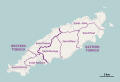 Tobago parishes.svg 872 × 599; 155 KB
-
 Trinidad and Tobago 2020 General Election Results Map.svg 6,183 × 4,967; 531 KB
-
 Trinidad and Tobago adm location map.svg 780 × 756; 36 KB
-
 أقاليم ترينيداد وتوباغو.svg 1,067 × 1,000; 70 KB


.svg)
.svg)
-fr.svg)
.svg)


