Category:Sacramento County, California
Naar navigatie springen
Naar zoeken springen
Counties of California: Alameda · Alpine · Amador · Butte · Calaveras · Colusa · Contra Costa · Del Norte · El Dorado · Fresno · Glenn · Humboldt · Imperial · Inyo · Kern · Kings · Lake · Lassen · Los Angeles · Madera · Marin · Mariposa · Mendocino · Merced · Modoc · Mono · Monterey · Napa · Nevada · Orange · Placer · Plumas · Riverside · Sacramento · San Benito · San Bernardino · San Diego · San Joaquin · San Luis Obispo · San Mateo · Santa Barbara · Santa Clara · Santa Cruz · Shasta · Sierra · Siskiyou · Solano · Sonoma · Stanislaus ·Sutter · Tehama · Trinity · Tulare · Tuolumne · Ventura · Yolo · Yuba – Consolidated city-county: San Francisco
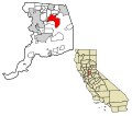
county in California, United States     | |||||
| Media uploaden | |||||
| Is een | |||||
|---|---|---|---|---|---|
| Vernoemd naar | |||||
| Locatie | Californië, Pacific States Region | ||||
| Hoofdplaats | |||||
| Locatie van hoofdvestiging |
| ||||
| Datum van oprichting of creatie |
| ||||
| Inwonertal |
| ||||
| Oppervlakte |
| ||||
| officiële website | |||||
 | |||||
Ondercategorieën
Deze categorie bevat de volgende 17 subcategorieën, van de 17 in totaal.
A
B
C
E
G
- Perrean Gray (5 B)
H
M
N
P
R
- Rancho Seco Regional Park (9 B)
S
- Sherman Island (California) (14 B)
Media in categorie "Sacramento County, California"
Deze categorie bevat de volgende 184 bestanden, van in totaal 184.
-
 Abandoned railroad and bike trail briefly meet - panoramio.jpg 1.280 × 960; 689 kB
-
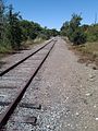 Abandoned railroad between Riley and Blue Ravine - panoramio.jpg 960 × 1.280; 610 kB
-
 Abandoned Railroad makes a nice walking path - panoramio.jpg 960 × 1.280; 707 kB
-
-

-
 Algae covered slough near Willow Creek - panoramio.jpg 960 × 1.280; 791 kB
-
 Along the pony express 01.jpg 1.817 × 2.135; 2,72 MB
-
 Alta Mesa Gun Club - panoramio (1).jpg 3.260 × 2.450; 1,63 MB
-
 Alta Mesa Gun Club - panoramio.jpg 3.260 × 2.450; 1,68 MB
-
 Am. River Fair Oaks 564 - panoramio.jpg 1.901 × 1.426; 842 kB
-
 Am. River Fair Oaks 566 - panoramio.jpg 2.160 × 1.620; 710 kB
-
 Am. River Fair Oaks 568 - panoramio.jpg 2.160 × 1.620; 768 kB
-
 Am. River Fair Oaks 580 - panoramio.jpg 2.160 × 1.620; 1,42 MB
-
 Am. River Fair Oaks 586 - panoramio.jpg 2.160 × 1.620; 1,68 MB
-
 Am. River Fair Oaks 594 - panoramio.jpg 2.160 × 1.620; 1,66 MB
-
 Am. River Fair Oaks 602 - panoramio.jpg 1.620 × 2.160; 1,3 MB
-
 American River levee work begins in Carmichael (15119155022).jpg 4.928 × 3.264; 8,1 MB
-
 American River levee work begins in Carmichael (15119526935).jpg 4.928 × 3.264; 8,95 MB
-
 America’s Great Outdoors event at the Effie Yeaw Nature Center (6195163503).jpg 5.616 × 3.744; 6,54 MB
-
 America’s Great Outdoors event at the Effie Yeaw Nature Center (6195164429).jpg 5.616 × 3.744; 8,25 MB
-
 America’s Great Outdoors event at the Effie Yeaw Nature Center (6195681450).jpg 5.616 × 3.744; 7,29 MB
-
 America’s Great Outdoors event at the Effie Yeaw Nature Center (6195682642).jpg 5.616 × 3.744; 10,45 MB
-
 Autocar WXLL Xpeditor in Sacramento County, CA.jpg 3.398 × 2.543; 3,9 MB
-
 Bad Sag - panoramio.jpg 3.264 × 2.448; 3,34 MB
-

-

-
 Carpenter Hill.jpg 4.000 × 3.000; 3,92 MB
-
 Chinese School Locke California - panoramio.jpg 3.264 × 2.448; 2,47 MB
-
 Cohn House 305 Scott St. Folsom, California Photography by me Oscar Mostofi.jpg 1.773 × 1.301; 1.023 kB
-
 Cohn House, 305 Scott St. Folsom, CA. 95630. Photographer- Oscar Mostofi Sept 18, 2014.JPG 4.272 × 2.848; 4,29 MB
-
 Congressman Dan Lungren gets updates from project manager Beth Salyers (6040945922).jpg 3.872 × 2.592; 4,24 MB
-

-
 Corps contractor inspects borehole near Watt Avenue bridge (9396698456).jpg 4.928 × 3.264; 9,2 MB
-
 Corps contractor tags one of 6,785 total plants (6643664269).jpg 4.928 × 3.264; 8,39 MB
-
 Corps hosts public workshop for Mayhew levee work (15244757049).jpg 6.000 × 4.000; 5,65 MB
-
 Corps hosts public workshop for Mayhew levee work (15244929358).jpg 6.000 × 4.000; 11,63 MB
-
 Corps hosts public workshop for Mayhew levee work (15431175252).jpg 6.000 × 4.000; 6,14 MB
-

-

-
 Corps park rangers help teach water safety (5830176709).jpg 2.721 × 2.383; 3,51 MB
-
 Corps practices for California Delta flood emergency (15053726436).jpg 4.112 × 2.592; 2,11 MB
-
 Corps' deputy commanding general tours Folsom spillway project (17391322789).jpg 3.744 × 5.616; 8,32 MB
-
 Corps' deputy commanding general tours Folsom spillway project (17391441799).jpg 5.350 × 3.567; 4,67 MB
-
 Corps' deputy commanding general tours Folsom spillway project (17575336722).jpg 5.616 × 3.744; 10,74 MB
-
 Corps' deputy commanding general tours Folsom spillway project (17577567841).jpg 3.027 × 4.541; 8,48 MB
-
 Creek alongside abandoned railroad - panoramio.jpg 1.280 × 960; 688 kB
-
 Csd.jpg 600 × 470; 125 kB
-
 Danny Santillan talks operational efficiency with Maria Gutierrez (7973864778).jpg 4.352 × 3.063; 9,68 MB
-
 Delta Cross Channel Sluice gate.JPG 3.264 × 2.448; 2,14 MB
-
 Diaz Unregalo De Dios.jpg 2.448 × 3.264; 2,15 MB
-
 Disassembled drip-o-lator IMG 1141.jpg 2.448 × 3.264; 1,28 MB
-
 E. Bidwell at Blue Ravine, Folsom, CA north - panoramio (1).jpg 1.293 × 1.293; 553 kB
-
 E. Bidwell at Blue Ravine, Folsom, CA north - panoramio.jpg 1.559 × 1.376; 852 kB
-
East Area Rapist Press Conference 2018 04 25.webm 52 min 58 s, 1.280 × 720; 393,28 MB
-
 East gate Folsom Prison - panoramio.jpg 2.560 × 1.920; 2,94 MB
-
 Ed Stewart inspects decomposed straw-netting (8663273093).jpg 3.744 × 5.616; 16,48 MB
-
 Edward P. Howe, Jr., House.jpg 2.448 × 3.264; 2,27 MB
-
 EG-CSD.jpg 278 × 116; 37 kB
-
 Ethnic Origins in Sacramento County, CA.png 7.000 × 5.000; 2,21 MB
-
-
 Faulty sprinkler.jpg 3.024 × 4.032; 2,65 MB
-
 Flag of Sacramento County, California.png 2.927 × 1.906; 6,88 MB
-
 Folsom prison in 1893 when it was still without walls.jpg 980 × 618; 150 kB
-
 GAMA Sacramento Campus.jpg 4.032 × 2.268; 6,23 MB
-
 Gate controls at American River near Folsom Prison - panoramio.jpg 800 × 600; 230 kB
-
 Gold River, United States (Unsplash).jpg 2.976 × 1.984; 5,78 MB
-
 H Street Bridge pedestrian approaches public outreach (14465794951).jpg 4.288 × 2.848; 5,17 MB
-
 Habitat irrigation system and beaver barrier (6643660553).jpg 4.673 × 3.095; 13,88 MB
-
 Hagan Park Rancho Cordova 83 - panoramio.jpg 2.756 × 2.072; 1,75 MB
-
 Hagan Park Rancho Cordova 84 - panoramio.jpg 2.756 × 2.072; 1,56 MB
-
 Happy future scientists (8672771468).jpg 2.744 × 2.608; 4,13 MB
-
 Harrington Way, Folsom - panoramio.jpg 1.760 × 1.260; 452 kB
-
 Hatchery guards.jpg 2.448 × 3.264; 3,35 MB
-
 Jawline.jpg 948 × 1.264; 139 kB
-
 Kadema Drive trail access sign (7728862078).jpg 4.928 × 3.264; 10,84 MB
-
 Kaiser Iron Point Road Folsom - panoramio.jpg 1.352 × 1.014; 300 kB
-
 Levee work topic of public meeting in Carmichael (9102928640).jpg 4.928 × 3.264; 8,35 MB
-
 Lupins in the dry slough - panoramio.jpg 1.296 × 972; 1,34 MB
-
 Main Ave, Fair Oaks, CA - panoramio (1).jpg 1.000 × 750; 354 kB
-
 Main Ave, Fair Oaks, CA - panoramio (2).jpg 1.000 × 750; 297 kB
-
 Main Ave, Fair Oaks, CA - panoramio.jpg 1.000 × 750; 285 kB
-
 Main St. Locke California - panoramio.jpg 3.264 × 2.448; 2,26 MB
-
 Main Street Locke California - panoramio.jpg 3.264 × 2.448; 2,51 MB
-
 Marsh near Blue Ravine, Folsom, CA - panoramio.jpg 3.176 × 2.509; 2,83 MB
-
 Mayhew levee repair inspection (16142964469).jpg 5.881 × 3.920; 13,22 MB
-
 Mayhew levee repair inspection (16143265707).jpg 6.000 × 4.000; 16,06 MB
-
 Mobilizing equipment near the Fairbairn Water Treatment Plant (10073069515).jpg 4.928 × 3.264; 9,56 MB
-
 Moe Adams and Danny Santillan conduct site tour (7973863192).jpg 3.922 × 2.807; 8,19 MB
-
 Moe Adams coducts a safety briefing (7973855162).jpg 2.798 × 3.200; 5,97 MB
-
 Music Circus Stage.jpg 480 × 640; 239 kB
-
 Near cache ground zero - panoramio.jpg 855 × 644; 325 kB
-
 Near Sacramento 904 - panoramio.jpg 3.260 × 2.450; 2,02 MB
-
 Near Sacramento 905 - panoramio.jpg 3.260 × 2.450; 1,72 MB
-
 Near Sacramento 906 - panoramio.jpg 3.260 × 2.450; 2,02 MB
-
 Near Sacramento 911 - panoramio.jpg 3.260 × 2.450; 2 MB
-
 Near Sacramento 913 - panoramio.jpg 3.260 × 2.450; 1,22 MB
-
 Near Sacramento 914 - panoramio.jpg 2.433 × 2.288; 856 kB
-
 Near Sacramento 916 - panoramio.jpg 3.260 × 2.450; 2,27 MB
-
 Near Sacramento 917 - panoramio.jpg 3.260 × 2.450; 2,26 MB
-
 Near Sacramento 920 - panoramio.jpg 3.260 × 2.450; 1,68 MB
-
 Near Sacramento 921 - panoramio.jpg 3.260 × 2.450; 2,15 MB
-
 Neosporin.jpg 2.336 × 1.536; 1,07 MB
-

-
 ON Gold Standard.jpg 3.024 × 4.032; 2,26 MB
-
 P v DeAngelo Redacted Search Warrant Final.pdf 1.275 × 1.650, 123 pagina's; 4,36 MB
-
 Peace, baby - Purim in Carmichael, California.jpg 3.000 × 2.400; 1,28 MB
-
 Phoenix Park Vernal Pool.jpg 2.448 × 3.264; 2,82 MB
-
 Phoenix Vernal Pool.jpg 3.024 × 4.032; 4,09 MB
-
 PhoenixVernalPoolMay2019.jpg 4.032 × 3.024; 4,23 MB
-
 Planting willow poles along Sacramento River (8465733479).jpg 4.928 × 3.264; 10,32 MB
-
 Planting willow poles along Sacramento River (8466827614).jpg 3.264 × 4.928; 8,73 MB
-
 Planting willow poles on Sacramento River (8466869780).jpg 1.280 × 720; 622 kB
-
 Pointing out riverbank erosion (6312815901).jpg 3.451 × 2.301; 4,21 MB
-
 Prairie City 624 - panoramio.jpg 2.000 × 1.500; 869 kB
-
 Prairie City 625 - panoramio.jpg 2.000 × 1.500; 663 kB
-
 Prairie City 626 - panoramio.jpg 2.000 × 1.500; 878 kB
-
 Prairie City 634 - panoramio.jpg 2.000 × 1.500; 636 kB
-
 Purim in Carmichael, California - Candies.jpg 2.100 × 1.500; 1,07 MB
-
 Raspado - panoramio.jpg 1.936 × 2.592; 1,72 MB
-
 Removing straw wattles (8664371886).jpg 5.616 × 3.744; 15,51 MB
-
 Replacing buoys for safer river navigation (7009556455).jpg 4.928 × 3.264; 8,27 MB
-
 Replacing buoys for safer river navigation (7009557663).jpg 4.928 × 3.264; 7,05 MB
-
 Resolution from the County of Sacramento (6277994097).jpg 1.732 × 2.774; 2,3 MB
-
 Rocks - panoramio (29).jpg 1.600 × 1.200; 594 kB
-
 Ropes Course for LDP level I, 2015 (15961823453).jpg 3.510 × 2.878; 5,25 MB
-
 Ropes Course for LDP level I, 2015 (16394375308).jpg 4.286 × 3.395; 5,99 MB
-
 Ropes Course for LDP level I, 2015 (16395749709).jpg 5.616 × 3.744; 7,81 MB
-
 Ropes Course for LDP level I, 2015 (16580382511).jpg 5.616 × 3.744; 6,71 MB
-
 Ropes Course for LDP level I, 2015 (16581614155).jpg 5.616 × 3.744; 10,19 MB
-
 Ropes Course for LDP level I, 2015 (16581618395).jpg 3.102 × 3.283; 4,48 MB
-
 Sac County Prairie - panoramio - Kurt Minard.jpg 2.048 × 1.536; 1,48 MB
-
 Sac County Prairie - panoramio.jpg 2.048 × 1.536; 1,78 MB
-
 Sacramento County Board of Supervisors.svg 360 × 185; 3 kB
-
-

-

-

-
-

-
 Sacramento County Jail.jpg 2.080 × 1.368; 590 kB
-
 Sacramento County, CA, USA - panoramio (1).jpg 3.264 × 2.448; 2,9 MB
-
 Sacramento County, CA, USA - panoramio.jpg 3.264 × 2.448; 2,08 MB
-
 Sacramento International Airport 5.jpg 4.288 × 3.216; 11,31 MB
-
 Sacramento LDS Temple - panoramio.jpg 1.200 × 900; 340 kB
-

-
 Sandhill Cranes Take flight - panoramio.jpg 2.863 × 1.900; 785 kB
-
 Scott Rd south of Folsom, CA B - panoramio.jpg 4.000 × 3.000; 1,49 MB
-
 Scott Rd south of Folsom, CA C - panoramio.jpg 3.333 × 2.340; 836 kB
-
 Scott Rd. south of Folsom - panoramio.jpg 2.756 × 2.072; 820 kB
-
 Scott Rd. south of Folsom, View of Prairie City - panoramio (1).jpg 2.756 × 2.072; 807 kB
-
 Scott Rd. south of Folsom, View of Prairie City - panoramio.jpg 2.756 × 2.072; 860 kB
-
 Scott Road South of Folsom A - panoramio.jpg 4.000 × 3.000; 1,97 MB
-
 Seal of Sacramento County, California.svg 1.021 × 1.021; 182 kB
-
 Skyward view from the Sacramento River (6863442062).jpg 3.264 × 4.928; 5,47 MB
-

-

-
 Spring wildflowers (5648499548).jpg 3.000 × 2.250; 4,25 MB
-
 Square steel plates mark where crews will soon drill (10073104676).jpg 4.928 × 3.264; 8,22 MB
-
 Steve Macias, 2007.jpg 600 × 799; 37 kB
-
 Straw wattles installed at River Park neighborhood levee section (15830188005).jpg 4.928 × 3.264; 10,94 MB
-
 Temporary nighttime lane closures on Sacramento's Watt Avenue bridge (9524675577).jpg 4.928 × 3.264; 9,12 MB
-
 Temporary nighttime lane closures on Sacramento's Watt Avenue bridge (9527463686).jpg 4.928 × 3.264; 10,14 MB
-
 Temporary sump station piping is in place (10073207405).jpg 4.928 × 3.264; 8,97 MB
-
 The Boss's Daughter 92.50 x 42.25 graphite on paper.JPG 3.072 × 2.304; 3,77 MB
-
 The California Conservation Corps practice flood fighting (15585395606).jpg 6.000 × 4.000; 13,03 MB
-
 The California Conservation Corps practice flood fighting (15585396866).jpg 5.594 × 3.729; 13,06 MB
-
 The Capitol Park - panoramio.jpg 3.000 × 4.000; 3,55 MB
-
 Too tense--A Homeless Encampment In California.jpg 3.610 × 2.029; 1,29 MB
-
 Track walking a River Park neighborhood levee section (15210225854).jpg 4.928 × 3.264; 10,11 MB
-
 Tree marked during flood risk reduction survey (6791540285).jpg 3.264 × 4.928; 8,59 MB
-
 Twitchell Island emergency exercise (15422438379).jpg 6.000 × 4.000; 13,2 MB
-
 USA Sacramento County, California age pyramid.svg 520 × 600; 8 kB
-
 Utility ‘potholing’ along the American River (8384312333).jpg 4.928 × 3.264; 9 MB
-
 Verifying utilities for American River levee work (15119155842).jpg 4.928 × 3.264; 9,3 MB
-
 Vernal Pools, Phoenix Park, Fair Oaks, CA - panoramio.jpg 1.000 × 750; 350 kB
-
 Very nice house in SAcramento - panoramio.jpg 2.408 × 1.660; 520 kB
-
 Vessel by Al Qöyawayma.jpg 2.204 × 1.480; 271 kB
-
 View of the state capitol from the Resources building - panoramio.jpg 1.280 × 960; 280 kB
-
 View to the North from the Resources building - panoramio.jpg 1.280 × 960; 288 kB
-
 Wilson's Snipe (39944684384).jpg 3.741 × 2.494; 5,73 MB
-
 Wilson's Snipe (39944690794).jpg 3.896 × 3.117; 7,07 MB
-
 Winton Gun Club - panoramio.jpg 3.260 × 2.450; 2,08 MB
-
 Woodlake-neighborhood-sacramento-95815-pic.jpg 530 × 509; 119 kB
-
 Wpdms usgs photo san francisco full bay.jpg 300 × 300; 46 kB


.jpg)


.jpg)
.jpg)
.jpg)
.jpg)
.jpg)
.jpg)


.jpg)
.jpg)
.jpg)
.jpg)
.jpg)
.jpg)
.jpg)
.jpg)
.jpg)
.jpg)
.jpg)
.jpg)
.jpg)
.jpg)
.jpg)


.jpg)


.jpg)


.jpg)


.jpg)


.jpg)
.jpg)
.jpg)


.jpg)


.jpg)

.jpg)

.jpg)
.jpg)


.jpg)
.jpg)
.jpg)
.jpg)
.jpg)


.jpg)
.jpg)
.jpg)
.jpg)


.jpg)
.jpg)
.jpg)
.jpg)
.jpg)
.jpg)
.jpg)
.jpg)
.jpg)
.jpg)
.jpg)


.jpg)


.jpg)


.jpg)
.jpg)
.jpg)
.jpg)
.jpg)

.jpg)
.jpg)
.jpg)
.jpg)

.jpg)
.jpg)


.jpg)
.jpg)
.jpg)

.jpg)
.jpg)


.jpg)
.jpg)


