Category:Saltney
Jump to navigation
Jump to search
town on the England–Wales border with the west part lying in Flintshire, Wales, and the eastern part in Cheshire, England  | |||||
| Upload media | |||||
| Pronunciation audio | |||||
|---|---|---|---|---|---|
| Instance of | |||||
| Location |
| ||||
| Partially coincident with |
| ||||
 | |||||
 | |||||


Subcategories
This category has the following 3 subcategories, out of 3 total.
Media in category "Saltney"
The following 200 files are in this category, out of 298 total.
(previous page) (next page)-
 "Dalmeny" on High Street, Saltney - geograph.org.uk - 366159.jpg 640 × 468; 93 KB
-
 2010 Wales Flintshire Community Saltney map.svg 512 × 568; 494 KB
-
 2024 Wales Flintshire Community Saltney map.svg 512 × 568; 394 KB
-
 A frosty morning alongside the A5104 and the moon - geograph.org.uk - 5958294.jpg 1,200 × 1,600; 227 KB
-
 A full rainbow over Saltney Ferry - geograph.org.uk - 3807972.jpg 640 × 480; 95 KB
-
 A seed head alongside the A5104 - geograph.org.uk - 5063923.jpg 1,024 × 766; 298 KB
-
 A shy Goldfinch - geograph.org.uk - 4666633.jpg 2,549 × 1,908; 705 KB
-
 A wintry scene in Saltney Ferry - geograph.org.uk - 5625997.jpg 1,024 × 769; 200 KB
-
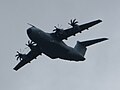 Airbus A400M Atlas - geograph.org.uk - 5055484.jpg 1,024 × 770; 113 KB
-
 Airbus Beluga 3 F-GSTC over Saltney - geograph.org.uk - 5598287.jpg 1,024 × 769; 75 KB
-
 Airbus Beluga XL2 leaving Hawarden Airport - geograph.org.uk - 6165006.jpg 1,600 × 1,203; 376 KB
-
 Airbus Beluga ^1 leaving for Hamburg - geograph.org.uk - 5620969.jpg 1,024 × 769; 56 KB
-
 Airbus Beluga ^2 landing at Hawarden Airport - geograph.org.uk - 5287505.jpg 1,024 × 770; 128 KB
-

-
 Airbus Industrie Beluga ^3 - geograph.org.uk - 3653096.jpg 478 × 640; 75 KB
-
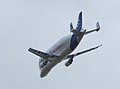
-
 Alongside Saltney Ferry footbridge - geograph.org.uk - 2316498.jpg 480 × 640; 120 KB
-
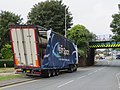 Another bridge strike in Chester Street, Saltney (geograph 5852668).jpg 1,600 × 1,199; 462 KB
-
 Awaiting harvest - geograph.org.uk - 1347628.jpg 640 × 457; 335 KB
-
 Awaiting harvest - geograph.org.uk - 1347629.jpg 640 × 457; 329 KB
-
 Balderton Brook - geograph.org.uk - 4561557.jpg 640 × 319; 38 KB
-
 Balderton Brook bridge - geograph.org.uk - 1407621.jpg 640 × 457; 255 KB
-
 Balderton Brook entering the River Dee - geograph.org.uk - 3808010.jpg 640 × 480; 128 KB
-
-
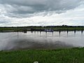 Barge dock on the River Dee - geograph.org.uk - 6184900.jpg 800 × 600; 73 KB
-

-
 Beluga taking off into the sunset - geograph.org.uk - 5571871.jpg 1,024 × 768; 109 KB
-
 Bench mark alongside Flint Road - geograph.org.uk - 2128033.jpg 480 × 640; 183 KB
-
 Bench mark on a gatepost in Flint Road - geograph.org.uk - 2317472.jpg 480 × 640; 206 KB
-
 Bench mark on Morgan's bike shop - geograph.org.uk - 1388195.jpg 480 × 640; 188 KB
-

-
 Bench mark on Saltney Stone Bridge - geograph.org.uk - 1459253.jpg 640 × 480; 228 KB
-
 Bench mark on ^63 High Street, Saltney - geograph.org.uk - 5698998.jpg 765 × 1,024; 248 KB
-
 Bench mark on ^63 High Street, Saltney - geograph.org.uk - 5914003.jpg 1,197 × 1,600; 558 KB
-
 Borders 2 Industrial Estate 1 - geograph.org.uk - 2171193.jpg 640 × 480; 97 KB
-
 Borders 2 Industrial Estate 2 - geograph.org.uk - 2171205.jpg 640 × 480; 90 KB
-
 Boundary Lane, Saltney - geograph.org.uk - 3692227.jpg 4,000 × 3,000; 2.76 MB
-
 Boundary Lane, Saltney - geograph.org.uk - 5808509.jpg 1,280 × 851; 346 KB
-
 Boundary Lane, Saltney - geograph.org.uk - 5808697.jpg 1,280 × 851; 328 KB
-
 Bridge Street, Saltney - geograph.org.uk - 282034.jpg 640 × 480; 126 KB
-
 Bridge Street, Saltney - geograph.org.uk - 282227.jpg 640 × 480; 88 KB
-
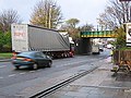 Bridge strike in Chester Road, Saltney - geograph.org.uk - 3821094.jpg 640 × 480; 223 KB
-
 Brutus outside Morrisons, Saltney on a sunny day - geograph.org.uk - 5545269.jpg 768 × 1,024; 123 KB
-
 Brutus' statue inside Morrisons supermarket - geograph.org.uk - 5558657.jpg 768 × 1,024; 137 KB
-
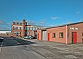 Brymau - geograph.org.uk - 1280158.jpg 640 × 457; 287 KB
-
 Brymau Two Trading Estate in Saltney - geograph.org.uk - 6176282.jpg 800 × 554; 121 KB
-
 Buildings on Saltney Business Park - geograph.org.uk - 2989469.jpg 1,600 × 1,200; 430 KB
-
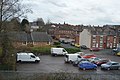 Car park, Saltney - geograph.org.uk - 4482802.jpg 640 × 426; 73 KB
-
 Chester Road - geograph.org.uk - 1347574.jpg 640 × 457; 224 KB
-
 Chester Road Saltney - geograph.org.uk - 1347589.jpg 640 × 457; 312 KB
-
 Chester Road Saltney - geograph.org.uk - 1347592.jpg 640 × 457; 410 KB
-
 Chester Road Saltney - geograph.org.uk - 1347594.jpg 640 × 457; 323 KB
-
 Chester Road Saltney - geograph.org.uk - 1347607.jpg 640 × 457; 312 KB
-
 Chester Road, Saltney - geograph.org.uk - 5809539.jpg 1,280 × 851; 354 KB
-
 Christmas lights along the A5104 through Saltney - 1 - geograph.org.uk - 6330021.jpg 1,198 × 1,600; 436 KB
-
 Christmas lights along the A5104 through Saltney - 2 - geograph.org.uk - 6330024.jpg 1,199 × 1,600; 351 KB
-
 Christmas Past by the River Dee - geograph.org.uk - 379444.jpg 640 × 480; 61 KB
-
 Church, High Street, Saltney, Flintshire - DSC08072.JPG 3,648 × 2,736; 3.56 MB
-
 Common Green Shieldbug - Palomena Prasina - geograph.org.uk - 4208097.jpg 1,024 × 767; 139 KB
-
 Cop House Farm - geograph.org.uk - 2990740.jpg 1,600 × 1,200; 277 KB
-
 Cop House Farm and the River Dee - geograph.org.uk - 6176164.jpg 800 × 642; 104 KB
-
 Cows grazing west of Chester - geograph.org.uk - 2838160.jpg 640 × 480; 90 KB
-

-

-

-
 Dee Coast Path - geograph.org.uk - 6184864.jpg 800 × 600; 102 KB
-
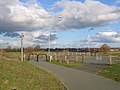 Dee Coastal Path and River Lane - geograph.org.uk - 1459425.jpg 640 × 480; 116 KB
-
 Dee Coastal Path towards River Lane - geograph.org.uk - 1459419.jpg 640 × 480; 108 KB
-
 Dee Coastal Path, Saltney - geograph.org.uk - 1459399.jpg 640 × 480; 123 KB
-
 Deeside sculpture (50359772398).jpg 2,736 × 3,648; 4.15 MB
-
 Deeside sculpture (50359773638).jpg 3,648 × 2,736; 2.28 MB
-
 Deva in sight - geograph.org.uk - 2508585.jpg 640 × 459; 61 KB
-
 Development site, Lache - geograph.org.uk - 2484958.jpg 640 × 306; 45 KB
-
 Disused filling station - geograph.org.uk - 1472512.jpg 640 × 457; 273 KB
-
 Disused petrol station - geograph.org.uk - 1451605.jpg 640 × 457; 273 KB
-
 Drainage Channel - geograph.org.uk - 39630.jpg 640 × 480; 143 KB
-
 Embankment towards Saltney Quay - geograph.org.uk - 2207537.jpg 640 × 480; 103 KB
-
 England-Wales border at Chester - geograph.org.uk - 6176356.jpg 800 × 517; 124 KB
-
 Farmland and new factories - geograph.org.uk - 1246925.jpg 640 × 480; 143 KB
-
 Farmland at Higher Ferry - geograph.org.uk - 33353.jpg 640 × 480; 167 KB
-
 Farmland near the airport - geograph.org.uk - 4556980.jpg 640 × 426; 30 KB
-
 Ferry Lane Higher Ferry - geograph.org.uk - 33439.jpg 640 × 470; 128 KB
-
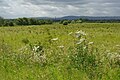 Fields at Saltney - geograph.org.uk - 5813344.jpg 1,280 × 851; 516 KB
-
 Fields at Saltney Ferry - geograph.org.uk - 5813368.jpg 1,280 × 851; 485 KB
-
 Flat farmland - geograph.org.uk - 4556985.jpg 640 × 426; 30 KB
-
 Flat farmland - geograph.org.uk - 4561547.jpg 640 × 426; 30 KB
-
 Flat farmland - geograph.org.uk - 4561549.jpg 640 × 321; 23 KB
-
 Flint Road towards Saltney Ferry - geograph.org.uk - 2317479.jpg 640 × 480; 160 KB
-
 Flood control and drainage ditch - geograph.org.uk - 36568.jpg 640 × 480; 179 KB
-
 Flooded drainage ditch in Saltney - geograph.org.uk - 4797931.jpg 4,608 × 3,456; 6.58 MB
-
 Footbridge across the River Dee - geograph.org.uk - 6176253.jpg 800 × 541; 62 KB
-
 Footbridge over R Dee at Higher Ferry, Saltney - geograph.org.uk - 4756028.jpg 1,024 × 768; 160 KB
-
 Footbridge over the River Dee - geograph.org.uk - 6184883.jpg 800 × 600; 77 KB
-
 Footbridge over the River Dee - geograph.org.uk - 6184889.jpg 800 × 518; 78 KB
-
 Footpath signpost at Higher Ferry - geograph.org.uk - 5810752.jpg 1,280 × 851; 435 KB
-
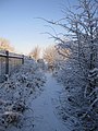 Footpath to Saltney Quay - geograph.org.uk - 2207536.jpg 480 × 640; 156 KB
-
 Former Leo's filling station and store - geograph.org.uk - 2037545.jpg 640 × 480; 108 KB
-
 Former superstore - geograph.org.uk - 1451601.jpg 640 × 457; 284 KB
-
 Freshly ploughed land - geograph.org.uk - 2989408.jpg 1,600 × 1,200; 317 KB
-
 George V pillarbox by St David's Terrace - geograph.org.uk - 1247009.jpg 480 × 640; 215 KB
-
 Go Outdoors Warehouse - geograph.org.uk - 4561555.jpg 640 × 498; 40 KB
-
 GO Outdoors, Saltney - geograph.org.uk - 2916384.jpg 5,184 × 3,456; 2.47 MB
-
 Goldfinch on a wire in Saltney Ferry - geograph.org.uk - 5474520.jpg 1,024 × 771; 97 KB
-
 Great Western House - geograph.org.uk - 299370.jpg 640 × 480; 121 KB
-

-
 Harvested field at Saltney - geograph.org.uk - 1497194.jpg 640 × 480; 170 KB
-
 Hawk Advanced Jet Trainer - geograph.org.uk - 4078251.jpg 640 × 481; 38 KB
-
 Health and fitness - geograph.org.uk - 1206076.jpg 640 × 457; 287 KB
-

-
 High tide at Saltney Ferry (2) - geograph.org.uk - 3768465.jpg 640 × 480; 76 KB
-
 High tide at Saltney Ferry (3) - geograph.org.uk - 3768467.jpg 640 × 480; 60 KB
-
 High tide at Saltney Ferry - geograph.org.uk - 3768463.jpg 640 × 480; 79 KB
-
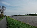 Higher Ferry bridge - geograph.org.uk - 2989549.jpg 1,600 × 1,200; 329 KB
-
 Higher Ferry Bridge - geograph.org.uk - 5810533.jpg 1,280 × 851; 476 KB
-
 Higher Ferry Bridge - geograph.org.uk - 5813111.jpg 1,280 × 851; 452 KB
-
 Houses on Shrewsbury Way, Lache - geograph.org.uk - 4482798.jpg 640 × 426; 54 KB
-

-
 Industrial buildings at Saltney - geograph.org.uk - 2989484.jpg 1,600 × 1,200; 321 KB
-
 Industrial landscape - geograph.org.uk - 4556989.jpg 640 × 276; 20 KB
-
 Industrial landscape - geograph.org.uk - 4561561.jpg 640 × 426; 41 KB
-
 Industrial Unit, Saltney - geograph.org.uk - 4482942.jpg 640 × 426; 49 KB
-
 Industrial units - geograph.org.uk - 1206096.jpg 640 × 457; 296 KB
-
 Industrial units - geograph.org.uk - 1472524.jpg 640 × 457; 343 KB
-
 Industrial units - geograph.org.uk - 4561554.jpg 640 × 277; 22 KB
-
 Industrial units - geograph.org.uk - 4561558.jpg 640 × 426; 42 KB
-
 Industrial units - geograph.org.uk - 4561563.jpg 640 × 426; 42 KB
-
 Kynaston Drive, Saltney - geograph.org.uk - 5813361.jpg 1,280 × 851; 411 KB
-
 Leo's disused filling station - geograph.org.uk - 2037535.jpg 640 × 480; 118 KB
-
 Lest We Forget - Saltney Community Centre - geograph.org.uk - 5997242.jpg 1,200 × 1,600; 389 KB
-
 Llwybr Arfordir Cymru - geograph.org.uk - 2989499.jpg 1,600 × 1,200; 368 KB
-
 Lookers Vauxhall Chester - geograph.org.uk - 5810846.jpg 1,280 × 851; 329 KB
-

-
 Looking towards Saltney Junction from Mount Pleasant, Chester.JPG 4,608 × 3,456; 3.67 MB
-
 Low tide on the River Dee-Afon Dyfrdwy - geograph.org.uk - 686767.jpg 640 × 480; 139 KB
-
 Mainwaring Drive Saltney - geograph.org.uk - 1347604.jpg 640 × 457; 320 KB
-
 Mig 23 - geograph.org.uk - 4681514.jpg 4,000 × 3,000; 5.25 MB
-
 Mig detail - geograph.org.uk - 4681516.jpg 4,000 × 3,000; 5.53 MB
-
 Migs at Hawarden Airport - geograph.org.uk - 4681517.jpg 4,000 × 3,000; 6.19 MB
-

-
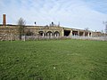 Mold Junction railway bridge - geograph.org.uk - 1190191.jpg 640 × 480; 140 KB
-

-
 Morrisons - geograph.org.uk - 4482950.jpg 640 × 426; 46 KB
-
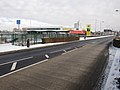 Morrisons first Christmas in Saltney - geograph.org.uk - 2207723.jpg 640 × 480; 117 KB
-
 Mount Pleasant, Saltney.JPG 4,608 × 3,456; 3.4 MB
-
 Moving an Airbus A380 wing ^1 - geograph.org.uk - 3829915.jpg 640 × 480; 73 KB
-
 Moving an Airbus A380 wing ^2 - geograph.org.uk - 3829924.jpg 640 × 480; 75 KB
-
 Moving an Airbus A380 wing ^3 - geograph.org.uk - 3829929.jpg 640 × 480; 78 KB
-
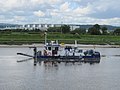
-
 Netto Supermarket, Saltney, Chester - DSC08066.JPG 3,648 × 2,736; 3.65 MB
-

-

-
 No through road to River Lane - geograph.org.uk - 1459868.jpg 640 × 480; 138 KB
-
 North Street, Saltney Ferry - geograph.org.uk - 5813396.jpg 1,280 × 851; 410 KB
-
 Old Boundary Marker in Saltney Ferry - geograph.org.uk - 6044793.jpg 768 × 1,024; 312 KB
-
 Old Boundary Marker in Saltney Ferry - geograph.org.uk - 6094815.jpg 768 × 1,024; 311 KB
-
 P. Dobbins (Chester) Ltd, scrap metal yard - geograph.org.uk - 5810158.jpg 1,280 × 851; 423 KB
-
 Padarn Close, Saltney - geograph.org.uk - 5809044.jpg 1,280 × 851; 368 KB
-

-
 Park Avenue, Saltney - geograph.org.uk - 3692212.jpg 4,000 × 3,000; 2.41 MB
-
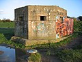 Pill Box on Saltney Quay - geograph.org.uk - 282280.jpg 640 × 480; 185 KB
-
 Pillbox along the River Dee in Chester - geograph.org.uk - 6176347.jpg 800 × 702; 136 KB
-
 Pillbox on Saltney Quay - geograph.org.uk - 2989438.jpg 1,600 × 1,200; 293 KB
-
 Pillbox on Saltney Quay - geograph.org.uk - 340610.jpg 640 × 480; 148 KB
-
 Pillbox on Saltney Quay - geograph.org.uk - 388755.jpg 640 × 480; 157 KB
-
 Pillbox on Saltney Quay in the snow - geograph.org.uk - 2207541.jpg 640 × 480; 152 KB
-
 Pillbox on Saltney Quay in the snow - geograph.org.uk - 2207547.jpg 640 × 480; 147 KB
-
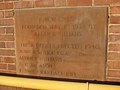 Plaque on the former RMW offices - geograph.org.uk - 2192335.jpg 640 × 480; 104 KB
-
 Postboxes in the Wilderness - geograph.org.uk - 2660933.jpg 1,910 × 1,349; 401 KB
-
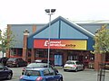 Pound store, St Davids Retail Park, High Street, Saltney, Flintshire - DSC08075.JPG 3,648 × 2,736; 3.57 MB
-

-

-
 Railway Bridge at Mold Junction - geograph.org.uk - 1190181.jpg 640 × 480; 178 KB
-
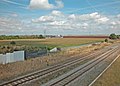 Railway Line Saltney Ferry - geograph.org.uk - 1347615.jpg 640 × 457; 322 KB
-
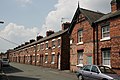 Railwaymens' housing, Ewart Street, Saltney Ferry, Flintshire, Wales, 2010. - panoramio.jpg 3,888 × 2,592; 2.97 MB
-
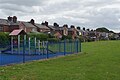 Rear of St David's Terrace, Saltney - geograph.org.uk - 5810108.jpg 1,280 × 851; 383 KB
-
 Red sun effect above Saltney - geograph.org.uk - 5570501.jpg 1,024 × 766; 140 KB
-
 Repairing a street light in Saltney - geograph.org.uk - 5450987.jpg 766 × 1,024; 239 KB
-

-
 River Dee at Saltney, aerial 2015 - geograph.org.uk - 4695528.jpg 1,600 × 967; 303 KB
-
 River Dee bore at Saltney Ferry - geograph.org.uk - 6007606.jpg 1,600 × 1,200; 325 KB
-
 River Dee near Higher Ferry House - geograph.org.uk - 6176249.jpg 800 × 505; 69 KB
-
 River Dee, Higher Ferry - geograph.org.uk - 5810690.jpg 1,280 × 851; 389 KB
-
 River Dee-Afon Dyfrdwy and cycleway - geograph.org.uk - 686773.jpg 640 × 480; 77 KB
-
 River lane - geograph.org.uk - 1451603.jpg 640 × 457; 272 KB
-
 River Lane - geograph.org.uk - 4482938.jpg 640 × 426; 50 KB
-

-
 River Lane Saltney - geograph.org.uk - 1407583.jpg 640 × 457; 228 KB
-
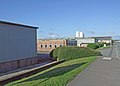 River Lane Saltney - geograph.org.uk - 1407586.jpg 640 × 457; 269 KB
-
 Rivet bench mark on Saltney quay - geograph.org.uk - 4813922.jpg 2,424 × 3,150; 1.89 MB
-
 Roadside wall in Flint Road - geograph.org.uk - 2128046.jpg 640 × 480; 145 KB
-
 Saltney Apartments - geograph.org.uk - 44918.jpg 640 × 414; 130 KB
-
 Saltney Bakery - geograph.org.uk - 44992.jpg 640 × 480; 147 KB
-
 Saltney Christian Centre - geograph.org.uk - 629173.jpg 480 × 640; 77 KB
-
 Saltney development site - geograph.org.uk - 3854332.jpg 640 × 480; 73 KB
-
 Saltney development site - geograph.org.uk - 3854333.jpg 640 × 480; 83 KB
-
 Saltney Ferry - geograph.org.uk - 1347598.jpg 640 × 457; 305 KB
-

-
 Saltney Ferry Primary School - geograph.org.uk - 1347610.jpg 640 × 457; 300 KB
-
 Saltney Ferry Road - geograph.org.uk - 5813374.jpg 1,280 × 851; 427 KB
-
 Saltney Ferry Road towards Mold Junction - geograph.org.uk - 1459366.jpg 640 × 480; 109 KB


.jpg)


.jpg)
.jpg)


_-_geograph.org.uk_-_3768465.jpg)
_-_geograph.org.uk_-_3768467.jpg)


,_High_Street,_Saltney,_Flintshire_-_DSC08079.JPG)


_Ltd,_scrap_metal_yard_-_geograph.org.uk_-_5810158.jpg)


