Category:Schnitzturm
Jump to navigation
Jump to search
| Object location | | View all coordinates using: OpenStreetMap |
|---|
former defence tower in Stansstad in the canton of Nidwalden, Switzerland   | |||||
| Upload media | |||||
| Instance of | |||||
|---|---|---|---|---|---|
| Part of | |||||
| Location | Stansstad, Nidwalden, Switzerland | ||||
| Street address |
| ||||
| Heritage designation | |||||
| Inception |
| ||||
| Height |
| ||||
| Elevation above sea level |
| ||||
 | |||||
Media in category "Schnitzturm"
The following 20 files are in this category, out of 20 total.
-
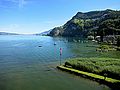
 Alter Hafen von Hergiswil.jpg 10,871 × 4,548; 10.88 MB
-
 CHE Stansstad COA.svg 512 × 612; 3 KB
-
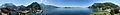 Schnitzturm 360 Panorama.jpg 9,912 × 1,216; 2.15 MB
-
 Schnitzturm Innenansicht.jpg 3,000 × 4,000; 2.5 MB
-
 Schnitzturm N.jpg 4,000 × 3,000; 2.82 MB
-
 Schnitzturm NO.jpg 4,000 × 3,000; 3.05 MB
-
 Schnitzturm NW.jpg 4,000 × 3,000; 2.96 MB
-
 Schnitzturm O.jpg 4,000 × 3,000; 4.18 MB
-
 Schnitzturm Plattform.jpg 4,000 × 3,000; 2.99 MB
-
 Schnitzturm S.jpg 4,000 × 3,000; 3.93 MB
-
 Schnitzturm SO.jpg 4,000 × 3,000; 3.47 MB
-
 Schnitzturm SW.jpg 4,000 × 3,000; 4.45 MB
-
 Schnitzturm Treppen.jpg 3,000 × 4,000; 3.18 MB
-
 Schnitzturm W.jpg 4,000 × 3,000; 3.59 MB
-
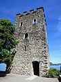 Schnitzturm.jpg 3,000 × 4,000; 4.38 MB
-
 Schnitzturm.Stansstad.jpg 2,750 × 2,061; 1.21 MB
-
 Stansstad NW.png 254 × 254; 6 KB
-
 Stansstad-coat of arms.svg 603 × 763; 13 KB
-
 Stansstad-Schnitzturm.jpg 1,800 × 1,200; 1.73 MB
-
 Switzerland-03564 - Schnitzturm (23814725340).jpg 6,140 × 4,211; 18.49 MB


.jpg)