Category:Sellindge
Jump to navigation
Jump to search
English: Sellindge is a village and civil parish on the A20 road between Ashford and Folkestone in Kent, South East England. Sellindge is part of North Downs West Ward of Folkestone and Hythe District Council but part of the Elham ward of Kent County Council
village and civil parish in Kent, United Kingdom .jpg) | |||||
| Upload media | |||||
| Instance of | |||||
|---|---|---|---|---|---|
| Location | Folkestone and Hythe, Kent, South East England, England | ||||
| Said to be the same as | Sellindge (Wikimedia duplicated page, civil parish) | ||||
 | |||||
Subcategories
This category has the following 2 subcategories, out of 2 total.
M
O
- Oasts in Sellindge (2 F)
Media in category "Sellindge"
The following 149 files are in this category, out of 149 total.
-
 A20 Ashford Road - geograph.org.uk - 2418823.jpg 4,320 × 3,240; 4.2 MB
-
 A20 Ashford Road, Sellindge - geograph.org.uk - 2418821.jpg 4,320 × 3,240; 4.27 MB
-
 A20 at Grove Bridge - geograph.org.uk - 4028773.jpg 640 × 488; 52 KB
-
 A20 at Grove Bridge - geograph.org.uk - 4054935.jpg 544 × 640; 54 KB
-
 A20 junction with B2067 - geograph.org.uk - 3918019.jpg 3,596 × 2,343; 1.11 MB
-
 A20 Sellindge - geograph.org.uk - 2418219.jpg 4,320 × 3,240; 4.13 MB
-
 A20 through Sellindge - geograph.org.uk - 4054987.jpg 567 × 640; 51 KB
-
 A20 through Sellinge - geograph.org.uk - 3388643.jpg 2,256 × 1,504; 2.56 MB
-
 A20 through Sellinge - geograph.org.uk - 4384348.jpg 1,024 × 683; 235 KB
-
 A20, west - geograph.org.uk - 4054990.jpg 589 × 640; 54 KB
-
 Another gap in the stack of lorries - geograph.org.uk - 4585292.jpg 1,024 × 557; 97 KB
-
 Barrow Green Farm - geograph.org.uk - 4390747.jpg 1,024 × 683; 196 KB
-
 Between the M20 and the railway, Barrow Hill - geograph.org.uk - 4908268.jpg 2,252 × 1,658; 1.08 MB
-
 Bob Fisher's garage, Sellindge - geograph.org.uk - 2418202.jpg 4,320 × 3,240; 4.54 MB
-
 Bridle gate beside the M20 Motorway - geograph.org.uk - 2076457.jpg 2,304 × 3,072; 2.56 MB
-
 Bridleway beside the M20 - geograph.org.uk - 2076468.jpg 3,072 × 2,304; 1.48 MB
-
 Bridleway between the M20 Motorway and CTRL - geograph.org.uk - 2076604.jpg 3,072 × 2,304; 2.51 MB
-
 Bridleway under two Railway bridges (2) - geograph.org.uk - 2076594.jpg 2,991 × 2,191; 1.61 MB
-
 Bridleway under two Railway bridges - geograph.org.uk - 2076523.jpg 3,072 × 2,304; 2.06 MB
-
 Bungalow on Stone Hill - geograph.org.uk - 1857784.jpg 1,024 × 683; 200 KB
-
 Bungalows on Greenfields, Stanford - geograph.org.uk - 1975128.jpg 1,024 × 768; 131 KB
-
 Coopers Lane, Sellindge - geograph.org.uk - 2418208.jpg 4,320 × 3,240; 4.54 MB
-
 Deer and Sheep, Harringe Court - geograph.org.uk - 2077906.jpg 3,072 × 1,728; 2.16 MB
-
 Dovecote at Barrow Green Farm - geograph.org.uk - 4384226.jpg 1,024 × 683; 250 KB
-
 Entering Sellinge on Swan Lane - geograph.org.uk - 3390407.jpg 2,256 × 1,504; 3.37 MB
-
 Eurostar train towards Ashford, near Sellindge - geograph.org.uk - 3100027.jpg 2,256 × 1,496; 905 KB
-
 Farm roller in action near Somerfield Court Farm - geograph.org.uk - 2076776.jpg 3,072 × 2,304; 2.02 MB
-
 Farm track to Somerfield Court Farm - geograph.org.uk - 2076724.jpg 3,072 × 2,304; 2.1 MB
-
 Farmland by the railway line - geograph.org.uk - 2958006.jpg 640 × 430; 25 KB
-
 Farmland near Barrowhill - geograph.org.uk - 2958022.jpg 640 × 430; 25 KB
-
 Farmland near Burn Brae - geograph.org.uk - 4756167.jpg 640 × 426; 45 KB
-
 Field side hedge and fence at Sellindge Triangulation Pillar - geograph.org.uk - 5571660.jpg 4,000 × 3,000; 4.28 MB
-
-
 Flat farmland by the railway - geograph.org.uk - 2703896.jpg 640 × 430; 37 KB
-
 Folkestone Racecourse - geograph.org.uk - 4390778.jpg 1,024 × 683; 160 KB
-
 Footbridge near Harringe Court Farm - geograph.org.uk - 2076754.jpg 3,072 × 2,304; 2.78 MB
-
 Footpath to Hoddiford Farm - geograph.org.uk - 1981715.jpg 640 × 480; 75 KB
-
 Footpath to Southenay Farm - geograph.org.uk - 1981768.jpg 640 × 480; 61 KB
-
 Gate on Harringe Lane - geograph.org.uk - 2077936.jpg 3,072 × 2,304; 1.86 MB
-
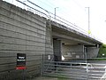
 Harringe Bridge - geograph.org.uk - 4028761.jpg 640 × 567; 67 KB
-
 Harringe Lane - geograph.org.uk - 5315057.jpg 640 × 428; 172 KB
-
 High Speed 1 - geograph.org.uk - 4028756.jpg 640 × 430; 72 KB
-
 High Speed 1 - geograph.org.uk - 4028770.jpg 640 × 415; 66 KB
-
 Horse at Harringe Court - geograph.org.uk - 1857793.jpg 1,024 × 768; 142 KB
-
 Horton Priory - geograph.org.uk - 399967.jpg 640 × 480; 70 KB
-
 Horton Priory from Moorstock Lane - geograph.org.uk - 643710.jpg 640 × 480; 244 KB
-
 Junction box by Grove Bridge, Barrowhill - geograph.org.uk - 4903264.jpg 2,048 × 1,536; 1.52 MB
-
 Land off Harringe Lane - geograph.org.uk - 3100050.jpg 2,256 × 1,496; 889 KB
-
 Lord of the manor of Sellindge Official Statutory Declaration.jpg 4,160 × 3,120; 2.58 MB
-
 Lord of the Manor of ~Sellindge.jpg 1,920 × 2,560; 1.35 MB
-
 Lorry park at the Airport Cafe, Barrowhill - geograph.org.uk - 4903481.jpg 2,048 × 1,536; 1.48 MB
-
 M20 by HS1 - geograph.org.uk - 4028768.jpg 640 × 298; 53 KB
-
 M20 Motorway towards Folkestone - geograph.org.uk - 3100035.jpg 2,256 × 1,496; 873 KB
-

-
 Moorstock Lane - geograph.org.uk - 4224049.jpg 640 × 480; 200 KB
-
 Moorstock Lane - geograph.org.uk - 4224054.jpg 640 × 480; 214 KB
-

-
 Old houses on Sothenay Lane - geograph.org.uk - 645234.jpg 640 × 480; 194 KB
-
 Operation Stack on M20 - geograph.org.uk - 4585282.jpg 1,024 × 540; 86 KB
-
 Ordnance Survey Flush Bracket S6388 - geograph.org.uk - 4928679.jpg 4,000 × 3,000; 2.15 MB
-
 Plain Road, near Stone Hill Farm - geograph.org.uk - 3737081.jpg 2,448 × 3,696; 5.94 MB
-
 Pole in field - geograph.org.uk - 5780254.jpg 409 × 640; 47 KB
-
 Posts by Ashford Rd - geograph.org.uk - 4054932.jpg 640 × 430; 45 KB
-
 Potatoes for sale - geograph.org.uk - 643656.jpg 640 × 480; 280 KB
-

-

-
 Pylon by railway line - geograph.org.uk - 5780257.jpg 640 × 426; 51 KB
-
 Pylon by railway line - geograph.org.uk - 5780263.jpg 640 × 426; 55 KB
-
 Pylon by railway line - geograph.org.uk - 5780265.jpg 640 × 426; 61 KB
-
 Pylon by the railway line - geograph.org.uk - 2958010.jpg 640 × 430; 35 KB
-
 Pylon by the railway line - geograph.org.uk - 2958014.jpg 640 × 430; 36 KB
-
 Pylon in a small woodland - geograph.org.uk - 2706205.jpg 640 × 367; 40 KB
-
 Pylon near Barrowhill - geograph.org.uk - 2958015.jpg 640 × 430; 28 KB
-
 Pylon near Somerfield Court Farm - geograph.org.uk - 5780274.jpg 640 × 425; 47 KB
-
 Pylons near Barrowhill - geograph.org.uk - 2703901.jpg 640 × 430; 34 KB
-
 Railways west of Harringe Bridge - geograph.org.uk - 5315073.jpg 640 × 480; 140 KB
-
-
 Relaxation of speed limit on A20 - geograph.org.uk - 4224042.jpg 640 × 480; 200 KB
-
 Road (A20) passing through Sellindge - geograph.org.uk - 4928692.jpg 4,000 × 3,000; 2.33 MB
-

-
 Sellindge Converter Station - geograph.org.uk - 4028729.jpg 640 × 430; 75 KB
-
 Sellindge Converter Station - geograph.org.uk - 413724.jpg 640 × 480; 72 KB
-
 Sellindge primary school on the A20 - geograph.org.uk - 643643.jpg 640 × 480; 210 KB
-
 Sellindge Sewage Treatment Works - geograph.org.uk - 4028741.jpg 640 × 430; 69 KB
-

-
 Sellindge telephone exchange - geograph.org.uk - 2418815.jpg 4,320 × 3,240; 3.87 MB
-
 Sellindge Village Hall - geograph.org.uk - 1435872.jpg 640 × 360; 39 KB
-
 Sellindge village hall - geograph.org.uk - 2418816.jpg 4,320 × 3,240; 3.97 MB
-
 Sellindge village hall - geograph.org.uk - 643649.jpg 640 × 480; 182 KB
-
 Sellindge, M20 - geograph.org.uk - 3133117.jpg 3,648 × 2,736; 3.11 MB
-
 Sellinge primary school - geograph.org.uk - 4384346.jpg 1,024 × 683; 246 KB
-

-
 Sheep farming, Harringe Court - geograph.org.uk - 5315084.jpg 640 × 428; 86 KB
-
 Sign for the Sellindge steam rally - geograph.org.uk - 643576.jpg 640 × 480; 159 KB
-
 Somerfield Court Farm - geograph.org.uk - 5780268.jpg 640 × 388; 37 KB
-
 Spot the odd one out ^ - geograph.org.uk - 2076799.jpg 3,072 × 1,728; 1.53 MB
-
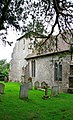 St Mary, Sellindge, Kent - geograph.org.uk - 2069661.jpg 610 × 1,000; 258 KB
-
 Stone Hill junction with the A20 - geograph.org.uk - 644400.jpg 640 × 480; 284 KB
-
 Strip of trees in a shallow valley - geograph.org.uk - 4756138.jpg 640 × 426; 40 KB
-
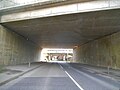 The A20 going under the M20 and railway, Barrowhill - geograph.org.uk - 4908264.jpg 2,304 × 1,728; 1.05 MB
-
 The Airport Cafe, Sellindge - geograph.org.uk - 2403620.jpg 4,320 × 3,240; 4.26 MB
-
-
 The Chase on Moorstock Lane - geograph.org.uk - 643663.jpg 640 × 480; 286 KB
-
 The Dukes Head pub on the A20 - geograph.org.uk - 644398.jpg 640 × 480; 205 KB
-

-
 The Dukes Head, Sellindge - geograph.org.uk - 4903275.jpg 2,048 × 1,536; 1.49 MB
-
 Track along the railway off Barrow Hill - geograph.org.uk - 4908269.jpg 2,304 × 1,728; 806 KB
-
 Tree by bridleway - geograph.org.uk - 5780276.jpg 640 × 426; 37 KB
-
 Trig Point beside Southenay Lane - geograph.org.uk - 1981701.jpg 3,072 × 2,304; 2.32 MB
-
 View along Priory Lane - geograph.org.uk - 644683.jpg 480 × 640; 328 KB
-
 View along Stone Hill - geograph.org.uk - 644661.jpg 640 × 480; 236 KB
-
 View from near Harringe Court - geograph.org.uk - 2076790.jpg 3,072 × 1,728; 1.39 MB
-
 View of Somerfield Court Farm - geograph.org.uk - 2076656.jpg 3,072 × 1,728; 1.32 MB
-

-
 View W along the A20 - geograph.org.uk - 644399.jpg 640 × 480; 208 KB
-
 Village sign - geograph.org.uk - 4384343.jpg 768 × 1,024; 210 KB
-

-
 Bottom end of Brook Lane - geograph.org.uk - 643627.jpg 640 × 480; 278 KB
-
 Bridges at Sellindge - geograph.org.uk - 400434.jpg 640 × 480; 76 KB
-

-
 Elm Tree Farm - geograph.org.uk - 643653.jpg 640 × 480; 236 KB
-
 Fields below Ashden House - geograph.org.uk - 422445.jpg 640 × 427; 67 KB
-

-
 Footpath past Ashden House - geograph.org.uk - 422413.jpg 640 × 427; 145 KB
-

-
 Footpath to Otterpool Manor - geograph.org.uk - 413708.jpg 640 × 480; 120 KB
-
 Footpath to Partridge Farm - geograph.org.uk - 415269.jpg 640 × 480; 70 KB
-
 Footpath toward Burch's Rough - geograph.org.uk - 454339.jpg 480 × 640; 129 KB
-
 Gibbins Brook - geograph.org.uk - 403188.jpg 640 × 480; 75 KB
-
 Glebe Farm on Stone Hill - geograph.org.uk - 644669.jpg 640 × 480; 193 KB
-
 Grass air strip - geograph.org.uk - 456343.jpg 640 × 480; 120 KB
-

-
 Houses along Moorstock Lane - geograph.org.uk - 643693.jpg 640 × 480; 269 KB
-
 Houses on Moorstock Road - geograph.org.uk - 643685.jpg 640 × 480; 274 KB
-
 Houses on Southenay Lane - geograph.org.uk - 644705.jpg 640 × 480; 176 KB
-

-
 Looking N along Moorstock Lane - geograph.org.uk - 643678.jpg 640 × 480; 321 KB
-

-
 Looking S along Moorstock Lane - geograph.org.uk - 643667.jpg 640 × 480; 260 KB
-
 Looking SW along Moorstock Lane - geograph.org.uk - 643727.jpg 640 × 480; 313 KB
-
 Looking towards Burch's Rough - geograph.org.uk - 454353.jpg 640 × 480; 118 KB
-
 M20 and two railways - geograph.org.uk - 413715.jpg 640 × 480; 91 KB
-
 New stile on the field edge - geograph.org.uk - 454386.jpg 480 × 640; 135 KB
-
 Southenay Farm from Southenay Lane - geograph.org.uk - 415383.jpg 640 × 480; 83 KB
-

-

-
 The view down Harringe Lane. - geograph.org.uk - 415397.jpg 640 × 480; 59 KB
-
 Upper Park Farm along the farm road - geograph.org.uk - 454369.jpg 640 × 480; 120 KB
-
 View from Harringe Bridge - geograph.org.uk - 415391.jpg 640 × 480; 53 KB


_-_geograph.org.uk_-_2076594.jpg)


_passing_through_Sellindge_-_geograph.org.uk_-_4928692.jpg)


