Category:Shaolin Monastery scenic spot
Jump to navigation
Jump to search
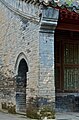
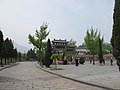
English: The original Shaolin Monastery died in 1928, killed and razed by a renegade Nationalist warlord, who subsequently suffered assassination himself for his plans to defect to the Japanese. After the death of Mao the Communist Party of China (CPC) rehabilitated the place as best they could, but the rebuilt temple was inadequate to their plans for a major tourism center and international Kung Fu educational center. Leaving the rebuilt monastery as a shell they built a new centre to the northeast on the left bank of the Shao Yang River bordering on Route G207, which splits from the course of the river to cross the mountains to the NW. The centre contains such items as the parking lot, the park headquarters, or "Songshan Shaolin Management Bureau," the government-run "Shaolin Tagou Martial Arts School" of de-Buddhized Kung Fu, with rows of barracks-like dormitories and a huge practice field, where the students are taught the tricks, so to speak, of flying monks and other stunt-man routines. It runs into Lucun village with its facilities for providing necessities to visitors. As the government allows foreigners to have schools there, a number of Kung Fu schools have taken up residence, such as the "Sh. Temple Martial Arts Academy," the "Sh. Kungfu Temple," and many others. The whole park was named "Shaolin Monastery Scenic Spot, which is a part of Songshan Scenic Area." It stretches along the whole upper Shao Yang from where it leaves Wuru Peak to where it enters Shaolin Reservoir, some 4.5 km (2.8 mi), and extends west up G207 some 2.55 km (1.58 mi).
Subcategories
This category has the following 5 subcategories, out of 5 total.
Media in category "Shaolin Monastery scenic spot"
The following 55 files are in this category, out of 55 total.
-
 15326-Dengfeng (49068500327).jpg 3,000 × 2,039; 2.29 MB
-
 15338-Dengfeng (48549547536).jpg 3,000 × 1,996; 1.77 MB
-
 15393-Dengfeng (49068294026).jpg 3,000 × 2,920; 2.63 MB
-
 2010 CHINE (4590872515).jpg 2,356 × 1,571; 2.93 MB
-
 2010 CHINE (4591069451).jpg 2,522 × 1,682; 3.21 MB
-
 2010 CHINE (4591467810).jpg 2,521 × 1,681; 2.28 MB
-
 2010 CHINE (4591695222).jpg 2,640 × 1,760; 4.06 MB
-
 Chinglish Sign at Shaolin Temple (48839961983).jpg 6,000 × 4,000; 5.98 MB
-
 Porte menant au monastère de Shaolin.JPG 800 × 601; 127 KB
-
 Shaolin Academy 15331-Dengfeng (49067942673).jpg 2,557 × 3,000; 3.29 MB
-
 Shaolin Academy 15339-Dengfeng (49068461266).jpg 3,000 × 2,646; 2.05 MB
-
 Shaolin Academy 15343-Dengfeng (49067943498).jpg 3,000 × 2,115; 2.74 MB
-
 Shaolin Academy 15349-Dengfeng (49068670437).jpg 3,000 × 1,822; 2.28 MB
-
 Shaolin Academy 15352-Dengfeng (49067945903).jpg 1,996 × 3,000; 2.17 MB
-
 Shaolin Academy 15355-Dengfeng (49068463501).jpg 3,000 × 2,635; 1.62 MB
-
 Shaolin Academy 15360-Dengfeng (49068464541).jpg 3,000 × 2,002; 1.16 MB
-
 Shaolin Academy 15362-Dengfeng (49068672182).jpg 3,000 × 2,234; 2.31 MB
-
 Shaolin Academy 15366-Dengfeng (49067947193).jpg 3,000 × 2,602; 2.14 MB
-
 Shaolin Academy 15378-Dengfeng (49067948743).jpg 2,565 × 3,000; 2.56 MB
-
 Shaolin Academy 15384-Dengfeng (49067949673).jpg 3,000 × 2,664; 1.59 MB
-
 Shaolin Academy 15392-Dengfeng (49067950123).jpg 3,000 × 2,391; 2.49 MB
-
 Shaolin Academy 15395-Dengfeng (49068468731).jpg 3,000 × 1,732; 2.36 MB
-
 Shaolin Academy 15403-Dengfeng (49068470466).jpg 3,000 × 2,083; 2.06 MB
-
 Shaolin chan tempel schweiz medien.jpg 1,440 × 480; 202 KB
-
 Shaolin Monastery - monk pic01.jpg 2,448 × 3,264; 4.43 MB
-
 Shaolin monk3.jpg 1,536 × 2,048; 347 KB
-
 Shaolin Temple (10198897436).jpg 640 × 480; 166 KB
-
 Shaolin Temple (10199654885).jpg 2,592 × 3,888; 2.55 MB
-
 Shaolin Temple (10199675286).jpg 3,888 × 2,592; 2.31 MB
-
 Shaolin Temple (10201460885).jpg 4,752 × 3,168; 4.75 MB
-
 Shaolin Temple - September 2011 (6168946513).jpg 1,781 × 1,388; 836 KB
-
 Shaolin Temple - September 2011 (6169482540).jpg 1,350 × 2,055; 1.09 MB
-
 Shaolin Temple - September 2011 (6169483030).jpg 1,288 × 1,926; 1.26 MB
-
 Shaolin Temple 15328-Dengfeng (48757381678).jpg 3,000 × 2,114; 2.46 MB
-
 Shaolin Temple 15332-Dengfeng (48757382143).jpg 3,000 × 1,996; 2.64 MB
-
 Shaolin Temple 15335-Dengfeng (48757895967).jpg 3,000 × 2,299; 1.9 MB
-
 Shaolin Temple 15342-Dengfeng (48757704086).jpg 3,000 × 1,786; 1.82 MB
-
 Shaolin Temple 15353-Dengfeng (48757896992).jpg 3,000 × 1,883; 2.17 MB
-
 Shaolin Temple 15368-Dengfeng (48757897397).jpg 3,000 × 1,996; 2.14 MB
-
 Shaolin Temple 15375-Dengfeng (48757383478).jpg 1,996 × 3,000; 2.2 MB
-
 Shaolin Temple 15377-Dengfeng (48757705956).jpg 2,918 × 3,000; 2.88 MB
-
 Shaolin Temple 15383-Dengfeng (48757706211).jpg 3,000 × 1,850; 2.04 MB
-
 Shaolin Temple 15396-Dengfeng (48757384393).jpg 1,996 × 3,000; 1.63 MB
-
 Shaolin Temple Amy Todd (10198878425).jpg 1,600 × 1,200; 494 KB
-
 Shaolin Temple Cooking Pot Made in Ming During Reign of Emperor Wanli (10200852946).jpg 3,456 × 5,184; 2.84 MB
-
 Shaolin Temple Song Shan Mountain (10199496685).jpg 3,888 × 2,592; 1.2 MB
-
 Shaolin Temple Stone Mill Made in Ming During Jiajing Emperor's 43rd Year (10200731504).jpg 5,184 × 3,456; 3.03 MB
-
 天下第一名寺牌坊 - panoramio (1).jpg 2,272 × 1,704; 888 KB
-
 天下第一名寺牌坊 - panoramio.jpg 2,272 × 1,704; 903 KB
-
 少林寺天下第一名刹牌坊 - panoramio.jpg 5,472 × 3,648; 7.54 MB
-
 少林寺景区停车场 - panoramio.jpg 2,272 × 1,704; 714 KB
-
 少林寺景区入口处 - panoramio.jpg 2,272 × 1,704; 734 KB
-
 少林寺景区出口 - panoramio (1).jpg 2,272 × 1,704; 932 KB
-
 少林寺景区出口 - panoramio.jpg 2,272 × 1,704; 738 KB
-
 少林寺景区古庙 - panoramio.jpg 2,272 × 1,704; 1.57 MB
.jpg)
.jpg)
.jpg)
.jpg)
.jpg)
.jpg)
.jpg)
.jpg)

.jpg)
.jpg)
.jpg)
.jpg)
.jpg)
.jpg)
.jpg)
.jpg)
.jpg)
.jpg)
.jpg)
.jpg)
.jpg)
.jpg)


.jpg)
.jpg)
.jpg)
.jpg)
.jpg)
.jpg)
.jpg)
.jpg)
.jpg)
.jpg)
.jpg)
.jpg)
.jpg)
.jpg)
.jpg)
.jpg)
.jpg)
.jpg)
.jpg)
.jpg)
.jpg)
.jpg)


.jpg)

