Category:Shepherdswell
Jump to navigation
Jump to search
English: Shepherdswell (also Sibertswold) is a village in Kent, England, UK. It is notable for the East Kent Railway, whose terminus is sited there.
village in Kent, England, UK | |||||
| Upload media | |||||
| Instance of | |||||
|---|---|---|---|---|---|
| Location | Shepherdswell with Coldred, Dover, Kent, South East England, England | ||||
 | |||||
Subcategories
This category has the following 6 subcategories, out of 6 total.
Media in category "Shepherdswell"
The following 72 files are in this category, out of 72 total.
-
Air Shaft and pylons - geograph.org.uk - 613770.jpg 640 × 427; 34 KB
-
Air Shaft and Upton Wood - geograph.org.uk - 613775.jpg 640 × 427; 102 KB
-
B and B on Coxhill Road, Shepherdswell - geograph.org.uk - 1532490.jpg 640 × 480; 126 KB
-
Bell Inn, Pub Sign - geograph.org.uk - 2142871.jpg 2,304 × 3,072; 1.23 MB
-
Bell Inn, Public House, Shepherdswell - geograph.org.uk - 2142868.jpg 3,072 × 2,304; 2.04 MB
-
Bricklayers Arms sign - geograph.org.uk - 1968522.jpg 768 × 1,024; 209 KB
-
Bricklayers Arms, Shepherdswell - geograph.org.uk - 1968220.jpg 1,024 × 768; 177 KB
-
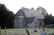
St Pancras Church - geograph.org.uk - 740067.jpg 640 × 480; 128 KB
-
Converted Wesleyan Chapel - geograph.org.uk - 2142852.jpg 3,072 × 2,304; 1.6 MB
-
Level crossing, Golgotha - geograph.org.uk - 219266.jpg 640 × 497; 76 KB
-
Mill Lane, Shepherdswell - geograph.org.uk - 1587174.jpg 640 × 480; 73 KB
-
Oast Cottages, Coxhill, Shepherdswell - geograph.org.uk - 1968532.jpg 1,024 × 683; 273 KB
-
Recreation Ground, Shepherdswell - geograph.org.uk - 613824.jpg 640 × 427; 97 KB
-
Rev Grubb memorial seat - geograph.org.uk - 712267.jpg 640 × 480; 130 KB
-
Shepherdswell Post Office - geograph.org.uk - 2142826.jpg 3,072 × 2,304; 1.91 MB
-
Shepherdswell Recreation Ground - geograph.org.uk - 613780.jpg 640 × 427; 50 KB
-
Shepherdswell, East Kent Railway (geograph 2592899).jpg 3,648 × 2,736; 2.19 MB
-
The Bell Inn and Village Green - geograph.org.uk - 1587137.jpg 640 × 458; 86 KB
-
The London - Dover line - geograph.org.uk - 219893.jpg 434 × 640; 54 KB
-
The Old Bakery, Shepherdswell - geograph.org.uk - 2142875.jpg 3,072 × 2,304; 1.62 MB
-
The Rec. Shepherdswell - geograph.org.uk - 712288.jpg 640 × 480; 97 KB
-
Topiary in Shepherds Well - geograph.org.uk - 643700.jpg 477 × 640; 57 KB
-
View along a bridleway from Golgotha - geograph.org.uk - 653140.jpg 640 × 480; 193 KB
-
Westcourt Lane, Shepherdswell - geograph.org.uk - 1743388.jpg 1,000 × 750; 258 KB
-
Church Hill, Shepherdswell - geograph.org.uk - 613789.jpg 640 × 427; 99 KB
-
Coldred Road from footpath - geograph.org.uk - 613831.jpg 640 × 427; 98 KB
-
Coxhill at Diamond Farm - geograph.org.uk - 516355.jpg 640 × 480; 123 KB
-
Cutting on the London-Dover line - geograph.org.uk - 156338.jpg 640 × 426; 120 KB
-
Farm road leading to West Court Farm - geograph.org.uk - 362372.jpg 640 × 480; 52 KB
-
Field view - geograph.org.uk - 366017.jpg 640 × 480; 60 KB
-
Footpath across West Court Downs - geograph.org.uk - 677129.jpg 640 × 480; 154 KB
-
Footpath to Coldred - geograph.org.uk - 712280.jpg 640 × 480; 107 KB
-
From Moon Hill, Shepherdswell - geograph.org.uk - 613778.jpg 640 × 427; 63 KB
-
Golgotha, East Kent - geograph.org.uk - 156324.jpg 640 × 426; 109 KB
-
Hill Avenue, Shepherdswell - geograph.org.uk - 613786.jpg 640 × 427; 141 KB
-
Houses on Coxhill Road - geograph.org.uk - 359840.jpg 640 × 480; 55 KB
-
Inscription on road-side shelter - geograph.org.uk - 712269.jpg 640 × 480; 109 KB
-
Junction of Lydden Hill with the A2 - geograph.org.uk - 363646.jpg 640 × 480; 47 KB
-
Junction with Long Lane on right - geograph.org.uk - 677123.jpg 640 × 480; 260 KB
-
Long Lane Farm - geograph.org.uk - 156336.jpg 640 × 426; 78 KB
-
Long Lane, Golgotha - geograph.org.uk - 157418.jpg 640 × 376; 63 KB
-
Looking N along Mill Lane - geograph.org.uk - 388500.jpg 640 × 480; 57 KB
-
Looking NE along field boundary - geograph.org.uk - 362369.jpg 640 × 480; 95 KB
-
Looking SE along West Court Lane - geograph.org.uk - 362396.jpg 640 × 480; 67 KB
-
Looking towards London - geograph.org.uk - 156347.jpg 640 × 426; 92 KB
-
Looking W along lane from Frogham - geograph.org.uk - 311204.jpg 640 × 480; 179 KB
-
North Downs Way, Shepherdswell - geograph.org.uk - 613816.jpg 640 × 427; 109 KB
-
On the North Downs Way - geograph.org.uk - 156331.jpg 640 × 426; 106 KB
-
Pointer on the North Downs Way - geograph.org.uk - 157289.jpg 426 × 640; 81 KB
-
Shepherdswell from the Coldred Road - geograph.org.uk - 653148.jpg 640 × 480; 129 KB
-
Shepherdswell village green - geograph.org.uk - 613744.jpg 640 × 427; 140 KB
-
Shepherdswell village green - geograph.org.uk - 613748.jpg 640 × 427; 112 KB
-
The Bricklayers Arms on Coxhill Road - geograph.org.uk - 362412.jpg 640 × 480; 68 KB
-
The edge of Hope Wood near the A2 - geograph.org.uk - 359842.jpg 640 × 480; 56 KB
-
The road from Wickham Bushes - geograph.org.uk - 363180.jpg 640 × 480; 77 KB
-
Track on the North Downs Way - geograph.org.uk - 157291.jpg 640 × 426; 111 KB
-
Track to West Court Farm - geograph.org.uk - 677127.jpg 640 × 480; 163 KB
-
View across field - geograph.org.uk - 366011.jpg 640 × 480; 55 KB
-
View of farmland. - geograph.org.uk - 306525.jpg 640 × 480; 185 KB


