Category:Sint-Amanduskerk (Hooglede)
Jump to navigation
Jump to search
| Object location | | View all coordinates using: OpenStreetMap |
|---|
|
This is a category about onroerend erfgoed number 50955
|
| NO WIKIDATA ID FOUND! Search for Sint-Amanduskerk (Hooglede) on Wikidata | |
| Upload media |
Media in category "Sint-Amanduskerk (Hooglede)"
The following 9 files are in this category, out of 9 total.
-
 Doopvont Sint-Amanduskerk - Hooglede.jpg 2,736 × 3,648; 3.28 MB
-
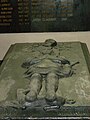 Grafsteen van Victor van Dixmude.jpg 1,920 × 2,560; 2.61 MB
-
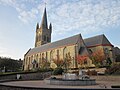 Hooglede Sint-Amandskerk.JPG 2,592 × 1,944; 1.22 MB
-
 Hooglede.JPG 2,048 × 1,536; 1.1 MB
-
 Lijst van Pastoors van Hooglede.jpg 2,824 × 2,132; 1.29 MB
-
 Monument Eerste Wereldoorlog - Hooglede.jpg 2,393 × 1,477; 754 KB
-
 Preekstoel hooglede.JPG 1,405 × 2,080; 566 KB
-
 Sint-Amanduskerk zijkant.JPG 2,080 × 1,544; 251 KB
-
 Sint-Amanduskerk.JPG 1,544 × 2,080; 408 KB


