Category:Southern Netherlands
Jump to navigation
Jump to search
historical region in Belgium | |||||
| Upload media | |||||
| Instance of | |||||
|---|---|---|---|---|---|
| Part of | |||||
| Different from | |||||
| |||||
Subcategories
This category has the following 20 subcategories, out of 20 total.
Media in category "Southern Netherlands"
The following 24 files are in this category, out of 24 total.
-
 A Map of the Netherlands or Low Countries in 1713 by Emanuel Bowen.jpg 1,753 × 1,643; 756 KB
-
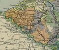
 Austrian Netherlands map-es.svg 3,912 × 2,872; 470 KB
-
 Austrian Netherlands map-fr.svg 3,912 × 2,872; 457 KB
-
 Carte leurs provinces, tels qu'en 1789 hu.svg 785 × 579; 666 KB
-

-
 Carte montrant les Pays-Bas autrichiens et leurs provinces, tels qu'en 1789-es.svg 4,163 × 3,060; 794 KB
-
 Carte montrant les Pays-Bas autrichiens et leurs provinces, tels qu'en 1789.svg 3,903 × 2,869; 519 KB
-
 Catholic (Southern) Netherlands by Vaugondy 1748.jpg 700 × 571; 92 KB
-
 Christ's Entry into Jerusalem MET sf-rlc-1975-1-2471-r.jpeg 436 × 642; 150 KB
-
 Christ's Entry into Jerusalem MET sf-rlc-1975-1-2471-v.jpeg 437 × 657; 91 KB
-
 Dalhem-comte.jpg 1,677 × 1,537; 478 KB
-
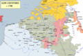 Low Countries 1700.png 1,520 × 1,028; 582 KB
-
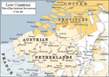 Low Countries 1740.png 813 × 575; 225 KB
-
 Map of Austrian Netherlands 1789.svg 880 × 650; 448 KB
-
 OoNL1786.png 565 × 481; 539 KB
-
 PaísesBajosAustriacos1786.svg 2,623 × 2,233; 621 KB
-
 Places de la Barrière des Pays-Bas autrichiens contre la France en 1715-fr.svg 3,903 × 2,869; 518 KB
-
 Rakouské Nizozemí v roce 1789.svg 883 × 647; 394 KB
-
 Reilly 177.jpg 1,659 × 921; 751 KB
-

-

-
 Share No. 4527 of the Ostend East India Company.jpg 575 × 913; 120 KB
-
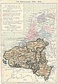 Southern Netherlands map 001.jpg 1,320 × 1,919; 582 KB
-
 Southern Netherlands map 002.jpg 1,320 × 1,919; 580 KB


_Netherlands_by_Vaugondy_1748.jpg)


_Schouwburg_van_den_Oorlog,_Beginnende_van_Ko,_RP-P-OB-83.039-19.jpg)


