Category:Southville (ward)
Jump to navigation
Jump to search
electoral ward of the unitary authority of Bristol  | |||||
| Upload media | |||||
| Instance of |
| ||||
|---|---|---|---|---|---|
| Location | City of Bristol, South West England, England | ||||
| Different from | |||||
 | |||||
Subcategories
This category has the following 5 subcategories, out of 5 total.
A
- Ashton Avenue Bridge (25 F)
- Ashton Gate railway station (16 F)
C
- Clifton Bridge railway station (14 F)
G
- Greville Smyth Park (4 F)
Media in category "Southville (ward)"
The following 200 files are in this category, out of 391 total.
(previous page) (next page)-
 A big pair of eyes on the Co-op - geograph.org.uk - 6257998.jpg 3,296 × 2,472; 3.35 MB
-
 A busy junction approaching Bristol's south west entry - geograph.org.uk - 5906200.jpg 2,304 × 1,704; 1.7 MB
-
 A change of course - geograph.org.uk - 6274253.jpg 3,296 × 2,472; 3.44 MB
-
 A corner shop in North Street - geograph.org.uk - 6257062.jpg 3,296 × 2,472; 3.29 MB
-
 A foggy day along Bower Ashton Terrace - geograph.org.uk - 6356254.jpg 3,296 × 2,472; 1.85 MB
-
 A forgotten mooring post on the banks of the Avon - geograph.org.uk - 6355587.jpg 2,472 × 3,296; 1.72 MB
-
 A gatehouse restored to use - geograph.org.uk - 5908164.jpg 2,304 × 1,704; 1.68 MB
-
 A gatehouse with glass and spikes - geograph.org.uk - 5908086.jpg 2,304 × 1,704; 1.61 MB
-
 A humble sink - geograph.org.uk - 5908174.jpg 1,704 × 2,304; 1.3 MB
-
 A lattice suspension - geograph.org.uk - 6189518.jpg 2,472 × 3,296; 3.13 MB
-
 A little patch of green in the suburbs - geograph.org.uk - 6258716.jpg 3,296 × 2,472; 3.33 MB
-
 A maze on a garage - geograph.org.uk - 6274138.jpg 3,296 × 2,472; 3.3 MB
-
 A mist on the bridge - geograph.org.uk - 6355616.jpg 3,296 × 2,472; 1.85 MB
-
 A new shape at the Gate - geograph.org.uk - 5906949.jpg 2,304 × 1,704; 1.31 MB
-
 A protected environmental site - geograph.org.uk - 6355570.jpg 3,296 × 2,472; 1.88 MB
-
 A riot of blossom - geograph.org.uk - 6445724.jpg 3,994 × 2,962; 6.82 MB
-
 A school asset - geograph.org.uk - 5908118.jpg 1,704 × 2,304; 1.66 MB
-
 A slippery road^ - geograph.org.uk - 6274261.jpg 3,296 × 2,472; 3.23 MB
-
 A thing for heights - geograph.org.uk - 5906867.jpg 2,304 × 1,704; 1.6 MB
-
 A370 Brunel Way - geograph.org.uk - 5818144.jpg 1,024 × 751; 117 KB
-
 Access Self Storage, Ashton Gate - geograph.org.uk - 6171945.jpg 1,920 × 1,280; 1.08 MB
-
 Access towers in the mist - geograph.org.uk - 6356257.jpg 3,296 × 2,472; 1.83 MB
-
 Across the Cut - geograph.org.uk - 6440728.jpg 4,682 × 3,122; 5.75 MB
-
 All manner of creations - geograph.org.uk - 5531970.jpg 2,304 × 1,704; 1.65 MB
-
 Allowing for some movement - geograph.org.uk - 6269391.jpg 2,472 × 3,296; 3.18 MB
-
 An eye-catching mural at the back of Bedminster Cricket Club - geograph.org.uk - 6355535.jpg 3,296 × 2,472; 1.83 MB
-
 An old benchmark on the Clifton Bridge Overbridge - geograph.org.uk - 6355337.jpg 3,296 × 2,472; 2.8 MB
-
 An owl and a very large pussycat - geograph.org.uk - 6257072.jpg 3,296 × 2,472; 3.29 MB
-

-
 Asda Bedminster car park - geograph.org.uk - 6274163.jpg 3,296 × 2,472; 3.41 MB
-
 Ashton Avenue Bridge - geograph.org.uk - 5699485.jpg 640 × 480; 69 KB
-
 Ashton Avenue Bridge - geograph.org.uk - 6454298.jpg 4,808 × 3,205; 6.73 MB
-
 Ashton Avenue Bridge - geograph.org.uk - 6462965.jpg 4,124 × 2,857; 4 MB
-
 Ashton Avenue Swing Bridge disappearing in the mist - geograph.org.uk - 6355614.jpg 3,296 × 2,472; 1.8 MB
-
 Ashton Bridge, New Cut - geograph.org.uk - 6440753.jpg 4,248 × 2,958; 3.61 MB
-
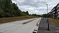 Ashton busway.jpg 5,312 × 2,988; 4.67 MB
-
 Ashton Gate & Bridge.jpg 1,024 × 768; 49 KB
-
 Ashton Gate Football Stadium - geograph.org.uk - 5911332.jpg 4,000 × 3,000; 2.38 MB
-

-
 Ashton Gate Junior School - geograph.org.uk - 5699339.jpg 640 × 480; 71 KB
-
 Ashton Gate Primary School - geograph.org.uk - 5699026.jpg 640 × 480; 107 KB
-
 Ashton Gate Primary School - geograph.org.uk - 5699342.jpg 640 × 480; 76 KB
-
 Ashton Gate Toll House, North Street - geograph.org.uk - 6058932.jpg 1,024 × 633; 148 KB
-
 Ashton Gate Underpass in the fog - geograph.org.uk - 6355626.jpg 3,296 × 2,472; 1.85 MB
-
 Ashton Gatehouse - geograph.org.uk - 5908079.jpg 1,704 × 2,304; 1.66 MB
-
 Ashton Road at the corner of Clift Road - geograph.org.uk - 6170157.jpg 1,920 × 1,280; 1.13 MB
-
 Ashton Road, Ashton Gate - geograph.org.uk - 6173164.jpg 1,920 × 1,280; 1.44 MB
-
 Ashton Road, Ashton Gate - geograph.org.uk - 6174161.jpg 1,920 × 1,280; 880 KB
-
 At Ashton Court (3) - geograph.org.uk - 6476268.jpg 3,817 × 2,755; 3.99 MB
-
 At the bottom of Greville Street - geograph.org.uk - 6263036.jpg 3,296 × 2,472; 3.38 MB
-
 Avon Bridge - geograph.org.uk - 6442726.jpg 4,787 × 3,192; 4.99 MB
-
 Avon Bridge - geograph.org.uk - 6444397.jpg 4,528 × 2,950; 3.08 MB
-
 Avon footbridge - geograph.org.uk - 6473710.jpg 3,343 × 2,287; 4.12 MB
-
 Avon New Cut - geograph.org.uk - 6473716.jpg 4,312 × 3,067; 5.35 MB
-
 Balfour Road's new homes - geograph.org.uk - 6263906.jpg 3,099 × 2,324; 1.99 MB
-
 Bath Road - geograph.org.uk - 6457544.jpg 4,671 × 3,186; 4.7 MB
-
 Beauley Road, Bristol - geograph.org.uk - 5698953.jpg 640 × 480; 64 KB
-
 Bedminster Bridge - geograph.org.uk - 6456945.jpg 4,896 × 3,264; 6.04 MB
-
 Bedminster identity parade - geograph.org.uk - 5531924.jpg 1,704 × 2,304; 1.57 MB
-
 Bedminster institutions - geograph.org.uk - 5532235.jpg 1,704 × 2,304; 1.39 MB
-
 Bedminster Parade in the sunlight - geograph.org.uk - 6274185.jpg 3,296 × 2,472; 3.29 MB
-
 Bedminster Parade, Bristol - geograph.org.uk - 6170895.jpg 1,848 × 1,162; 962 KB
-
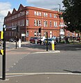
 Bedminster Station - geograph.org.uk - 5994330.jpg 1,024 × 681; 192 KB
-
 Bedminster Station - geograph.org.uk - 5994380.jpg 1,024 × 681; 197 KB
-
 Bedminster Station - geograph.org.uk - 5994382.jpg 1,024 × 681; 209 KB
-
 Bedminsterroundabout.jpg 640 × 480; 91 KB
-
 Benchmark on Lime Street - geograph.org.uk - 6257063.jpg 3,296 × 2,472; 3.59 MB
-
 Beware of the car traps^ - geograph.org.uk - 6356175.jpg 3,296 × 2,472; 1.89 MB
-
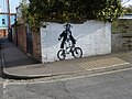
 Biking outside the Hen and Chicken - geograph.org.uk - 6257077.jpg 3,296 × 2,472; 3.4 MB
-
 Boundary stone outside the old police buildings - geograph.org.uk - 6355311.jpg 3,296 × 2,472; 2.61 MB
-
 Boundary stone, odd stone - geograph.org.uk - 6355297.jpg 3,296 × 2,472; 1.8 MB
-
 Bower Ashton Campus, UWE Bristol - geograph.org.uk - 5911294.jpg 4,000 × 3,000; 2.51 MB
-
 Brick Arches - geograph.org.uk - 6477796.jpg 2,024 × 1,428; 1.19 MB
-
 Bridge across the muddy Avon - geograph.org.uk - 6207401.jpg 1,024 × 576; 195 KB
-
 Bridge over the River Avon - geograph.org.uk - 5994390.jpg 1,024 × 570; 125 KB
-
 Bristol , Clift House Road - geograph.org.uk - 2392351.jpg 3,264 × 2,448; 2.6 MB
-
 Bristol Apartments (1) - geograph.org.uk - 6458153.jpg 4,896 × 3,264; 6.8 MB
-
 Bristol Apartments (18) - geograph.org.uk - 6458296.jpg 3,613 × 2,629; 3.36 MB
-
 Bristol Apartments (2) - geograph.org.uk - 6458157.jpg 2,975 × 4,270; 3.99 MB
-
 Bristol Archives - geograph.org.uk - 6444398.jpg 4,624 × 3,184; 4.13 MB
-
 Bristol Beer Factory - geograph.org.uk - 5699446.jpg 640 × 480; 74 KB
-
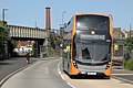
 Bristol Cumberland - Basin First 37609 (WX58JXT).jpg 1,024 × 768; 215 KB
-
 Bristol Cumberland Basin - First 36808 (YM17FKA).JPG 1,366 × 910; 299 KB
-
 Bristol Cumberland Basin - First 36836 (YP67XDL).JPG 1,366 × 910; 257 KB
-
 Bristol MMB V7 Cumberland Basin.jpg 2,304 × 1,728; 1.22 MB
-
 Bristol MMB V8 Cumberland Basin.jpg 2,304 × 1,728; 1.45 MB
-
 Bristol MMB W3 Cumberland Basin.jpg 2,304 × 1,728; 1.66 MB
-
 Bristol MMB W8 Cumberland Basin.jpg 1,681 × 1,727; 591 KB
-
 Bristol MMB «I2 Bristol to Exeter Line 220004.jpg 3,663 × 2,298; 2.8 MB
-
 Bristol MMB «I9 Windmill Hill.jpg 3,807 × 2,196; 2.97 MB
-
 Bristol MMB «J0 Bristol to Exeter Line.jpg 3,861 × 2,388; 3.75 MB
-
 Bristol MMB «J1 Bristol to Exeter Line.jpg 3,805 × 2,499; 4.52 MB
-
 Bristol Pubs (11) - geograph.org.uk - 6450253.jpg 2,843 × 4,033; 3.61 MB
-
 Bristol Pubs (15) - geograph.org.uk - 6450290.jpg 3,581 × 2,648; 2.77 MB
-
 Bristol Pubs (20) - geograph.org.uk - 6457887.jpg 2,378 × 3,380; 1.87 MB
-
 Bristol Pubs (5) - geograph.org.uk - 6450004.jpg 4,597 × 3,064; 4.57 MB
-
 Bristol Pubs (6) - geograph.org.uk - 6450012.jpg 4,561 × 3,150; 4.78 MB
-
 Bristol South Baths entrance - geograph.org.uk - 6263879.jpg 2,472 × 3,296; 3.25 MB
-
 Bristol South swimming baths - geograph.org.uk - 6271829.jpg 2,472 × 3,296; 3.23 MB
-
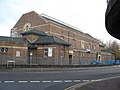
 Bristol South Swimming Pool - geograph.org.uk - 5698356.jpg 640 × 480; 90 KB
-
 Bristol South Swimming Pool - geograph.org.uk - 609787.jpg 640 × 480; 74 KB
-
 Bristol southville.png 702 × 780; 148 KB
-
 Bristol Steam 78' at Ashton Park - geograph.org.uk - 6406415.jpg 1,801 × 1,201; 410 KB
-
 Bristol Steam 78' at Ashton Park - Steam crane - geograph.org.uk - 6406416.jpg 1,799 × 1,199; 427 KB
-

-
 Bristol sunset TF800ISO.jpg 3,069 × 1,965; 1.78 MB
-
 Bristol Temple Meads Station - geograph.org.uk - 5631468.jpg 640 × 426; 61 KB
-
 Brunel Way - geograph.org.uk - 5699481.jpg 640 × 480; 50 KB
-
 Brunel Way Pump Track - geograph.org.uk - 5634968.jpg 800 × 600; 171 KB
-
 Brunel Way, Ashton Gate - geograph.org.uk - 6171946.jpg 1,824 × 1,116; 1.15 MB
-
 Cameron Balloons premises, Bedminster, Bristol - geograph.org.uk - 5919605.jpg 996 × 1,024; 228 KB
-
 Canada Way - geograph.org.uk - 6444404.jpg 4,896 × 3,264; 6.17 MB
-
 Canada Way bridge - geograph.org.uk - 6356232.jpg 3,296 × 2,472; 1.8 MB
-
 Catherine's House - geograph.org.uk - 6274260.jpg 3,296 × 2,472; 3.3 MB
-
 Celebrating Bristol in 3D - geograph.org.uk - 6269392.jpg 3,296 × 2,472; 3.49 MB
-
 Church Lane houses, Bedminster, Bristol - geograph.org.uk - 5912883.jpg 1,024 × 779; 193 KB
-
 Church Lane, Bedminster, Bristol - geograph.org.uk - 5912852.jpg 1,024 × 774; 209 KB
-
 Circular Cast Iron Urinal, Mill Lane, Bedminster - geograph.org.uk - 6060005.jpg 895 × 1,024; 156 KB
-
 Clanage Road in the fog - geograph.org.uk - 6355239.jpg 3,296 × 2,472; 2.48 MB
-
 Clarke Street, Bedminster - geograph.org.uk - 6274257.jpg 3,296 × 2,472; 3.4 MB
-
 Clifton Suspension Bridge 1935 - geograph.org.uk - 5815104.jpg 640 × 447; 70 KB
-
 Colliter's Brook takes a sharp left - geograph.org.uk - 6356266.jpg 3,296 × 2,472; 1.86 MB
-
 Colliters Brook - geograph.org.uk - 6465575.jpg 3,579 × 2,543; 3.67 MB
-
 Colourful art on a house on Catherine Mead Street - geograph.org.uk - 6258719.jpg 3,296 × 2,472; 2.46 MB
-
 Containers - geograph.org.uk - 5631463.jpg 640 × 425; 45 KB
-
 Coronation Cafe, Bristol - geograph.org.uk - 2136177.jpg 1,024 × 768; 170 KB
-
 Coronation Road, Bristol - geograph.org.uk - 5699515.jpg 640 × 480; 70 KB
-
 Coronation Road, Southville - geograph.org.uk - 6173159.jpg 1,920 × 1,280; 1.04 MB
-
 Creative mural - geograph.org.uk - 6263033.jpg 3,296 × 2,472; 3.21 MB
-
 Crossing East Street - geograph.org.uk - 6454576.jpg 4,896 × 3,264; 5.68 MB
-
 Crossing Gaol Ferry Bridge - geograph.org.uk - 6453666.jpg 4,721 × 3,264; 6.56 MB
-
 Cut and Dried - geograph.org.uk - 6440751.jpg 4,284 × 2,978; 3.86 MB
-
 Cut Mark, Bristol, The Tobacco Factory - geograph.org.uk - 5702341.jpg 960 × 1,280; 395 KB
-
-
 Dame Emily Park - geograph.org.uk - 5698369.jpg 640 × 480; 111 KB
-
 Dean Lane Park.jpg 116 × 240; 17 KB
-
 Designer Utility - geograph.org.uk - 6453652.jpg 4,603 × 3,175; 6.41 MB
-
 Disused building with asbestos - geograph.org.uk - 6356226.jpg 3,296 × 2,472; 1.86 MB
-
 Early Riser - geograph.org.uk - 6454584.jpg 3,993 × 2,917; 3.44 MB
-
 Edmundson Electrical, Bedminster, Bristol - geograph.org.uk - 5912705.jpg 1,024 × 785; 177 KB
-
 Embarkation point - geograph.org.uk - 6457203.jpg 2,754 × 1,952; 1.86 MB
-
 Entering Dame Emily Park - geograph.org.uk - 6271815.jpg 3,296 × 2,472; 3.5 MB
-
 Entering North Street - geograph.org.uk - 6454579.jpg 4,534 × 3,166; 3.97 MB
-
 Entrance Lock (sealed) - geograph.org.uk - 6473695.jpg 1,853 × 1,369; 1.32 MB
-
 Festival Way fun and games - geograph.org.uk - 6356217.jpg 3,296 × 2,472; 1.85 MB
-
 Footbridge over Portishead Way - geograph.org.uk - 5906871.jpg 2,304 × 1,704; 1.79 MB
-

-
 Former Railway Sidings - geograph.org.uk - 6460487.jpg 4,256 × 2,804; 5.42 MB
-
 Former Tobacco Factory, Bedminster - geograph.org.uk - 5698048.jpg 640 × 480; 82 KB
-
 From colour to comfort - geograph.org.uk - 5532123.jpg 2,304 × 1,704; 1.71 MB
-
 From Norfolk Place - geograph.org.uk - 5531934.jpg 1,704 × 2,304; 1.68 MB
-
 Gaol Ferry Bridge from below - geograph.org.uk - 6271877.jpg 3,296 × 2,472; 3.47 MB
-
 Gaol Ferry Bridge, Bristol - geograph.org.uk - 5699516.jpg 640 × 480; 105 KB
-
 Gaol Ferry Bridge, Bristol - geograph.org.uk - 5907916.jpg 1,024 × 750; 770 KB
-
 Gatehouse upper room - geograph.org.uk - 5908183.jpg 2,304 × 1,704; 1.27 MB
-
 Give us a ring - geograph.org.uk - 5532092.jpg 1,704 × 2,304; 1.35 MB
-
 Giving Bristol a higher profile - geograph.org.uk - 6268312.jpg 2,472 × 3,296; 2.98 MB
-
 GPS and EPC Direct, Bedminster, Bristol - geograph.org.uk - 6200579.jpg 1,600 × 958; 334 KB
-
 Graffiti on a Bedminster corner, Bristol - geograph.org.uk - 6200159.jpg 1,600 × 1,200; 532 KB
-
 Graffito - geograph.org.uk - 6453491.jpg 3,480 × 2,627; 5.75 MB
-
 Greville Smyth Community Bowls Club - geograph.org.uk - 5699456.jpg 640 × 480; 89 KB
-
 Greville Smyth Park - geograph.org.uk - 6444827.jpg 4,896 × 3,264; 5.65 MB
-
 Greville Smyth Park - geograph.org.uk - 6444843.jpg 4,896 × 3,264; 5.99 MB
-
 Greville Smyth Park - geograph.org.uk - 6445721.jpg 4,896 × 3,264; 6.3 MB
-
 Greville Smyth Park - geograph.org.uk - 6458964.jpg 4,896 × 3,264; 6.13 MB
-
 Greville Smyth Park by Ashton Road - geograph.org.uk - 6171944.jpg 1,920 × 1,280; 1.91 MB
-
 Greville Smyth Park on Clift House Road - geograph.org.uk - 2470383.jpg 1,500 × 1,000; 330 KB
-
 Greville Smyth Park, Ashton Gate - geograph.org.uk - 5699452.jpg 640 × 480; 115 KB
-
 Greville Smyth Park, Ashton Gate - geograph.org.uk - 6171942.jpg 1,920 × 1,280; 1.96 MB
-
 Grow your own^ - geograph.org.uk - 6454678.jpg 3,894 × 2,674; 5.17 MB
-
 Hair, Beauty and colourful coral - geograph.org.uk - 6263021.jpg 3,296 × 2,472; 3.29 MB
-
 Handsome terrace houses on Coronation Road, Southville - geograph.org.uk - 2233630.jpg 3,788 × 2,841; 3.57 MB
-
 Helping the light - geograph.org.uk - 5532223.jpg 1,704 × 2,304; 1.56 MB
-
 Hereford Street signpost, Bedminster, Bristol - geograph.org.uk - 6200543.jpg 1,405 × 1,600; 572 KB
-
 Hereford Street, Bedminster, Bristol - geograph.org.uk - 6200550.jpg 1,600 × 1,189; 540 KB
-
 Hobbs House Bakery, - geograph.org.uk - 5698918.jpg 640 × 480; 78 KB
-
 Holy Cross Catholic Church - geograph.org.uk - 5698352.jpg 640 × 480; 76 KB
-
 Holy Trinity church, Dean Lane - geograph.org.uk - 6263887.jpg 3,296 × 2,472; 3.23 MB
-
 House with plaque, Raleigh Road - geograph.org.uk - 5698996.jpg 640 × 480; 59 KB
-
 Houses of Bristol (16) - geograph.org.uk - 6465906.jpg 3,584 × 2,608; 3.47 MB
-
 Houses of Bristol (17) - geograph.org.uk - 6465908.jpg 1,124 × 836; 367 KB
-
 Houses of Bristol (26) - geograph.org.uk - 6469543.jpg 4,708 × 3,139; 3.62 MB
-
 Houses of Bristol (27) - geograph.org.uk - 6469549.jpg 4,590 × 3,020; 3.09 MB
-
 Houses of Bristol (28) - geograph.org.uk - 6469554.jpg 4,160 × 2,905; 4.04 MB
-
 Houses of Bristol (29) - geograph.org.uk - 6469572.jpg 4,896 × 3,264; 4.84 MB
-
 Houses of Bristol (30) - geograph.org.uk - 6469576.jpg 3,925 × 2,849; 5.35 MB
-
 Houses of Bristol (31) - geograph.org.uk - 6469891.jpg 3,980 × 2,808; 2.85 MB
-
 Houses of Bristol (32) - geograph.org.uk - 6469896.jpg 3,026 × 4,042; 4.17 MB
-
 Houses of Bristol (33) - geograph.org.uk - 6469898.jpg 2,403 × 3,172; 1.91 MB
-
 Houses of Bristol (34) - geograph.org.uk - 6469903.jpg 2,754 × 3,936; 3.94 MB
-
 Houses of Bristol (35) - geograph.org.uk - 6469910.jpg 4,377 × 3,045; 4.1 MB
-
 Houses of Bristol (36) - geograph.org.uk - 6470227.jpg 3,130 × 4,084; 2.98 MB
-
 Houses of Bristol (37) - geograph.org.uk - 6470236.jpg 3,023 × 3,910; 2.87 MB
-
 Houses of Bristol (38) - geograph.org.uk - 6470239.jpg 3,063 × 4,040; 2.42 MB
-
 Houses of Bristol (4) - geograph.org.uk - 6464778.jpg 3,854 × 2,877; 5.08 MB
-
 Houses of Bristol (5) - geograph.org.uk - 6464786.jpg 4,735 × 3,157; 5 MB
-
 Houses on St Luke's Crescent - geograph.org.uk - 6174635.jpg 1,673 × 1,150; 529 KB
-
 Hunters estate agents - geograph.org.uk - 6271810.jpg 2,472 × 3,296; 3.16 MB
-
 I'm tired of humans - geograph.org.uk - 5531938.jpg 2,304 × 1,704; 1.68 MB
-
 I've got my eye on you^ - geograph.org.uk - 5699450.jpg 640 × 480; 72 KB


_-_geograph.org.uk_-_6476268.jpg)


_-_geograph.org.uk_-_6458153.jpg)
_-_geograph.org.uk_-_6458296.jpg)
_-_geograph.org.uk_-_6458157.jpg)


.jpg)
.JPG)
.JPG)


_-_geograph.org.uk_-_6450253.jpg)
_-_geograph.org.uk_-_6450290.jpg)
_-_geograph.org.uk_-_6457887.jpg)
_-_geograph.org.uk_-_6450004.jpg)
_-_geograph.org.uk_-_6450012.jpg)


_-_geograph.org.uk_-_6473695.jpg)


_-_geograph.org.uk_-_6465906.jpg)
_-_geograph.org.uk_-_6465908.jpg)
_-_geograph.org.uk_-_6469543.jpg)
_-_geograph.org.uk_-_6469549.jpg)
_-_geograph.org.uk_-_6469554.jpg)
_-_geograph.org.uk_-_6469572.jpg)
_-_geograph.org.uk_-_6469576.jpg)
_-_geograph.org.uk_-_6469891.jpg)
_-_geograph.org.uk_-_6469896.jpg)
_-_geograph.org.uk_-_6469898.jpg)
_-_geograph.org.uk_-_6469903.jpg)
_-_geograph.org.uk_-_6469910.jpg)
_-_geograph.org.uk_-_6470227.jpg)
_-_geograph.org.uk_-_6470236.jpg)
_-_geograph.org.uk_-_6470239.jpg)
_-_geograph.org.uk_-_6464778.jpg)
_-_geograph.org.uk_-_6464786.jpg)


&filefrom=IMO+Attended+Car+Wash%2C+Bedminster%2C+Bristol+-+geograph.org.uk+-+5919596.jpg#mw-category-media)