Category:Spey Bay
Jump to navigation
Jump to search
village in Moray, Scotland, UK  | |||||
| Upload media | |||||
| Instance of | |||||
|---|---|---|---|---|---|
| Location |
| ||||
| Different from | |||||
 | |||||
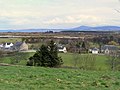
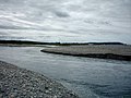
English: Spey Bay is a small settlement in Moray, Scotland. It is situated at the eastern side of the mouth of the River Spey on the coast of the Moray Firth between the village of Kingston on the western side of the Spey, and the fishing port of Buckie to the east.
Subcategories
This category has the following 3 subcategories, out of 3 total.
S
- Spey Bay railway station (4 F)
T
- Tugnet Ice House (11 F)
- Tugnet Wildlife Centre (6 F)
Media in category "Spey Bay"
The following 65 files are in this category, out of 65 total.
-
 18th Fairway at Spey Bay Golf Club.JPG 2,048 × 1,536; 871 KB
-
 18th Green at Spey Bay Golf Club.jpg 2,048 × 1,536; 893 KB
-
 1st Fairway at Spey Bay Golf Club.JPG 2,048 × 1,536; 845 KB
-
 Beach at Tugnet - geograph.org.uk - 3702986.jpg 640 × 428; 91 KB
-
 Beach near the mouth of the Spey - geograph.org.uk - 6456103.jpg 1,600 × 1,067; 463 KB
-
 Building Site - geograph.org.uk - 5284513.jpg 640 × 427; 342 KB
-
 Burn of Tynet enters Spey Bay - geograph.org.uk - 86366.jpg 640 × 427; 76 KB
-
 Close-up of the inscription (OpenBenches 2691).jpg 2,048 × 1,536; 1.23 MB
-
 Cottage at Spey Bay - geograph.org.uk - 5284519.jpg 640 × 427; 343 KB
-
 Driftwood on the beach, Spey Bay - geograph.org.uk - 5555547.jpg 1,600 × 1,200; 559 KB
-
 Floods and Water Tower - geograph.org.uk - 5284495.jpg 640 × 427; 282 KB
-
 He Liked This Place - panoramio.jpg 4,320 × 3,240; 6.21 MB
-
 Houses at Spey Bay - geograph.org.uk - 3124965.jpg 2,272 × 1,704; 1.71 MB
-
 Lakiehead - geograph.org.uk - 5284503.jpg 640 × 427; 265 KB
-
 Long shot of the bench (OpenBenches 2691-1).jpg 2,048 × 1,536; 1.76 MB
-
 Looking out to Spey Bay - geograph.org.uk - 4261083.jpg 2,523 × 1,819; 1.19 MB
-
 Looking towards Spey Bay - geograph.org.uk - 749500.jpg 640 × 480; 80 KB
-
 Lyle, Montgomerie and Torrance - geograph.org.uk - 5284502.jpg 640 × 427; 273 KB
-
 Mor Abair - geograph.org.uk - 5284521.jpg 640 × 427; 295 KB
-
 Mouth of the Spey - geograph.org.uk - 3703002.jpg 640 × 428; 78 KB
-
 Old railway cutting, Nether Dallachy, Spey Bay,.JPG 4,608 × 3,456; 6.64 MB
-
 Old railway, Nether Dallachy, Spey Bay, Scotland.JPG 4,554 × 3,384; 5.67 MB
-
 Photographers at the mouth of the Spey - geograph.org.uk - 6456100.jpg 1,600 × 1,067; 415 KB
-
 Portgordon - geograph.org.uk - 3354613.jpg 3,872 × 2,592; 2.26 MB
-
 Scottish Dolphin Centre and Tugnet Ice House - geograph.org.uk - 5555900.jpg 1,600 × 1,092; 518 KB
-
 Shingle bank, Spey Bay - geograph.org.uk - 5555542.jpg 1,600 × 1,200; 466 KB
-
 Shingle Beach - geograph.org.uk - 580940.jpg 640 × 415; 282 KB
-
 Shingle Beach at Spey Bay - geograph.org.uk - 850314.jpg 640 × 391; 268 KB
-
 Shingle Ridges - geograph.org.uk - 580936.jpg 640 × 413; 285 KB
-
 Shingle Spit at Tugnet - geograph.org.uk - 6898290.jpg 1,024 × 683; 592 KB
-
 Site of Spey Bay Hotel - geograph.org.uk - 5284508.jpg 640 × 427; 264 KB
-
 Spey Bay - geograph.org.uk - 162782.jpg 640 × 480; 78 KB
-
 Spey Bay - geograph.org.uk - 5284482.jpg 640 × 427; 281 KB
-
 Spey Bay - geograph.org.uk - 5284515.jpg 640 × 427; 275 KB
-
 Spey Bay - geograph.org.uk - 5284517.jpg 640 × 427; 330 KB
-
 Spey Bay - geograph.org.uk - 58651.jpg 640 × 427; 137 KB
-
 Spey Bay - geograph.org.uk - 6359.jpg 640 × 345; 200 KB
-
 Spey Bay - geograph.org.uk - 6675.jpg 640 × 231; 105 KB
-
 Spey Bay - geograph.org.uk - 73204.jpg 640 × 427; 124 KB
-
 Spey Bay - geograph.org.uk - 73219.jpg 640 × 427; 135 KB
-
 Spey Bay - geograph.org.uk - 73225.jpg 640 × 427; 136 KB
-
 Spey Bay Golf Club - geograph.org.uk - 2540464.jpg 640 × 359; 186 KB
-
 Spey Bay Golf Club - geograph.org.uk - 2745326.jpg 640 × 359; 84 KB
-
 Spey Bay Golf Club - geograph.org.uk - 5284505.jpg 640 × 427; 289 KB
-
 Spey Bay Golf Course - geograph.org.uk - 326182.jpg 640 × 480; 59 KB
-
 Spey Bay Hotel - geograph.org.uk - 326185.jpg 640 × 480; 56 KB
-
 Spey Bay Hotel - geograph.org.uk - 4368426.jpg 640 × 404; 227 KB
-
 Spey Bay Hotel - geograph.org.uk - 4368433.jpg 640 × 406; 253 KB
-
 Spey Bay Hotel - geograph.org.uk - 4368435.jpg 640 × 386; 226 KB
-
 Spey Bay Hotel, 1961 - geograph.org.uk - 4213759.jpg 2,359 × 1,106; 1.22 MB
-

-
 Spey Bay Osprey - geograph.org.uk - 162773.jpg 640 × 480; 44 KB
-
 Spey Bay railway station site.JPG 4,286 × 2,394; 3.82 MB
-
 Spey Cottage - geograph.org.uk - 5284526.jpg 640 × 427; 320 KB
-
 Speybay - panoramio.jpg 3,947 × 2,929; 2.99 MB
-
 Sunset Spey Bay Nature Reserve - geograph.org.uk - 6414043.jpg 1,024 × 683; 209 KB
-
 The Beach at Spey Bay - geograph.org.uk - 3079606.jpg 640 × 480; 97 KB
-
 The Estuary at Spey Bay - geograph.org.uk - 733037.jpg 640 × 480; 84 KB
-
 The mouth of the Spey - geograph.org.uk - 5555906.jpg 1,600 × 1,035; 433 KB
-
 The Spey meets the sea - geograph.org.uk - 59000.jpg 640 × 427; 104 KB
-
 The Tugnet Osprey - geograph.org.uk - 6672.jpg 426 × 640; 182 KB
-
 Tugnet Sundial - geograph.org.uk - 3558636.jpg 640 × 480; 473 KB
-
 Weatherworn Shed - geograph.org.uk - 5304437.jpg 4,272 × 2,848; 1.66 MB
-
 Where once a Hotel - geograph.org.uk - 5304380.jpg 4,272 × 2,848; 1.81 MB
-
 River Spey entrance - geograph.org.uk - 23961.jpg 480 × 640; 76 KB


.jpg)


.jpg)


