Category:St. Georg (Böhen)
Jump to navigation
Jump to search
| Object location | | View all coordinates using: OpenStreetMap |
|---|
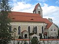
church building in Böhen, Bavaria, Germany _2.JPG) _24.JPG) | |||||
| Upload media | |||||
| Instance of | |||||
|---|---|---|---|---|---|
| Named after | |||||
| Location | Böhen, Unterallgäu, Swabia, Bavaria, Germany | ||||
| Street address |
| ||||
| Heritage designation | |||||
 | |||||
Subcategories
This category has only the following subcategory.
P
- Pulpit of St. Georg (Böhen) (2 F)
Media in category "St. Georg (Böhen)"
The following 46 files are in this category, out of 46 total.
-
 Blick vom Günztal - panoramio.jpg 2,816 × 2,120; 1.47 MB
-
 Böhen Kirche - panoramio.jpg 4,000 × 3,000; 4.83 MB
-
 Böhen Nagelfluh.jpg 2,816 × 2,120; 723 KB
-
 Böhen Pferd.jpg 2,816 × 2,120; 1.44 MB
-
 Der Hl.Georg im Kampf mit dem Drachen - panoramio.jpg 2,816 × 2,120; 1.45 MB
-
 Kirche Innenraum - panoramio.jpg 2,816 × 2,120; 1.43 MB
-
 St. Georg (Böhen) 1.JPG 2,592 × 1,944; 1.56 MB
-
 St. Georg (Böhen) 10.JPG 2,592 × 1,944; 1.56 MB
-
 St. Georg (Böhen) 11.JPG 1,944 × 2,592; 1.6 MB
-
 St. Georg (Böhen) 12.JPG 1,944 × 2,592; 1.91 MB
-
 St. Georg (Böhen) 13.JPG 1,944 × 2,592; 1.63 MB
-
 St. Georg (Böhen) 14.JPG 1,944 × 2,592; 1.86 MB
-
 St. Georg (Böhen) 15.JPG 2,592 × 1,944; 1.59 MB
-
 St. Georg (Böhen) 16.JPG 2,592 × 1,944; 1.46 MB
-
 St. Georg (Böhen) 17.JPG 2,592 × 1,944; 1.6 MB
-
 St. Georg (Böhen) 18.JPG 2,592 × 1,944; 1.29 MB
-
 St. Georg (Böhen) 19.JPG 2,592 × 1,944; 1.42 MB
-
 St. Georg (Böhen) 2.JPG 2,592 × 1,944; 1.22 MB
-
 St. Georg (Böhen) 20.JPG 1,944 × 2,592; 1.63 MB
-
 St. Georg (Böhen) 21.JPG 1,944 × 2,592; 1.55 MB
-
 St. Georg (Böhen) 22.JPG 1,944 × 2,592; 1.85 MB
-
 St. Georg (Böhen) 23.JPG 2,592 × 1,944; 2.07 MB
-
 St. Georg (Böhen) 24.JPG 2,592 × 1,944; 1.75 MB
-
 St. Georg (Böhen) 25.JPG 1,944 × 2,592; 1.09 MB
-
 St. Georg (Böhen) 26.JPG 1,944 × 2,592; 1.52 MB
-
 St. Georg (Böhen) 28.JPG 2,592 × 1,944; 1.82 MB
-
 St. Georg (Böhen) 29.JPG 2,592 × 1,944; 1.81 MB
-
 St. Georg (Böhen) 3.JPG 2,592 × 1,944; 1.93 MB
-
 St. Georg (Böhen) 30.JPG 2,592 × 1,944; 1.8 MB
-
 St. Georg (Böhen) 31.JPG 2,592 × 1,944; 1.45 MB
-
 St. Georg (Böhen) 32.JPG 1,944 × 2,592; 1.74 MB
-
 St. Georg (Böhen) 33.JPG 1,944 × 2,592; 1.65 MB
-
 St. Georg (Böhen) 34.JPG 1,944 × 2,592; 1.63 MB
-
 St. Georg (Böhen) 35.JPG 1,944 × 2,592; 1.31 MB
-
 St. Georg (Böhen) 36.JPG 2,592 × 1,944; 1.35 MB
-
 St. Georg (Böhen) 37.JPG 2,592 × 1,944; 1.35 MB
-
 St. Georg (Böhen) 38.JPG 1,944 × 2,592; 1.33 MB
-
 St. Georg (Böhen) 4.JPG 1,944 × 2,592; 1.64 MB
-
 St. Georg (Böhen) 5.JPG 1,944 × 2,592; 1.67 MB
-
 St. Georg (Böhen) 6.JPG 1,944 × 2,592; 1.62 MB
-
 St. Georg (Böhen) 7.JPG 1,944 × 2,592; 1.8 MB
-
 St. Georg (Böhen) 8.JPG 2,592 × 1,944; 1.57 MB
-
 St. Georg (Böhen) 9.JPG 2,592 × 1,944; 1.36 MB
-
 St. Georg (Böhen) Grab Sepp Haggenmüller.JPG 2,592 × 1,944; 2.08 MB
-
 St. Georg (Böhen) Grab Wanner.JPG 1,944 × 2,592; 1.86 MB
-
 Turm und Kirche aus dem heimischen Nagelfluh - panoramio.jpg 2,816 × 2,120; 1.45 MB


_1.JPG)
_10.JPG)
_11.JPG)
_12.JPG)
_13.JPG)
_14.JPG)
_15.JPG)
_16.JPG)
_17.JPG)
_18.JPG)
_19.JPG)
_20.JPG)
_21.JPG)
_22.JPG)
_23.JPG)
_25.JPG)
_26.JPG)
_28.JPG)
_29.JPG)
_3.JPG)
_30.JPG)
_31.JPG)
_32.JPG)
_33.JPG)
_34.JPG)
_35.JPG)
_36.JPG)
_37.JPG)
_38.JPG)
_4.JPG)
_5.JPG)
_6.JPG)
_7.JPG)
_8.JPG)
_9.JPG)
_Grab_Sepp_Haggenm%C3%BCller.JPG)
_Grab_Wanner.JPG)
