Category:St Mary's Road, Garston
Jump to navigation
Jump to search
| Object location | | View all coordinates using: OpenStreetMap |
|---|

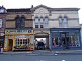
The main shopping street in Garston.
Subcategories
This category has the following 3 subcategories, out of 3 total.
Media in category "St Mary's Road, Garston"
The following 16 files are in this category, out of 16 total.
-
 71 - 73 St Marys Road, Garston.jpg 5,152 × 3,864; 7.24 MB
-
 Asda, Garston.jpg 3,764 × 2,213; 3.6 MB
-
 Bank of Liverpool, Garston.jpg 3,094 × 3,681; 5.65 MB
-
 Beaconsfield Terrace, St Mary's Road, Liverpool L19.jpg 1,280 × 960; 579 KB
-
 Derelict buildings, St Mary's Road, Garston.jpg 800 × 600; 147 KB
-
 Former Midland Bank, Garston.jpg 3,383 × 2,448; 4.08 MB
-
 The Mariners, Garston.jpg 4,308 × 3,683; 7.01 MB
-
 Parr's Bank, 103 St Marys Road, Garston.jpg 4,512 × 3,438; 6.6 MB
-
 Shops on St Mary's Road, Liverpool L19 (1).jpg 1,280 × 960; 597 KB
-
 Shops on St Mary's Road, Liverpool L19 (2).jpg 1,280 × 960; 589 KB
-
 Shops on St Mary's Road, Liverpool L19 (3).jpg 1,280 × 960; 571 KB
-
 Shops on St Mary's Road, Liverpool L19.jpg 1,280 × 960; 546 KB
-
 St Mary's Road sign, Garston.jpg 5,152 × 3,864; 7.38 MB
-
 St Mary's Road, Garston.jpg 5,109 × 3,331; 18.92 MB
-
 Village Motors, St Mary's Rd, Garston - geograph.org.uk - 947691.jpg 640 × 480; 58 KB
-
 Village Taxis, St Mary's Road, Liverpool L19.jpg 1,280 × 960; 581 KB


.jpg)
.jpg)
.jpg)


