Category:Stob Ghabhar
Jump to navigation
Jump to search
1090m high mountain in Scotland  | |||||
| Upload media | |||||
| Instance of | |||||
|---|---|---|---|---|---|
| Location |
| ||||
| Mountain range | |||||
| Topographic prominence |
| ||||
| Elevation above sea level |
| ||||
 | |||||
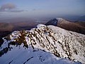
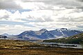
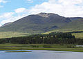
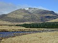
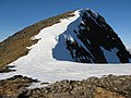
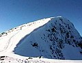
Stob Ghabhar is a mountain situated nine kilometres north west of Bridge of Orchy, in the west highlands of Scotland. It is part of the Black Mount group of mountains and stands on the border of the Argyll and Bute and Highland council areas.
Media in category "Stob Ghabhar"
The following 35 files are in this category, out of 35 total.
-
 Abhainn Shira and Stob Ghabhar - geograph.org.uk - 927628.jpg 640 × 480; 52 KB
-
 Aonach Eagach - geograph.org.uk - 107469.jpg 640 × 480; 73 KB
-
 Aonach Eagach - geograph.org.uk - 332251.jpg 640 × 360; 75 KB
-

-
 Loch Tulla - geograph.org.uk - 115519.jpg 640 × 327; 49 KB
-
 Schotland Rannoch Moor Blackwater Ben Nevis 8-05-2010 13-05-56.jpg 3,216 × 2,136; 3.68 MB
-
 South ridge of Stob Ghabhar - geograph.org.uk - 107461.jpg 640 × 480; 67 KB
-
 Sron a' Ghearrain ridge.jpg 640 × 462; 79 KB
-
 Stob Ghabhar - geograph.org.uk - 1229971.jpg 640 × 480; 76 KB
-
 Stob Ghabhar - geograph.org.uk - 330461.jpg 640 × 480; 67 KB
-
 Stob Ghabhar - geograph.org.uk - 330711.jpg 640 × 420; 55 KB
-
 Stob Ghabhar - geograph.org.uk - 941225.jpg 425 × 640; 52 KB
-
 Stob Ghabhar across Loch Tulla 2.jpg 1,866 × 1,341; 190 KB
-
 Stob Ghabhar and Coirein Lochain - geograph.org.uk - 1203021.jpg 640 × 480; 86 KB
-

-

-

-
 Stob Ghabhar-1090m-3576ft - geograph.org.uk - 946132.jpg 640 × 433; 93 KB
-
 The Abhainn Shira - geograph.org.uk - 632908.jpg 800 × 600; 210 KB
-
 The Aonach Eagach of Stob Ghabhar - geograph.org.uk - 902240.jpg 640 × 480; 101 KB
-
 The summit of Stob Ghabhar - geograph.org.uk - 540171.jpg 800 × 600; 226 KB
-
 The west ridge of Stob a' Choire Odhair - geograph.org.uk - 538585.jpg 800 × 600; 254 KB
-
 View east from Meall nan Eun - geograph.org.uk - 639618.jpg 800 × 600; 166 KB
-
 View northwest from Stob Ghabhar - geograph.org.uk - 1014580.jpg 640 × 448; 92 KB
-

-
 On Stob Ghabhar - geograph.org.uk - 330698.jpg 640 × 431; 62 KB
-
 On Stob Ghabhar - geograph.org.uk - 332277.jpg 640 × 480; 70 KB
-
 Southern slopes of Stob Ghabhar - geograph.org.uk - 330813.jpg 640 × 480; 86 KB
-
 Southern slopes of Stob Ghabhar - geograph.org.uk - 331467.jpg 640 × 480; 91 KB
-
 Stob Ghabhar - geograph.org.uk - 331433.jpg 640 × 449; 73 KB
-
 Stob Ghabhar - geograph.org.uk - 332266.jpg 639 × 393; 44 KB
-
 Stob Ghabhar - geograph.org.uk - 332268.jpg 640 × 480; 80 KB
-
 Stob Ghabhar - geograph.org.uk - 358990.jpg 640 × 456; 70 KB
-
 Summit ridge of Stob Gabhar - geograph.org.uk - 35154.jpg 348 × 266; 20 KB
-
 West ridge, Stob Ghabhar - geograph.org.uk - 332282.jpg 640 × 480; 69 KB


