Category:Stronchreggan
Jump to navigation
Jump to search
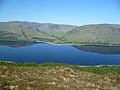
English: Stronchreggan is a scattered coastal hamlet, on the north eastern shores of Loch Linnhe, and is situated directly across from Fort William in Inverness-shire, Scottish Highlands and is in the Scottish council area of Highland.
human settlement in Highland, Scotland, UK | |||||
| Upload media | |||||
| Instance of | |||||
|---|---|---|---|---|---|
| Location | Highland, Scottish Highlands, Scotland | ||||
 | |||||
Media in category "Stronchreggan"
The following 16 files are in this category, out of 16 total.
-

-
 Above Loch Linnhe - geograph.org.uk - 2971587.jpg 2,560 × 1,920; 1.9 MB
-
 Adder - geograph.org.uk - 267385.jpg 640 × 447; 129 KB
-
 Corran Narrows - geograph.org.uk - 267477.jpg 640 × 448; 44 KB
-
 Loch Linnhe - geograph.org.uk - 2799421.jpg 640 × 430; 43 KB
-
 Shoreline on Loch Linnhe - geograph.org.uk - 2369907.jpg 640 × 480; 81 KB
-
 Stonchreggan from Loch Linnhe - geograph.org.uk - 3069569.jpg 3,869 × 2,835; 3.02 MB
-
 Sunset on Loch Linnhe - geograph.org.uk - 3922178.jpg 1,600 × 1,200; 186 KB
-
 The shore of Loch Linnhe - geograph.org.uk - 3107134.jpg 640 × 430; 33 KB
-
 Ben Nevis from Loch Eil - geograph.org.uk - 253406.jpg 375 × 500; 44 KB
-
 Loch Eil. - geograph.org.uk - 256837.jpg 640 × 480; 111 KB
-
 Loch Linnhe - geograph.org.uk - 238369.jpg 640 × 480; 93 KB
-
 Loch Linnhe - geograph.org.uk - 238777.jpg 640 × 480; 74 KB
-
 Loch Linnhe near Fort William - geograph.org.uk - 192027.jpg 640 × 480; 68 KB
-

-
 View across loch Lhinne - geograph.org.uk - 371469.jpg 640 × 482; 57 KB


