Category:Swinhope Burn, Northumberland
Jump to navigation
Jump to search
watercourse in Northumberland  | |||||
| Upload media | |||||
| Instance of | |||||
|---|---|---|---|---|---|
| Location | Northumberland, North East England, England | ||||
 | |||||
Media in category "Swinhope Burn, Northumberland"
The following 19 files are in this category, out of 19 total.
-
 Bridge over Swinhope Burn (2) - geograph.org.uk - 1057938.jpg 640 × 480; 106 KB
-
 Bridge over Swinhope Burn (3) - geograph.org.uk - 1057961.jpg 640 × 480; 123 KB
-
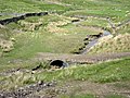 Bridge over Swinhope Burn - geograph.org.uk - 445458.jpg 640 × 480; 134 KB
-

-
 Remains of old mine near Swinhope Burn - geograph.org.uk - 1050299.jpg 640 × 480; 105 KB
-
 Swinhope Burn (2) - geograph.org.uk - 1057965.jpg 640 × 480; 99 KB
-
 Swinhope Burn (3) - geograph.org.uk - 1057979.jpg 640 × 480; 97 KB
-
 Swinhope Burn - geograph.org.uk - 1057956.jpg 640 × 480; 93 KB
-
 Swinhope Burn - geograph.org.uk - 987427.jpg 640 × 480; 135 KB
-
 Swinhope Burn and Moor (2) - geograph.org.uk - 1050306.jpg 640 × 480; 99 KB
-

-
-
 Swinhope Burn and old mine spoil heaps - geograph.org.uk - 1057948.jpg 640 × 480; 107 KB
-
 Swinhope Burn near Spartylea Bridge - geograph.org.uk - 445491.jpg 640 × 480; 127 KB
-
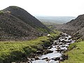
 Swinhope Burn valley near Spartylea - geograph.org.uk - 445486.jpg 640 × 480; 89 KB
-
 The headwaters of Swinhope Burn (2) - geograph.org.uk - 1744582.jpg 640 × 480; 27 KB
-

-
 The Swinhope valley - geograph.org.uk - 3098405.jpg 640 × 480; 91 KB
-
 Valley of Swinhope Burn - geograph.org.uk - 445421.jpg 640 × 480; 97 KB
_-_geograph.org.uk_-_1057938.jpg)
_-_geograph.org.uk_-_1057961.jpg)


_-_geograph.org.uk_-_1057965.jpg)
_-_geograph.org.uk_-_1057979.jpg)

_-_geograph.org.uk_-_1050306.jpg)
_-_geograph.org.uk_-_1057972.jpg)
_-_geograph.org.uk_-_1057974.jpg)


_-_geograph.org.uk_-_1744582.jpg)
_-_geograph.org.uk_-_1734277.jpg)

