Category:Tannadice (civil parish)
Jump to navigation
Jump to search
Scottish parish in Angus, Scotland, UK | |||||
| Upload media | |||||
| Instance of | |||||
|---|---|---|---|---|---|
| Named after | |||||
| Location |
| ||||
| Population |
| ||||
| Area |
| ||||
 | |||||
Subcategories
This category has the following 2 subcategories, out of 2 total.
M
T
Media in category "Tannadice (civil parish)"
The following 200 files are in this category, out of 316 total.
(previous page) (next page)-
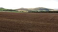
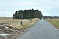
 A large field, Derachie - geograph.org.uk - 2647960.jpg 640 × 360; 182 KB
-
 A newly cultivated field - geograph.org.uk - 2647957.jpg 640 × 360; 183 KB
-
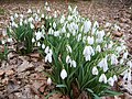 A sign of early spring in Glenmoy - geograph.org.uk - 2296811.jpg 640 × 480; 265 KB
-
 A view to Tannadyce House estate - geograph.org.uk - 4692317.jpg 4,608 × 3,456; 3.12 MB
-
 A view towards Barnyards - geograph.org.uk - 4692324.jpg 4,608 × 3,456; 3 MB
-
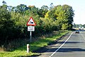 A90 Southbound near to Finavon - geograph.org.uk - 6157750.jpg 800 × 533; 742 KB
-
 After the harvest - geograph.org.uk - 2647356.jpg 640 × 360; 187 KB
-
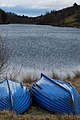 Anglers' Boats - geograph.org.uk - 2375230.jpg 428 × 640; 78 KB
-
 Angus arable - geograph.org.uk - 2647979.jpg 640 × 360; 167 KB
-
 Approach to Tannadice - geograph.org.uk - 5176099.jpg 640 × 480; 69 KB
-
 Approaching Memus - geograph.org.uk - 4902382.jpg 1,600 × 1,036; 195 KB
-
 B957 after heavy rain - geograph.org.uk - 4902463.jpg 1,600 × 1,214; 302 KB
-
 B957 near Tannadyce House - geograph.org.uk - 3265358.jpg 1,200 × 797; 463 KB
-
 B957 past farm buildings at Barnyards - geograph.org.uk - 3265355.jpg 1,200 × 797; 376 KB
-
 Baikies, Glen Quiech - geograph.org.uk - 5773701.jpg 640 × 360; 81 KB
-
 Baldoukie - geograph.org.uk - 2647970.jpg 640 × 360; 181 KB
-
 Baldoukie - geograph.org.uk - 2647975.jpg 640 × 360; 194 KB
-
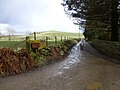
 Baldoukie Farm, Tannadice - geograph.org.uk - 1094674.jpg 640 × 426; 56 KB
-
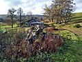
 Balloch (ruins) - geograph.org.uk - 5965641.jpg 1,600 × 1,200; 622 KB
-
 Barley field near Meikle Coull - geograph.org.uk - 3596690.jpg 640 × 480; 85 KB
-
 Barnyards Farm, Tannadice - geograph.org.uk - 5176100.jpg 640 × 480; 53 KB
-
 Beautiful farmland south of the Angus hills - geograph.org.uk - 5899906.jpg 5,184 × 3,888; 5.86 MB
-
 Beer garden, Drovers Inn at Memus - geograph.org.uk - 4692677.jpg 4,608 × 3,456; 3.17 MB
-

-
 Benscravie from Tulloch hill - geograph.org.uk - 1111173.jpg 640 × 430; 46 KB
-
 Between Glenquiech and Glenmoy - geograph.org.uk - 3635434.jpg 1,600 × 1,200; 616 KB
-
 Bog Burn - geograph.org.uk - 2647983.jpg 640 × 360; 208 KB
-
 Boggy grazing land near Cowhillock farm - geograph.org.uk - 1203964.jpg 640 × 427; 193 KB
-
 Bogside Farm, Glenmoy - geograph.org.uk - 2296828.jpg 640 × 366; 144 KB
-
 Bogside Farmhouse - geograph.org.uk - 2615864.jpg 640 × 480; 208 KB
-
 Bogside Farmhouse - geograph.org.uk - 2615874.jpg 640 × 427; 169 KB
-
 Boulder - geograph.org.uk - 5967472.jpg 1,600 × 1,200; 546 KB
-
 Bridge At Justinhaugh - geograph.org.uk - 3292018.jpg 983 × 715; 118 KB
-
 Bridge over the South Esk - geograph.org.uk - 4692683.jpg 3,987 × 2,849; 2.08 MB
-
 Bridge to Kinrive Farm - geograph.org.uk - 2644404.jpg 640 × 480; 292 KB
-
 Bridge to Kinrive Farm in Glenmoy - geograph.org.uk - 1865756.jpg 2,816 × 2,112; 2.97 MB
-
 Bridge, Glen Moy - geograph.org.uk - 2639886.jpg 640 × 480; 253 KB
-
 Broad ridge south of Mount Sned near Glen Lethnot - geograph.org.uk - 2903365.jpg 3,648 × 2,736; 4.76 MB
-
 Broad ridges west of Hill of Garbet near Glen Lethnot - geograph.org.uk - 2903391.jpg 3,648 × 2,736; 4.69 MB
-
 Broomfauld Cottage - geograph.org.uk - 5965663.jpg 1,600 × 1,200; 714 KB
-

-
 Buckies from Clashencake - geograph.org.uk - 5773708.jpg 640 × 360; 64 KB
-
 Burnside - geograph.org.uk - 4902336.jpg 1,600 × 1,064; 267 KB
-
 Burnside Farm - geograph.org.uk - 3600322.jpg 640 × 480; 63 KB
-
 Burnside Farm, Memus - geograph.org.uk - 1094728.jpg 640 × 427; 47 KB
-
 Cairn Farm - geograph.org.uk - 1119756.jpg 640 × 427; 80 KB
-
 Cairn, Ogil Hill - geograph.org.uk - 1203954.jpg 640 × 427; 153 KB
-
 Cattle grazing - geograph.org.uk - 3596700.jpg 480 × 640; 117 KB
-

-

-
 Clump of coniferous trees, South Esk - geograph.org.uk - 1202786.jpg 427 × 640; 231 KB
-
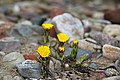 Coltsfoot (Tussilago farfara) - geograph.org.uk - 1202785.jpg 640 × 427; 197 KB
-
 Cortachy Bridge - geograph.org.uk - 2456834.jpg 480 × 640; 227 KB
-
 Cortachy Bridge - geograph.org.uk - 5054670.jpg 4,599 × 3,449; 3.16 MB
-
 Cortachy flora - geograph.org.uk - 1899626.jpg 2,560 × 1,920; 1.41 MB
-
 Cottage near Horniehaugh - geograph.org.uk - 1203999.jpg 640 × 427; 232 KB
-
 Courtford Bridge - geograph.org.uk - 5054598.jpg 4,313 × 2,651; 3.72 MB
-

-
 Craigmoy - geograph.org.uk - 5965704.jpg 1,600 × 1,200; 626 KB
-
 Craigton Croft - geograph.org.uk - 5965698.jpg 1,600 × 1,200; 695 KB
-
 Dark driveway - geograph.org.uk - 5788929.jpg 5,184 × 3,888; 6.28 MB
-
 Denside Cross Roads - geograph.org.uk - 5176092.jpg 640 × 480; 93 KB
-
 Denside Crossroads - geograph.org.uk - 5054614.jpg 3,820 × 2,576; 2.02 MB
-
 Denside Crossroads at Wintertime - geograph.org.uk - 1157003.jpg 640 × 427; 52 KB
-

-
 Derachie Farm - geograph.org.uk - 1007917.jpg 640 × 427; 93 KB
-
 Derachie Farm - geograph.org.uk - 3600327.jpg 640 × 480; 80 KB
-
 Derachie Farm - geograph.org.uk - 5787519.jpg 5,184 × 3,888; 5.44 MB
-
 Derachie Farmhouse - geograph.org.uk - 5787525.jpg 5,184 × 3,888; 6.44 MB
-
 Dismantled railway bridge at Nether Balgillo - geograph.org.uk - 3265395.jpg 1,200 × 797; 681 KB
-
 Disused quarry, Ogil Hill - geograph.org.uk - 1203937.jpg 640 × 427; 188 KB
-
 Doulin Haugh Footbridge - geograph.org.uk - 2296795.jpg 480 × 640; 234 KB
-
 Driveway leading to West Memus Farm - geograph.org.uk - 1156997.jpg 640 × 427; 81 KB
-
 Driveway to the Mains of Coull - geograph.org.uk - 3600325.jpg 640 × 480; 76 KB
-
 Drover's Inn, Memus - geograph.org.uk - 3597611.jpg 640 × 480; 88 KB
-
 Drovers Inn - geograph.org.uk - 5054640.jpg 4,608 × 3,456; 4.64 MB
-
 Drovers Inn, Memus - geograph.org.uk - 4692662.jpg 4,608 × 3,456; 2.96 MB
-
 Drovers Inn, Memus - geograph.org.uk - 5054625.jpg 4,455 × 3,341; 3.05 MB
-
 Dry stone wall, Ogil Hill - geograph.org.uk - 1203959.jpg 427 × 640; 215 KB
-
 Ducks and geese on the pond - geograph.org.uk - 4901777.jpg 1,600 × 1,200; 505 KB
-
 Duthriss Hill - geograph.org.uk - 2877857.jpg 640 × 480; 67 KB
-
 East Memus - geograph.org.uk - 2647403.jpg 640 × 360; 183 KB
-
 East Memus Farm - geograph.org.uk - 1007911.jpg 640 × 427; 95 KB
-
 East Murthill - geograph.org.uk - 4902531.jpg 1,600 × 1,141; 222 KB
-
 Elly farm, Glen Clova - geograph.org.uk - 6204271.jpg 1,600 × 1,200; 640 KB
-
 Elly steadings - geograph.org.uk - 6204289.jpg 1,600 × 1,200; 549 KB
-
 Entering Memus - geograph.org.uk - 4692648.jpg 4,151 × 2,520; 1.55 MB
-
 Entering Tannadice - geograph.org.uk - 4692341.jpg 3,322 × 1,711; 982 KB
-

-
 Entrance to Cortachy Home Farm - geograph.org.uk - 5787548.jpg 5,184 × 3,888; 4.74 MB
-

-
 Fallen trees - geograph.org.uk - 6324755.jpg 1,600 × 1,200; 603 KB
-
 Farm road to Broom Farm - geograph.org.uk - 3265382.jpg 1,200 × 797; 373 KB
-
 Farmhouse, East Memus - geograph.org.uk - 1204011.jpg 427 × 640; 191 KB
-
 Farmland beside Derachie Farm - geograph.org.uk - 2609692.jpg 3,648 × 2,736; 5.64 MB
-
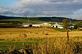
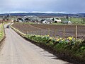
 Farmland near Wellford - geograph.org.uk - 3265379.jpg 1,200 × 797; 436 KB
-
 Farmland, East Marcus, near Finavon - geograph.org.uk - 3521608.jpg 1,024 × 681; 123 KB
-
 Farmland, East Memus - geograph.org.uk - 1204013.jpg 640 × 427; 167 KB
-
 Field of barley at Baldoukie Farm - geograph.org.uk - 3600331.jpg 640 × 480; 48 KB
-
 Field of barley near Knowehead - geograph.org.uk - 3600337.jpg 640 × 480; 78 KB
-
 Field of barley near Knowehead. - geograph.org.uk - 3600333.jpg 640 × 480; 86 KB
-
 Field of oilseed rape - geograph.org.uk - 3600330.jpg 640 × 480; 94 KB
-

-
 Field of potatoes - geograph.org.uk - 3600326.jpg 640 × 480; 91 KB
-
 Field of wheat at Derachie Farm - geograph.org.uk - 3600328.jpg 640 × 480; 70 KB
-
 Field, Miltonbank farm - geograph.org.uk - 1202768.jpg 640 × 427; 213 KB
-
 Field, Soutra Hill - geograph.org.uk - 1203929.jpg 640 × 427; 264 KB
-

-
 Fields at Nether Careston - geograph.org.uk - 5414775.jpg 1,024 × 684; 120 KB
-
 Fields by Derachie - geograph.org.uk - 2704477.jpg 640 × 480; 84 KB
-
 Fields east of Cortachy - geograph.org.uk - 3074835.jpg 2,592 × 1,944; 1.13 MB
-
 Finlarig faithful friend - geograph.org.uk - 1203978.jpg 427 × 640; 264 KB
-
 Fireplace - geograph.org.uk - 5965652.jpg 1,200 × 1,600; 532 KB
-

-
 Foreside of Cairn - geograph.org.uk - 4902461.jpg 1,600 × 1,012; 141 KB
-
 Forest Giants - geograph.org.uk - 1266376.jpg 479 × 638; 159 KB
-
 Forfar Sign At Justinhaugh - geograph.org.uk - 3292023.jpg 988 × 712; 81 KB
-
-
 Freshly burnt heather south of Mount Sned - geograph.org.uk - 2903386.jpg 3,648 × 2,736; 4.84 MB
-

-

-
 Garden at Shallgreen - geograph.org.uk - 1883981.jpg 1,384 × 989; 208 KB
-
 Gated entrance to Tannadice cemetery - geograph.org.uk - 4692349.jpg 4,295 × 3,221; 2.77 MB
-
 Gateway to Cortachy Castle - geograph.org.uk - 4901703.jpg 1,600 × 1,112; 432 KB
-
 Glack Farmhouse - geograph.org.uk - 1865763.jpg 2,679 × 1,968; 2.15 MB
-
 Glen Moy - geograph.org.uk - 2639866.jpg 640 × 480; 248 KB
-
 Glen Moy road - geograph.org.uk - 2639856.jpg 640 × 480; 285 KB
-
 Glenmoy road - geograph.org.uk - 5965727.jpg 900 × 1,600; 725 KB
-
 Glenmoye farm - geograph.org.uk - 1865846.jpg 2,816 × 2,112; 2.97 MB
-
 Gorse by the roadside - geograph.org.uk - 5787517.jpg 5,184 × 3,888; 3.35 MB
-
 Grassland, Soutra Hill - geograph.org.uk - 1203934.jpg 640 × 427; 207 KB
-
 Green field near Eskview - geograph.org.uk - 5787495.jpg 5,184 × 3,888; 6.13 MB
-

-
 Gulls, oyster-catchers and sheep in soggy pasture - geograph.org.uk - 4902402.jpg 1,600 × 1,253; 342 KB
-

-
 Harvest Scene near Justinhaugh - geograph.org.uk - 937920.jpg 640 × 427; 74 KB
-
 Hawthorn clinging on, Ogil Hill - geograph.org.uk - 1203942.jpg 427 × 640; 224 KB
-
 Heading to St.Arnold's Seat - geograph.org.uk - 5351082.jpg 640 × 480; 83 KB
-

-
 Hill of Glansie trig pillar - geograph.org.uk - 5755903.jpg 5,184 × 3,888; 5.5 MB
-
 Hill of Glansie Trig Point - geograph.org.uk - 2878055.jpg 640 × 480; 90 KB
-
 Hillside Cottage, Glenmoy, Angus on 14.04.10 - geograph.org.uk - 1810477.jpg 1,600 × 1,200; 652 KB
-
 House near Haer Cairn, near Finavon - geograph.org.uk - 5414782.jpg 1,024 × 683; 117 KB
-
 Industrial Rust - geograph.org.uk - 1266383.jpg 638 × 479; 164 KB
-
 Jacuzzi for pampered grouse by Hill of Garbet - geograph.org.uk - 2903356.jpg 3,648 × 2,736; 4.76 MB
-
 Justinhaugh Bridge - geograph.org.uk - 5787505.jpg 5,184 × 3,888; 4.44 MB
-

-
-
 Knochill - geograph.org.uk - 4901751.jpg 1,600 × 1,147; 316 KB
-
 Knowehead crossroads - geograph.org.uk - 4692583.jpg 3,868 × 2,698; 2.08 MB
-

-

-
 Little Benscreavie - geograph.org.uk - 2639873.jpg 640 × 480; 258 KB
-
 Living pine and dead pine - geograph.org.uk - 5351096.jpg 5,184 × 3,888; 5.24 MB
-
 Lonely track - geograph.org.uk - 5351104.jpg 5,184 × 3,888; 6.46 MB
-

-

-
 Looking towards Elly - geograph.org.uk - 1743507.jpg 640 × 427; 219 KB
-
 Looking up Benscravie - geograph.org.uk - 1499473.jpg 640 × 480; 108 KB
-
 Major -General Sinclair-Maclagan - geograph.org.uk - 1203984.jpg 640 × 427; 246 KB
-
 Meikle Coull - geograph.org.uk - 2647966.jpg 640 × 360; 195 KB
-
 Meikle Coull Farm and Cottages - geograph.org.uk - 1094682.jpg 640 × 426; 70 KB
-

-
 Memus - geograph.org.uk - 2647379.jpg 640 × 360; 184 KB
-
 Memus and the Glens Community Hall - geograph.org.uk - 3600321.jpg 640 × 480; 76 KB
-

-
 Metallic miscellany - geograph.org.uk - 3596685.jpg 640 × 480; 67 KB
-
 Metallic miscellany - geograph.org.uk - 3596687.jpg 640 × 480; 73 KB
-
 Midtown - geograph.org.uk - 1203987.jpg 427 × 640; 187 KB
-
 Mill at Baikies - geograph.org.uk - 5773705.jpg 1,600 × 900; 468 KB
-
 Minor road at Milton of Ogil - geograph.org.uk - 5176086.jpg 640 × 480; 63 KB
-
 Minor road at Nether Balgillo - geograph.org.uk - 5176552.jpg 640 × 480; 123 KB
-
 Minor road near Baldoukie - geograph.org.uk - 3265350.jpg 1,200 × 797; 356 KB
-
 Minor road near Broom Farm - geograph.org.uk - 3265393.jpg 1,200 × 797; 369 KB
-
 Minor road near Knowehead - geograph.org.uk - 3265378.jpg 1,200 × 797; 393 KB
-
 Minor road near Noranside - geograph.org.uk - 3265362.jpg 1,200 × 797; 437 KB
-
 Minor road near Shielhill Bridge - geograph.org.uk - 3265346.jpg 1,200 × 797; 586 KB
-
 Minor road near Tannadice - geograph.org.uk - 3265361.jpg 1,200 × 797; 516 KB
-
 Mobile phone mast near Tannadice - geograph.org.uk - 3265360.jpg 797 × 1,200; 750 KB
-
 Modern house near Baldoukie - geograph.org.uk - 3596694.jpg 640 × 480; 55 KB
-
 Moonset from Finavon, Strathmore - geograph.org.uk - 6006588.jpg 1,600 × 1,065; 436 KB
-
 Moonset near Finavon, Strathmore - geograph.org.uk - 6006587.jpg 1,600 × 1,065; 594 KB
-
 Moorland, Pinderachy - geograph.org.uk - 1187552.jpg 640 × 427; 216 KB
-

-

-

-

-
 Muddy track - geograph.org.uk - 4902419.jpg 1,600 × 1,200; 389 KB
-
 Naked Tam - geograph.org.uk - 5351079.jpg 5,184 × 3,888; 5.87 MB
-
 New gate north of Parkside - geograph.org.uk - 5965713.jpg 1,600 × 1,200; 550 KB
-
 New Polytunnels - geograph.org.uk - 5787537.jpg 5,184 × 3,888; 5.21 MB
-
 Newton of Inshewan - geograph.org.uk - 4901734.jpg 1,600 × 1,215; 355 KB
-
 Newton of Inshewan - geograph.org.uk - 5787543.jpg 5,184 × 3,888; 4.96 MB
-
 Newton of Inshewan Farm - geograph.org.uk - 1094730.jpg 640 × 426; 34 KB
-
 North end of Glenmoy - geograph.org.uk - 3635417.jpg 1,600 × 1,200; 373 KB
-
 Old barns, Cowhillock farm - geograph.org.uk - 1203973.jpg 640 × 427; 250 KB
-
 Old crossroads sign - geograph.org.uk - 5788939.jpg 5,184 × 3,888; 6.48 MB
-

-

-
 Old Fashioned Crossroads Signpost - geograph.org.uk - 1216100.jpg 640 × 427; 90 KB


_-_geograph.org.uk_-_5965641.jpg)


_-_geograph.org.uk_-_1202785.jpg)


&filefrom=Old+Kinrive+bridge+-+geograph.org.uk+-+3635449.jpg#mw-category-media)