Category:Tehachapi Mountains
Zur Navigation springen
Zur Suche springen
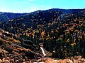
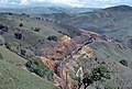
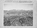
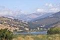
English: The Tehachapi Mountains are part of the Transverse Ranges of California. The Tehachapis separate the San Joaquin Valley from the Mojave Desert. The range is often used to delineate Southern California (to south and west) and Northern California (to north and northwest). The Tehachapi Mountains are a significant wildlife corridor between the western Transverse Ranges and the southern Sierra Nevada
Gebirgszug  | |||||
| Medium hochladen | |||||
| Ist ein(e) | |||||
|---|---|---|---|---|---|
| Ort |
| ||||
| Länge |
| ||||
| Gebirgszug | |||||
| Höchster Punkt |
| ||||
| Höhe über dem Meeresspiegel |
| ||||
 | |||||
Unterkategorien
Es werden 13 von insgesamt 13 Unterkategorien in dieser Kategorie angezeigt:
In Klammern die Anzahl der enthaltenen Kategorien (K), Seiten (S), Dateien (D)
C
E
- Eriogonum callistum (6 D)
F
- Fort Tejon State Historic Park (63 D)
G
K
- Kelso Mine (1 D)
R
T
- Tejon Pass (21 D)
- Tejon Ranch (26 D)
W
- Alta Wind Energy Center (5 D)
- Tehachapi Pass Wind Farm (50 D)
Seiten in der Kategorie „Tehachapi Mountains“
Diese Kategorie enthält nur die folgende Seite.
Medien in der Kategorie „Tehachapi Mountains“
Folgende 85 Dateien sind in dieser Kategorie, von 85 insgesamt.
-
 20050101 Tehachapi Windmills 04 pano.jpg 1.927 × 600; 299 KB
-
 AlpineForest.jpg 2.608 × 1.952; 1,65 MB
-
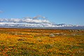
 Antelope valley californie.jpg 800 × 431; 171 KB
-

-

-
-
 Battling the fire 120814-F-UF872-005.jpg 4.288 × 2.848; 7,24 MB
-
 BerninaFall.jpg 1.941 × 2.741; 1,15 MB
-
 BerninaTop.jpg 2.347 × 1.756; 888 KB
-
 BNSF GE C44-9W Caliente - Bakersfield.jpg 4.583 × 2.829; 3,8 MB
-
 Bulletin of the Department of Geology (1904) (20421568846).jpg 3.261 × 1.936; 763 KB
-
 Bulletin of the Department of Geology (1904) (20447782375).jpg 3.280 × 1.824; 1,45 MB
-
 California - Sulphur Spring Valley through Treasure Island - NARA - 23935387.jpg 4.350 × 3.382; 2,44 MB
-
 California Army and Air National Guard aircraft battle blazes 120814-F-UF872-211.jpg 2.848 × 4.288; 7,39 MB
-
 California State Route 58 at Cameron Canyon Road 1.jpg 2.400 × 1.600; 746 KB
-

-
 Clouds and Water (5006640294).jpg 1.200 × 803; 812 KB
-
 Coast horned lizard (Phrynosoma coronatum), Tehachapi Mountains.jpg 1.280 × 960; 172 KB
-
-
 CummingsNorth.jpg 2.608 × 1.952; 1,71 MB
-
 Early Morning at Sandcut, CA. Santa Fe Trains -- 4 Photos (31309667995).jpg 2.000 × 1.335; 1,75 MB
-
 EastTehachapiCrest.jpg 959 × 719; 289 KB
-
 EnteringGrapevine.JPG 3.456 × 2.592; 3,8 MB
-

-
 GormanCAwildflowers.jpg 2.272 × 1.712; 1,36 MB
-
 Grapevine, California.jpg 3.609 × 2.405; 1,66 MB
-
 Kawaiiasu Family.jpg 621 × 640; 117 KB
-
 Looking West From Bear Mountain.jpg 930 × 626; 145 KB
-
 Microserissylvatica.jpg 1.280 × 960; 138 KB
-
 Mojave Desert, Tehachapi Mountains, and San Joaquin Valley (California) – satellite image.jpg 8.824 × 5.336; 13,03 MB
-
 MountainClimber.JPG 2.608 × 1.952; 2,12 MB
-
 NF-15B NASA 837 flying over Tehachapi Mountains (ED07-0026-10).jpg 3.000 × 2.400; 3,28 MB
-
 On the Techachapi Mts, Techachapi Pass, Cal (NBY 3418).jpg 811 × 458; 74 KB
-
 2009-0726-CA-Tehachapi-CourtlandtGross.jpg 1.688 × 1.172; 1,57 MB
-
 Ridge Route ca 1920 4.jpg 1.066 × 652; 114 KB
-
 SierraCrest.jpg 1.620 × 1.212; 422 KB
-
 Sinks of Tehachapa, California. (Boston Public Library).jpg 1.500 × 1.002; 209 KB
-

-

-

-

-
-

-

-

-

-
 SP 7449 EB East of tunnel 10 Aug86xRP - Flickr - drewj1946 (crop1).jpg 555 × 386; 183 KB
-
 SP 7449 EB East of tunnel 10 Aug86xRP - Flickr - drewj1946 (crop2).jpg 448 × 381; 147 KB
-
 SP 7449 EB East of tunnel 10 Aug86xRP - Flickr - drewj1946.jpg 1.008 × 659; 487 KB
-
 Aerial-TehachapiAirport.jpg 550 × 369; 85 KB
-
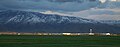
 Tehachapi Mountains (3380462608).jpg 3.888 × 2.592; 7,27 MB
-
 Tehachapi Mountains (Transverse Ranges) California – labeled satellite image.png 4.313 × 3.924; 31,85 MB
-
 Tehachapi Mountains (Transverse Ranges), California – satellite image.jpg 4.313 × 3.924; 7,54 MB
-
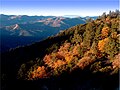
 Tehachapi Mountains from Grapevine.jpg 3.619 × 2.035; 1,07 MB
-
 Tehachapi Mountains – topographic map.jpg 8.413 × 7.265; 78,11 MB
-
 Tehachapi Mountians - panoramio.jpg 3.264 × 4.011; 8,8 MB
-
 Tehachapi sign.jpg 721 × 401; 69 KB
-
 Tehachapi tunnel ten (2098).JPG 2.048 × 1.536; 846 KB
-
 Tehachapi wind farm 2.jpg 1.200 × 800; 121 KB
-
 Tehachapi wind farm 4.jpg 1.200 × 1.048; 137 KB
-
 Tehachapi Wind Turbines.jpg 3.264 × 2.448; 581 KB
-

-

-
 Tejon Pass, 1868.jpg 2.541 × 1.694; 1,54 MB
-
 Tejon Pass2015.jpg 3.559 × 2.668; 1,31 MB
-
 TejonPassSign.JPG 3.200 × 2.133; 3,3 MB
-
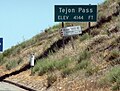 TejonPassSign.jpg 1.540 × 1.168; 1,15 MB
-
 TejonSouth.jpg 2.608 × 1.952; 1,01 MB
-
 TejonWest.jpg 2.694 × 2.016; 808 KB
-
 The last rays of the sun.jpg 5.616 × 2.211; 2,99 MB
-

-

-
 Fort Tejon Barracks from CO Qtrs.JPG 2.272 × 1.704; 607 KB
-

-
 Wpdms shdrlfi020l tehachapi mountains.jpg 300 × 315; 51 KB
-
 Yucca brevifolia 19.jpg 2.000 × 1.626; 533 KB
-
 Acer negundo californicum Tehachapi.jpg 1.280 × 960; 228 KB
-
 Amsinckia menziesii (Menzies' fiddleneck), Gorman.jpg 3.072 × 2.048; 1,81 MB
-

-
-
 Kern County California Incorporated and Unincorporated areas Keene Highlighted.svg 2.250 × 1.050; 215 KB
-

-
 Kern County California Incorporated and Unincorporated areas Tehachapi Highlighted.svg 2.250 × 1.050; 215 KB
-
 Monardellalanceolata.jpg 1.280 × 960; 150 KB
-
 Trifolium albopurpureum.jpg 1.280 × 960; 181 KB


.jpg)
.jpg)


_(20421568846).jpg)
_(20447782375).jpg)


.jpg)
.jpg)
,_Tehachapi_Mountains.jpg)
.jpg)

.jpg)

.jpg)


_%E2%80%93_satellite_image.jpg)

.jpg)
.jpg)


.jpg)
.jpg)
.jpg)
.jpg)
.jpg)
.jpg)
.jpg)
.jpg)
.jpg)
.jpg)
.jpg)
.jpg)


.jpg)


.JPG)


_(cropped).jpg)
.jpg)


.jpg)
.jpg)

.jpg)


,_Gorman.jpg)


_California_%E2%80%93_labeled_satellite_image.png)
,_California_%E2%80%93_satellite_image.jpg)